The attractions of the Rwenzori Mountains include six Rwenzori Mountains, Margherita Peak, alpine lakes, vegetation, bird species, waterfalls, and the Bakonzo people.
Ptolemy called them the Mountains of the Moon two thousand years ago, guessing at a range so persistently shrouded in cloud that no European confirmed its existence until 1889. Today the Rwenzori remain one of the least visited, most quietly extraordinary wilderness destinations on the African continent, and this guide exists to show you exactly why.
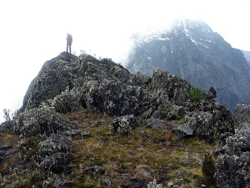 The Rwenzori are Africa’s highest block mountain range, thrust upward along a fault line of the Albertine Rift rather than formed by volcanic activity, which is precisely why they carry permanent ice on the equator, a geological rarity shared with only Kilimanjaro and Mount Kenya on this continent. Rwenzori Mountains National Park has held UNESCO World Heritage status since 1994, recognized for exceptional biodiversity and a landscape found nowhere else at this precise combination of latitude and altitude. Within its roughly 1,000 square kilometers, six distinct vegetation zones stack on top of one another across barely thirty kilometers of horizontal distance, from savannah grassland through montane rainforest, bamboo forest, heather and giant heather, Afro-alpine moorland, and finally bare rock and glacier, a compression of ecological transition normally associated with traveling thousands of kilometers in latitude.
What draws serious trekkers here is not any single attraction but the accumulation of them: six named glaciated massifs, Africa’s third-highest summit, roughly twenty alpine lakes cradled in glacially carved valleys, giant lobelias and giant groundsels found almost nowhere else on Earth, 217 recorded bird species with seventeen found only in this range, and a resident Bakonzo culture that has lived at these mountains’ feet for centuries and still shapes the guiding and porter traditions every trekker relies on today. This page brings every one of these attractions together in a single, comprehensive resource, explaining not just what each one is, but where it sits, how to reach it, what a visit genuinely involves, and which of our itineraries takes you there.
Quick Overview: The Rwenzori’s Headline Attractions
Attraction | Best Known For | Best Trek |
Margherita Peak | Uganda’s and Africa’s third-highest point (5,109m) | 7–9 Day Margherita Peak Summit Treks |
Mount Stanley | Africa’s third-highest massif, remaining glaciers | Central Circuit or Kilembe Trail summit itineraries |
Mount Speke | Non-technical-approach alpine summit, quiet trails | 5-Day Mount Speke Trek |
Mount Baker | Scenic, comparatively accessible alpine climb | 5-Day Edward Peak Trek |
Weismann’s Peak | Non-technical summit with four-lake panorama | Kilembe Trail Weismann’s Peak itineraries |
Lake Bujuku | Iconic alpine lake beneath three massifs | Central Circuit itineraries |
Lake Kitandara | Twin glacial lakes, the range’s most photographed spot | 6-Day Portal Peaks Trek |
Lake Mahoma | Accessible short-trek alpine lake | 3-Day Lake Mahoma Trek |
Mubuku Valley | Classic Central Circuit approach valley | Central Circuit itineraries |
Bigo Bog & Giant Lobelias | Surreal Afro-alpine flora at altitude | Any high-altitude Kilembe or Central Circuit trek |
The Mountain Peaks of the Rwenzori
Six great glaciated massifs make up the Rwenzori Mountains range, each rising along a compact horseshoe of high ground barely thirty kilometers across, yet each has a distinct character, history, and level of demand. What follows is a complete profile of every named peak worth knowing before you plan a Rwenzori trek.
Margherita Peak (Mount Stanley), 5,109 Metres
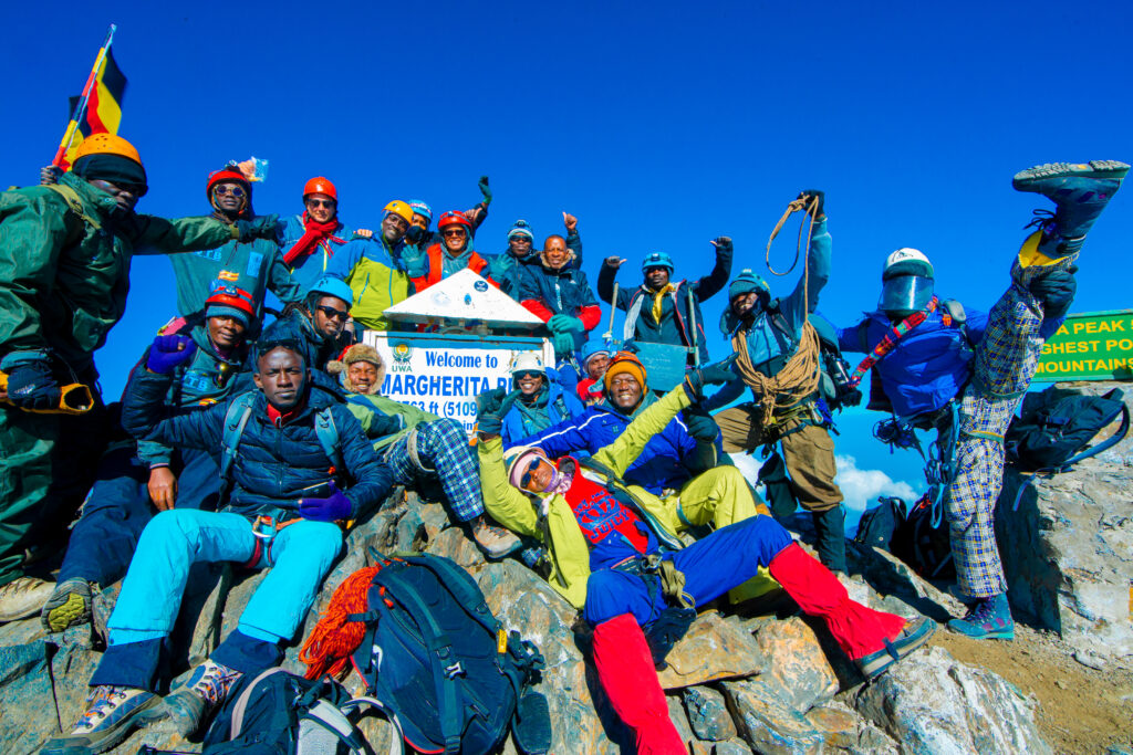
Margherita Peak is the Rwenzori’s defining attraction and Africa’s third-highest summit, surpassed only by Kilimanjaro and Mount Kenya. Reaching it requires genuine glacier travel across the remaining ice of the Stanley Plateau, roped movement, crampons, and a qualified mountain guide, making it a serious mountaineering objective rather than a walk-up. Most successful summit attempts take six to nine days, depending on the route and acclimatization pacing, and are made via either the Kilembe Trail or the Central Circuit Trail, which both meet at high camps beneath Mount Stanley before a pre-dawn summit push. The nearby Alexandra and Albert peaks on the same massif are visible from the summit ridge but are not part of standard guided itineraries.
Our 6-Day, 7-Day and 9-Day Margherita Peak itineraries cover both approaches in full detail, with pacing built around genuine acclimatization rather than a rushed summit push.
Mount Stanley — The Massif Behind Margherita
Mount Stanley is the broader massif of which Margherita Peak is simply the highest point, and its ridge also carries Alexandra Peak and the lower summit of Albert. Its glaciers, though retreating, remain the most extensive in the range and are visible from Bujuku Hut, Scott Elliot Pass, and Hunwick’s Camp on both major trekking approaches, making it a visual centerpiece even for trekkers not attempting the summit itself.
Mount Speke—4,890 meters
Mount Speke is the range’s second-highest massif and a genuinely rewarding, comparatively quiet alternative to Margherita Peak, its own highest point, Vittorio Emanuele Peak, involving a rope-protected ascent through the narrow Groundsel Gully rather than extended glacier travel. Positioned directly across the Bujuku Valley from Mount Baker, with Mount Stanley’s wall rising beyond, Speke also forms one corner of the range’s celebrated Portal Peaks panorama.
See our 5-Day Mount Speke Trek via the Central Circuit for the full itinerary.
Mount Baker—4,843 meters
Mount Baker’s highest point, Edward Peak, is often considered the most scenic and comparatively accessible of the range’s technical summits, reached via a shorter approach than Stanley or Speke while still delivering commanding views across the Bujuku Valley toward its neighboring massifs. It remains a genuine mountaineering objective requiring rope work on its final approach, not a non-technical walk.
Our 5-Day Edward Peak Trek on Mount Baker covers this route in full.
Weismann’s Peak (Mount Luigi di Savoia)—4,620 Metres
Weismann’s Peak, the highest point on Mount Luigi di Savoia, is the range’s best non-technical high-altitude objective, reached via the Kilembe Trail through Sine, Mutinda, and Bugata camps without the glacier travel that Stanley, Speke, and Baker all require. Its summit delivers a rare simultaneous view of Stanley, Speke, and Baker across a basin of glacial lakes, making it a favorite for trekkers who want the range’s drama without technical mountaineering demands.
For a complete breakdown of routes, difficulty, and planning, see our dedicated Weismann’s Peak guide.
Mount Gessi—Approximately 4,715 Metres
Mount Gessi, whose highest point is Bottego Peak, lies in the range’s quieter northern reaches and is attempted by only a small handful of expeditions each year, offering genuine solitude for trekkers who have already climbed the range’s more frequented summits and want a rarely visited alternative.
Our 7-Day Mount Gessi Trek to Bottego Peak is built specifically for this remote objective.
Mount Emin—4,798 Metres
Mount Emin’s highest point, Umberto Peak, sits among the range’s least-visited massifs, approached via longer, more remote itineraries that combine sections of both major trails. It rewards experienced, patient trekkers seeking genuine wilderness rather than a well-trodden path.
The Portal Peaks —Baker, Speke and Stanley Together
The Portal Peaks are not a single named summit but the striking cluster of Mount Baker, Mount Speke, and Mount Stanley as they present themselves together from the upper Bujuku Valley and Scott Elliot Pass, framing the valley like the pillars of a gateway. This panorama, rather than any individual peak, is the objective of trekkers who want the range’s most dramatic scenery without a technical summit attempt.
Our 6-Day Portal Peaks Trek via the Central Circuit focuses entirely on this view and culminates at Kitandara Lakes.
The Equatorial Glaciers of the Rwenzori
Permanent ice on the equator exists only because altitude, not latitude, governs temperature at this scale: above roughly 4,500 meters on Mounts Stanley, Speke, and Baker, air temperatures remain cold enough year-round to sustain glacial ice despite the range’s position barely half a degree north of the equator. This phenomenon makes the Rwenzori one of only three locations in Africa, alongside Kilimanjaro and Mount Kenya, where equatorial glaciers exist at all, and by most current assessments the Rwenzori glaciers are retreating at a rate comparable to or faster than both.
Remaining ice today is concentrated on the upper reaches of Mount Stanley, where the Stanley Plateau glacier must still be crossed on a Margherita Peak summit attempt, along with smaller remnant ice fields on Mount Speke and Mount Baker. Extent has reduced dramatically over the past century, and scientific assessments consistently point to continued retreat within the coming decades. This situation gives every current Rwenzori glacier crossing an unusual, quietly sobering significance: trekkers who summit today are witnessing ice that will very likely have changed and may have substantially disappeared within a single generation, making the Rwenzori’s glaciers a genuinely globally significant indicator of climate change on the African continent, not merely a scenic backdrop.
The Alpine Lakes of the Rwenzori
Rwenzori Mountains National Park contains close to twenty glacially formed lakes, scattered across its major valleys and carved by the same ice that once extended far lower down the range’s flanks than it does today. Three lakes in particular anchor the trekking experience.
Lake Bujuku
Lake Bujuku sits at the head of the Bujuku Valley at approximately 3,900 meters, in the shadow of Mount Stanley, Mount Speke, and Mount Baker simultaneously, making it one of the most photographed single locations in the entire range.

Its still, glassy surface mirrors the surrounding peaks on calm mornings, and Bujuku Hut, set just above the water, serves as the principal staging camp for summit attempts on all three neighboring massifs. Wildlife around the lake is limited at this altitude, but the botanical scenery, giant groundsels and lobelias crowding its shoreline, is exceptional. It is reached via the Central Circuit Trail on day three of most itineraries departing from Nyakalengija.
Lake Kitandara
The twin Kitandara Lakes, at approximately 4,023 meters in a hanging valley beyond Scott Elliot Pass, are widely regarded as the single most beautifully positioned overnight stop on the entire Central Circuit trail, with Mount Baker’s face rising almost directly overhead and reflected in the water on a calm evening. Photographers consistently rate this location the finest single vantage point in the range. Most trekkers reach it via Scott Elliot Pass from Bujuku Hut, most commonly as the centerpiece of our 6-Day Portal Peaks Trek.
Lake Mahoma
Lake Mahoma, at approximately 2,651 meters, is the most accessible of the range’s named alpine lakes, reached within a single day’s walk from Nyakalengija through pristine montane forest without the altitude or distance demands of the higher lakes. Its accessibility makes it the natural choice for families, first-time trekkers, or travelers wanting a genuine taste of Rwenzori scenery within a short, non-technical itinerary.
Rwenzori Trekking Expeditions‘ 3-Day Lake Mahoma Trek focuses specifically on this lake and the surrounding forest zone.
Other Notable Alpine Tarns
Beyond these three headline lakes, the range’s Kilembe side carries a chain of smaller glacial tarns, including Lake Kopello, Lake Africa, and Lake Bugata, clustered near Bugata Camp on the approach to Weismann’s Peak, along with Lake Irene and a scattering of smaller unnamed pools throughout the upper Nyamwamba Valley, several of which formed behind moraine dams left by retreating ice.
The Great Valleys of the Rwenzori
Three major valleys shape almost every Rwenzori trekking itinerary, each carved by glacial action and each supporting a distinct sequence of ecosystems as elevation climbs.
Bujuku Valley
The Bujuku Valley is the Central Circuit’s principal corridor, running from John Matte Hut past the Bigo Bog to Lake Bujuku itself, with Mount Stanley, Mount Speke, and Mount Baker all visible from its upper reaches. Its combination of giant lobelia fields, boardwalked bog crossings, and dramatic massif views makes it the ecological and scenic heart of any Central Circuit itinerary.
Mubuku Valley
The Mubuku Valley carries the lower approach to the Central Circuit Trail from Nyakalengija, its dense montane rainforest home to the range’s best wildlife viewing, including blue monkeys, black and white colobus monkeys, and a wide range of forest birds, before the trail climbs out of the valley toward Nyabitaba and the higher zones beyond.
Nyamwamba Valley
The Nyamwamba Valley forms part of the Kilembe Trail’s descent route from Weismann’s Peak toward Kiharo Camp, with its upper reaches home to dense stands of giant groundsel and a distinctive microenvironment shaped by ancient glacial moraine, where the endemic Rwenzori red forest duiker can realistically be seen in its more open, fire-affected sections.
Waterfalls Along the Trekking Routes
Waterfalls appear throughout the Rwenzori’s lower and middle elevations, fed by the range’s exceptionally high rainfall and glacial meltwater from the peaks above. Enock’s Falls, close to Sine Camp on the Kilembe Trail, is among the most accessible, viewable from the hut’s own verandah without any detour required.
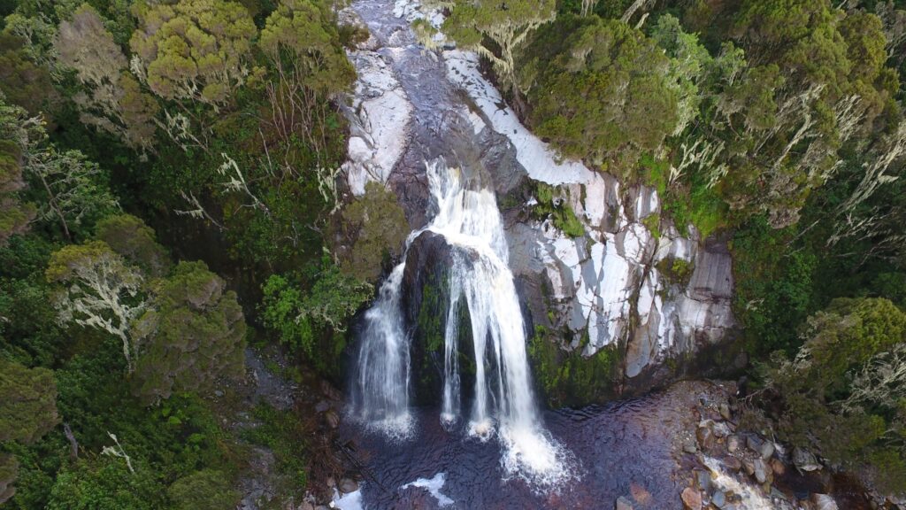
Numerous unnamed cascades thread down the Mutinda and Bugata valley walls on the same trail, generally at their fullest and most dramatic during and immediately after the wetter months, though photography is often better in drier conditions when mist and low cloud lift enough to reveal the full drop. A dedicated waterfall-focused itinerary exists for travelers who want this feature as the centerpiece of their visit rather than a passing highlight along a longer route.
See our 4-Day Rwenzori Waterfalls Hike on the Kilembe Trail, built specifically around this attraction.
The Vegetation Zones: A Journey Through Six Ecosystems
Few places on Earth compress so much ecological transition into so little horizontal distance. From the park boundary to the summit ice, trekkers pass through six distinct zones, each with its character, and it is this progression, as much as any single peak or lake, that defines the Rwenzori experience.
Savannah Zone (680–1,800 metres)
The lowest zone, mostly below the trailheads themselves, consists of grassland and cultivated smallholdings surrounding the park boundary, giving way abruptly to forest as the trail begins.
Afro-Montane Forest Zone (1,800–2,600 metres)
Dense, moisture-laden forest dominated by podocarpus and symphonia trees, it is home to the range’s best wildlife viewing and the setting for the first one to two days of most itineraries.
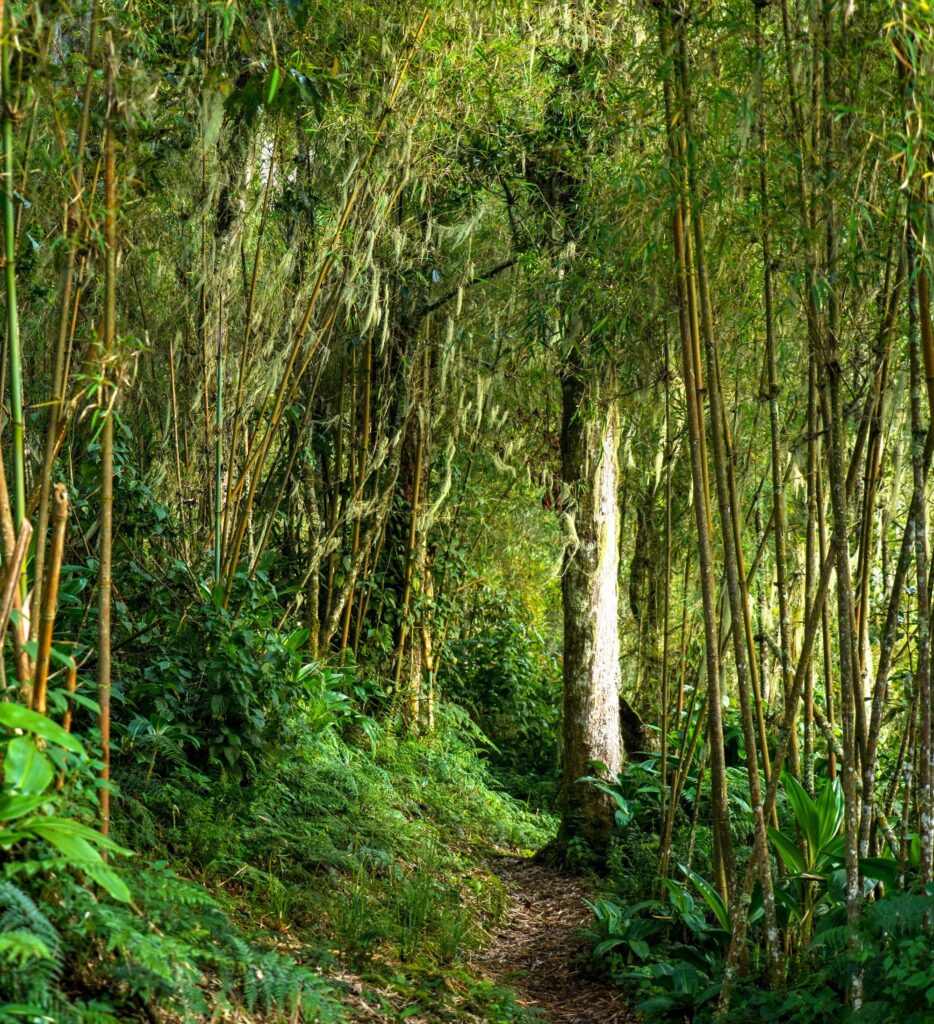
Bamboo Forest Zone (2,600–2,900 metres)
A narrow but distinctive band of dense mountain bamboo, muting sound and light in equal measure, generally muddy underfoot and often the trickiest short stretch of any Rwenzori itinerary in wetter months.
Heather/Rapanea Zone (2,900–4,000 metres)
Ancient, gnarled tree heather draped in old man’s beard lichen dominates this broad zone, opening gradually into the first proper mountain views as the canopy thins with altitude.
Afro-Alpine Moorland (4,000–4,500 metres)
This is the zone that gives the Rwenzori its most iconic photographs: giant lobelias rising in silver spires and giant groundsels crowding the bog margins, a botanical community found only in East Africa’s high equatorial mountains above roughly 3,800 meters and nowhere else on the planet at this scale. The combination of intense equatorial sunlight and near-freezing overnight temperatures has driven these plants to evolve genuinely unique adaptations, from insulating rosettes to water-retaining stem structures, found in remarkably similar form only on Kilimanjaro and Mount Kenya.
Rocky and Glacial Zone (4,500–5,109 metres)
The highest zone strips away nearly all vegetation, bare rock, scree, and the range’s remaining glacial ice, defining the final approach to every major summit.

Wildlife of the Rwenzori Mountains
Rwenzori Mountains National Park is home to approximately seventy recorded mammal species, six of which are endemic to the Albertine Rift and several are rare even within it, alongside 217 recorded bird species, seventeen of which are found only within this range. As with any wild mountain environment, sightings are never guaranteed on a given day, and the park’s dense forest cover means many species are heard far more often than seen.
Mammals
Black and white colobus monkeys and blue monkeys are the most reliable primate sightings, generally encountered in the lower montane forest during the first two days of any itinerary. Elusive forest elephants are occasionally recorded within the park’s forested lower zones, though sightings are rare and itineraries cannot guarantee them.
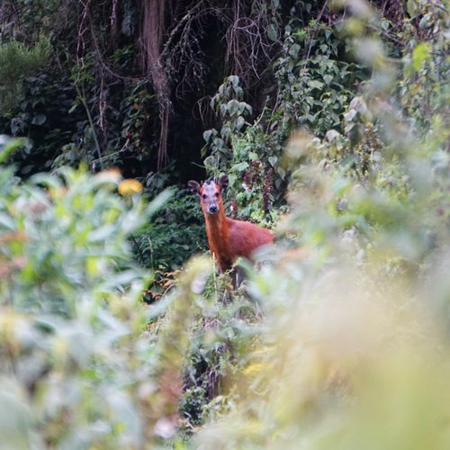
Bushbuck and the endemic Rwenzori red forest duiker are more common in the Afro-alpine zone, especially in areas where historic wildfires have created shorter, more visible undergrowth, and the rare Rwenzori otter has also been seen along the range’s river systems.
Birds
The lower forest zone hosts the greatest bird diversity, including the striking Rwenzori turaco, the handsome francolin, and a wide range of sunbirds, with the golden-winged and blue-headed sunbirds particularly associated with the heather and Afro-alpine zones at higher elevations.
Raptors and Albertine Rift endemics reward patient, attentive trekkers throughout the lower and middle zones, and birdwatching enthusiasts consistently rate the Rwenzori among East Africa’s most rewarding montane birding destinations, precisely because of this endemism.
Reptiles and Amphibians
The endemic three-horned Rwenzori chameleon is the signature reptile sighting, usually seen on low branches in the heather and bamboo zones, along with various montane amphibian species that are adapted to the range’s consistently damp, cool conditions.

The Rwenzori’s Finest Scenic Viewpoints
Margherita Peak’s summit ridge offers the single most complete panorama in the range on a clear morning, with Stanley’s ice fields, Speke and Baker beyond, and the Albertine Rift fading toward the horizon, though it is earned only through a genuine technical summit attempt. The Bujuku Valley delivers a similarly dramatic, far more accessible reward, with all three central massifs visible from the trail itself, without requiring any summit.
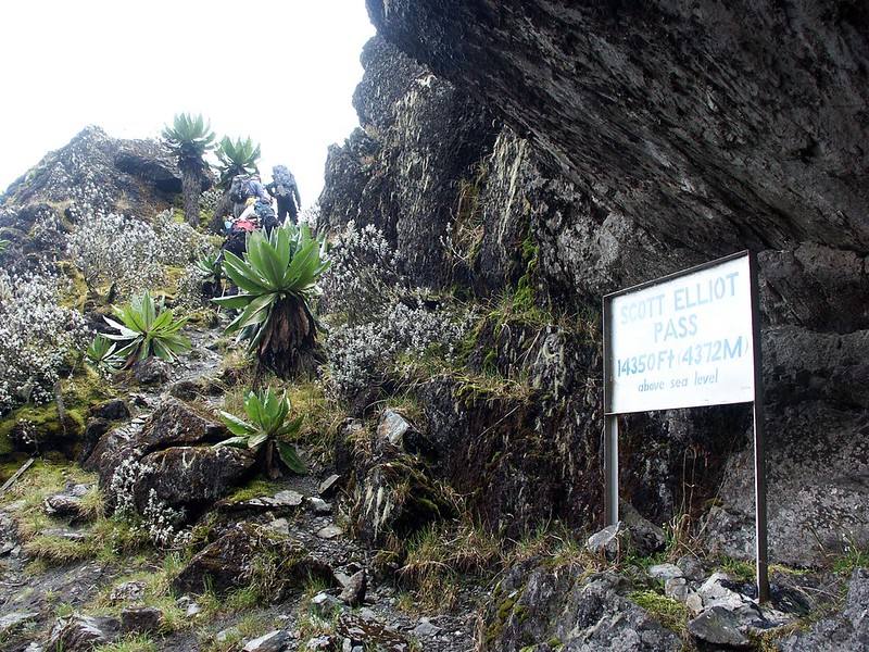 Scott Elliot Pass and Freshfield Pass both offer sweeping high-altitude views across neighboring valleys and toward the range’s glaciers; the former is reached on the way to Kitandara Lakes, and the latter on longer Central Circuit trail traverses. Lake Kitandara itself, with Mount Baker mirrored in its still water, is consistently rated the range’s finest single photographic viewpoint, while the Portal Peaks panorama and Weismann’s Peak’s four-lake summit view round out the shortlist of viewpoints no serious Rwenzori itinerary should skip.
Cultural Attractions: The Bakonzo and the Mountains
The Bakonzo people have lived at the foot of the Rwenzori for generations, and their relationship with the range runs considerably deeper than a simple backdrop to trekking tourism. Traditional Bakonzo belief holds the mountains and their peaks in genuine reverence, with specific summits and features carrying spiritual significance passed down through oral tradition, and many of the porters, guides, and cooks who support every itinerary in this range come from Bakonzo communities with generational, first-hand familiarity with these trails. Visitors with time before or after a trek can arrange visits to villages near Kilembe or Nyakalengija, where community tourism initiatives offer insight into Bakonzo daily life, traditional handicrafts, and, where available, cultural performances of traditional dance and music. These experiences complement a trekking itinerary particularly well for families and first-time visitors to Uganda, adding meaningful cultural context to the physical achievement of the climb itself.
UNESCO World Heritage Status
Rwenzori Mountains National Park was inscribed as a UNESCO World Heritage Site in 1994, recognized for its outstanding universal value as one of Africa’s most biologically diverse and visually dramatic mountain ecosystems. The inscription highlights the park’s exceptional natural beauty, its status as one of only three locations on the continent with permanent equatorial glaciers, and the remarkable diversity of habitats found within its boundaries, from lowland forest to Afro-alpine moorland and glacial ice, all within a single, compact range. This status has real conservation value: the Uganda Wildlife Authority manages the park under UNESCO’s biodiversity protection framework, funding ranger patrols, trail maintenance, and habitat protection directly through park permit fees, and every trekker who visits contributes, in a small but direct way, to the continued protection of this genuinely globally significant landscape.
For a full account of the inscription and its significance, see our dedicated UNESCO World Heritage Status guide.
Which Attraction Is Right for Me?
If You like… | Visit… |
Uganda’s highest point and a genuine mountaineering achievement | |
A shorter, accessible scenic hike suited to families and first-timers | Lake Mahoma |
Rare alpine plants and the range’s most iconic botanical scenery | Bujuku Valley and the Bigo Bog |
The best birdwatching in the range | The lower montane forest zones |
Dramatic mountain views without a technical summit | |
The single best photography location in the range | Lake Kitandara and Scott Elliot Pass |
A rarely visited, genuinely remote objective | |
A cultural dimension alongside the trekking | Bakonzo village and community tourism experiences near Kilembe |
Attractions by Trek Duration
Not every visitor has 9 days to give to the Rwenzori, and the range rewards shorter visits just as genuinely as longer expeditions, provided expectations are matched to the time available.
1 Day Nyabitaba Hut Trek
A single day from Nyakalengija reaches Nyabitaba and the lower rainforest zone, giving the best chance for primate and bird sightings in the entire range in a short time, ideal for travelers who want a brief Rwenzori taste along with a wider Uganda itinerary.
Two to Three Days
This window comfortably reaches Lake Mahoma or the John Matt area, taking in waterfalls and the transition into giant heather forest, without the altitude or technical demands of the higher camps.
Four to Six Days
Four to six days opens up Mutinda Lookout, the full Bujuku Valley, and Kitandara Lakes, the range’s most photogenic middle-altitude attractions, generally without requiring a technical summit attempt.
Seven to Nine Days
A genuine Margherita Peak, Mount Stanley, or combined multi-peak expedition requires a full seven-to-nine-day itinerary, taking in the range’s highest glacial landscapes and high alpine passes.
How the Rwenzori Change Through the Seasons
Waterfall flow peaks during and immediately after the wetter months, when the range’s rivers run fullest, though heavier cloud cover during these periods often reduces summit and long-distance visibility.
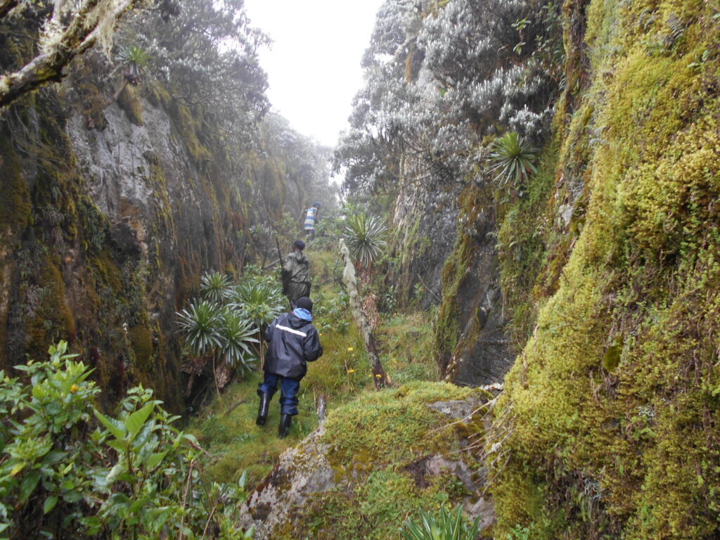
Photography of the giant lobelia and groundsel fields benefits from the clearer light of the drier windows, roughly December to February and June to August, when trail conditions across the Bigo Bog and similar boggy sections are also noticeably firmer underfoot. Bird activity in the lower forest zones remains fairly consistent year-round, making birdwatching one of the few Rwenzori attractions genuinely unaffected by seasonal timing. No season in this range guarantees a fully clear summit view or entirely dry trail conditions; the Rwenzori’s persistent cloud cover is part of what kept the range hidden from outside knowledge for so long, and every itinerary should be planned with that reality in mind rather than an expectation of guaranteed sunshine.
Routes of the Rwenzori Mountains
Two principal trails access the range’s major attractions. The Central Circuit Trail starts at Nyakalengija near Kasese and goes through the Mubuku and Bujuku valleys, passing Nyabitaba, John Matte, and Bujuku huts, and leads to Mount Stanley, Mount Speke, Mount Baker, and Kitandara Lakes via Scott Elliot Pass, making it the standard approach for most summit and Portal Peaks itineraries.
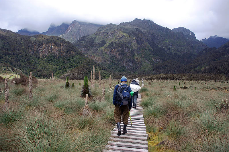
The Kilembe Trail departs from the town of Kilembe on the range’s southern flank and climbs through Sine, Mutinda, and Bugata camps toward Weismann’s Peak and, on longer itineraries, Margherita Peak from the opposite direction, offering a quieter trail with a different sequence of vegetation zones and waterfalls. Neither route is objectively superior; the right choice depends on which attractions matter most to you and how the two trails’ distinct pacing and scenery suit your travel style.
Read our detailed comparisons of the Central Circuit Trail and the Kilembe Trail for a full route-by-route breakdown.
Cost of Rwenzori Trekking
Costs across the range scale primarily with trek duration, technical demand, and group size. Shorter, non-technical itineraries such as the 3-Day Lake Mahoma Trek or 4-Day Rwenzori Waterfalls Hike sit at the more accessible end of the range’s pricing, reflecting their shorter duration and simpler logistics. Multi-day summit itineraries to Margherita Peak, Mount Speke, or Mount Baker cost significantly more because they require more days, specialist technical equipment, and a higher guide-to-client ratio for safe glacier or rope-protected travel. Park entry and trekking permit fees, payable to the Uganda Wildlife Authority, apply across every itinerary regardless of route or duration, and group size also affects per-person cost, with smaller private groups generally costing more per traveler than larger shared departures. We provide a precise, current quotation for any itinerary or combination of routes upon inquiry, since park fee schedules and operating expenses shift from season to season.
Practical Visitor Information
Every visitor to Rwenzori Mountains National Park must be accompanied by a Uganda Wildlife Authority ranger and a licensed mountain guide for the duration of any trek, a mandatory requirement rather than an optional add-on, and park entry and trekking permits are arranged as part of every itinerary we run. Fitness expectations vary considerably by route: a short Lake Mahoma trek demands only general good health and basic hiking comfort, while a Margherita Peak or Mount Speke summit attempt requires a genuine base of cardiovascular fitness built over months rather than weeks beforehand. Accommodation throughout the range consists of maintained wooden mountain huts and tented camps rather than hotels, with all meals prepared fresh by a dedicated camp cook regardless of itinerary. Private road transport connects Entebbe or Kasese to whichever trailhead your itinerary uses, and travel insurance covering trekking at altitude, along with a valid Uganda visa obtainable online in advance, is required for every visitor. Packing recommendations vary by season and by whether your itinerary includes a technical summit, and we provide a tailored gear list, including rental options, ahead of every departure.
What to Wear and Pack for a Rwenzori Trek
Layering is the universal packing principle across every Rwenzori itinerary, given how far any single day moves between warm lowland forest and the genuine cold of a high mountain camp.
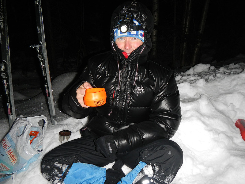
A technical base layer, an insulating mid layer, and a genuinely waterproof and windproof outer shell are the foundation for any trek, and a heavier insulated jacket is essential for any itinerary above 3,500 meters. Sturdy, well broken-in waterproof hiking boots with solid ankle support are non-negotiable given how boggy the range’s middle elevations become, and gaiters make a considerable difference through the bamboo and Bigo Bog sections in particular.
- Waterproof hardshell jacket and trousers, genuinely waterproof rather than merely resistant
- Insulated mid and outer layers, warm hat and gloves for camps above 3,000 metres
- A four-season sleeping bag rated to at least minus 5°C, available for rental
- Trekking poles, particularly valuable through boggy sections and long descent days
- Headlamp with spare batteries for early starts and camp routines
- Personal first-aid kit, sunscreen and UV-rated sunglasses
- Technical mountaineering gear (crampons, harness, ice axe) for any glacier-crossing summit itinerary, available for rental
Full gear rental across every itinerary can be arranged in advance through our team; see our Rwenzori packing and gear rental guide for a complete route-by-route breakdown.
Attractions in the Rwenzori Mountains for Beginners includes: Beautiful sceneries, such a glacial lakes, glacial rivers, snow-capped peaks, tumbling waterfalls, hot springs, endemic birds, butterflies, insects, and reptiles, among many others
The Rwenzori Mountains are an iconic geographical feature located in Uganda, East Africa, renowned for their extensive diversity of ecosystems and rich cultural legacy. 
Rwenzori Mountains National Park is home to Africa’s third highest peak, Margherita, renowned for its glacier, and also features a range of other summits that soar high into the clouds. The Rwenzori Mountains include numerous attractions, hosting a diverse array of plant types and wildlife within their proximity. Rwenzori National Park features varied landscapes that transition from dense rainforests to glacial zones, each characterized by various plant and animal species. In the Rwenzori Mountains, visitors can expect to see a variety of sceneries, such as glacial lakes, glacial rivers, snow-capped peaks, tumbling waterfalls, hot springs, endemic birds, butterflies, insects, and reptiles, among many others.
In addition to its natural beauty, the Rwenzori mountains have a rich cultural legacy and a noteworthy past that hikers can learn about from the legends that the inhabitants have about them.
Rwenzori summits
The Rwenzori mountains known as the Rwenzori ranges is a home to a number of Peaks which collectively create the Rwenzori mountains.

The peaks are breathtakingly beautiful, but they are also difficult and demand hikers’ physical Strength. Margherita Peak is the tallest peak on the Rwenzori Mountains, rising a breathtaking 5109 meters above sea level. It is the most renowned peak that attracts hikers year-round, adorned with snow, drawing visitors globally to explore its breathtaking beauty and uniqueness. Mount Speke, standing at 4,890 meters above sea level, is the second highest peak in the Rwenzori Mountains, with Victoria Emmanuel being the highest point. The summit features jagged peaks and challenging rocky terrain, offering stunning vistas. Mount Baker’s Edward Peak rises to an elevation of 4,844 meters above sea level; it presents a challenge suitable for hiking without the necessity for technical equipment, unlike Margherita Peak. It presents stunning landscapes with remarkable views. Mount Stanley features more than four peaks, including the notable Alexander Peak, Albert Peak, and Cheptegei Peak. Mount Emin is another notable summit in the Rwenzori Mountains, offering superb vistas, followed by Mount Gessi. The mountain features numerous accessible summits, inviting hikers to explore the splendor of the Rwenzori mountains.
Abundant Historical Heritage and Cultural Significance
The history of the Rwenzori Mountains is linked to the indigenous Bakonzo people residing in the region. For ages, they have inhabited the mountains, believing that these peaks had spiritual importance in their lives. They link their tradition to myths and gods, as well as spirits inhabiting the peaks and foothills of the Rwenzori Mountains. The Rwenzori Mountains have historically held considerable cultural significance, as the local population believes they are central to the ceremonies and customs of the Bakonjo. They think that the gods of the mountains are responsible for their crops’ plentiful rains and that their prayers are answered by them. Additionally, the mountains are connected to fertility and good fortune by the inhabitants. Infertile ladies think that going to the mountains and praying to the gods can benefit them.

Additionally, some plant species are claimed to provide women with the fruit of their wombs if they use them. Furthermore, once you visit, the residents are incredibly hospitable and friendly.
Through their ancient music and dances, the Bakonjo will welcome you into their rich culture. As you immerse yourself in the rich cultural history of the Bakonjo people around the mountains, those who have the time will share stories and myths about the Rwenzori mountains.An ecosystem with diverse plants and animals
The Rwenzori Mountains are an ecological hotspot with numerous Plants and Animals. The Rwenzori mountains are home to a wide variety of ecosystems, which makes them a popular destination for researchers, photographers, filmmakers, mountain hikers, and nature lovers. The Rwenzori Mountains‘ vegetation is arranged in a very distinctive district zone, each with its own distinct plant species and animals that can adapt to the varying temperatures and elevations. At lower altitudes or at the foothills of the mountains, flora such as Prunus africana and Magavu trees are present in the tropical forest. The bamboo zone comprises bamboo trees, while the heather zone is characterized by giant heather trees. Additionally, the Alpine zone features giant lobelias, groundsels, and everlasting flowers. Hardy plants such as lichens and mosses are able to endure the severe weather conditions found in the rock and glacier zone.
The colobus and blue monkeys are among the animals found in the Rwenzori Mountains. The three-horned chameleon is found in forested regions, while Dickers can be observed in the Alpine zone. Numerous species of birds, including the distinguished Rwenzori turaco and the malachite sunbird, can be observed in the very first vegetation zones of the mountain. The Rwenzori Mountains are home to more than 217 different bird species, making them an ideal location for birdwatchers.
Glacial Lakes
The Rwenzori mountains’ lakes are the result of glacial processes, specifically the melting of ice at their summits. The lakes are well-known for their pristine waters and beautiful scenery. The most notable lakes in the Rwenzori Mountains are Kitandara Lakes, which are twin lakes in the alpine zone and are renowned for their turquoise blue waters, and Lake Bujjuku, which is situated in the Bujjuku triangle. The Mahoma route, which is located in the mountain’s lower elevations, leads to Lake Mahoma. The other large lake is Irene Lake, which is surrounded by mountain rocks. The glacial lakes provide a necessity for maintaining the mountain’s vegetation.
Glacial Rivers
The rivers come from the melting glaciers of the Rwenzori Mountains‘ high summits. Rivers that run by the mountains provide a plentiful supply of clean, pure water to the communities surrounding them.
The River Mubuku, which originates from the glacier melting of the Mount Stanley peaks, is one of the biggest rivers in the Rwenzori mountains. It serves as a primary water source for both home and agricultural purposes, passing through gorges and valleys. The River Nyamwanba is a remarkable river traversing the Kilembe communities from the steep mountain ranges. Its origins are from Mount Luigi di Savor and Baker. The river is essential for the residents of Kasese, supplying water for domestic and agricultural use; nonetheless, it is notorious for overflowing its banks, resulting in flooding and deaths in Kilembe. From Lake Bujjuku, the River Bujjuku meanders through heathers before joining Mubuku at Kurt Shafer Bridge, where it combines into a one river.

The river Nyamugasani, which boasts amazing waterfalls and quick-moving waters, rises from the western slopes of the Rwenzori mountains. It additionally provides water for the community. The Ruimi River is another notable river in the Rwenzori Mountains, characterized by its fresh and pristine waters.
Furthermore, when in the Rwenzori highlands, one may observe numerous rivers and countless streams that make their way through the Rwenzori trekking routes.
Rwenzori Waterfalls
The Rwenzori mountains are home to an abundance of waterfalls, yet the majority of which can be found along the Kilembe route. They offer picturesque vistas for trekkers, with certain locations being highly accessible, allowing hikers to swim during their expedition.
Enock Falls are the first falls seen from Sine Camp and are located in the mountain’s forest montane zone. Cathy’s falls are more spectacular and forceful, coming from the glacial waters of the Rwenzori mountains. The area around these falls is sometimes hazy, which adds to their beauty. The Nyamwamba waterfalls, which come from the Nyamwamba River, are surrounded by thick vegetation. They provide stunning vistas as their waters cascade into numerous streams. The Plozza waterfalls are remarkable, including many streams cascading over various rocks before descending into a huge pool. Engwe Falls are located among the tall trees of the deep forests, and they drop over a wide cliff. Kamalha Falls is one of the most powerful waterfalls along the Kilembe routes, situated at high altitudes, producing deafening roars and enveloped in mist.
Diverse Climatic conditions and vegetation zones
The Rwenzori Mountains exhibit numerous vegetation zones and diverse climatic conditions, impacted by varying altitudes, each possessing special features. The tropical montane forest zone, situated at altitudes of 1800m to 2500m, is the initial zone on the slopes of the Rwenzori Mountains, distinguished by its lush forest cover. Beyond 2500m is the bamboo zone, characterized by tall, dense bamboo trees, extending up to 3000m.
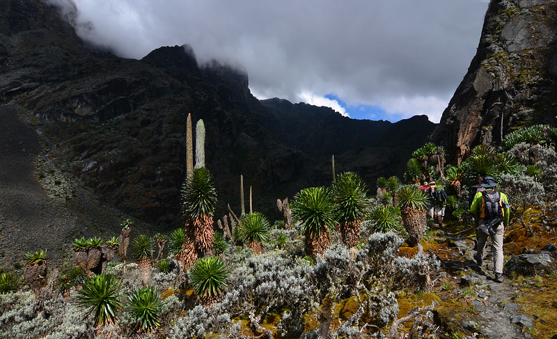
The heather zone, which stretches from 3000 to 4000 meters above sea level, is distinguished by heather trees. The Alpine zone, ranging from 4000m to 4500m, is characterized by huge lobelias, giant groundsels, and everlasting flowers. Above 4500m lies the rock and glacier zone, which is inhospitable to flora and fauna; however, moss and lichen are present in this region. The region is characterized by severe weather and extremely cold temperatures.
Glacier and icy rocks
The Rwenzori Mountains are among the rare locations in the Equatorial region where the peaks are covered in glaciers. Although the glaciers on certain peaks of the Rwenzori Mountains have decreased over the years, they remain mostly intact; yet, climate changes and global warming significantly contribute to their continued melting.

The Rwenzori Mountains consist of massive boulders frequently adorned with moss and lichens, often capped with a thin layer of ice at higher elevations. The rocks and glacier collectively create a remarkable landscape in the Rwenzori Mountains. Despite the glacier’s gradual retreat, it continues to supply all the lakes, rivers, streams, and other water bodies in the Rwenzori region.
The rocks serve as a reminder of how the Rwenzori mountains were formed, which was caused by up thrust forces pushing the block and sculpting the rangers into the present-day ranges.
Rwenzori Birds
The Rwenzori mountain is home to more than 217 different species of birds, including endemic species within the area. The mountain is an ideal location for birdwatchers seeking to observe rare bird species while also experiencing the thrill of hiking across the various terrains of the mountains.

Among the rare species found in the Rwenzori mountains are the Rwenzori turaco, Shelley’s crimsoning, dwarf honeyguide, and malachite sunbird. Bird species inhabit the deep forest zone, extending to the heather zone and some in the Alpine zone, providing hikers with an extraordinary experience throughout their excursions.
Concluding Remarks
The Rwenzori Mountains embody a fusion of natural beauty and profound cultural heritage. The majestic peaks that constitute the block mountain of the Rwenzori ranges serve as a significant attraction, drawing hikers from around the world to explore their breathtaking beauty.
The Rwenzori Mountains host a diverse ecosystem, with numerous plant species and animals that thrive in this environment. In addition to the unique vegetation that varies with altitude, the mountains are a prime location to experience a variety of climate variations due to their various climatic conditions that fluctuate with altitude levels. With more than 51 lakes, the Rwenzori Mountains boast a multitude of water features, including lakes, rivers, and waterfalls, providing hikers with a plethora of breathtaking vistas and sights to take in on their journey.
The Bakonjo people, who have endured and resided near the Rwenzori Mountains, possess a rich and historically significant culture linked to the presence of these mountain ranges.
The Rwenzori mountains are a hidden gem with untamed beauty that offers a truly unforgettable experience, allowing trekkers to not only meditate on its beauty but also immerse themselves in this great challenge and become one of the many heroes who have conquered it. This is true whether you want to explore Margherita Peak, discover the glacier on the peaks, or even see the cascading waterfalls.