Why Mountains Inspire Myths
Long before the Rwenzori had a name that any outsider would recognize, mountains in general already held a particular place in the human imagination, and it helps to understand why before looking at this range specifically. Across cultures on every continent, high peaks have repeatedly been treated as sacred ground, the dwelling places of ancestors or deities, thresholds between the human world and something beyond it. Mountains are frequently cast as the origin points of rivers, which is not merely poetic: a community’s water, and therefore its survival, genuinely does begin somewhere up in that high, unreachable country, which makes reverence toward the source a fairly reasonable human instinct rather than a purely superstitious one. Mountains are also, simply, mysterious in a way that flatter landscapes are not. Clouds swallow their upper reaches for days at a time. Weather changes with an abruptness that feels almost intentional. Distance and difficulty keep most people from ever setting foot on the highest ground, leaving that space open for whatever a community’s oral tradition chooses to place there.
The Rwenzori inherited this general pattern of mountain reverence and then intensified it considerably because almost every feature that makes a mountain mysterious elsewhere is present here in an unusually extreme form: near-permanent cloud, genuine glaciers within sight of the equator, remote valleys that took Western science until the late nineteenth century to even confirm existed, and a botanical world in the upper zones that looks like nothing else on the continent. Understanding that mountains everywhere tend to generate this kind of story-making makes it easier to see the Rwenzori’s own mythology as part of a much older and broader human pattern, rather than something unusual to the range alone.
The “Mountains of the Moon”
The name most associated with this range predates any European’s actual sighting of it by roughly seventeen centuries, and the story of how that happened is genuinely one of the more remarkable episodes in the history of geography. Around the second century AD, the Alexandrian scholar Claudius Ptolemy compiled a description of the known world, the Geographia, in which he recorded a source for the Nile: a range of snow-capped mountains he called, in the Latin later used to translate his Greek, the ‘Lunae Montes,’ the Mountains of the Moon. Ptolemy was working from secondhand testimony passed along trade routes rather than personal observation, and for well over a thousand years afterward, European geographers debated, copied, embellished, and occasionally dismissed this account without any way of confirming it directly.
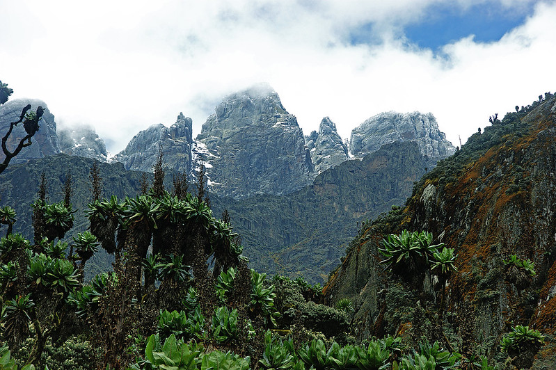
What followed was one of history’s longer-running geographical mysteries: the search for the true source of the Nile, a question that occupied explorers, geographers, and more than a few reputations for centuries. It was not until 1888 that the explorer Henry Morton Stanley, traveling through the region on the Emin Pasha Relief Expedition, recorded a clear sighting of a genuinely snow-capped range rising above the cloud that had, until then, kept it hidden from outside observation. Stanley’s account is widely credited as the moment Western exploration connected Ptolemy’s ancient description to an actual place on the map.
It is worth being precise about what historians and geographers have settled as history here and what they still reasonably debate. It is a fact that the Rwenzori range exists, holds glaciers, and feeds Nile tributaries. That Stanley’s sighting was a landmark moment in resolving centuries of geographical uncertainty about this region is well documented. Whether Ptolemy’s informants were describing this specific range, rather than a more general and possibly composite account of East Africa’s high country, is a question serious historians continue to discuss rather than one with a single settled answer, and we think that honesty serves the story better than a tidier version would. What’s beyond dispute is this: for the better part of two thousand years, a legend held that snow existed near the equator, feeding the world’s most storied river, and the legend turned out to be substantially true.
Bakonzo Cultural Beliefs and the Living Mountain
No account of Rwenzori mythology is honest if it treats the mountain’s meaning as something that arrived with European explorers because the Bakonzo people, whose homeland occupies the foothills and lower slopes of the range on the Ugandan side, have lived alongside and made meaning from these peaks for far longer than any written record exists. It would be a disservice to compress an entire living culture into a handful of bullet points, and we won’t attempt that here; what we can offer, respectfully and with appropriate humility about the limits of what an outside operator can accurately convey, is an outline of the kind of relationship that traditional Bakonzo belief describes.
In Bakonzo tradition, the mountain is widely understood not as inert geography but as something closer to an active presence, commonly associated in oral accounts passed down through generations with the bringing of rain and the shaping of the weather that governs life in the valleys below. Certain high places, passes, and water sources have historically carried particular significance, treated with a degree of care and, in some accounts, ceremony that reflects the mountain’s role as the source of the rivers on which agricultural communities in the foothills have long depended. As with any living oral tradition, these beliefs are not uniform across every Bakonzo family or generation, nor have they remained static across the twentieth and twenty-first centuries, shaped as they have been by mission Christianity, formal schooling, and the arrival of trekking tourism itself. We would rather say plainly that we cannot speak comprehensively for Bakonzo cultural belief than offer a flattened, unchanging version of it. What we can say with confidence, from years of guiding on these trails, is that the Bakonzo guides and porters who lead every expedition on this mountain have a relationship with it that goes far beyond professional familiarity, and travelers who ask questions with genuine curiosity, rather than treating the culture as a curiosity itself, are almost always rewarded with generous, thoughtful answers.
The Mountains Hidden by Cloud
One of the most persistent and understandable themes running through Rwenzori storytelling, across both local tradition and the accounts of early foreign visitors, concerns the mountain’s habit of disappearing. For days at a stretch, the upper peaks sit entirely behind cloud, visible from the valley only as a grey wall with no suggestion of the glaciated summits above. It takes very little imagination to see how a landscape that hides itself so consistently might give rise to stories of concealed kingdoms, of spirits that draw a veil across the peaks to protect what lies within, or of a mountain that reveals itself only to those it chooses to.
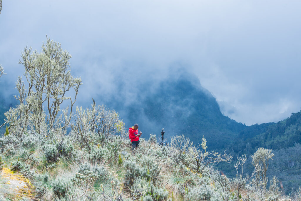
We present these as exactly what they are: folklore born from a genuinely striking meteorological pattern, not documented historical fact. The scientific explanation is more mundane and, in its own way, just as compelling: the Rwenzori generates its own persistent cloud cover as moist air rising from the Congo Basin condenses against the range’s high, cool slopes, but knowing the mechanism does nothing to diminish the emotional force of watching a mountain vanish and reappear in front of you.
Snow on the Equator: From Disbelief to Documented Fact
Historical Belief
For much of the period between Ptolemy’s account and Stanley’s 1888 sighting, the notion of permanent snow and ice within a few degrees of the equator struck many European geographers as implausible on its face, an evocative traveler’s tale rather than a serious geographical claim, dismissed by some scholarly opinion of the era as simply impossible.
Scientific Reality
The explanation, once observed directly, is straightforward atmospheric science rather than any contradiction of equatorial climate: temperature falls with altitude regardless of latitude, and the Rwenzori’s highest summits rise well above 5,000 meters, into conditions cold enough to sustain permanent ice and, at the summit of Mount Stanley, genuine glaciers, among the last remaining anywhere in Africa. What centuries of scholars debated from a distance, any trekker who reaches Stanley Plateau today can confirm simply by looking down at the ice beneath their crampons.
Sacred Peaks
It is tempting, in content written for travelers, to assign a tidy legend to every named summit, a specific myth for Margherita Peak, another for Mount Stanley, and another for Mount Baker’s Edward Peak. We’ve chosen not to invent that tidiness. What can be said honestly is that prominent high points across the range have historically held varying degrees of spiritual significance within Bakonzo tradition, consistent with the broader pattern of mountain reverence found across many cultures, and that different communities and family lineages within the wider Bakonzo cultural sphere have described this significance in different ways rather than through a single, unified legend.
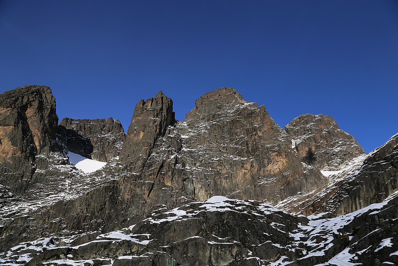
Where specific, well-documented oral traditions exist about a particular peak or pass, our guides are glad to share them on the trail, told properly, in context, and credited to the community they come from, which is a very different thing from packaging a myth for a webpage without that grounding.
Rivers Born from the Mountains
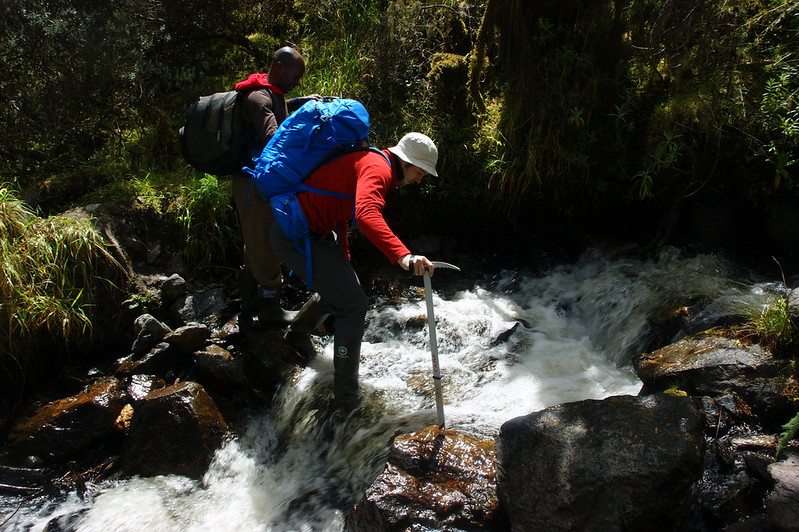
Few features of the Rwenzori carry as much practical and cultural weight as its rivers. The range sits on a genuine hydrological divide, feeding tributaries toward both the Nile system to the east and the Congo system to the west, a fact that alone would justify the reverence long attached to its water sources, quite apart from any mythology. Communities living in the foothills have depended on rivers descending from these slopes for irrigation, drinking water, and daily life for as long as those communities have existed there, and it is entirely consistent with patterns found worldwide that water emerging from a source this remote and this difficult to reach would come to carry both spiritual and practical significance. Treating a river’s mountain source with a degree of ceremony or care is, in this light, less a quaint superstition and more a reasonably sophisticated form of environmental respect, arrived at long before the language of conservation existed to describe it that way.
The Giant Plants of the Afro-Alpine Zone
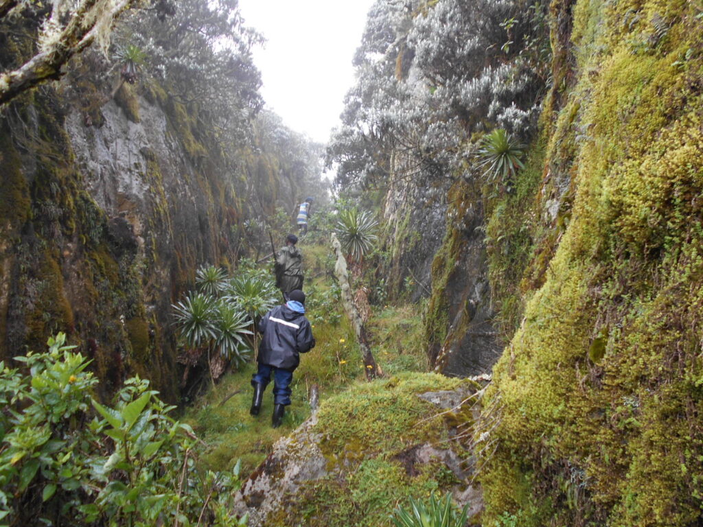
Nothing prepares a first-time trekker for the Rwenzori’s Afro-alpine zone quite the way a photograph fails to prepare them for a giant lobelia in person. Rising through the heather zone toward roughly 3,500 to 4,500 meters, the vegetation shifts into something that looks, frankly, extraterrestrial: giant groundsels with thick, gnarled trunks crowned in rosettes of leaves and giant lobelias sending up flowering spikes taller than an adult standing beside them. It is entirely understandable that early visitors to this zone, and quite possibly Bakonzo communities long before them, developed stories around plants this strange in appearance. Science offers a more measured but no less remarkable explanation: these species have evolved specific adaptations, dense rosettes that trap warmth, water-retaining structures, and other mechanisms to survive a climate that swings from intense equatorial sun by day to sub-zero frost by night, conditions found in very few places on Earth outside East Africa’s highest peaks. Storytelling does not exaggerate the plants; if anything, seeing them in person tends to exceed whatever a traveler expected from the photographs.
Early Explorer Accounts
The written record left by nineteenth- and early twentieth-century explorers offers a genuinely useful window into how overwhelming this landscape appeared to outsiders encountering it for the first time. Stanley’s 1888 expedition documented the sighting that connected the range to Ptolemy’s ancient account. The Duke of Abruzzi’s 1906 expedition went considerably further, undertaking the first serious scientific and mountaineering survey of the range’s glaciers and peaks and, in the process, achieving the first recorded ascents of several of the Rwenzori’s highest summits. These accounts, read today, describe dense and disorienting mist, bog that swallowed a boot to the knee, terrain that shifted dramatically from dense forest to bare rock and ice within a matter of days, and vegetation unlike anything the explorers had catalogued elsewhere on the continent.
It is worth distinguishing, as these accounts themselves sometimes blur, between an explorer’s genuine and understandable astonishment, a real, documented human reaction, and the range’s later verified scientific description. An explorer calling a landscape otherworldly is a testimony, not a scientific classification, however evocative and useful it may be for understanding the emotional impact of this place. Both kinds of record matter, and we’ve tried to keep them distinguishable throughout this guide rather than letting one borrow the authority of the other.
Myths vs. Facts
A single reference table cannot capture the nuance of every debate above, but it offers a useful, honest summary of where legend and evidence currently stand.
Myth or Legend | What We Know Today |
The peaks vanish because spirits conceal them. | Persistent, self-generated cloud cover from moist Congo Basin air regularly obscures the summits as it condenses against the range’s high slopes, representing a real meteorological pattern that likely inspired the folklore rather than serving as a literal claim. |
Snow and ice cannot exist this close to the equator. | Altitude, not latitude, governs temperature; the Rwenzori’s highest summits rise well above 5,000 meters, cold enough to sustain permanent ice and glaciers. |
The ‘Mountains of the Moon’ were purely imaginary, a product of travelers’ exaggeration. | Ptolemy’s account, recorded around 150 AD, described a real geographic phenomenon later linked to this range by Stanley in 1888, though the precise historical identification remains debated among scholars rather than fully settled. |
The giant plants are a traveler’s exaggeration. | Giant lobelias and giant groundsels are real, scientifically documented Afro-alpine species with specific adaptations to extreme daily temperature swings at altitude. |
Where genuine scholarly debate exists, as with the precise historical identification of Ptolemy’s account, we’ve tried to say so plainly rather than resolve it more neatly than the evidence allows.
How Myths Shaped Exploration
The Rwenzori’s mythology did not simply decorate its history; it actively drove it. Ptolemy’s account of snow-capped mountains feeding the Nile became a fixed reference point in European geography for centuries, informing maps and theories about African geography long before anyone from outside the region had confirmed the range existed. The long, competitive, and often fraught nineteenth-century search for the source of the Nile, one of the defining geographical quests of the Victorian era, was shaped in part by the persistent question of whether Ptolemy’s ancient legend pointed to something real. When Stanley’s 1888 sighting appeared to confirm it, the moment fed directly into a wave of public fascination with the region, which in turn helped draw the Duke of Abruzzi’s rigorous 1906 scientific and mountaineering expedition. In a very real sense, an ancient legend recorded in Alexandria helped set in motion the chain of events that eventually put the Rwenzori on the world’s map, a rare example of mythology functioning as a genuine, if imperfect, geographical hypothesis.
Why These Stories Still Matter
It would be all too simple to treat the Rwenzori’s myths as historical curiosities, interesting but no longer relevant to a modern trekking expedition. We’d push back gently on that framing. These stories continue to shape how the mountain is understood by the communities who live alongside it, informing local identity and a sense of custodianship that predates the national park designation by centuries. They continue to draw travelers who want more from a mountain than elevation gain and summit statistics, as well as people who are curious about the layered human history of a place, not just its physical challenge.
And they continue to matter for conservation, because a mountain regarded with genuine reverence, by both the community that has always lived beside it and the visitors who come to walk it, tends to be a mountain treated with more care. None of that requires presenting every legend as literal fact. It simply requires taking the living tradition seriously, which is what we aim to do on every trek we guide.
Responsible Cultural Tourism on the Rwenzori
A trek through the Rwenzori is also, whether travelers arrive expecting an adventure or not, a passage through the Bakonzo homeland, and a small amount of thoughtfulness goes a long way toward making that encounter respectful. We encourage every guest to approach local traditions with genuine curiosity rather than treating them as photo opportunities or novelties; ask your guide questions, and expect that some answers may be personal, incomplete, or simply not intended for outside audiences, which is entirely their right. Always ask permission before photographing individuals, ceremonies, or homes along the approach to the trailhead, and graciously accept if that permission isn’t given.
Where community-run initiatives, craft cooperatives, or cultural centers exist near the trailheads, supporting them directly channels tourism revenue to the people whose ancestral landscape you are about to walk through. None of this is complicated, but it requires treating the Bakonzo not as a backdrop to your Rwenzori story but as the mountain’s oldest and most rightful storytellers.
What to See and Do in Rwenzori Mountains National Park
Beyond its mythology, the park itself rewards exploration on its own considerable merits. Trekkers move through five distinct vegetation zones on a single multi-day itinerary: montane forest, bamboo, heather, Afro-alpine moorland, and finally bare rock and glacier, a botanical journey found in almost no other single trek on the continent. Along the way, the giant lobelias and groundsels described above grow next to real glaciers on Mount Stanley, which are still there despite well-documented retreat, and a network of glacial lakes, including Lake Bujuku and Lake Mahoma, that mark several of the standard routes. Birdlife is excellent throughout the lower forest zones, and the range’s remoteness means trails that feel, refreshingly, uncrowded compared with East Africa’s more famous peaks. For a fuller sense of what each specific route offers, our team can walk you through the distinct character of both the Kilembe Trail and the Central Circuit Trail when you inquire.
What to Wear and Pack
Because the Rwenzori moves through so many climatic zones in a single day—humid lower forest, cold and often wet upper moorland, and near-freezing conditions at the higher camps—proper layering and waterproofing matter more here than on almost any comparable African trek.
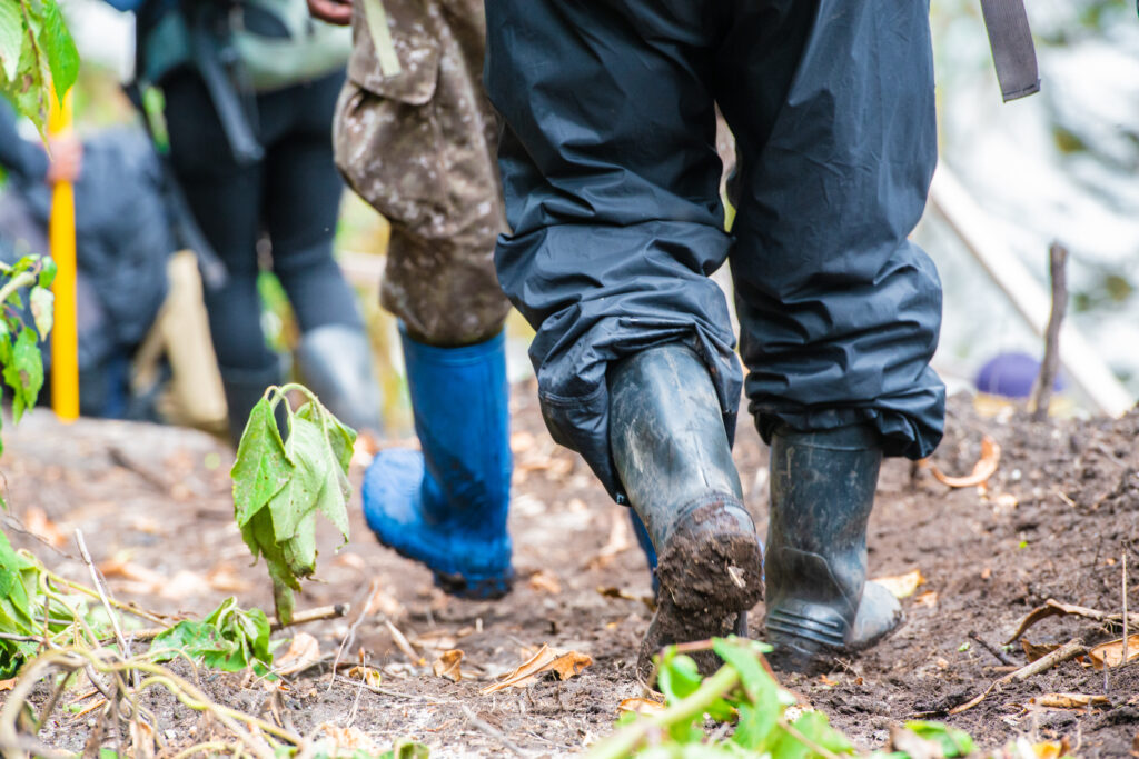
We’ve covered the topic in complete depth in our dedicated packing guide, which walks through exactly what to wear each day, which gear can be rented locally, and which items are worth bringing from home; it’s essential reading before any Rwenzori booking, whichever itinerary you choose.
Curated Itineraries: Walk Into the Legend
Reading about the Rwenzori’s myths is one thing. Standing on the pass where the cloud breaks and the mountain that inspired two thousand years of story finally shows itself is another experience altogether. Below are two of our most requested itineraries: a focused expedition to Mount Baker’s Edward Peak and a longer journey combining the Rwenzori with Uganda’s gorilla trekking, each built as a fully private, seamlessly arranged experience from the moment you land.
Itinerary One: Mount Baker & Edward Peak Expedition
6 Days / 5 Nights — Kilembe Trail — Private Departure
Of the Rwenzori’s six major massifs, Mount Baker holds a particular kind of drama: less crowded than the approach to Margherita Peak but every bit as demanding, rising through the Kilembe Trail’s forest and heather zones to the rocky crown of Edward Peak at 4,843 meters. This itinerary is built for trekkers who want the full emotional arc of a Rwenzori summit, the mist, the giant lobelias, and the pass where the range finally reveals itself without committing to the longer full-traverse expeditions.
Day-by-Day Summary
Day | Overview |
Day 1 | Arrival in Entebbe, private transfer and overnight |
Day 2 | Fly or drive to Kasese; trailhead briefing and gear check |
Day 3 | Trek begins: Kilembe trailhead to Sine Camp |
Day 4 | Sine Camp to Samalira Camp, through the heather zone |
Day 5 | Samalira Camp to Mutinda Camp, approach to Edward Peak |
Day 6 | Summit push to Edward Peak and descent; transfer to Kasese |
Day-by-Day Itinerary
Day 1: Entebbe
The lake air at Entebbe carries a particular softness after a long flight, and a private vehicle is already waiting when you clear arrivals. There’s no rush tonight, just a quiet transfer to a lakeside guesthouse, dinner arranged for whenever you’re ready for it, and the first, distant sense that somewhere west of here, hidden behind cloud that has sat over it for longer than anyone can measure, a mountain is waiting.
Day 2: Drive to Kasese
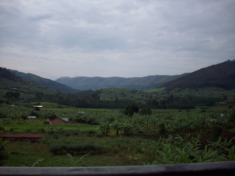
Morning brings the choice of a short domestic flight or a scenic private road transfer west, with the country opening into tea plantations and the long green folds of the Rift Valley escarpment. Kasese arrives by afternoon, and with it your first real look at the Rwenzori’s lower slopes, usually wrapped in the same mist that has confounded explorers for centuries.
Your guide will cond
Conduct a dedicated gear check, followed by a briefing over an early dinner, and then you will spend the evening at a comfortable lodge near the trailhead, with everything arranged so that the only decision left for tomorrow is which boot to lace first.
Day 3: Kilembe To Sine Camp
The Kilembe trailhead announces itself with a wall of green, montane forest thick with birdsong, the trail underfoot alternating between packed earth and root. Your private guide sets a pace matched to your fitness rather than a fixed schedule, pausing where the forest offers something worth pausing for: a chameleon caught mid-step, a stand of wild orchids, or the first glimpse of L’Hoest’s monkeys moving through the canopy.
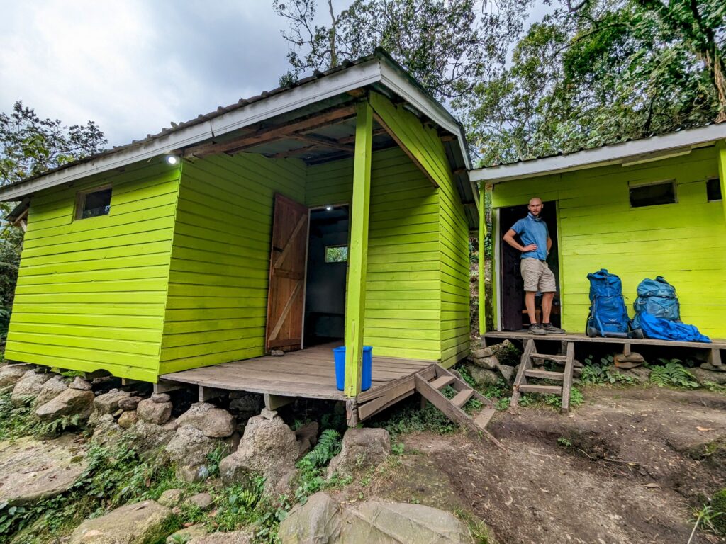
Since Camp arrives by mid-afternoon, tents are already pitched by the support team, a hot meal waiting as the light softens and the forest’s daytime noise gives way to something quieter.
Day 4: Trek to Samalira Camp
The forest thins, and the character of the mountain changes entirely. Bamboo gives way to heather draped in old man’s beard lichen, ghostly in the morning mist, and the first giant groundsels, plants that no photograph quite prepares you for, begin to appear along the trail.
The going is steadily steeper today, the air noticeably thinner by the time Samalira Camp comes into view, tucked into a fold of the mountain with views back down the valley you climbed. A curated evening around a warm meal, altitude beginning to make itself gently known, and the kind of fatigue that comes with real accomplishment rather than mere effort.
Day 5: Trek to Mutinda Camp
Today’s walk crosses fully into the Afro-alpine zone, where giant lobelias stand taller than a person, and the landscape takes on the otherworldly quality that gave this range its centuries of legend.
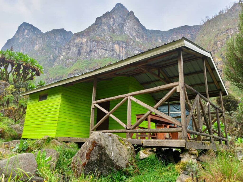
Mutinda Camp sits high enough that the temperature drops sharply once the sun goes, and for the first time, if the cloud cooperates, Mount Baker itself becomes visible ahead, rock and streaked snow rising out of the moorland. Dinner tonight comes with an early curfew; tomorrow begins in the dark.
Day 6: Edward Peak and Descent
The summit push begins well before first light, with headlamps picking out a trail that steepens into scrambling near the top. Edward Peak’s final approach demands full attention and rewards it completely, a scramble across broken rock to a summit at 4,843 meters, the whole range spreading out below in whatever light the mountain has decided to offer this particular morning. The descent that follows is long, knees tested by the same terrain that tested lungs on the way up, but it ends, eventually, back at the trailhead, a private vehicle waiting to carry you into Kasese for a proper shower, a real bed, and the particular satisfaction of a summit earned rather than simply reached.
What’s Included / What’s Excluded
This itinerary is arranged as a fully private expedition, meaning your pace, your rest stops, and your daily rhythm are yours alone, nothing shared with another group’s schedule.
What’s Included
Park entrance and trekking fees for the Kilembe Trail route, a dedicated mountain guide and full porter team, all camp accommodation and full-board meals throughout the trek, private road or domestic flight transfer between Entebbe and Kasese, one night’s accommodation in Entebbe and one in Kasese before the trek begins, and a pre-trek equipment check and briefing.
What’s Excluded
International flights, Uganda visa fees, travel insurance, personal trekking gear (available to rent locally where noted in our packing guide), gratuities for the guide and porter team, and personal expenses are not included.
Best Time to Travel
This route is at its best during the two drier windows: mid-December to mid-February and June through August, when firmer trail conditions and clearer visibility give the Edward Peak summit push the best possible chance of a clear view across the range.
Itinerary FAQ
How difficult is the Mount Baker and Edward Peak trek?
It’s a genuinely demanding trek requiring good cardiovascular fitness and comfort with steep, sometimes exposed scrambling near the summit, though it does not require prior technical mountaineering experience.
Is this itinerary suitable for a private couple or small group?
Yes, it’s built specifically as a private departure, so pacing and rest days are arranged entirely around your group, whether that’s a solo traveler, a couple, or a small party of friends.
Can this itinerary be extended to include Margherita Peak?
Yes, our team can adapt this route into a longer multi-peak expedition. If you’d like to include Margherita Peak or other summits, simply let us know when enquiring.
Itinerary Two: Rwenzori Summit & Gorilla Trekking Journey
11 Days / 10 Nights — Central Circuit to Margherita Peak + Bwindi Gorilla Trekking
For travelers who want the complete Ugandan story in one journey, the Mountains of the Moon and the mountain gorillas of Bwindi Impenetrable Forest, this itinerary threads a full Margherita Peak summit expedition together with a private gorilla trekking excursion, connected by scenic road transfers through the Rift Valley.
Day-by-Day Summary
Day | Overview |
Day 1 | Arrival in Entebbe, private transfer and overnight |
Day 2 | Transfer to Kasese; briefing and gear check |
Day 3 | Central Circuit trailhead to Nyabitaba Camp |
Day 4 | Nyabitaba to John Matte Camp |
Day 5 | John Matte to Bujuku Camp, beneath the glaciers |
Day 6 | Bujuku to Elena Hut, final summit approach |
Day 7 | Summit push to Margherita Peak; descent to Kitandara |
Day 8 | Descent to trailhead; transfer to Kasese for rest |
Day 9 | Private transfer to Bwindi Impenetrable Forest |
Day 10 | Private gorilla trekking excursion in Bwindi |
Day 11 | Transfer to Entebbe and departure |
The Full Journey
Day 1: Entebbe
Lake Victoria’s evening light meets you almost as soon as you clear customs, a private driver already holding a sign with your name. Tonight is simply for arriving, a lakeside dinner, an early night, and the pleasant awareness that the real journey begins tomorrow.
Day 2: Drive to Nyakalengija
A private vehicle carries you west through Uganda’s green interior toward Kasese, the Rwenzori’s cloud-wrapped silhouette growing steadily larger through the windscreen across the afternoon. Gear check, trail briefing, and a satisfying dinner settle any pre-trek nerves before an early night.
Day 3: Nyakalengija to Nyabitaba
The Central Circuit trailhead opens into dense montane forest almost immediately, with roots and leaves underfoot and the calls of black-and-white colobus somewhere overhead. Nyabitaba Camp perches on a ridge, with the Bujuku and Mubuku valleys falling away on either side, marking your first camp and your first genuine sense of how far this range stretches beyond what the eye can measure from below.
Day 4: Trek To John Matte
Today’s trail crosses the infamous lower bog sections, with boardwalks easing what would otherwise be a genuinely difficult crossing, before rising into bamboo and the first true heather. John Matte Camp sits with a clear outlook toward the peaks still hidden, for now, behind the day’s building cloud.
Day 5: Beneath the Glaciers at Bujuku
The giant groundsels arrive in earnest today, strange and towering, as the trail skirts Lake Bujuku with Mount Baker, Mount Stanley, and Mount Speke all rising, when the cloud allows it, in a single extraordinary panorama. Bujuku Camp, cradled beneath all three, feels less like a campsite and more like the floor of an amphitheater.
Day 6: Trek To Elena Hut
A shorter but steeper day carries you up toward Elena Hut, perched at the edge of the glacier zone. This afternoon includes a technical briefing from your guide, crampon and ice axe technique, roped movement, and exactly what tomorrow’s pre-dawn push will demand, before an early dinner and an even earlier bedtime.
Day 7: Trek To Margherita Peak
The alarm sounds well before midnight. Headlamps, rope, and crampons bite into ice that has fed two millennia of legend about snow at the equator, and then, if the mountain is generous this particular morning, the summit itself: 5,109 meters, the Congo basin spread to the west, and the whole Rwenzori range laid out below in the thin light of not-quite-dawn.
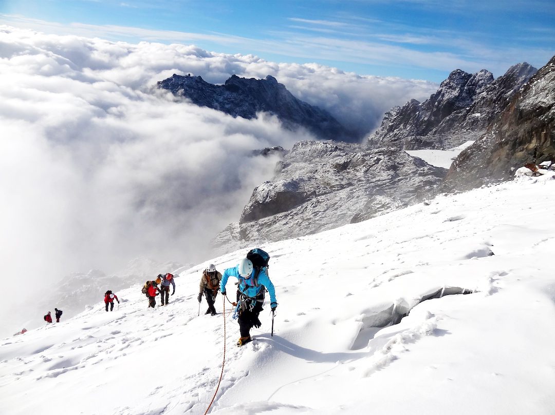
The descent to Kitandara’s twin lakes takes the rest of the day, legs weary in the particular way that only follows a summit actually earned.
Day 8: Descent and Rest
The final descent retraces familiar ground back toward the trailhead, the forest feeling different in reverse, before a private vehicle collects you for a hot shower and a proper bed in Kasese, giving you a full day to let the legs, and the memory, settle.
Day 9: South to Bwindi
A long, scenic private transfer carries you south through the Rift Valley toward Bwindi Impenetrable Forest, Uganda’s second UNESCO icon after the Rwenzori itself, the landscape shifting from mountain moorland to dense, ancient rainforest en route.
Day 10: Gorilla Trekking
A private guide and tracking team lead you into Bwindi’s forest, following signs left by one of the park’s habituated gorilla families until, without much warning, you’re standing a few respectful meters from a silverback going about an entirely unhurried morning.
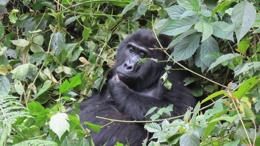
An hour passes that somehow feels both instant and enormous, and then the walk back out, the forest around you suddenly much louder than it was on the way in.
Day 11: Departure
A final private transfer carries you back to Entebbe, time enough for a last lakeside lunch before your evening flight, two of Uganda’s most extraordinary experiences, seamlessly arranged from first landing to last.
What’s Included / What’s Excluded
What’s Included
The package includes all park entrance and trekking fees for the Central Circuit route to Margherita Peak, a dedicated mountain guide and full porter team, all camp accommodation and full-board meals during the trek, technical mountaineering equipment for the glacier summit section, one Bwindi gorilla trekking permit per person, a private guide and tracking team in Bwindi, all private road transfers between Entebbe, Kasese, and Bwindi, and hotel accommodation on non-trekking nights.
What’s Excluded
International flights, Uganda visa fees, travel insurance, personal trekking gear, gratuities for guides, porters, and trackers, and personal expenses are not included.
Best Time to Travel
For the trekking portion, the drier windows of mid-December to mid-February and June through August offer the best summit conditions and visibility. Gorilla trekking in Bwindi is possible year-round, though the same drier months also make for firmer forest trails, making this combined itinerary particularly well suited to travel within those two windows.
Itinerary FAQ of Rwenzori Hike & Gorilla Trek
Can the trekking and gorilla portions be booked separately?
Yes, though combining them into one seamless itinerary, as arranged here, avoids duplicate transfers and lets our team handle every logistical connection between the two experiences.
Do I need separate fitness levels for the trek and the gorilla trekking?
The Margherita Peak summit is the more physically demanding component and requires solid trekking fitness; gorilla trekking in Bwindi is moderately strenuous but considerably less technical and achievable by most reasonably fit travelers.
How far in advance should I book, given the gorilla permit requirement?
Gorilla permits in Bwindi are limited and should be secured well in advance, ideally several months ahead of your intended dates, particularly for travel during the peak trekking windows.