Where Are the Rwenzori trekking Routes Located?
All three Rwenzori Mountains trekking routes of Rwenzori Mountains National Park, begin and end on the Ugandan side of the range, in or near the town of Kasese in western Uganda, roughly 6 to 7 hours by road from Kampala or a short scheduled flight from Entebbe. The Rwenzori Mountains themselves straddle the border between Uganda and the Democratic Republic of Congo, with the international boundary running along the range’s highest ridgelines, meaning that from Margherita Peak’s summit, Uganda lies to the east and the DRC to the west, separated by only a few meters of glacier.
The Central Circuit trail begins at the Nyakalengija trailhead, roughly 22 kilometres from Kasese, at the Rwenzori Mountains National Park headquarters where permits are checked and porters assemble. The Kilembe Trail begins at a separate trailhead in Kilembe village, a former copper-mining settlement approximately 14 kilometres from Kasese on the range’s southern flank, and climbs the Nyamwamba Valley before curving north to meet the Central Circuit’s high camps near Lake Kitandara. The Bukurungu Trail uses its own private trailhead and wild-camping infrastructure, tracing a route past several of the range’s lesser-visited lakes before it, too, joins the Central Circuit trail for the final approach to the summit massif.
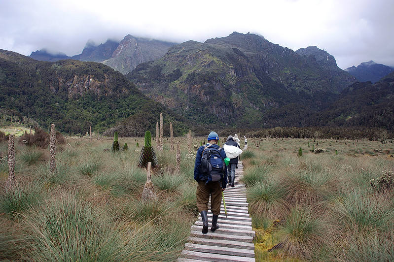
Geographically, it helps to picture the range as a single knot of six glaciated massifs, Stanley, Speke, Baker, Emin, Gessi, and Luigi di Savoia, with the various trailheads arranged around its base like spokes on a wheel. Every spoke eventually leads to the same hub of high alpine camps beneath Mount Stanley, which is why the choice of route matters less for where you end up than for the journey you take to get there.
The Central Circuit Trail Of Rwenzori Mountains
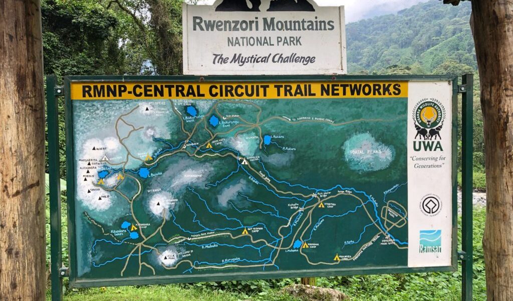
The Central Circuit trail is the oldest established trekking route in the Rwenzori, walked in some form since the earliest European mapping expeditions of the early twentieth century, including the Duke of Abruzzi’s landmark 1906 ascent of Margherita Peak. It remains the most comprehensive and most walked route through the range today, managed by Rwenzori Mountaineering Services under Uganda Wildlife Authority oversight, and it is the route by which the vast majority of trekkers who summit Margherita Peak each year make their attempt.
Route Layout and Typical Duration
From the Nyakalengija trailhead, the Central Circuit trail climbs through rainforest to Nyabitaba Hut, then continues through bamboo and heather zones to John Matte Hut and onward into the Bujuku Valley, reaching Bujuku Hut beside its namesake lake at the foot of the Stanley, Baker, and Speke massifs. From Bujuku, the trail climbs steeply over the Scott Elliott Pass to Elena Hut, the final staging point for the Margherita Peak summit attempt, before descending to Kitandara Hut and returning via the Freshfield Pass to Guy Yeoman Hut and back down to Nyabitaba and the trailhead. Depending on the itinerary chosen, the full circuit runs anywhere from five days for a shorter, non-summit exploration to nine days for a complete summit expedition with proper acclimatization built in.
Major Camps and Highest Elevation
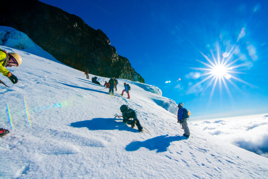
The circuit’s principal huts, in order of ascent, are Nyabitaba (2,650m), John Matte (3,505m), Bujuku (approximately 3,977m), Elena (4,541m), Kitandara (4,023m), and Guy Yeoman (3,505m). The trail’s highest point is Margherita Peak itself at 5,109 meters, reached via a technical glacier crossing above Elena Hut that involves fixed ropes and, on the final approach, short sections of rock scrambling.
Highlights Of The Central Circuit Trail
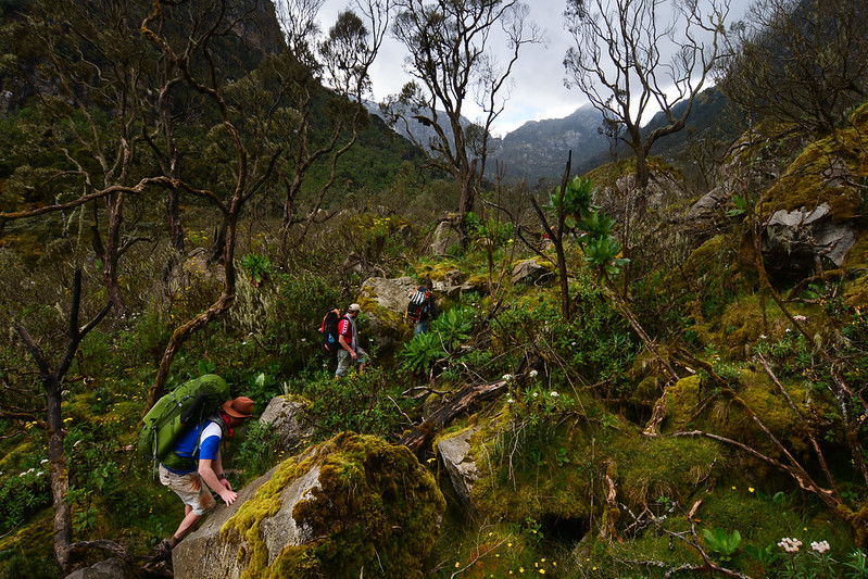
Nyabitaba’s forested ridge above the confluence of the Mubuku and Bujuku rivers offers the trek’s gentlest introduction, rich with colobus and blue monkey sightings. John Matte marks the trail’s entry into true Afro-alpine terrain, with the first giant groundsels appearing along the path. The Bujuku Valley and Lake Bujuku form the circuit’s most photographed stretch, giant lobelias standing in their thousands beneath the glaciated flanks of Mount Baker and Mount Stanley. Elena Hut is the gateway to Margherita Peak’s summit attempt, while Kitandara Hut, set beside twin glacial lakes, and the Freshfield Pass above it, offer some of the finest panoramic mountain views anywhere in the range. Guy Yeoman marks the trek’s return to gentler, warmer terrain before the final descent.
The Central Circuit Trail is Best For
The Central Circuit trail is the clear choice for trekkers whose primary goal is reaching Margherita Peak by the most direct, well-established route, and it remains outstanding for scenic trekking, wildlife encounters in its lower forest zones, and photography of the range’s most iconic alpine lake and glacier landscapes.
The Kilembe Trail of the Rwenzori Mountains
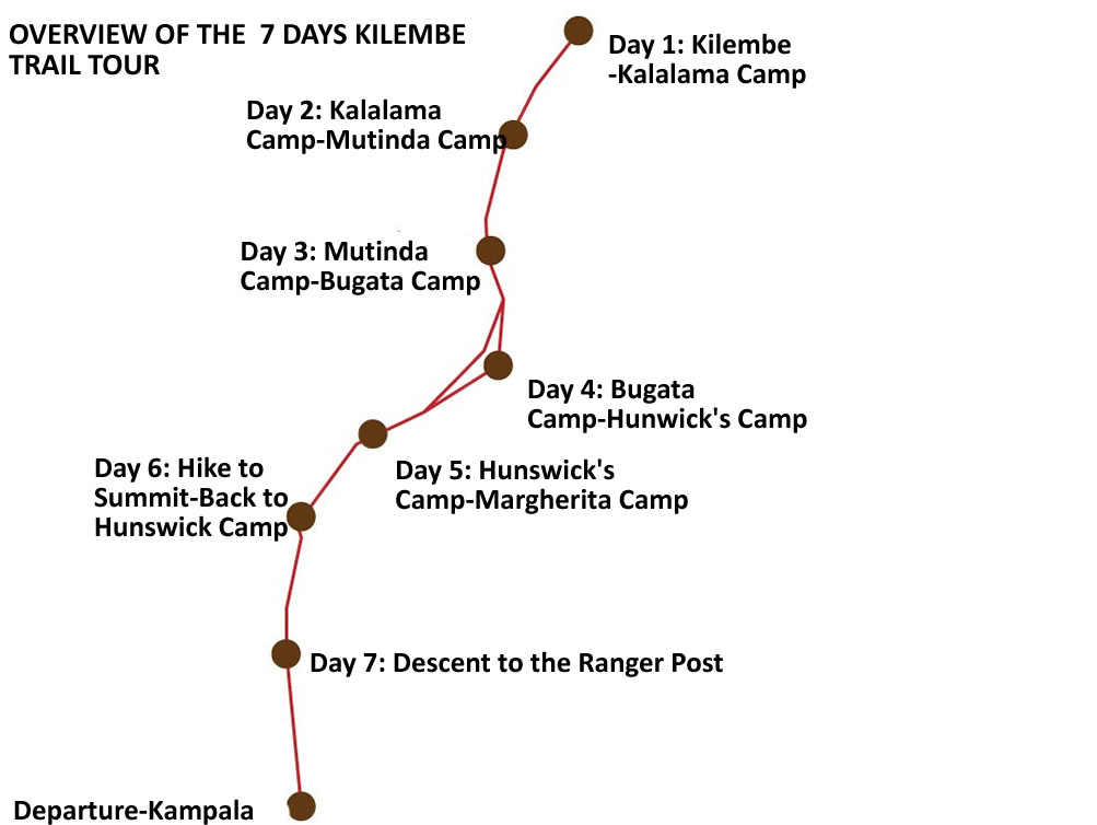
The Kilembe Trail’s line was first surveyed as early as 1895 by the botanist Scott Elliott, but it was only formally developed and opened for organized trekking considerably later, commonly dated to between 2009 and 2011, with the construction of a series of purpose-built huts by Rwenzori Trekking Services, built to a noticeably higher standard than the Central Circuit Trail’s older facilities. It remains fully operational today under continuous Uganda Wildlife Authority oversight, and it is now regarded by many experienced Rwenzori guides as the range’s premier route for trekkers who want a longer, more gradual, and arguably more visually varied journey to the summit.
Major Camps and Routes
The Kilembe Trail begins at the Kilembe trailhead near Kasese and climbs the Nyamwamba Valley, passing a sequence of camps that typically include Sine Camp, Kalalama Camp, Mutinda Camp or Bugata Camp depending on the specific itinerary, and Margherita Camp, before joining the Central Circuit’s high alpine network near Lake Kitandara for the final approach to Elena Hut and Margherita Peak. Because the route joins the established summit infrastructure rather than duplicating it, Kilembe trekkers use many of the same high camps as Central Circuit trail trekkers for the actual summit attempt.
Scenic Highlights and Vegetation
The Kilembe trail approach is widely considered the more dramatic of the two major routes in its lower sections, passing more than eight significant waterfalls in its opening days alongside the Nyamwamba River, and offering long views over the Rift Valley floor that the Central Circuit’s more enclosed forest approach does not provide in the same way. The vegetation sequence mirrors the broader Rwenzori pattern, montane forest giving way to bamboo, heather, and giant Afro-alpine moorland, but the pacing across a longer route allows this transition to unfold more gradually.
Differences from the Central Circuit Trail
The Kilembe Trail’s defining practical advantage is acclimatization: as the longer of the two major routes, typically run over eight to twelve days rather than five to nine, it allows a more gradual altitude gain, a meaningful benefit for trekkers who know from experience that they acclimatize slowly. Its accommodation is also generally newer and somewhat more comfortable than the Central Circuit Trail’s older huts. Its principal trade-off is time and cost, a longer trek means more days of guiding, porterage, and permits, and it is, on balance, best suited to already-experienced hikers rather than first-time trekkers, precisely because its added length demands a bigger overall commitment of fitness and time.
The Minor Trail Routes of the Rwenzori Mountains
Bukurungu Trail of the Rwenzori Mountains
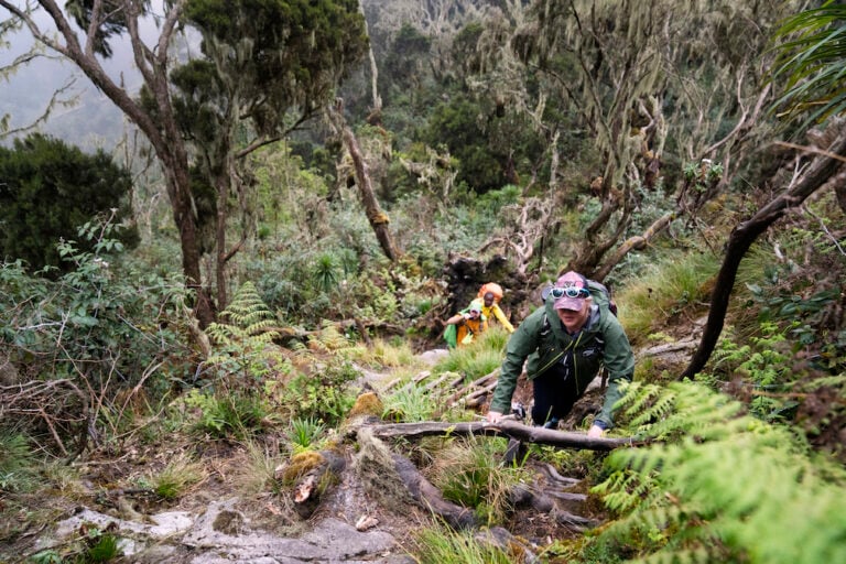
The Bukurungu Trail is the newest established route in the Rwenzori Mountains range, privately operated and using wild camping instead of fixed huts, which strongly appeals to travelers who want to experience something closer to how the range’s earliest explorers did. The Bukurungu trail Of the Rwenzori Mountains passes a sequence of lakes rarely seen by Central Circuit trail or Kilembe trekkers, including Lake Mughuli, Lake Bukurungu, Lake Bujuku, and Lake Irene, before it, too, joins the Central Circuit trail for the final summit approach to Margherita Peak. It suits trekkers who are comfortable trading hut comfort for a wilder, more solitary mountain experience.
Diamond Trail and Karangura Trail
The Rwenzori Mountains also consist of several shorter trails primarily used for day hikes, birding walks, and acclimatization outings, in addition to the three principal trekking routes that reach Margherita Peak, rather than full summit expeditions. The Diamond Trail and the Karangura Trail both fall into this category, offering access to lower-elevation forest, waterfall, and viewpoint scenery without the commitment of a multi-day summit itinerary, useful options for travelers looking to combine a shorter Rwenzori taste with time elsewhere in Uganda.
Compare Every Rwenzori Trekking Route Aspect
With the two major routes described in full, it is worth putting them side by side across the specific factors that actually drive most trekkers’ decisions.
Difficulty
Feature | Central Circuit | Kilembe Trail |
Mud | Present, especially through Bigo Bog | Present, though somewhat less boggy overall |
Altitude | High up to 5,109 m | High, up to 5,109 m (shared summit) |
Rock scrambling | Some sections near the summit | Depends on the specific itinerary chosen |
Trek length | Shorter overall (5–9 days) | Longer overall (7–12 days) |
Acclimatization profile | Faster ascent, less gradual | More gradual, generally gentler on the body |
Scenery
The Central Circuit trail is unmatched for its concentration of alpine lakes, with Bujuku and Kitandara both sitting directly on the trail, and for the giant lobelia and groundsel moorland of the Bujuku Valley, which is widely considered the range’s single most photogenic stretch. The Kilembe Trail counters with its waterfall-rich lower valley, more than eight significant falls in its opening days, and long, open views over the Rift Valley floor that the more enclosed Central Circuit trail rarely offers. Both routes deliver genuine equatorial glacier views near the summit, since they converge on the same high camps beneath Mount Stanley and pass through heather forest and giant lobelia zones, though the sequencing and density differ.
Wildlife On The Rwenzori Mountains Trekking Routes
Both Central Circuit Trail & Kilembe Trail routes offer real opportunities to see black-and-white colobus and blue monkeys in their lower forest zones, along with a strong variety of birdlife, including the endemic Rwenzori turaco and numerous sunbird species, the Central Circuit trail’s Nyabitaba stretch and the Kilembe Trail’s lower Nyamwamba Valley are both well regarded among birders.

Both the Rwenzori trekking routes of the Central Circuit & Kilembe occasionally reveal endemic and near-endemic species associated with the range’s Afro-alpine zone, including the Rwenzori three-horned chameleon. As with any wild forest, sightings are a matter of patience and timing rather than guarantee, and neither route can promise a specific encounter.
Vegetation Zone of the Rwenzori Mountains Trekking Route
Both Kilembe trail & Central Circuit routes of the Rwenzori Mountains pass through the same broad ecological Vegetation Zones that makes the Rwenzori globally significant, lowland and montane rainforest, dense bamboo forest, tree heather woodland, giant lobelia and groundsel moorland, and finally alpine rock and permanent ice near the summit. The Central Circuit trail compresses this sequence into a shorter overall trek, while the Kilembe Trail’s greater length allows each zone more room to unfold, which many trekkers find gives a stronger sense of genuinely climbing through an ecological gradient rather than passing through it quickly.
Photography Of The Rwenzori Mountains Trekking Routes
For sunrise photography, Elena Hut’s approach to Margherita Peak on either route delivers the range’s finest pre-dawn light on ice and rock. For alpine lakes, the Central Circuit trail has the clear edge, with both Lake Bujuku and the twin Kitandara lakes directly on its path. For forest and waterfall photography, the Kilembe Trail’s lower valley is the stronger choice. For wildlife photography, both routes offer comparable opportunities in their lower forest zones, while for pure alpine moorland drama, with giant lobelias silhouetted against glaciated peaks, the Bujuku Valley on the Central Circuit Trail is, in our experience, the single most rewarding stretch in the entire range.
Which Rwenzori Mountains Trekking Route Reaches Which Attractions?
Attraction | Central Circuit | Kilembe Trail | Bukurungu Trail |
Margherita Peak | Yes. | Yes (via Central Circuit link) | Yes (via Central Circuit link) |
Lake Bujuku | Yes. | No (unless combined) | Yes. |
Kitandara Lakes | Yes. | Yes. | No |
Nyamwamba waterfalls | No | Yes. | No |
Scott Elliott Pass | Yes. | No (unless combined) | No |
Freshfield Pass | Yes. | Depends on itinerary | No |
Lake Mughuli / Bukurungu / Irene | No | No | Yes. |
Mutinda Lookout | No | Yes (on select itineraries) | No |
Which Rwenzori Mountains Trekking Route Should I Choose?
The Rwenzori Trekking Route choice is rarely about which trail is objectively best; it is about which Rwenzori Mountains trekking trail matches who you are and what you want from your days on the Rwenzori Mountains. Here is our honest, field-tested guidance for the traveler profiles we see most often.
First-Time Visitors
If this is your first Rwenzori trek, and ideally your first multi-day high-altitude trek anywhere, the Central Circuit trail is almost always the best starting point. It is shorter, better established, and faster to organize, and its huts and support infrastructure are the most tested in the range.
Experienced Mountaineers
Trekkers who have already completed high-altitude multi-day treks elsewhere, and who want a longer, more physically demanding, and more varied approach, are well suited to the Kilembe Trail, where its extended length and more gradual acclimatization profile reward those who already know how to pace a long expedition.
Photographers
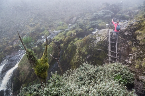
For photographers whose priority is alpine lake and glacier imagery, the Central Circuit’s Bujuku Valley and Kitandara Lakes are difficult to beat. Photographers drawn to waterfalls and dramatic valley light may prefer the Kilembe Trail’s lower sections, and either route delivers exceptional summit sunrise photography from Elena Hut.
Birdwatchers
Both major routes offer strong lower-forest birding, and neither has a decisive edge; the deciding factor for birders is usually which route’s overall length and pacing better suits the rest of their trip, since birding rewards unhurried mornings regardless of trail.
Families
Full summit expeditions on any route are not appropriate for young children given the altitude, technical summit terrain, and sustained physical demands involved. Families with teenagers or young adults in strong physical condition are better served by shorter, non-summit itineraries on the Central Circuit’s lower sections, such as a Nyabitaba or Lake Mahoma exploration, instead of a full multi-day expedition.
Luxury Travelers
No Rwenzori Mountains trekking route in the mountains offers true luxury accommodation on the mountain itself; this is a genuinely rustic, hut-and-camp environment on every trail. Travelers seeking the most comfortable available mountain accommodation generally find the Kilembe Trail’s newer huts a modest step up from the Central Circuit trail’s older facilities, though the difference should not be mistaken for anything approaching lodge-level comfort.
Summit Climbers
The Central Circuit trail remains the default choice for trekkers whose main goal is to reach Margherita Peak by the fastest and most established route, as it is the most direct and frequently guided path to the summit staging camps.
Rwenzori Mountains Trekking Route Difficulty
Every serious trekker deserves an honest account of what a Rwenzori expedition actually demands physically, regardless of which route they choose.
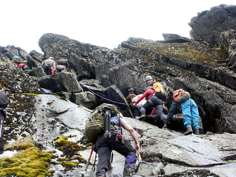
Daily hiking hours typically run between five and eight hours on both major routes, and occasionally longer on summit day itself. Mud is a near-constant presence on the lower and mid-elevation sections of every route, most notoriously through the Central Circuit’s Bigo Bog, and waterproof, well broken-in boots are non-negotiable regardless of trail. Altitude becomes the deciding factor above roughly 3,500 meters on any route, where thinning air, not raw fitness, determines how most trekkers who do not summit are turned back. River and stream crossings occur on both major routes, some requiring careful footwork on wet rock, particularly in the days following Nyabitaba or its Kilembe equivalent. Weather is genuinely unpredictable on every trail in every season, capable of turning a clear morning into driving rain or hail within twenty minutes. Summit day itself, on either route, is the most demanding single day of the expedition — a pre-dawn departure, glacier travel with fixed ropes, and short rock-scrambling sections above 5,000 metres that require full concentration rather than casual effort.
Weather by Each Rwenzori Trekking Route
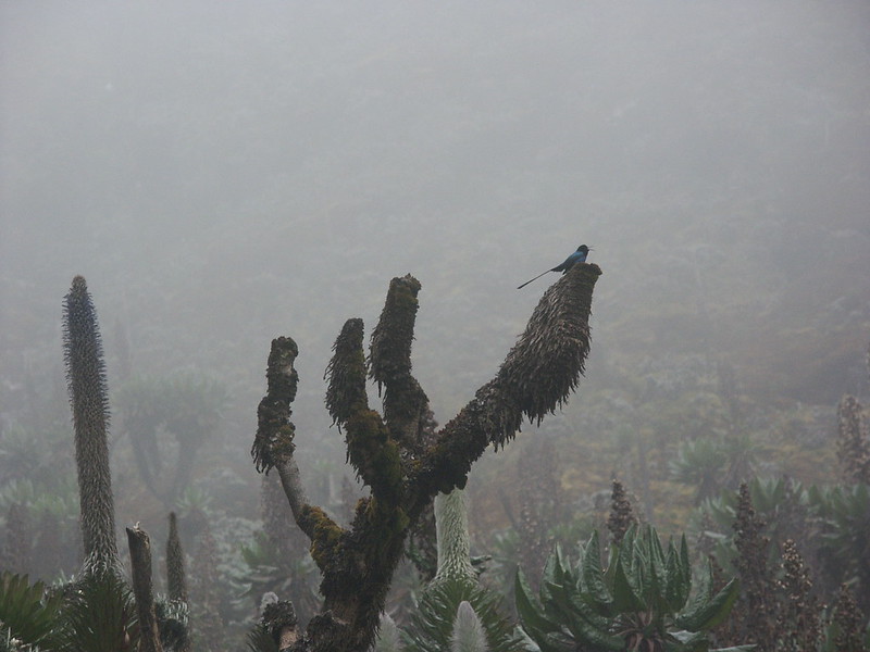
Rainfall patterns are similar across all three major Rwenzori Mountains trekking routes, since they cross the same range and the same equatorial highland climate, but the Central Circuit’s Bujuku Valley bog sections hold water longer after rain than the Kilembe Trail’s lower valley, which is somewhat better drained. Visibility on both major routes is best in the two drier windows, December through February and June through August, when cloud tends to clear earlier in the day and linger less over the high passes. Temperature drops sharply with elevation on every route, from warm, humid lowland forest to sub-zero conditions at the highest huts and on summit day itself, while wind exposure is most pronounced on the Central Circuit’s Trail Scott Elliott and Freshfield passes and on the Kilembe Trail’s more open ridge sections. Regardless of season or route, mountain weather in the Rwenzori remains genuinely unpredictable, and every itinerary we run builds in flexibility for exactly this reason.
Accommodation Along the Rwenzori Mountains Trekking Route
Rwenzori Mountains hut accommodation on the Central Circuit is functional rather than comfortable, with bunk-style sleeping platforms, shared common rooms, pit latrines, and no electricity beyond what a wood stove or your headlamp provides. Water is drawn from nearby streams and treated before use. The Kilembe Trail’s huts, built more recently, offer a modest step-up in construction quality and general upkeep, though the same absence of electricity and the same reliance on treated stream water apply. The Bukurungu Trail dispenses with huts altogether in favor of wild camping, tents pitched fresh each night by the porter team, which trekkers should realistically expect to be the most basic accommodation option of the three, offset by its genuine wilderness character.
Route Elevation Profiles
A note on verified figures The most consistently reported figures for hut altitudes below come from park authorities and prior expedition data; in particular, Bujuku Hut is cited across sources to be between roughly 3,900m and 3,977m. Treat these as reliable planning estimates, and confirm precise figures with your guide or GPS device on the trek. |
Central Circuit Trail Route of the Rwenzori Mountains
Stage | Elevation |
Starting point (Nyakalengija) | ~1,700m |
Nyabitaba Hut | 2,650m |
John Matte Hut | 3,505m |
Bujuku Hut | ~3,977 m |
Elena Hut (via Scott Elliott Pass, ~4,372m) | 4,541 m |
Margherita Peak (highest point) | 5,109 m |
Kitandara Hut | 4,023 m |
Guy Yeoman Hut (via Freshfield Pass) | 3,505m |
Kilembe Trail of Rwenzori Trekking Expeditions
Stage | Elevation |
Starting point (Kilembe) | ~1,600 m |
Sine Camp | ~2,596 m |
Kalalama Camp | ~3,141 m |
Mutinda / Bugata Camp (itinerary-dependent) | ~3,650m–4,062m |
Margherita Camp joins the Central Circuit near Kitandara. | ~4,023 m |
Margherita Peak (highest point, shared summit) | 5,109 m |
Suggested Itineraries by Trip Length
Not every Rwenzori trek needs to reach the summit, and matching trip length to a realistic route is one of the most common planning mistakes we see. Here is our field-tested guidance, organized by trip length.
Trip Length | Suggested Route |
1 Day | Nyabitaba day hike — a gentle rainforest introduction without an overnight on the mountain |
2 Days | Lake Mahoma or Nyabitaba overnight—a genuine taste of the range’s lower forest zone |
3 Days | John Matte Hut—reaches the edge of the Afro-alpine zone without a summit attempt |
5 Days | Bujuku Hut—the Bujuku Valley’s giant lobelia moorland, a strong non-summit highlight trek |
7–9 Days | Full Margherita Peak summit expedition via the Central Circuit |
8–12 Days | Full Margherita Peak summit expedition via the longer, more gradual Kilembe Trail |
For the complete detail behind these shorter options, see our dedicated guides to the 3-Day Lake Mahoma Trek, 4-Day John Matte Hut Trek, and 5-Day Bujuku Hut Trek.
Route by Fitness Level
Fitness Level | Recommended Route |
Beginner | Short nature trek (1–2 days) — Nyabitaba or Lake Mahoma |
Moderate | 2–4 day trek—John Matte Hut or equivalent |
Strong | 5–6 day trek—Bujuku Hut or a Kilembe Trail introduction |
Experienced | Full summit expedition—Central Circuit or Kilembe Trail |
Best Time for Rwenzori Mountains Trekking Routes
December through February and June through August remain the two most reliable windows across all Rwenzori Mountains trekking routes, offering the clearest visibility for both photography and safe glacier travel on summit day. Rainfall is heavier and trails muddier outside these windows on all routes, though the range remains trekkable year-round for well-prepared parties, and bird activity in the lower forest zones is, if anything, richer during the wetter months on both the Central Circuit and Kilembe Trail. Whichever route and season you choose, mountain weather in the Rwenzori remains unpredictable year-round, and no operator, ourselves included, can promise a clear summit day on any date.
What to Pack & Wear for a Rwenzori by Route
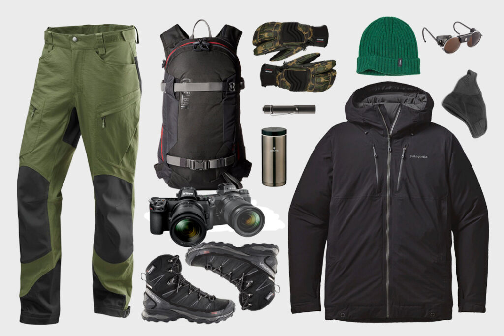
Core equipment needs are essentially identical across all three major Rwenzori Mountains trekking routes: waterproof, well-broken-in hiking boots; a full rain shell, warm gloves; a headlamp with spare batteries; a comfortable daypack; a porter-carried duffel bag; and trekking poles for the sustained descents every route involves. A four-season sleeping bag rated to at least minus ten degrees Celsius is essential for any route’s high camps, whether in a Central Circuit or Kilembe Trail hut or a Bukurungu Trail tent, and is available to rent locally rather than purchased for a single trip. Trekkers choosing the Kilembe Trail’s longer itinerary should pack for a correspondingly longer stretch without laundry access, and Bukurungu Trail trekkers should note that wild camping demands slightly more robust personal insulation than a hut with four walls and a stove.
For a complete, itemized checklist with local rental options, see our full Rwenzori Packing List.
Safety Considerations of the Rwenzori Mountains Trekking Routes
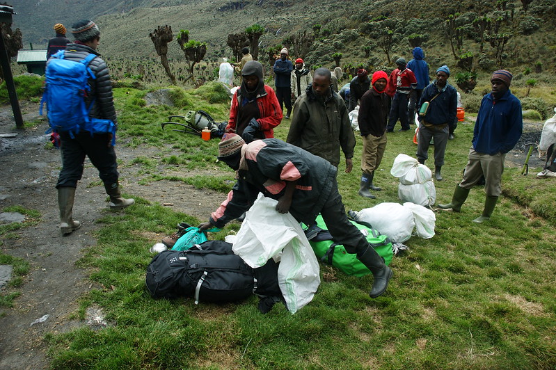
Every Rwenzori trekking route in this guide is walked with a licensed professional guide and a supporting porter team, both of which are mandatory under Uganda Wildlife Authority regulations and, more practically, essential to safe navigation through terrain that becomes genuinely disorienting in cloud or rain. Guides on every major route carry radios or satellite communicators for emergency contact with park headquarters, and rangers are trained in basic evacuation procedures, though it is worth noting plainly that a technical mountain rescue in the Rwenzori’s more remote sections can take considerably longer to organize than in more developed trekking destinations.
Weather-related risk is managed primarily through pacing and guide judgment rather than fixed schedules; a guide’s authority to slow, delay, or turn back a summit attempt should be treated as a safety feature, not an inconvenience. Trekkers on any route should carry personal identification, travel insurance details, and any critical medication on their person at all times, since porters and support gear are not always within immediate reach on exposed sections of trail.
Conservation of the Rwenzori Mountains Trekking Routes
Every trekker on every Rwenzori trekking route contributes directly to the conservation of a genuinely irreplaceable ecosystem. Park entry fees and permit costs pay for Uganda Wildlife Authority ranger patrols, trail maintenance, and hut upkeep on all three major Rwenzori trekking routes, while licensed local guiding and porterage support the communities most invested in the range’s long-term protection. The Rwenzori’s UNESCO World Heritage status was inscribed specifically for its extraordinary endemism, giant lobelias and groundsels found nowhere else on Earth, wetlands that regulate water supply for millions of people downstream, and equatorial glaciers that are retreating year on year as the planet warms. Staying strictly on established trails, packing out all waste, and using licensed operators who employ local guides and porters are the simplest, most effective ways any trekker can help preserve what makes this range worth protecting.
Expert Rwenzori Trekking Route Advice
The guidance below reflects patterns we have observed across years of guiding trekkers on both the Central Circuit Trail & Kilembe Trail major routes, field experience rather than universal rules, and worth weighing against your circumstances.
First-time summit climbers most often report the greatest satisfaction on the Central Circuit’s classic nine-day itinerary rather than its faster five-day variant, because the extra acclimatization days noticeably improve both summit success rates and overall enjoyment of the trek. The single most common itinerary mistake we see is choosing a shorter trip length than a trekker’s actual fitness and altitude tolerance warrants, based on the mistaken belief that fitness alone can substitute for acclimatization time; it generally cannot, and altitude illness remains the leading reason trekkers turn back before the summit on either major route. Itinerary length matters most in the days between 3,500 and 4,500 metres, where the body’s ability to adjust, not raw hiking strength, becomes the deciding factor in whether a summit attempt succeeds.
Weather affects route planning less by season than by day-to-day variability, which is why the most experienced guides build slack into a summit-day contingency rather than fixing it to a single calendar date regardless of conditions. Finally, the value of an experienced local guide and porter team on any Rwenzori trekking route is difficult to overstate. Beyond the legal requirement, local guides have intimate, up-to-date knowledge of trail conditions, hut status, and weather patterns that no guidebook, including this one, can fully replace.