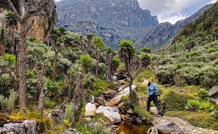
The Bukurungu Trail Of Rwenzori Mountains
Bukurungu Trail: Rwenzori Mountains National Park's Wilderness Camping Route
Bukurungu is an officially gazetted Uganda Wildlife Authority (UWA) trekking route, listed on UWA’s current park activity tariff alongside the Rwenzori Mountain Hike and other permitted trails. It is not a proposed, historical, or closed route
Bukurungu Trail—Wilderness camping route through the Rwenzori Mountains
The Bukurungu Trail of Rwenzori Mountains—The Ultimate Guide to Rwenzori Mountains National Park’s Most Untamed Wilderness Trek.
“Entry: Kasanzi Gate, Omukorukumi · Exit: Mihunga Gate, Nyakalengija · Pure Wilderness Camping. Established 2018 · UWA & WWF Partnership · Four Alpine Lakes · No Mountain Huts”
This is the Bukurungu Trail, and it is the most untamed trekking experience available in the Rwenzori Mountains of Uganda and, by honest reckoning, one of the finest wilderness hiking routes in all of East Africa. Established in 2018 through a formal partnership between the Uganda Wildlife Authority and the World Wildlife Fund, the Bukurungu Trail is the third and newest major route through Rwenzori Mountains National Park. It enters the park at the Kasanzi gate in the Omukorukumi area on the northern approaches to the range, traverses some of the most remote and least-visited terrain in the entire national park, passes between the dramatic landforms of the Portal Peaks and Mount Gessi, intersects with the Central Circuit trail at the Bigo Swamp, and exits at the Mihunga gate near Nyakalengija. Along the way, it visits four magnificent alpine lakes, including Irene, Mughuli, Bukurungu, and Bujuku, and passes through every vegetation zone the Rwenzori offers, from equatorial montane rainforest to the glaciated summit approaches of Mount Stanley. Unlike the Central Circuit Trail, with its mountain huts and decades of established infrastructure, or the Kilembe Trail with its fixed camp facilities, the Bukurungu Trail is a pure wilderness camping route. There are no huts. No bunk rooms. No crowds. What there is, instead, is the Rwenzori Mountains in their most original form: four lakes, a wilderness sky, and the profound satisfaction of walking where almost no one else has been.
“The Bukurungu Trail does not show you the Rwenzori Mountains. It returns you to it: raw, unmediated, and entirely on the mountain’s own terms.”
Bukurungu Trail: At a Glance
The Bukurungu Trail is a wilderness camping route through Rwenzori Mountains National Park, on the northern side of the range in Kabarole District. It is the park’s designated tent-based trekking corridor; there are no huts anywhere on it, running from the Kasanzi park gate near Omukorukumi village up through the Bukurungu flats to the four alpine lakes of Irene, Mughuli, Bukurungu, and Bujuku, where it joins the Central Circuit trail at the Bigo Swamp. It is currently open and permitted by the Uganda Wildlife Authority, best suited to experienced, well-prepared trekkers who have likely already done the Rwenzori once and are looking for a quieter, more self-sufficient route rather than a first mountain experience.
Altitude Range: Approx. 1,500 m (Kasanzi Gate) to 5,109 m (Margherita Peak via Central Circuit Trail)
| Detail | Bukurungu Trail |
| Country | Uganda, Western Region |
| Route Types | Point-to-point traverse: Kasanzi Gate (north) to Mihunga Gate (south) |
| Accommodation | Pure wilderness camping—quality tents provided; no mountain huts anywhere on the route |
| Mountain range | Rwenzori Mountains (“Mountains of the Moon”) |
| Conservation | Trail design actively extends UWA protection into an under-managed park corridor. |
| Distance | Approximately 60–70 km for the full traverse; 80–90 km with Margherita summit |
| Wildlife | Chimpanzees · L’Hoest monkeys · Colobus · Rwenzori Turaco · 200+ bird species |
| Unique Features | Portal Peaks & Mount Gessi traverse · Bigo Swamp junction · No other trekking groups |
| Established | 2018—Uganda Wildlife Authority (UWA) and WWF partnership |
| Protected area | Rwenzori Mountains National Park—UNESCO World Heritage Site |
| Trail type | Multi-day wilderness camping route (no huts) |
| Entry gate | Kasanzi Park Gate, Omukorukumi village, Kabarole District-Northern Rwenzori Approach |
| Exit gate | The exit gate connects to the Central Circuit trail at Bujuku/Bigo Swamp, leading to Nyabitaba and Nyakalengija, or via the Mihunga gate on some Rwenzori itineraries. Confirm routing for your dates |
| Distinguishing feature | Four alpine lakes (Irene, Mughuli, Bukurungu, and Bujuku) and open-camp accommodation rather than huts |
| Trek length | Typically 7–8 days one-way to a Margherita summit; shorter non-summit itineraries possible. |
| Difficulty | Challenging remote, unmaintained sections, no hut infrastructure to fall back on |
| Best for | Experienced hikers, repeat Rwenzori trekkers, and travelers who specifically want a wild-camping route |
| Highest point | Margherita Peak (5,109 m), where itineraries connect to the Central Circuit trail, was not reached on shorter Bukurungu-only treks |
| Current status | As of 2026, the route is open and UWA-permitted; verify camp and porter arrangements before booking. |
| Best Months | December to March and June to September for most stable camping and summit conditions |
Experience Rwenzori Beyond Expectations
Spots Filling Fast — Schedule Your Trek Today

The Bukurungu Trail: Why This Route Exists and Why It Matters
To understand the Bukurungu Trail, you need to understand the section of Rwenzori Mountains National Park it traverses. While the Central Circuit trail has been receiving trekkers since the 1950s and the Kilembe Trail, which officially opened in 2011, the northern extension of the Rwenzori Mountains, the corridor that now forms the Bukurungu Trail, remained effectively unmanaged for organized trekking throughout that period. The terrain was accessible to experienced mountaineers with local guides, but there was no formal trail, no designated camping infrastructure, and no structured mechanism to ensure that trekking activity supported rather than undermined the conservation of this extraordinarily biodiverse section of the park.
The 2018 partnership between the Uganda Wildlife Authority and WWF addressed this gap with deliberate intention. The Bukurungu trail was designed as a conservation intervention as much as a tourism product, a managed route that extended the protective footprint of guided tourism into a northern park corridor that had previously received very little formal management attention. Every porter, every camping fee, and every guided expedition on the Bukurungu Trail generates income for the communities living adjacent to the northern park boundary, creating a direct economic link between the conservation of this wilderness and the well-being of the people who share it. For trekkers who care about responsible travel and the kind of people drawn to a wilderness camping trail like this one typically do, that context gives every campfire a meaning beyond the practical.
The trail itself takes its name from the Bukurungu Lake and the high-altitude moorland surrounding it, which forms the emotional and ecological heart of the route. At an elevation of approximately 3,500 meters, surrounded by giant lobelias and groundsel trees and with the silence of genuine remoteness in all directions, the Bukurungu camping zone is the experience most trekkers cite when someone asks them, months later, what the trail was really like. It is the answer to that question, and it is unlike anything available on either of the other two Rwenzori routes.
How to Get to the Bukurungu Trail
The Bukurungu Trail begins at the Kasanzi Park Gate in Omukorukumi, on the northern approaches to the Rwenzori range. This is a different entry point from the Central Circuit Trail (Nyakalengija, near Kasese) and the Kilembe Trail (Kyanjuki, near Kasese), and the logistics of reaching it reflect its position in the less-trafficked north.
From Entebbe International Airport or Kampala
The most convenient approach to the Kasanzi Gate is via Fort Portal, the principal town of Kabarole District and the closest urban center to the northern Rwenzori approaches. From Entebbe International Airport, Fort Portal is approximately 300 kilometers away, a journey of four to five hours by your dedicated private vehicle, significantly shorter than the six-hour Kasese drive used for the Central Circuit trail and Kilembe Trail approaches. From Fort Portal, the road to Omukorukumi winds through Rwenzori foothills communities whose cultivated terraces and banana groves provide the last view of the agricultural world before the national park boundary absorbs everything. Your private vehicle and driver are arranged seamlessly as part of your expedition package, with departure timing calibrated to your specific flight arrival so that no connection is rushed.
The Northern Approach Road
Unlike the well-established Kasese-to-Nyakalengija approach of the Central Circuit trail, the road to Kasanzi Gate is less frequently travelled and carries a quality of approach that matches the trail itself, quiet, forested, and increasingly remote as the national park boundary draws near. Your dedicated vehicle handles this approach on your behalf; you arrive at the gate with your private guide, porter team, and all expedition equipment already assembled and briefed. The RRHA community guides who manage the Bukurungu Trail are based here, and the formalities of park entry, permit checking, and team introduction are handled by our team in advance.
Combining with the Central Circuit Exit
Because the Bukurungu Trail exits at Mihunga Gate near Nyakalengija, the same exit point as the Central Circuit Trail, post-trek logistics naturally default to Kasese town. Your dedicated vehicle is positioned at Mihunga Gate on the day of your scheduled exit, seamlessly arranged before your departure from Kasanzi Gate, so that the transition from mountain to lowland is as smooth as possible. For trekkers combining the Bukurungu approach with a Margherita Peak summit via the Central Circuit trail, the exit through Nyakalengija feels like a completion: the full Rwenzori traversed from north to south, from wilderness camp to summit glacier.
Experience Rwenzori Beyond Expectations
Spots Filling Fast — Schedule Your Trek Today
The Vegetation Zones: An Immersive Step-by-Step Trekking Story
What makes the Rwenzori Mountains botanically extraordinary is their vertical compression of ecological worlds that would otherwise be separated by thousands of kilometers of latitude. The Bukurungu Trail traverses all five Rwenzori Vegetation Zones, approaching from the north and ascending through a sequence of transitions that arrive not as gentle gradations but as distinct, abrupt threshold moments when the quality of light, the smell of the air, the texture of the ground underfoot, and the character of the silence all change simultaneously. The following is not a description of what you will encounter. It is an attempt to narrate what it feels like to walk through.
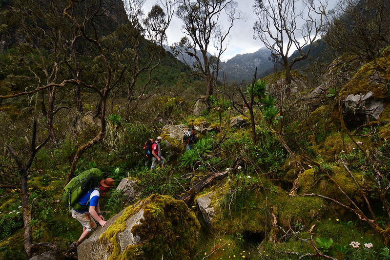
Montane Rainforest Zone 1,500 m – 2,400 m | The Kasanzi Gate at Omukorukumi marks the exact moment the world changes. Your private guide briefs the porter team in the compound at the park boundary; equipment loads are distributed, the day’s route is confirmed, and the gate is opened. Within twenty steps of passing through it, the farmland of the Rwenzori foothills has disappeared behind you, and the montane rainforest has taken over with a completeness that is almost theatrical. This area is the forest of the Albertine Rift, one of Africa’s most biodiverse ecosystems, and on the Bukurungu Trail’s northern approach it feels genuinely undisturbed in a way that even the finest sections of the Central Circuit do not quite match. Giant Podocarpus trees, some of them centuries old, form a canopy thirty meters above the path. Mosses and ferns cover every available surface. The light that reaches the trail floor is green and filtered and moves as the canopy shifts in the upper breeze. Black-and-white colobus monkeys announce themselves with the crash of branches high above, that startling, heavy percussion of large primates moving fast through a forest crown. L’Hoest monkeys watch from lower branches with the patient, evaluative gaze of animals that have made a considered assessment and found you unthreatening. Chimpanzees are present in this zone, their calls carrying through the forest at frequencies that the trees seem designed to amplify. Your private guide knows the territories, the daily movement patterns, and the calls that distinguish feeding from alarm from communication. Many Bukurungu trekkers describe a morning spent quietly in this lower forest, listening, watching, and moving slowly, as the wildlife experience they were least expecting and most grateful for. The first camp, pitched by the porter team in a forest clearing while you take tea and let the day decompress around you, introduces the particular character of this expedition: no hut walls, no bunk platform, and no other trekking group thirty meters away. Just the tent, the forest, the sound of a nearby stream, and the Rwenzori darkness settling in as the cook prepares the first hot dinner of the trail. |
Bamboo & Mimulopsis Forest 2,400 m – 3,000 m | The transition into the bamboo zone arrives with a change in sound before a change in vegetation, the layered bird calls of the montane forest giving way to the softer, more percussive notes of bamboo stems touching in the wind. African mountain bamboo creates a different kind of forest than the one below it: more architectural, more uniform in its vertical lines, but with a quality of filtered golden light through the stems on clear mornings that is entirely its own. Mimulopsis elliotii, a species found throughout the Albertine Rift mountain forests, grows alongside the bamboo and, on its irregular seven-year flowering cycle, fills this zone with masses of purple-blue blooms that transform the trail into something that experienced Rwenzori guides describe as one of the range’s finest botanical displays. Whether or not your expedition coincides with a flowering year, the bamboo-mimulopsis corridor has a distinct and memorable character. The path narrows. The elevation gain becomes consistent. The altitude begins to arrive in the body, bringing with it the particular quality that distinguishes mountain breathing from lowland breathing: a slight adjustment, a recalibration of the lungs’ understanding of what adequate oxygen feels like. This phenomenon is normal. Your private guide sets the pace with the authority of someone who has walked this zone many times and understands exactly what the body needs at this stage of the ascent. Lake Irene, the first of the four defining lakes of the Bukurungu Trail, appears in the transition zone between bamboo and heather. Its surface holds that quality of absolute stillness that belongs to high-altitude mountain water: cold, transparent, and reflective with a precision that makes the surrounding vegetation appear in the lake as clearly as it appears in reality. Standing at the shore of Lake Irene for the first time is the moment most trekkers understand, viscerally, why this trail has a waiting list. |
Giant Heather Forest 3,000 m – 3,800 m | | The heather zone on the Bukurungu Trail’s northern approach has a scale and openness that distinguishes it from the equivalent zone on the Central Circuit Trail’s more sheltered eastern approach. Tree heathers, Erica arborea and Philippia species, grow to heights of fifteen meters or more, and their trunks are so densely covered with old man’s beard lichen that individual stems are difficult to distinguish from the hanging grey-green curtains suspended below each branch. On overcast mornings, when the cloud presses low and the light filters through this curtain at a low angle, the effect is cathedral-like: hushed, vast, and entirely its own kind of beautiful. It is in this zone that the Rwenzori fully reveals why it was called the Mountains of the Moon, not because of any lunar resemblance from a distance, but because of the otherworldly atmosphere that settles in the forest when the cloud is close, the light is grey, and everything drips with moisture, creating a sense of existing in a different relationship to ordinary time. Lake Mughuli sits in a sheltered hollow in the middle heather zone, its surface on calm mornings a perfect mirror for the surrounding trees and the fragment of sky visible above them. This area is typically the location of the second or third overnight camp, and it is the one that most Bukurungu Trail trekkers cite as the expedition’s defining image: the lake below, the heather forest closing in on three sides, the peaks briefly visible above the tree line on clear mornings. Birdsong at Lake Mughuli at dawn, the Rwenzori turaco, the Rwenzori double-collared sunbird, and the handsome francolin constitute a natural sound composition that no music could improve on. Your cook has the morning tea ready before you have properly woken up. The view from inside the unzipped tent door is sufficient justification for the entire journey. |
Afro-Alpine Moorland—The Bukurungu Flats 3,500 m – 4,200 m | The Bukurungu Flats are the emotional heart of this trail and the landscape that gives it its name and its reputation. Above the heather zone, the forest canopy opens and the afro-alpine moorland spreads in all directions, a broad, saturated plateau at high altitude where giant lobelias and groundsel trees stand in groupings that look designed rather than random, the vegetation thinning as altitude increases until each individual plant becomes a solitary statement against the sky. Giant lobelias (Lobelia wollastonii) grow in silver spires that can be more than three meters tall, with exceptionally large basal rosettes and tall flower spikes that are as dramatic as anything in the botanical world when they bloom. Giant groundsel, or Dendrosenecio adnivalis, stand on bare trunks topped with enormous cabbage-like rosettes, forming clusters in the valley bottoms and on sheltered slopes that, in low mist, look like the silhouettes of a prehistoric world. Lake Bukurungu (the trail’s namesake lake) sits in the heart of this moorland at approximately 3,500 meters. It is the most dramatically positioned of the four lakes: open, exposed, and fully encircled by moorland, with the high mountain ridgelines visible above it in all directions on clear days. Camping above Lake Bukurungu is the expedition’s most celebrated overnight experience. The tent is pitched on cleared moorland by your porter team; the cook prepares dinner on portable stoves as the last light leaves the western ridgeline; and then the sky performs. The Bukurungu Flats camp, at this altitude and this latitude, has no light pollution from any direction. The equatorial sky at 3,500 metres on a clear night is one of the great astronomical displays available on the African continent, with stars so numerous and so bright that the familiar shapes of constellations are difficult to pick out from the general density of light. Waking at dawn, stepping outside into the cold air with a cup of tea from the ever-attentive cook, and watching the first light build across the Bukurungu Flats from inside an empty wilderness is the image that Bukurungu Trail trekkers carry home and find impossible to leave behind. |
High Alpine & Glacier Zone 4,200 m – 5,109 m | | Above the Bigo Swamp junction, where the Bukurungu Trail intersects with the Central Circuit Trail for the first time since Kasanzi Gate, the character of the expedition changes. The wilderness camping of the previous days gives way, for those continuing to the summit, to the established Central Circuit trail infrastructure: the ascent to Bujuku Camp, then Elena Camp at 4,541 meters, and finally the 2:00 a.m. start on summit day that carries the team up through the Elena Glacier and across the Stanley Plateau to Margherita Peak at 5,109 meters. Lake Bujuku, the fourth of the Bukurungu Trail’s defining lakes, lies at this junction, and arriving at it from the north via the Bukurungu approach gives it a different aspect than the Central Circuit’s conventional eastern view. The glaciers of Mount Stanley are visible across the lake surface from the northern approach, and the reflection of the mountain’s western face in the water on still mornings has a quality that Central Circuit trekkers, approaching from the east, simply never see. For trekkers who have spent six or seven days in the wilderness to reach this point, the sight of Lake Bujuku and the peaks above it carries a particular weight of achievement. The summit on Margherita Peak, for those who continue, completes a mountain traverse that runs the full length of the Rwenzori range from north to south, a journey through every vegetation zone, past four alpine lakes, through genuine wilderness, and over permanent equatorial ice, that represents the most comprehensive single Rwenzori experience available. |
Experience Rwenzori Beyond Expectations
Spots Filling Fast — Schedule Your Trek Today
Four Alpine Lakes: The Spiritual Backbone of the Bukurungu Trail
Ask any guide who has walked the Bukurungu Trail what defines it above all else, and the answer will almost always come back to the lakes. Four alpine lakes, each at a different altitude, each with a different vegetation surround, and each reflecting the sky and the peaks above in a different quality of light, give the trail a narrative structure that is both practical (each lake is associated with a camping zone) and emotional (each lake is a destination within the destination). No other route in the Rwenzori offers this concentration of glacial water features.
Lake Irene Bamboo-Heather Transition Zone | The first of the four, Lake Irene typically appears at the transition between the bamboo and heather zones and arrives with the impact of a landscape element that has been waiting patiently for you to discover it. Sitting in a glacially carved hollow and surrounded by the opening canopy of the upper bamboo zone, Irene has the particular stillness of high-altitude water, mirror-flat on calm mornings, the surrounding trees and sky reflected with a precision that makes the visual composition seem almost contrived. It is the lake that most frequently stops trekkers mid-stride, the camera suddenly insufficient to record what the eye sees. Your private guide knows this effect and gives it space. |
Lake Mughuli Lower Heather Zone · Overnight Camp | Lake Mughuli sits in the sheltered lower heather zone and is the location of one of the trail’s most treasured overnight camps. It is slightly more sheltered than Bukurungu and has a lakeshore character, with a forest on three sides and a view down the northern valley on the fourth that creates a sense of intimate enclosure rather than exposed grandeur. Dawn at Mughuli is the trail’s finest sound experience: the resident bird species begin before the light arrives, the lake surface begins to reflect the gradually brightening sky, and the mist, always present in the Rwenzori at this hour and this altitude, rolls across the water surface in slow, deliberate waves that look like breath. The cook has tea ready before anyone has fully woken up. |
Lake Bukurungu Bukurungu Flats Moorland · Signature Camp | The lake that names the trail occupies the most dramatically open setting of the four. Lake Bukurungu sits on the exposed moorland of the Bukurungu Flats at approximately 3,500 meters, fully encircled by the open Afro-alpine landscape with the high ridgelines visible in all directions. It is larger than Mughuli and Irene and responds to wind in a way that the sheltered lower lakes do not, surface texture changing by the hour, and color moving from grey to blue to silver to the extraordinary orange-gold of a Rwenzori sunset reflected on open water. The camp above Lake Bukurungu is the expedition’s finest overnight: the sky is simply unobstructed here, the lobelias stand in silhouette against the stars, and the silence belongs to a place so genuinely remote that even experienced mountain guides pause to acknowledge it. |
Lake Bujuku Central Circuit Junction · 3,962 m | The fourth lake and the one shared with the Central Circuit, Lake Bujuku lies at the junction zone where the Bukurungu Trail connects with the northern approach from the established eastern route. It is the largest of the four and the most iconic, encircled by Mount Stanley, Mount Speke, and Mount Baker, with the Elena Glacier visible on clear days above the western shore. Arriving at Lake Bujuku from the north via the Bukurungu Trail provides it an added dimension of arrival: after days of genuine wilderness, the sight of the established Bujuku hut and the three towering massifs reflected in the lake surface has the quality of a revelation rather than a scheduled stop. The Bukurungu trekker who reaches this point has earned this view in a way that is qualitatively different from the Central Circuit trail trekker who has been building toward it for three days. |
Rwenzori Mountain Ranges Visible from the Bukurungu Trail
The Bukurungu Trail’s northern approach reveals the Rwenzori Mountain from angles that neither the Central Circuit Trail nor the Kilembe Trail provides. In particular, the northern and western faces of the main peaks serve as defining visual features of the upper Bukurungu experience, even though they are rarely photographed and described in trekking literature.
Mount Stanley 5,109 m—Margherita, Alexandra & Albert Peaks | It is the highest point in the Rwenzori and the summit objective on the full Bukurungu-to-Central Circuit trail traverse. From the upper Bukurungu moorland, Mount Stanley’s western glaciers come into view, and they appear differently from the northern approach, with the Elena Glacier showing a more direct face than the angled view from the Central Circuit trail’s Bujuku approach. For trekkers who have walked the Bukurungu Trail from Kasanzi Gate, arriving at Margherita Peak (5,109m) carries the particular weight of a summit earned through a genuinely long and demanding approach. The first ascent was made by the Duke of Abruzzi on 18 June 1906. |
Mount Gessi 4,715m — Bottego (4,715m) & Iolanda (4,703m) Peaks | One of the least-visited and least-documented massifs in the Rwenzori range, Mount Gessi is most directly experienced on the Bukurungu Trail’s traverse section between the Portal Peaks and the main circuit junction. The trail passes close enough to Mount Gessi’s northern approaches for its true scale to be apparent in a way that is simply not possible from the Central Circuit trail. Guides who regularly walk the Bukurungu Trail describe the section of trail that moves between Mount Gessi and the Portal Peaks as one of the finest high-altitude traverses in the entire range, with panoramic views in all directions that no other Rwenzori route accesses. |
The Portal Peaks 4,627 m—Northern Rwenzori Landmark | Visible from the Bukurungu Flats moorland section and forming part of the distinctive northern skyline throughout the middle portion of the trail, the Portal Peaks are a visually arresting feature of the northern Rwenzori that most visitors to the park never see from this angle. Their silhouette against the sky above the moorland, particularly at dawn and dusk when the light is most directional, is one of the trail’s most frequently photographed compositions. |
Mount Speke 4,890m — Vittorio Emanuele Peak | The second-highest Rwenzori massif is visible from the Bujuku junction zone and from the upper Central Circuit trail sections for those continuing to Margherita Peak. From the northern Bukurungu approach, Mount Speke is seen in profile, its long eastern ridgeline creating an elegant silhouette above Lake Bujuku that Central Circuit trail trekkers approaching from the east never see from this angle. The contrast between this northern perspective and the conventional eastern view is one reason experienced Rwenzori mountaineers who have done the Central Circuit trail return specifically for the Bukurungu Trail. |
Mount Baker 4,843 m—Edward Peak | Mount Baker’s northern face becomes increasingly prominent as the Bukurungu Trail approaches the junction of the Central Circuit trail, providing a different and arguably more imposing aspect than its well-photographed eastern face seen from the Central Circuit’s Kitandara approach. From the high moorland of the Bukurungu flats on clear days, Baker’s northern buttresses are visible above the ridgeline to the south, providing a visual anchor for the upper section of the day’s route. |
Experience Rwenzori Beyond Expectations
Spots Filling Fast — Schedule Your Trek Today
Where You Sleep: Wild Camping on the Bukurungu Trail
The defining characteristic of the Bukurungu Trail accommodation experience is its complete absence of built infrastructure. There are no huts, no bunk platforms, no shared kitchens, no charging points, and no other trekking groups in the same camp. Instead, there are designated wilderness camping zones, flat ground areas maintained by the Uganda Wildlife Authority and managed by the RRHA community guides, where your porter team sets up your tent, your cook prepares your meals on portable stoves, and the quality of the experience depends entirely on the quality of the equipment, the expertise of the guide team, and the character of the landscape itself.
Rwenzori Trekking Expeditions provides all camping equipment as part of every Bukurungu Trail package: quality dome tents with waterproof groundsheets, foam sleeping mats, sleeping bag liners (your own -10°C sleeping bag is an essential personal item), portable cooking stoves and fuel, cooking utensils, water treatment equipment, and camp hygiene supplies. The porter team handles all setup and breakdown; your only morning task is to pack your personal daypack. The camps themselves are not random; they are positioned with deliberate attention to the views they command, the shelter they provide from the Rwenzori’s famously changeable weather, and the altitude gain that each day’s stage represents for safe acclimatisation.
Forest Clearing Camp 1,800–2,200m Night 1 — Montane Forest Zone | The first wild camp of the Bukurungu Trail is pitched in a forest clearing in the lower montane zone, typically close enough to a water source for the cook to work efficiently and sheltered enough from the expected evening weather for a comfortable first night. The camp setup on Day 1 establishes the rhythm of the expedition: the porter team moves with practiced efficiency, the cook begins dinner before the tent has fully cooled from the afternoon sun, and the forest sounds replace the lowland world completely. At dusk, chimpanzee calls are sometimes audible from this camp. This is the night when the journey truly begins. |
Lake Irene Camp Approx. 2,600–2,800 m Night 2 — Bamboo-Heather Transition | The camp above or near Lake Irene, positioned at the transition between the bamboo and heather zones, offers the first proper mountain campsite of the expedition: higher, colder, and with the lake visible below from the tent door. The evening here introduces the particular quality of the Bukurungu Trail nights, with the lake surface holding the last light, the heather forest darkening around the camp, and the porter team’s voices low and warm as they prepare dinner, a quality that will deepen over the following days. A clear night at this elevation provides a significant improvement in the star quality available from the lower forest camp. |
Lake Mughuli Camp Approx. 3,000–3,200 m Night 3 — Lower Heather Zone | The Mughuli overnight camp, the most intimate of the four lake camps, sits above or beside the lake, sheltered by the lower heather forest. The sound of the lake at night, occasionally wind-rippled, more often completely still, accompanies every hour of sleep. Dawn here, with the mist on the water and the first birds establishing their morning territory, is the Bukurungu Trail’s finest auditory experience. The cook has the tea ready before the tent zip opens. This is the morning that converts most Bukurungu trekkers from interested participants into committed devotees of the trail. |
Bukurungu Flats Camp Approx. 3,400–3,600 m Night 4 — Signature Wilderness Camp | The camp on the Bukurungu Flats above Lake Bukurungu is the expedition’s most celebrated overnight and the one most likely to appear in any trekker’s post-trip account of the Rwenzori. Pitched on open moorland with the lake below and the giant lobelias standing in silhouette in every direction, this camp has an unobstructed sky, no surrounding forest to limit the view, and no hut walls to reduce the exposure to the full Rwenzori night. The stars above this camp, on a clear evening, are the kind that remind a person how infrequently they look up. Waking before dawn and stepping into the cold, absolutely silent, entirely wild Bukurungu Flats is the experience the trail is built around. |
Upper Moorland Camp Approx. 3,800–4,100 m Night 5 — Before Bigo Junction | The final wilderness camp before the trail connects with the Central Circuit at the Bigo Swamp junction. Positioned in the upper groundsel-lobelia zone, this camp has a different quality from the lower ones, more exposed, colder, with the high peaks more prominently framing the evening sky. The giant groundsel trees that surround the camp are ancient beyond any reasonable human scale; some of these plants are hundreds of years old. The porter team pitches the tent efficiently, and the cook compensates for the temperature with a particularly warm and substantial dinner. Here, the team makes the final preparations for the Central Circuit connection. |
For accommodation before and after the Bukurungu Trail expedition, Fort Portal is the most convenient gateway town for the northern trailhead. The Rwenzori View Guesthouse in Fort Portal provides comfortable pre-trek accommodation with excellent food and a peaceful garden. For those completing the full traverse via Nyakalengija, Kasese’s Margherita Hotel, named for the peak, offers a welcome return to hot showers, fresh food, and a proper bed after the trek. Our team coordinates both seamlessly as part of your expedition logistics. View our full pre- and post-trek accommodation guide here.
Bukurungu Trail vs. Central Circuit vs. Kilembe Trail
Choosing between the three Rwenzori routes is one of the most important decisions a trekker makes, and it deserves an honest, experienced answer from people who have guided all three. The table below summarizes the key differences; the narrative beneath it provides the context that makes those differences meaningful.
Feature | Central Circuit | Kilembe Trail | Bukurungu Trail |
Entry Point | Nyakalengija | Kyanjuki (Kasese) | Kasanzi (Omukorukumi) |
Route Type | Loop | Linear traverse | Point-to-point traverse |
Accommodation | Mountain huts | Fixed camp facilities | Pure wilderness camping |
Duration | 5–9 days | 6–9 days | 7–14 days |
Difficulty | Moderate–Strenuous | Strenuous | Challenging–Strenuous |
Trekker Density | Highest | Moderate | Lowest / near-solitary |
Alpine Lakes | 1–2 (Bujuku) | 2 (Kitandara + more) | 4 (Irene, Mughuli, Bukurungu, Bujuku) |
Unique Feature | Classic route, huts | Six waterfalls | Wild camping, 4 lakes |
Best For | First-time Rwenzori | Scenic summit climb | Wilderness purists, return visitors |
Summit Access | Margherita direct | Margherita via S-W | Margherita via Central Junction |
The Central Circuit trail is the right choice for first-time Rwenzori trekkers and for those who want to summit Margherita Peak with the highest possible support infrastructure around them. The Kilembe Trail is the right choice for technically minded mountaineers who want a more dramatic approach to the summit via the southern circuit’s waterfalls and glacial valleys. The Bukurungu Trail is the right choice for experienced mountain hikers who have either already done one of the other routes and want to see the Rwenzori from an entirely different perspective or who arrive with serious wilderness camping credentials and want an Rwenzori experience that prioritizes solitude, wildlife, and genuine remoteness above all other considerations. All three are available as privately guided expeditions with Rwenzori Trekking Expeditions. You can compare the routes in detail on our Rwenzori routes overview page.
Experience Rwenzori Beyond Expectations
Spots Filling Fast — Schedule Your Trek Today
Attractions and Highlights of the Bukurungu Trail
Wildlife in the Northern Rwenzori Forest
The lower forest zones of the Bukurungu Trail cross a part of the Rwenzori’s Albertine Rift biodiversity corridor that is much less disturbed by people than the busier southern approaches. Chimpanzees live in this northern forest, and their presence on the Bukurungu Trail is felt through evening calls from camp, brief sightings in the canopy, and the sound of their movement through the trees before dawn, which is different from the managed encounters of a conventional chimpanzee tracking activity.

On the lower trail sections, visitors regularly encounter Hoest monkeys, black-and-white colobus, red-tailed monkeys, and three-horned chameleons. Birdwatching is exceptional throughout; 217 species are recorded in the national park, with the Rwenzori turaco, Rwenzori double-collared sunbird, handsome francolin, and barred long-tailed cuckoo among the regular sightings on the Bukurungu approach.
The Bigo Swamp: Where the Trails Meet
The Bigo Swamp is one of the Rwenzori’s most distinctive landscape features and the junction where the Bukurungu Trail connects with the Central Circuit Trail. A high-altitude wetland saturated with water and populated by enormous tussock grass formations, the Bigo Swamp is navigated via a combination of elevated boardwalk sections and the characteristic tussock-jumping that Rwenzori guides describe as both the trail’s most physically demanding routine and its most entertaining one. The giant lobelias at Bigo are as dense and large as any in the Afro-alpine zones above, and the moorland views from the edge of the swamp, looking south toward Mount Stanley and north across the terrain just traversed, offer one of the best 360-degree high-altitude perspectives in the entire Rwenzori.
The Portal Peaks and Mount Gessi Traverse
The section of the Bukurungu Trail that passes between the Portal Peaks and Mount Gessi is the route’s most dramatic high-altitude traverse and the one that most distinguishes it from both the Central Circuit Trail and the Kilembe Trail. Views from this section encompass the northern Rwenzori in its full breadth, north toward the Rwenzori foothills of Kabarole District, south toward the main Stanley-Speke-Baker massifs, and east and west across the range’s outer flanks. This section serves as the foundation for experienced mountaineers wishing to attempt Mount Gessi (4,715m) or the Portal Peaks as part of an extended Bukurungu expedition.
Conservation in Action
Walking the Bukurungu Trail is, among other things, a direct participation in one of East Africa’s most thoughtful conservation interventions. The trail’s 2018 establishment under the UWA-WWF partnership created a managed tourism corridor in a previously unmanaged section of the national park, directing economic benefits from trekking to communities living adjacent to the northern park boundary. Your guide and porter team are members of those communities, their livelihoods directly connected to the health of the ecosystem you are walking through. Every expedition on the Bukurungu Trail is therefore a contribution, however modest, to the ongoing viability of this approach to conservation tourism.
Best Time to Trek the Bukurungu Trail
The Bukurungu Trail’s wild camping format makes it more weather-sensitive than the hut-based routes. A full night of sustained rain in a quality mountain tent at 3,500 metres is manageable with proper equipment, but the quality-of-experience premium of a dry evening at the Bukurungu Flats camp with the full sky and the stars and the lake reflecting them is significant enough that the dry-season windows carry a particular weight for this route.
December to March: Primary Dry Season (Recommended for Summit Trekkers)
The driest and most reliably clear period of the year. Nights at the Bukurungu Flats camp in January and February, on the best evenings, are extraordinary: the equatorial sky at 3,500 meters, with no cloud cover and no light pollution, is one of those natural phenomena that experienced mountain guides still pause to acknowledge. Summit conditions via the Central Circuit trail junction are at their most stable. On the best mornings, the surfaces of all four lakes are mirror-calm. Availability in this window fills four to six months in advance; book early.
June to September: Long Dry Season (Most Popular)
The long dry season is the Bukurungu Trail’s peak period and the most balanced window for the complete expedition. The days are long, the vegetation is in full botanical bloom, and the weather is reliable enough to plan confidently without constant contingency. The lower forest wildlife is most active in this period. Summit success rates via the Central Circuit trail connection are high. The Bukurungu Flats bloom with maximum Afro-alpine color in July, which experienced guides consistently describe as the trail’s finest botanical month.
March to May and October to November: Wetter Periods
The transitional and wetter months bring increased rainfall, deeper saturation in the moorland sections, and reduced clarity on summit days. The Bukurungu Trail is walkable in these periods with appropriate gear, and some experienced wilderness campers specifically choose the shoulder season for the atmospheric mist in the heather zone, the swollen stream crossings, and the complete solitude that comes from being one of very few trekking parties on an already hushed trail. April and November are the wettest months and are best avoided for summit-focused expeditions. The lower forest sections, however, are at their most vivid and wildlife-active in the wet seasons.
Difficulty, Physical Preparation, and Who This Trail Is For
Let me be straightforward with you, as I would be with any trekker considering this route: the Bukurungu Trail is the most demanding of the three Rwenzori options, and it is not the right choice for someone undertaking their first multi-day mountain trek. The combination of sustained elevation gain, remote terrain with no hut infrastructure, multiple consecutive nights of wilderness camping, and the physical demands of the full traverse makes the Bukurungu Trail a route for people who are genuinely fit, genuinely experienced, and genuinely committed to a wilderness experience.
Overall Difficulty Rating
The full Bukurungu Trail to the Central Circuit trail junction is rated challenging. The complete traverse, including Margherita Peak, is rated strenuous. The nature trek options in the lower Bukurungu area, which cover the forest zone and Lake Irene without going up to the upper moorland, are rated moderate and suitable for fit recreational hikers who are well prepared.
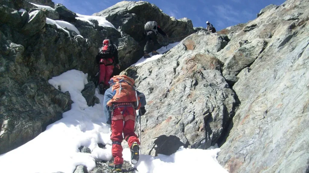
The wild camping format adds a layer of physical demand beyond the hiking itself: camp management, earlier starts to allow for longer days, and the absence of hut warmth in the evening all require additional resilience that must be present before the trail begins.
Who Is This Trail For?
The Bukurungu Trail is designed for trekkers who have prior multi-day mountain experience, are comfortable with wilderness camping at altitude, and who actively want the solitude and rawness that this route provides rather than merely tolerating the absence of huts as a necessary compromise. It is a particularly fine choice for experienced hikers who have already completed the Central Circuit Trail or Kilembe Trail and want to see the Rwenzori from its most untouched direction. It is also appropriate for first-time Rwenzori trekkers who arrive with serious wilderness camping backgrounds from other mountain ranges and understand what they are committing to.
Physical Preparation
Six months before departure: establish a consistent aerobic base of at least five hours of cardio activity per week. Four months before: transition to regular multi-day hiking with a loaded pack and sustained elevation gain, targeting at least 800 meters of ascent per individual session. Two months before: complete at least two three-day back-to-back hiking programs with overnight camping to condition the body for the specific demands of consecutive camping days at altitude. One month before: maintain frequency while reducing intensity. Arrive rested. Altitude experience above 3,000 meters is strongly recommended before the full traverse. Our comprehensive guide for Rwenzori fitness preparation is available on our website for all starting fitness levels.
Experience Rwenzori Beyond Expectations
Spots Filling Fast — Schedule Your Trek Today
What to Wear and Carry: Gear for the Bukurungu Wild Camping Expedition
The Bukurungu Trail’s wilderness camping format requires more personal gear investment than the hut-based routes. The porter team provides and carries all group camping equipment, including tents, stoves, cooking utensils, and water treatment systems. Your personal kit, however, needs to be fully adequate for a range of conditions from warm forest walking to cold, wet moorland camping at 3,500 metres.

Sleeping Bag, The Single Most Critical Personal Item
A sleeping bag rated to a minimum of -10°C is non-negotiable for the Bukurungu Trail. The Bukurungu Flats camp, located at approximately 3,500 meters, can experience genuinely cold temperatures on clear nights—nights that also showcase the finest sky you will see from the Rwenzori, providing slight consolation. Without the warmth of a hut, your sleeping bag becomes the only insulation between you and the mountain night. Rental sleeping bags are available in Kasese and Fort Portal, but for this specific trail we strongly recommend bringing your own quality bag rather than depending on a rental item.
Waterproof System
The Rwenzori is famously one of the wettest mountain ranges on earth, and the Bukurungu Trail’s more remote terrain makes rapid weather changes both more likely and less manageable than on the hut-based routes. A quality waterproof shell jacket and waterproof trousers that can sustain two or three consecutive days of intermittent rain without saturating are the standard to target. Breathability matters: the physical exertion of the Bukurungu Trail’s steeper sections generates enough heat that a non-breathable waterproof becomes uncomfortable within minutes. Waterproof gaiters reduce the amount of mud that reaches the inside of your boots on the boggy moorland sections.
Footwear
Waterproof hiking boots rated for sustained wet terrain and significant elevation change are required throughout. Rubber boots (gumboots) are provided complimentary for the boggy moorland sections of the alpine zone. Technical crampons for the glacier sections of the Central Circuit trail on summit day are provided for those undertaking the full Margherita traverse. Trekking poles are more valuable on the Bukurungu Trail than on either of the other two routes, as the absence of constructed trail sections in several areas means more uneven terrain over longer periods.
Technical Summit Equipment, Provided
Rwenzori Trekking Expeditions provides all technical glacier equipment for the Central Circuit connection on Margherita summit day, including crampons, ice axes, harnesses, helmets, belay devices, and fixed ropes, as part of every full Bukurungu-Margherita expedition package. Briefing and fitting take place at Elena Hut on the evening before summit day. No prior technical equipment experience is required.
Additional Essentials for Wilderness Camping
A quality headlamp with substantial spare batteries is essential; camp setup and breakdown in pre-dawn or post-dusk conditions is a regular feature of this trail. A waterproof dry bag for your sleeping bag protects the one item most critical to your comfort from tent condensation or rain ingress. Trekking poles. Personal first aid kit including altitude headache medication. High-factor sunscreen and UV-protective sunglasses from Day 3 onward. Water purification tablets as a personal backup to the cook’s boiling system. Three liters of water-carrying capacity per person per day from the upper moorland onward. View our complete Bukurungu Trail packing list here.
Bukurungu Trail Itinerary Options
3–4 Day Lower Forest Nature Trek | Montane rainforest, chimpanzee observation zones, and Lake Irene. Rated Moderate. This trek is ideal for families and first-time Bukurungu visitors who want a cultural forest and wildlife experience without the commitment of the upper moorland. |
5–6 Day Four Lakes Trek | Full four-lake sequence: Irene, Mughuli, Bukurungu, and approach to Bujuku junction. No glacier travel. Rated Challenging. The most immersive Bukurungu Trail experience without the summit addition. |
9-Day Full Bukurungu Traverse | Kasanzi Gate to Mihunga Gate via all four lakes and the Bigo Swamp junction. Wilderness camping throughout. Rated Strenuous. The complete standalone Bukurungu experience. |
10–14 Day Bukurungu + Margherita | The full Bukurungu Trail wilderness traverse connects to the Central Circuit trail for the Margherita Peak (5,109 m) summit. The most comprehensive single Rwenzori expedition is available. Rated Strenuous. |
Bukurungu + Gorilla Trekking | Combines the full Bukurungu Trail with gorilla trekking in Bwindi Impenetrable Forest—western Uganda’s two greatest wilderness experiences in a single 14–16 day journey. |
15-Day Grand Rwenzori Traverse | Bukurungu approach, Portal Peaks and Mount Gessi extension, and multi-peak Central Circuit summit. The most ambitious single Rwenzori expedition. For experienced mountaineers only. |
All Bukurungu Trail itineraries are available as privately guided, personally designed expeditions with Rwenzori Trekking Expeditions. There are no shared group departures, and no template itineraries are applied without reference to who is walking them. Your expedition, your mountain, your wilderness. Contact our team to begin planning.
What Is Included in Your Bukurungu Trail Expedition
Every Bukurungu Trail expedition with Rwenzori Trekking Expeditions comes fully provisioned for the specific demands of a wilderness camping route.
- Your private, licensed mountain guide, a Bakonzo guide with personal knowledge of the northern Rwenzori extension and its cultural as well as natural landscape, accompanies your team for every step of the trek.
- A Uganda Wildlife Authority ranger guide is embedded throughout.
- Your dedicated porter team carries all expedition equipment in specialist loads: tents, sleeping mats, cooking apparatus, fuel, food supplies, emergency equipment, and personal client loads up to the agreed porter weight limit.
- All wilderness camping equipment is provided, including quality dome tents with waterproof groundsheets, foam sleeping mats, portable cooking stoves and fuel, cooking utensils, water treatment systems, and camp hygiene supplies.
- Your cook prepares three hot meals daily from Day 1 until the final descent day. Hot drinks, tea, coffee, and cocoa are available morning and evening throughout.
- All Uganda Wildlife Authority national park entry fees and Bukurungu Trail camping permits are included and pre-arranged.
- For expeditions continuing to Margherita Peak, complete technical glacier equipment, crampons, ice axes, harnesses, ropes, helmets, and belay devices is provided.
- Emergency first aid equipment and supplemental oxygen are carried on all summit expeditions.
- Every package includes a private transfer from Fort Portal or Kasese to the Kasanzi Gate trailhead and a return vehicle from Mihunga Gate.
What Is Not Included
- International flights and Uganda entry visa costs are the responsibility of each traveler.
- The expedition package does not include pre- and post-trek accommodation in Fort Portal and Kasese; our team provides recommendations and reservation assistance.
- A personal sleeping bag rated to a minimum of -10°C is the most critical piece of personal equipment for this trail and is not provided; rental options exist locally, but a personal quality bag is strongly recommended.
- Personal hiking boots, a waterproof clothing system, and trekking poles are each the trekker’s personal responsibility.
- You must have comprehensive travel insurance that covers high-altitude trekking to 5,200 meters, wilderness evacuation, and helicopter rescue; specialist adventure policies from World Nomads, Battleface, or Allianz usually provide the necessary coverage.
- Personal snacks, alcoholic beverages, and personal trail purchases are not included.
- Gratuities for guides and porters are entirely at each client’s discretion and warmly encouraged as a direct contribution to the communities whose livelihoods depend on this trail.
Experience Rwenzori Beyond Expectations
Spots Filling Fast — Schedule Your Trek Today
Frequently Asked Questions About the Bukurungu Trail
The Bukurungu Trail is the least-documented of the three Rwenzori routes and generates the most pre-booking questions from serious trekkers. The following answers the most common of those questions, with the directness and honesty that every trekker deserves when planning an expedition of this commitment.
The Bukurungu Trail is the third and newest major trekking route through Rwenzori Mountains National Park in western Uganda. Established in 2018 through a partnership between the Uganda Wildlife Authority (UWA) and the World Wildlife Fund (WWF), it is a pure wilderness camping trail, meaning there are no mountain huts anywhere on the route. The trail enters the park at the Kasanzi Gate in Omukorukumi on the northern approaches to the Rwenzori range, traverses remote terrain between the Portal Peaks and Mount Gessi, visits four alpine lakes (Irene, Mughuli, Bukurungu, and Bujuku), connects with the Central Circuit Trail at the Bigo Swamp, and exits at the Mihunga Gate near Nyakalengija. It can be walked as a standalone wilderness trail in 7 to 10 days or combined with a Margherita Peak summit in 10 to 14 days.
The Bukurungu Trail is classified as challenging to strenuous, making it the most demanding of the three Rwenzori routes in terms of cumulative effort, terrain difficulty, and the extra physical demands of multi-night wilderness camping without hut infrastructure. It is not recommended for first-time multi-day trekkers or for those who have never camped at altitude. Trekkers should arrive with prior multi-day mountain hiking experience, comfort with wilderness camping, and a strong cardiovascular base developed over at least four to six months of specific preparation. The lower Bukurungu nature trek options, reaching Lake Irene and the forest zones without ascending to the upper moorland, are rated moderate and are accessible to fit recreational hikers.
No. The Bukurungu Trail is a pure wilderness camping route with no mountain huts at any point. This is its defining characteristic and the most important practical difference from both the Central Circuit Trail (which has six mountain huts) and the Kilembe Trail (which has fixed camp facilities). All camping equipment, quality dome tents, sleeping mats, portable stoves, cooking utensils, and camp hygiene supplies are provided and carried by the Rwenzori Trekking Expeditions porter team. The one critical piece of personal equipment each trekker must provide is a quality sleeping bag rated to a minimum of -10°C.
The Bukurungu Trail visits four alpine lakes that give the trail much of its identity and visual narrative: Lake Irene, at the bamboo-heather transition zone; Lake Mughuli, in the lower heather zone and the site of one of the trail’s finest overnight camps; Lake Bukurungu, on the open moorland of the Bukurungu Flats at about 3,500 meters and the most dramatically positioned of the four; and Lake Bujuku, at the junction with the Central Circuit Trail, surrounded by Mount Stanley, Mount Speke, and Mount Baker, and visible from below the Elena Glacier on clear days. No other Rwenzori route visits four alpine lakes within a single expedition.
The Bukurungu Trail begins at the Kasanzi Park Gate in Omukorukumi, approached most conveniently via Fort Portal in Kabarole District. From Entebbe International Airport, Fort Portal is approximately 300 kilometers, a four- to five-hour drive by private vehicle. From Fort Portal, the road to Omukorukumi adds approximately one hour. Charter flights from Entebbe to Kasese Airfield place trekkers within approximately one hour of Fort Portal by road. Rwenzori Trekking Expeditions arranges all transfer logistics from the airport or city to the Kasanzi Gate trailhead as part of every expedition package.
Yes. The Bukurungu Trail’s connection with the Central Circuit at the Bigo Swamp junction makes it possible, and for many experienced mountaineers, deeply rewarding, to use the Bukurungu Trail as the approach route to Margherita Peak (5,109 m), the third-highest point in Africa. From the Bigo junction, the standard Central Circuit Trail route applies: ascent via John Matte, Bujuku, and Elena camps, then glacier travel on summit day. This combined traverse, entering from the north via Kasanzi Gate and exiting via Mihunga Gate after the summit, represents the most comprehensive single Rwenzori experience available and takes 10 to 14 days depending on pace and acclimatization.
Different seasons offer different photographic rewards. March through May is recommended for lush forest, waterfall drama, and saturated greens. June through August and December through February offer clearer air, extended panoramas, and better light for mountain landscape photography. Mist and atmospheric photography is possible in all seasons, with the most dramatic mist conditions in the shoulder seasons.
December through March and June through September are the most reliable months for the Bukurungu Trail, as these two dry seasons offer the most stable camping conditions, the most dependable summit access via the Central Circuit trail connection, and the best chances for the four alpine lakes to provide the mirror-calm morning reflections that define the trail’s visual character. The trail is walkable in the wetter periods (April–May and October–November) with appropriate equipment, but summit success rates drop and wild camping comfort is significantly reduced during these months. January, February, July, and August are the most recommended individual months.
Yes, with itinerary selection that matches the family’s collective fitness and experience. The lower Bukurungu nature trek, which includes the montane forest, chimpanzee observation zones, and Lake Irene but does not go up to the upper moorland, is suitable for fit, motivated teenagers aged 14 and above and can be arranged as a 3-to-4-day family wilderness camping experience of genuine quality. The full traverse to the upper moorland and Margherita Peak is recommended for participants aged 16 and above with solid multi-day hiking fitness. We design all family Bukurungu Trail itineraries individually; contact our team to discuss what is appropriate for your specific group’s ages, fitness levels, and experience backgrounds.
The lower forest sections of the Bukurungu Trail provide a chimpanzee habitat that experiences significantly less human disturbance than the more trafficked Rwenzori corridors, resulting in wildlife encounters that are more ambient and less predictable than those in managed tracking scenarios, a quality that experienced wildlife travellers often prefer. In the forest zones, visitors regularly encounter Hoest monkeys, black-and-white colobus, red-tailed monkeys, and three-horned chameleons. The Rwenzori turaco, Rwenzori double-collared sunbird, handsome francolin, and barred long-tailed cuckoo are among the 217 bird species recorded in the national park. Wildlife is never guaranteed but is consistently reported on the lower and middle trail sections.
Comprehensive travel insurance covering high-altitude trekking to a minimum of 5,200 metres, wilderness medical evacuation, and helicopter rescue is required for all participants on the Bukurungu Trail. The trail’s remote character, particularly the wilderness camping zones away from established infrastructure, makes adequate evacuation insurance more important here than on either of the hut-based Rwenzori routes. Specialist adventure travel policies from World Nomads, Battleface, or Allianz typically include the required coverage. Evidence of adequate insurance is requested at booking confirmation and must be in place before the expedition departs from Kasanzi Gate.
Standard altitude illness risk applies given the elevation gain to Lake Irene Camp and beyond. See our Rwenzori Altitude Sickness Guide, and never treat this page as medical advice.
The Omukorukumi and wider Katebwa areas of Kabarole District, home to Bakonzo farming communities distinct from those serving the Central Circuit and Kilembe Trail
It is led by qualified guides following standard park safety procedures, but its remoteness and lack of hut infrastructure mean it carries more inherent risk than the Central Circuit or Kilembe Trail, and evacuation response times can be longer.
Cost depends on trek length, group arrangement, and season. Contact Rwenzori Trekking Expeditions for a current quote tailored to your dates rather than relying on a fixed published figure.
Typically park fees, permits, guide and porter fees, camping equipment, meals during the trek, and ground transportation, confirm the specific inclusions for your quoted itinerary.
Yes. Rwenzori Trekking Expeditions frames all Bukurungu itineraries as private departures for solo trekkers, couples, families with appropriate fitness, and small groups up to eight, rather than shared group products.
Given the route’s lower traffic and more variable camp arrangements, booking well ahead of your intended dates provides more flexibility to confirm guide, porter, and camp logistics.
Overnight temperatures at the higher camps, particularly Lake Irene Camp, regularly drop well below freezing, while daytime temperatures in the lower forest can be warm and humid.
Yes, frequently and often without much warning, at any time of year.
Bukurungu’s trailhead is accessed via Fort Portal rather than Kasese, making it a meaningfully different and generally longer transfer from Kasese than to the Central Circuit trail or Kilembe trailheads
UWA requires registered guides for park trekking activities, so an independent, unguided trek is not a viable option regardless of route.
Guides adjust pace and, where necessary, itinerary timing in response to conditions; severe weather can require a delayed start or altered schedule. Build flexibility into your travel dates where possible.
You’ll need full waterproof and insulating layers, waterproof trekking boots, a four-season sleeping bag, a headlamp, trekking poles, and dry bags. See our full packing list section above and our complete Rwenzori packing list.
Fort Portal is the natural staging point, with lodges and guesthouses available; Rwenzori Trekking Expeditions arranges these accommodations as part of a private departure.
Most departures route from Entebbe or Kampala overland to Fort Portal, then to the Kasanzi park gate near Omukorukumi, a different approach from the Kasese-based trailheads used for the Central Circuit trail and Kilembe Trail.
Camps are generally positioned near streams or the trail’s lakes, but all water must be treated before drinking.
Camps are basic ground-camping sites; permanent toilet infrastructure comparable to the hut network on other routes should not be assumed. Please confirm the current facilities with your trip coordinator.
Lake Irene Camp, at an approximate elevation of 4,495 metres, should be treated as approximate pending independent verification.
Kasanzi Camp, Kambeho Camp, Lamia Camp, Lake Bukurungu Camp, Bigo Camp, and Lake Irene Camp, in roughly that order depending on itinerary shape.
The summit day itself is technical regardless of approach route, involving glacier travel that requires proper mountaineering equipment and, ideally, prior experience or a pre-summit technical briefing.
No additional permit beyond the standard Rwenzori trekking and summit permits is required to continue from Bukurungu onto the Central Circuit toward the peak.
Yes, summit-bound Bukurungu itineraries inherently combine with the Central Circuit for the final ascent and descent. Some operators also offer custom combinations with Kilembe on request; confirm feasibility for your dates.
Depending on the itinerary and weather conditions, Mount Stanley and Margherita Peak are visible from the higher moorland sections near Lake Irene and the Central Circuit junction.
Yes, indirectly, Bukurungu joins the Central Circuit trail near Bujuku and Bigo Swamp, and summit-bound itineraries then follow the Central Circuit’s established glacier approach to the peak.
The Bukurungu-specific sections do not require technical climbing. The final approach to Margherita Peak, reached by joining the Central Circuit, does involve glacier travel and requires crampons, an ice axe, and roped movement.
No. It is a multi-day route with no viable one-day itinerary given the distance to the first camps.
It is generally considered at least as demanding, and in some respects more so, due to the lack of hut infrastructure and the less-maintained condition of some upper sections.
Yes, porters are arranged as part of a standard trekking package and are particularly valuable on this route given the additional camping equipment that must be carried.
Yes. UWA requires qualified guides for trekking in Rwenzori Mountains National Park, and Bukurungu’s remoteness and lighter trail marking make experienced guiding especially important.
No. It is best suited to experienced multi-day trekkers, ideally those who have already completed at least one prior high-altitude trek.
Plan for 4–5 days for a shorter, non-summit exploratory trek, or 7–8 days for a full expedition to Margherita Peak.
Challenging. It involves 5–8 hours of daily walking through forest, bamboo, and moorland with sustained elevation gain, mud, and river crossings, and there is no hut infrastructure to fall back on if conditions turn.
Yes. The entire route lies within the park and is subject to the same UWA regulations, ranger presence, and entry fees as the Central Circuit Trail and Kilembe Trail.
No. They are separate, purpose-built routes with different trailheads, different terrain for most of their length, and a different accommodation model, Bukurungu is camping-only, and the Central Circuit trail is hut-based. They do connect near Bujuku and Bigo Swamp for trekkers continuing to the summit.
Experience Rwenzori Beyond Expectations
Spots Filling Fast — Schedule Your Trek Today
Begin Your Bukurungu Trail Expedition
“There are people who come to the Rwenzori for the summit certificate. And then there are people who come for the particular quality of silence that settles over the Bukurungu Flats at 3:00 in the morning, when the stars reflect in the lake below and no other human being is within several kilometers in any direction. Those people know who they are. This trail knows them too.” |
You have read this text far. That means the Bukurungu Trail is already doing to you what it does to most people who encounter it properly, creating a quiet, persistent insistence that is difficult to explain and harder to ignore. That response is accurate information about yourself. Not everyone experiences it. The people who do are the right ones for this trail.
Rwenzori Trekking Expeditions is the booking partner for Bukurungu Trail expeditions, working in direct collaboration with the RRHA community guides and the Uganda Wildlife Authority to deliver private, personally guided wilderness camping treks through Africa’s most untamed mountain route. Every expedition we design via the Bukurungu Trail is built around the specific people undertaking it, their fitness level, their prior experience, their tolerance for genuine wilderness, and what they are actually hoping to find when the forest closes around them and the world they left at Kasanzi Gate has completely disappeared.
Your porter team is expert and dedicated, assembled, briefed, and equipped before you arrive. Your private guide has walked this trail in every season and knows its character in ways that only repetition and genuine attention can produce. The camps are selected for their views, their shelter, and their position relative to the day’s altitude gain. The cook rises before you do. The sleeping bag is rated for the temperatures at the Bukurungu Flats. The technical glacier equipment fits properly and is checked the evening before summit day. The vehicle is confirmed and waiting at Mihunga Gate on the day of your final descent. Not a single logistical decision is left to chance or to you.
The only thing this expedition requires from you is that you arrive with genuine fitness, a genuine willingness to be in a genuinely wild place, and the reasonable trust that the team you have chosen knows what they are doing. We do. We have been doing it on these mountains for over a decade, and the Bukurungu Trail, the newest and least traveled of the three Rwenzori routes, is the expedition we are most proud to offer.
Experience Rwenzori Beyond Expectations