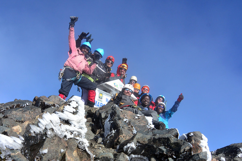
Mount Stanley, home to Margherita Peak at 5,109 m, is the highest mountain in the Rwenzori Mountains, the highest point in both Uganda and the Democratic Republic of the Congo, and Africa’s third-highest summit.  Mount Stanley rises within Rwenzori Mountains National Park, a UNESCO World Heritage Site straddling the two countries’ shared border, and it carries one of only three remaining glacier systems left on the African continent, an equatorial ice field that has existed since long before human memory and is now, within a single human generation, disappearing.
Discover Mount Stanley’s location, its peaks and glaciers today, its rock type and age, who first climbed Mount Stanley and when, the wildlife and vegetation around Mount Stanley, and how to get there. When a claim is drawn from a specific scientific source, we say so; when it reflects the accumulated, on-the-ground experience of our guiding team, we say that too.
What makes Mount Stanley matter, beyond the statistics, is what it represents: proof that permanent ice can exist almost exactly on the equator, a living record of nearly two billion years of African geological history compressed into a single climbable massif, and one of the last places on the continent where a trekker can move from tropical rainforest to true glacier travel within the space of a week.
Quick Facts About Mount Stanley Of Rwenzori Mountains
Mountain | Mount Stanley |
Highest peak | Margherita Peak—5,109 meters (16,762 ft) |
Other major peaks | Alexandra (5,091m), Albert (5,087m), Savoia (4,977m), Elena (4,970m), Elizabeth (4,928m), Philip (4,920m), Moebius (4,916m) |
Country | Uganda and the Democratic Republic of the Congo (summit ridge forms the international border) |
Mountain range | Rwenzori Mountains (Mountains of the Moon) |
National park | |
UNESCO status | |
Mountain type | Non-volcanic fault-block (horst) massif of Precambrian metamorphic rock |
Rock age | Basement rock dated to roughly 1.4–2 billion years old; uplifted along the Albertine Rift beginning approximately 3–4 million years ago |
Glaciation | Africa’s largest remaining glacier system, though rapidly retreating; total glacier area approximately 0.35 km² as of 2024 |
Africa ranking | Third-highest mountain on the continent, after Kilimanjaro (5,895m) and Mount Kenya (5,199m) |
Main access routes | Central Circuit Trail (via Elena Hut), Kilembe Trail (via Margherita Camp), Bukurungu Trail (via Irene Lakes Camp) |
Difficulty | Strenuous trekking with a technical, glaciated summit day requiring rope, crampons, and guide-led glacier travel |
First recorded ascent | 18 June 1906, by Luigi Amedeo of Savoy (Duke of the Abruzzi), with guides Joseph Petigax, Cesare Ollier, and Joseph Brocherel |
Location: Where Is Mount Stanley?
Mount Stanley sits almost exactly on the equator, at approximately 0°23′N, 29°52′E, on the border between western Uganda and the Democratic Republic of the Congo. It is the highest and most northerly of the six glaciated Rwenzori Mountains that constitute the Rwenzori range, itself the eastern rift-shoulder uplift of the Albertine Rift, the western branch of the Great Rift Valley. The mountain is flanked to the north by Mount Speke and to the south by Mount Baker, with the Bujuku Valley separating Stanley from Speke and forming the approach corridor used by the historic Central Circuit Trail.
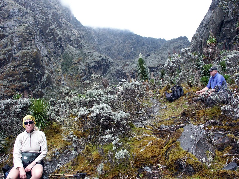
The entire massif lies within Rwenzori Mountains National Park on the Ugandan side, with a corresponding protected zone across the border in the DRC’s Rwenzori sector. The nearest town and gateway for virtually all commercial trekking access is Kasese, Uganda, roughly 380 kilometers, or about 6 to 7 hours by road or a short domestic charter flight, from Kampala and Entebbe. From Kasese, both the Central Circuit trailhead at Nyakalengija and the Kilembe trailhead near Kasese town provide direct routes to the lower slopes of Mount Stanley.
Why Is Mount Stanley Famous?
Mount Stanley’s fame rests on a specific, unusual combination of superlatives. It is Africa’s third-highest mountain, behind only Kilimanjaro and Mount Kenya, and unlike those two volcanic giants, it is entirely non-volcanic — a slab of ancient continental crust thrust skyward by rift tectonics rather than built up from lava and ash. It carries Margherita Peak, one of a small number of points on Earth where glacial ice persists within a few degrees of the equator, a phenomenon so improbable that European geographers dismissed reports of it as legend for close to two thousand years. And it sits inside Rwenzori Mountains National Park, recognized by UNESCO in 1994 for hosting Africa’s richest montane flora and one of its most unusual and least-visited alpine environments.
For mountaineers, Stanley is appealing because it requires real technical skills, roped glacier travel, crevasse awareness, and fixed-line rock sections, which are not needed on the standard trekking routes of Kilimanjaro or Mount Kenya, making a Margherita Peak summit a significantly different achievement from a walk-up African summit.
The Peaks of Mount Stanley
Mount Stanley is not a single summit but a massif of at least nine named peaks exceeding 4,900 meters, linked by the Stanley Plateau, Africa’s largest remaining icefield, and by connecting ridgelines and glacier traverses. This section, often skipped over in general Rwenzori overviews, profiles each of the massif’s principal summits individually.
Margherita Peak, The Summit On MOunt Stanley Of Rwenzori
Elevation | 5,109 metres (16,762 ft)—the highest point on Mount Stanley and Africa’s third-highest summit |
Location | The easternmost and highest point of the Stanley massif, on the Uganda–DRC border |
Difficulty | Technical; requires roped glacier travel across the Stanley Plateau and Margherita Glacier, a steep rock-and-ice gully, and a final fixed-rope rock wall to the summit |
Historical significance | First climbed on 18 June 1906 by Luigi Amedeo, Duke of the Abruzzi; named in honour of Queen Margherita of Italy |
Typical climbing route | From Elena Hut (4,541m) on the Central Circuit trail, via the Stanley Plateau and the col between Margherita and Alexandra peaks, comparable approaches exist from Margherita Camp on the Kilembe Trail and Irene Lakes Camp on the Bukurungu Trail |
Alexandra Peak on Mount Stanley Of Rwenzori
Elevation | 5,091 metres (16,703 ft), the second-highest point on the massif |
Location | Immediately adjacent to Margherita Peak, connected via the Stanley Plateau |
Difficulty | Technically, the East Ridge route is considered an excellent, somewhat less crowded alternative or companion climb to Margherita |
Historical significance | Named for Alexandra of Denmark, Queen of the United Kingdom at the time of the Duke of the Abruzzi’s 1906 expedition |
Typical climbing route | Approached across the Stanley Plateau from Elena Hut, often combined with a Margherita Peak summit attempt on the same expedition |
Albert Peak On Mount Stanley Of Rwenzori
Elevation | 5,087 metres (16,690 ft) |
Location | Part of the central Stanley massif, near Alexandra and Margherita |
Difficulty | Technical glacier and rock climbing, less frequently attempted commercially than Margherita or Alexandra |
Historical significance | Named for Albert I of Belgium, reflecting the massif’s naming convention honouring European royalty of the exploration era |
Typical climbing route | Accessed from the Stanley Plateau in conjunction with an extended multi-peak itinerary |
Savoia Peak of Mount Stanley, Rwenzori Mountains
Elevation | 4,977 metres (16,330 ft)—the highest summit in the southern peak cluster |
Location | South of the main Margherita–Alexandra–Albert cluster |
Difficulty | Technical, involving glacier approach and rock scrambling |
Historical significance | Named for the House of Savoy, the Italian royal family of Luigi Amedeo, Duke of the Abruzzi, who led the 1906 first-ascent expedition |
Typical climbing route | Approached via the southern glacier fields, typically as an extension for expeditions targeting multiple Stanley summits |
Elena Peak Of Rwenzori Mountains
Elevation | 4,970 metres (16,300 ft) |
Location | Adjacent to Elena Hut, the principal high-altitude staging point for Margherita summit attempts on the Central Circuit |
Difficulty | Moderate to technical, involving glacier terrain near the hut |
Historical significance | Named, along with Elena Hut and the Elena Glacier, for Queen Elena of Italy, wife of King Victor Emmanuel III |
Typical climbing route | Accessed directly from Elena Hut, often as an acclimatisation objective before a Margherita attempt |
Additional named summits on the Stanley Massif include Elizabeth Peak (4,928 m), Philip Peak (4,920 m), and Moebius Peak (4,916 m), among others, together forming, with the peaks above, one of the most complex and rewarding multi-summit mountaineering objectives in Africa. Most commercial expeditions focus on Margherita Peak alone, with Alexandra as the most common secondary objective for climbers seeking an extended itinerary.
The named peaks of Mount Stanley, ranked by elevation, are as follows: Margherita Peak, at 5,109 meters, is Africa’s third-highest summit.
History of Mount Stanley
Mount Stanley’s history divides cleanly into two categories that are worth keeping distinct: the oral and cultural traditions of the peoples who have lived in its shadow for centuries and the documented record of European exploration and mountaineering. Both matter, but they answer different questions.
Indigenous Knowledge and the Mountains of the Moon
The Bakonzo and Baamba peoples, whose communities have lived along the Rwenzori’s lower slopes for generations, held detailed traditional knowledge of the range’s geography, weather, and resources long before any European expedition arrived, and the mountains retain deep cultural and spiritual significance in Bakonzo tradition to this day, particularly around the glaciated peaks. Separately, and centuries earlier, the Greco-Roman geographer Ptolemy recorded, around 150 AD, an account attributed to earlier travelers describing snow-capped mountains at the source of the Nile, which he named the Lunae Montes, the Mountains of the Moon. Whether Ptolemy’s account drew directly on Bakonzo or related regional knowledge passed along Nile trade routes is not something the historical record settles with certainty, and we present it here as a documented ancient reference rather than a confirmed indigenous attribution.
European Exploration
For close to two thousand years after Ptolemy, European geographers treated the Mountains of the Moon as a legend, reasoning that permanent snow could not plausibly exist so close to the equator. That assumption held until 1888–1889, when the Welsh-American explorer Henry Morton Stanley, crossing the region during his expedition to relieve Emin Pasha, became the first European to sight the range and confirm the presence of a genuine glaciated mountain chain—the massif that would later carry his name.
The Duke of the Abruzzi Expedition and the First Ascent
The definitive exploration of Mount Stanley came in 1906, when Luigi Amedeo of Savoy, Duke of the Abruzzi, led a large, scientifically equipped Italian expedition into the range, accompanied by professional alpine guides, scientific researchers, and the noted mountaineering photographer Vittorio Sella, supported by a team of several hundred porters. On 18 June 1906, Luigi Amedeo, together with guides Joseph Petigax, Cesare Ollier, and Joseph Brocherel, achieved the first recorded ascent of Margherita Peak, and over the course of the expedition, the team went on to complete first ascents of all six of the range’s glaciated massifs.
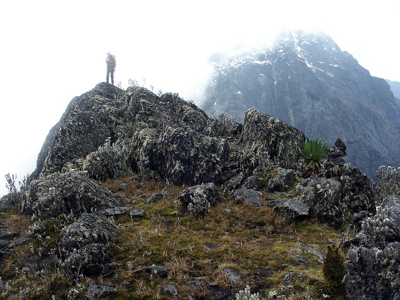
The expedition also mapped, measured, and named the majority of the Rwenzori’s individual peaks and glaciers, many after members of the Italian royal family and the expedition’s own patrons, a naming convention still in use today.
The Evolution of Mountaineering on Stanley
Following the 1906 expedition, Mount Stanley saw sporadic mountaineering and scientific visits through the twentieth century, interrupted for periods by regional instability in the 1970s through the 1990s. Commercial trekking access developed substantially from the 1990s onward, beginning with the establishment of Rwenzori Mountains National Park in 1991 and its UNESCO inscription in 1994, followed by the growth of licensed community trail operators on the Central Circuit trail and later the Kilembe trail and Bukurungu routes. Ongoing safety infrastructure improvements, including new bridging and fixed-rope installations on the Margherita Glacier route recently, have made the summit meaningfully safer to reach than in the expedition’s early decades.
Geology of Mount Stanley
Mount Stanley is not a volcano, a fact that surprises many first-time visitors familiar with Kilimanjaro or the Virunga range. It is a horst: a block of ancient continental crust uplifted along steep bounding faults while the land on either side subsided to form the Albertine Rift Valley floor. The bedrock itself is Precambrian basement rock, primarily gneiss, quartzite, schist, and amphibolite, dated by geologists to somewhere between roughly 1.4 and 2 billion years old, rock that formed deep within the Earth’s crust long before complex life existed, later exhumed and thrust skyward as the Albertine Rift began forming approximately three to four million years ago.
What this formation means in practical terms for a trekker is striking: standing on the Stanley Plateau, you are touching rock that once sat many kilometers beneath the Earth’s surface, uplifted by tectonic forces relative to the neighboring rift floor by roughly three kilometers. The range’s steep valleys, sheer rock faces, and knife-edge ridgelines are the product of this fault-block uplift combined with intense subsequent erosion and, during past ice ages, extensive glacial carving; the U-shaped valleys and moraine ridges visible along the Central Circuit trail and Kilembe trails are direct physical evidence of the mountain’s much larger historic glaciers.
The Glaciers of Mount Stanley
Glacial ice can exist this close to the equator for one essential reason: altitude. At over 5,000 meters, Mount Stanley’s summit zone remains cold enough year-round to sustain permanent snow and ice despite its equatorial latitude, in the same way Kilimanjaro and Mount Kenya once supported (and, in fading form, still support) their own tropical glaciers. Mount Stanley today holds the largest remaining glacier system among the three, anchored by the Stanley Plateau, historically Africa’s largest icefield, along with the Elena and Margherita glaciers that connect it to the summit ridge.
The trend, however, is unambiguous and well documented. Peer-reviewed remote-sensing research published in 2024 found that the Rwenzori Range as a whole has retained only around 5.8 percent of its glacier extent recorded at the start of the twentieth century, with more than 90 percent of even the early-2020s ice extent now gone. Field surveys by the NGO Project Pressure, in partnership with the Uganda Wildlife Authority and UNESCO, found that the Stanley Plateau glacier alone lost about 29.5 percent of its surface area between 2020 and 2024, with the total glacier area across Mount Stanley measured at about 0.35 square kilometers in 2024 and increasingly broken into separate ice bodies rather than a single continuous field. Mount Speke and Mount Baker, the range’s other two historically glaciated massifs, have already lost their glaciers entirely, leaving Mount Stanley as the sole remaining glaciated peak in the Rwenzori and, by extension, one of only three glaciated mountains left anywhere in Africa.
This retreat carries real scientific and human significance. The Rwenzori’s glaciers and their high-altitude water storage feed river systems relied on by an estimated five million people living in the plains below the range, and for the Bakonzo people, the glaciated peaks are deeply significant, understood in tradition as the dwelling place of the deity Kitasamba. Ongoing 3D mapping and time-lapse monitoring, developed through the Project Pressure, UWA–UNESCO partnership, aim to document the loss in detail and support both scientific understanding and local water security planning as the ice continues to retreat.
For today’s climbers, this means the technical character of a Margherita summit attempt continues to evolve year to year: expect genuine glacier travel with crevasse hazard on the Stanley Plateau and Margherita Glacier; roped travel led by your guide; and fixed lines on the steepest rock-and-ice sections, but also be aware that route conditions can shift materially between seasons as the ice continues to fragment, which is precisely why an experienced, currently active local guiding team matters more here than on almost any other African summit.
Vegetation Zones on the Ascent
A climb to Margherita Peak is, among other things, a journey through five distinct climate zones, each connected to a specific stage of the route.
Zone | Approx. Elevation | What You Experience |
Montane Forest | 1,450–2,500m | Dense tropical hardwood forest; primates and forest birds; the trek’s first one to two days |
Bamboo | 2,400–3,000m | Dense Arundinaria bamboo stands, cooler, damper, and dimmer underfoot |
Heather-Rapanea | 3,000–3,500m | Giant heathers draped in moss and lichen: the John Matte to Bujuku stretch on the Central Circuit |
Afroalpine Moorland | 3,500–4,500m | Giant lobelias and groundsels; the Bigo Bog boardwalks; Bujuku to Elena Hut |
Nival / Glacial | 4,500m+ | Bare rock, permanent snow, and glacier; the Stanley Plateau and final summit approach |
Each zone shapes the climb in a very concrete way: the montane forest and bamboo sections determine your first two acclimatization days’ fitness demands, the heather and moorland zones are where altitude first becomes a genuine physiological factor, and the nival zone is where trekking gives way to technical mountaineering.
Wildlife of Mount Stanley -Rwenzori Mountains
Mount Stanley’s approach routes pass through some of the richest wildlife habitat in the Rwenzori range, though, as with the range generally, sightings concentrate heavily in the lower zones and become progressively scarcer with altitude.
Primates
Blue monkeys and black-and-white colobus monkeys are seen regularly in the montane forest on the first days of any Stanley approach, while the shyer L’Hoest’s monkey and chimpanzee are present but far less consistently encountered; chimpanzees in particular are more often heard than seen.
Birds
The lower and mid-altitude forest and bamboo zones on the approach to Stanley have many Albertine Rift endemic birds, including the Rwenzori turaco and handsome francolin, while the Afro-alpine moorland below Elena Hut is prime habitat for the scarlet-tufted (malachite) sunbird, which is closely associated with the giant lobelia stands that define this zone.
Endemic and Notable Species
The Rwenzori three-horned chameleon, endemic to the Albertine Rift, is regularly found by experienced guides in the forest zone, while the range’s endemic Rwenzori otter shrew and Rwenzori duiker are present but genuinely rare encounters given their secretive habits.
Amphibians and Reptiles
Montane frog species, some of which have limited ranges in the Albertine Rift, are most active and vocal after rain in the lower forest zone, while reptile diversity, including chameleons and forest skinks, is mostly found below the bamboo zone and decreases sharply as temperatures drop with altitude.
For a full species-by-species treatment, including identification details, elevation ranges, and conservation status, see our dedicated Rwenzori Mountains Wildlife Guide.
Climbing Mount Stanley: The Practical Guide
Route Options
Three established routes provide access to a Margherita Peak summit attempt. The Central Circuit Trail, approaching from Nyakalengija, is the most established route, staging the final summit push from Elena Hut (4,541m) after a multi-day approach through Nyabitaba, John Matte, and Bujuku. The Kilembe Trail, approaching from the south near Kasese, offers a longer, more gradual acclimatization profile, staging the summit attempt from Margherita Camp (4,485 m).
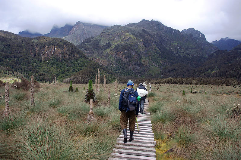
The Bukurungu Trail, a newer wilderness-camping route without hut infrastructure, stages its summit attempt from Irene Lakes Camp (4,495m) and is best suited to experienced, self-sufficient trekkers.
Summit Itinerary
A standard Margherita summit attempt via the Central Circuit trail runs seven to nine days total: several days of steady ascent through the vegetation zones to Elena Hut, a pre-dawn summit push across the Stanley Plateau to Margherita Peak, and a multi-day descent. Kilembe itineraries typically run a day or two longer, trading time for a gentler acclimatization curve. In both cases, summit day itself begins one to two hours after midnight, reaching the summit around sunrise before conditions on the exposed glacier and rock sections begin to deteriorate later in the day.
Acclimatisation
Every well-built Stanley itinerary paces altitude gain deliberately, with the Kilembe Trail’s longer profile specifically valued for reducing altitude-related risk. A dedicated rest or acclimatization day is typically built in immediately before the summit push, and any trekker showing moderate to severe symptoms of altitude sickness will be held at their current elevation or brought down by their guide, regardless of proximity to the summit.
Technical Sections
The main technical challenge on Mount Stanley is crossing the Stanley Plateau and Margherita Glacier, which requires roped travel, crampons, and crevasse awareness, followed by a steep rock-and-ice gully and a final fixed-rope rock wall to the summit. No prior mountaineering certification is required, but your guide will teach and directly supervise all technical rope and crampon technique on the mountain.
Equipment
Your operator provides technical glacier equipment, crampons, an ice axe, a harness, a climbing helmet, and a rope, so you do not need to purchase it. Personal equipment should include waterproof, well broken-in hiking boots; a full layering system from moisture-wicking base layers through to a heavyweight down jacket; waterproof outer shells for both jacket and trousers; a warm hat and insulated gloves; trekking poles; and a four-season sleeping bag rated to at least minus ten degrees Celsius for nights at Elena Hut and above.
Safety and Guide Requirements
A Margherita Peak attempt is only undertaken with a licensed guide from an authorized route operator, and Uganda Wildlife Authority regulations require this procedure for all trekkers. Guides carry pulse oximeters, are trained in altitude sickness recognition and glacier rescue technique, and maintain final authority over any summit-day decision.
Fitness Expectations
Trekkers should be capable of hiking six to eight hours on consecutive days over uneven, often muddy terrain well before departure, with genuine cardiovascular conditioning built up over at least eight to twelve weeks of training. This is a considerably more demanding physical undertaking than a standard Kilimanjaro trek, both in terms of daily walking hours and in the technical demands of summit day itself.
Weather and Climate on Mount Stanley
Mount Stanley’s climate is shaped by its equatorial location combined with extreme altitude, producing conditions that shift dramatically both by season and by time of day. Two wetter periods, March to May and September to November, bring the heaviest and most sustained rainfall, particularly through April; two drier windows, June to August and December to February, offer comparatively firmer trails and a higher likelihood of clear summit mornings, though rain remains possible in any month at this latitude.
Temperature varies enormously with elevation and time of day. Base-camp forest elevations remain warm and humid year-round, while summit-zone temperatures at Elena Hut and above regularly fall below freezing overnight even in the warmest months, with daytime temperatures on the Stanley Plateau itself typically ranging from around 5°C to 15°C but capable of sharp, sudden drops when cloud or wind moves in. This diurnal swing, driven by intense equatorial solar radiation by day and rapid radiative cooling under clear night skies, is often more physically challenging for trekkers to manage than the absolute cold itself. Visibility on summit day is highly weather-dependent; the pre-dawn start for most Margherita attempts is timed specifically to maximize the chance of a clear, calm weather window before afternoon clouds typically build.
Best Time to Climb Mount Stanley
June through August and mid-December through February remain the two most reliable windows for a Margherita Peak attempt, offering firmer trail conditions on the lower approach, better glacier visibility on the Stanley Plateau, and a stronger likelihood of clear photography conditions at sunrise. Photographers specifically targeting glacier and summit shots should prioritize these dry-season windows, since low clouds in the wetter months can obscure the upper mountain for days at a time. That said, no period on this equatorial range guarantees dry weather, and trekkers should pack and plan for rain regardless of season.
Equipment Guide: Why Each Item Matters
Item | Why It’s Necessary |
Waterproof hiking boots | The Rwenzori’s near-daily rain and boggy lower trails make waterproofing and ankle support essential; this is not terrain for lightweight trail shoes |
Crampons (operator-provided) | Required for secure footing crossing the Stanley Plateau and Margherita Glacier’s ice and firm snow |
Climbing helmet (operator-provided) | Protects against rockfall and ice fall on the summit gully and fixed-rope rock wall |
Climbing harness (operator-provided) | Required for roped travel across crevassed glacier terrain and the fixed-line summit sections |
Waterproof outer shell (jacket & trousers) | Near-daily precipitation across every vegetation zone makes a genuinely waterproof, breathable shell essential, not optional |
Heavyweight down jacket | Overnight temperatures at Elena Hut and above regularly fall below freezing |
Trekking poles | Reduce strain on muddy, root-tangled lower trails and steep scree above the treeline. |
Safety on Mount Stanley
Altitude Sickness
Altitude sickness is the principal hazard on any Stanley itinerary above 4,000 meters. Reputable operators build gradual ascent profiles into their standard itineraries, carry pulse oximeters, and maintain a non-negotiable policy of holding or descending any trekker showing moderate to severe symptoms, regardless of proximity to the summit.
Glacier Travel
The Stanley Plateau and Margherita Glacier have real crevasse hazards, but these are reduced by roped travel, careful route-finding by experienced guides, and, after recent Uganda Wildlife Authority safety upgrades, extra fixed ropes and a bridge over a known crevasse hazard on the standard route.
River Crossings
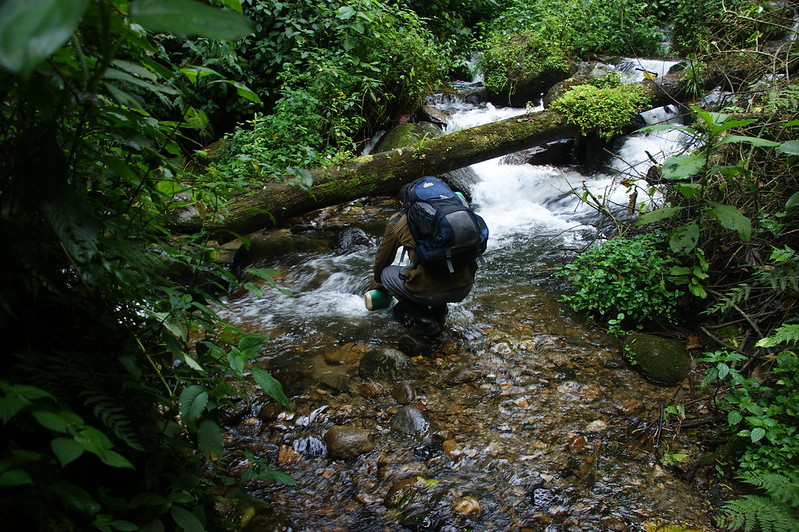
Lower-route river and stream crossings, particularly during the wetter months, can rise quickly after heavy rain; guides assess crossing conditions daily and will delay or reroute where necessary.
Weather Hazards
Rapid weather changes, particularly afternoon cloud and precipitation, are managed through pre-dawn summit timing and a guide’s authority to postpone or abort a summit attempt if conditions deteriorate.
Emergency Procedures and Rescue Support
All trekkers should carry comprehensive travel insurance explicitly covering high-altitude trekking and emergency evacuation. Licensed operators have established evacuation procedures that work with Uganda Wildlife Authority rangers, but the range’s remoteness makes any rescue a serious logistical undertaking, showing why prevention through pacing, honest symptom reporting, and guide authority is more important here than the promise of rescue after the fact.
Photography Guide
Best Viewpoints
The Stanley Plateau itself offers the most dramatic wide-angle glacier and summit photography on the mountain, while the approach from Bujuku Hut provides a rare simultaneous view of Mounts Baker, Stanley, and Speke together.
Sunrise and Sunset
Summit sunrise from Margherita Peak, timed by the standard pre-dawn departure schedule, is the signature shot of any Stanley expedition, with the curvature of the Albertine Rift often visible below the cloud line in clear conditions.
Wildlife Photography
Reserve wildlife photography ambitions for the montane forest sections of the approach, where light and subject density are both considerably better than in the upper zones; see our Wildlife Photography Tips for lens and settings guidance specific to this terrain.
Glacier and Landscape Photography
A wide-angle lens is essential for both the Stanley Plateau’s icefield and the Afro-alpine moorland’s giant lobelia landscapes; protect equipment from near-constant humidity with a dedicated dry bag and silica gel packets, and budget extra time at Elena Hut for a genuinely clear pre-dawn or dusk shooting window given how quickly cloud can move in.
Mount Stanley stands third among Africa’s highest peaks, behind Kilimanjaro and Mount Kenya, but is the only one of the three that is non-volcanic in origin.
Conservation of Mount Stanley
Mount Stanley and the wider Rwenzori Mountains National Park have held UNESCO World Heritage status since 1994, in recognition of the range’s exceptional glaciated landscapes and unmatched montane biodiversity. The park is managed by the Uganda Wildlife Authority, which oversees resource protection, ranger-based ecological monitoring, and community conservation programs, working in transboundary partnership with authorities across the DRC border.
Glacier monitoring has become an increasingly central part of the park’s scientific work, through the ongoing partnership between the Uganda Wildlife Authority, UNESCO, and the NGO Project Pressure, which has produced the first detailed 3D mapping of Mount Stanley’s remaining ice and installed time-lapse monitoring equipment to track its continued retreat. Responsible trekking practice on Stanley follows standard Leave No Trace principles: staying on designated trails and boardwalks to protect fragile Afro-alpine vegetation, packing out all waste, minimizing noise and disturbance around wildlife, and using licensed operators whose fees directly fund park protection and local community livelihoods.
Mount Stanley Compared with Other African Mountains
Mountain | Height | Origin | Country |
Mount Stanley (Margherita Peak) | 5,109 m | Fault-block (non-volcanic) | Uganda / DR Congo |
Mount Kenya (Batian Peak) | 5,199 m | Volcanic (eroded core) | Kenya |
Kilimanjaro (Uhuru Peak) | 5,895 m | Volcanic (stratovolcano) | Tanzania |
This comparison highlights what makes Mount Stanley genuinely distinctive among Africa’s three highest peaks: it is the only one of the three that is not volcanic in origin, and its standard summit route is the only one of the three that requires roped glacier travel and technical rock climbing rather than a non-technical trekking ascent.