Day 1: Arrival at Entebbe — Transfer to Kasese
The journey begins the moment you land at Entebbe International Airport, where your dedicated Rwenzori Trekking Expeditions representative meets you in the arrivals hall. A discreet placard with your name and a warm greeting quickly settle you into your private 4WD vehicle for the drive west toward the Rwenzori foothills.
The road to Kasese, approximately 370 kilometers, is itself a slow revelation of Uganda’s extraordinary landscapes. Kampala’s suburbs give way to the sprawling equatorial farmlands of the Katonga wetlands, then to the western escarpment, where the savanna broadens and, on a clear afternoon, the distant smear of mountains appears on the horizon. By the time you reach Kasese, the gateway town to the Rwenzori, nestled between the copper-rich hills and the Queen Elizabeth National Park, the mountains themselves have grown into something unmistakable: dark, cloud-wrapped, and vast.
The evening is yours to settle into your Kasese guesthouse, share a proper dinner, and meet your lead guide for a briefing that covers equipment, altitude awareness, the day-by-day rhythm of the route ahead, and any last questions you might have. Tonight, we inspect gear, not tomorrow morning, so we leave nothing to chance at the trailhead. Rest well. Tomorrow, the mountain begins.
Getting to the Rwenzori: Entebbe International Airport is the primary international gateway. From Entebbe, Kasese is approximately a 5–6 hour private drive via Kampala and Fort Portal or 4–5 hours via Mbarara. Domestic flights to Kasese Airport (operated by Aerolink Uganda) offer a 1-hour alternative, subject to scheduling. Rwenzori Trekking Expeditions privately arranges all transfers. |
Day 2: Nyakalengija Gate (1,646m) → Nyabitaba Hut (2,651m)
After an early breakfast and the short drive to Nyakalengija, the official park gate and trailhead, you complete your Uganda Wildlife Authority permit formalities while your porter team organizes loads with the quiet efficiency of people who know this mountain in their bones. The Bakonjo porters of the Rwenzori are not just carriers. They are guides, historians, and mountain interpreters, many of them third-generation Rwenzori professionals whose families have worked these slopes since the expeditions of the Duke of Abruzzi.
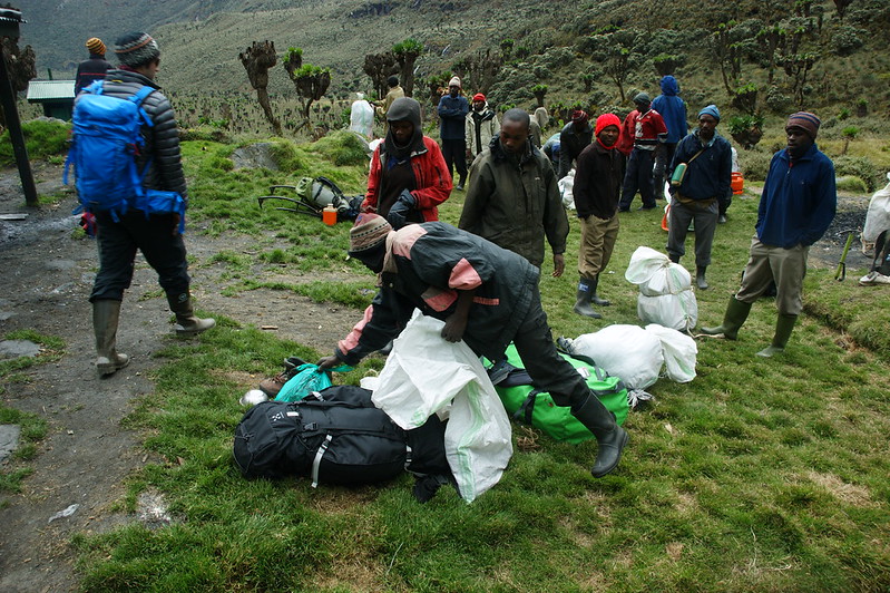
The first hours on trail are a sensory immersion. The forest here is primordial: towering Podocarpus trees draped in moss and lichen, the bark of the trail dark with moisture, shafts of equatorial light piercing the canopy at angles that change with every bend. Rwenzori turacos flash their copper-red wings overhead. Olive baboons regard you with philosophical indifference from their high branches. The air is heavy, green, and alive.
As the trail steepens above the Mubuku River valley, the forest character shifts; giant tree heather begins to appear, its gnarled trunks encased in moss two inches thick, and the understory opens to reveal spectacular views down the valley you have ascended. Nyabitaba Hut appears late in the afternoon, perched on a ridge above the confluence of the Mubuku and Bujuku rivers, mist drifting through the heather around it. Dinner is a hot, filling affair prepared by your camp cook, the first of many mountain meals that will surprise you with their quality.
Day 3: Nyabitaba Hut (2,651m) → John Matte Hut (3,505m)
This is the day the Rwenzori begins to reveal its most distinctive character, the surreal Afro-alpine zone that has earned the range the title of “Africa’s Galapagos.” The trail crosses the Mubuku River on a suspended log bridge and climbs steadily through a landscape unlike anything in the conventional understanding of African wilderness.
Giant groundsels, Senecio adnivalis, stand at head height and above, their cabbage-like rosettes mounted on shaggy, prehistoric-looking trunks. Giant lobelias, Lobelia wollastonii, erupt from the bog like green rockets, their spike flowers reaching two meters in height. Between them, the trail winds through spongy peat and heather heath, always with the distant roar of unseen waterfalls as accompaniment. This is the moorland the Victorian explorers described as “bewildering” and “unearthly,” and nothing in the intervening century has made those words inaccurate.
John Matte Hut sits at the head of the upper Bujuku Valley, at 3,505 meters, with the central peaks massing above it and the lower forest a distant dark canopy below. The evening light here, when clouds permit, can be extraordinary, the glaciers of the upper peaks catching copper and gold as the sun drops behind the Congo escarpment. Your guide brief for the following day covers the ascent to Bujuku and the Scott Elliot Pass approach.
Day 4: John Matte Hut (3,505m) → Bujuku Hut (3,977m)
The terrain from John Matte Hut becomes increasingly dramatic. The trail passes through the famous “Portal Peaks” viewpoint, where the entire upper Bujuku Valley opens before you, a glaciated cirque of extraordinary scale, the peaks of Speke, Baker, and Stanley encircling the valley’s head like the walls of a natural amphitheater. The Bujuku Lake, at 3,977 meters, lies at the valley’s heart, its dark waters reflecting whatever sky the Rwenzori chooses to offer, often clouds, occasionally astonishing clarity.
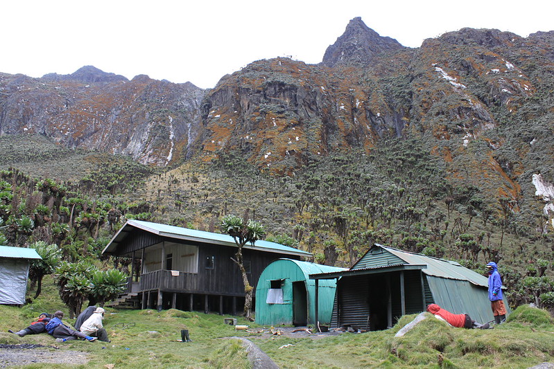
Progress through the valley floor requires patience and a sense of humor. The Rwenzori’s famous boggy terrain, locally described as “the mud,” reaches its full expression here, where thick peat can swallow a boot to the ankle at an unwary step and where the trail’s characteristic log-and-plank bridges demand a certain athleticism. Your porters navigate it with a fluency that years of experience confer. You navigate it with gaiters and trekking poles, and with the satisfying knowledge that this terrain is what makes Rwenzori trekking categorically different from any other mountain experience in Africa.
Bujuku Hut is your highest camp so far, and the cold here is genuine, with nights dropping to between 0°C and 5°C even in the dry season. Your cook will have a warm meal ready, and the evening briefing with your guide covers tomorrow’s relatively short but critical ascent to Elena Hut and your first encounter with the glacier.
Day 5: Bujuku Hut (3,977 m) → Elena Hut (4,541m) — Glacier Orientation
This is a shorter day in terms of distance, but a pivotal one in terms of preparation. The ascent from Bujuku Hut to Elena Hut, your base for the summit attempt, gains 564 meters over terrain that transitions from Afro-alpine moorland to rocky moraine to, finally, the permanent snowfield at the glacier’s edge. As you climb above 4,200 meters, the vegetation begins to thin dramatically, the air to cool sharply, and the scale of the mountain to impose itself in a way that no photograph truly prepares you for.
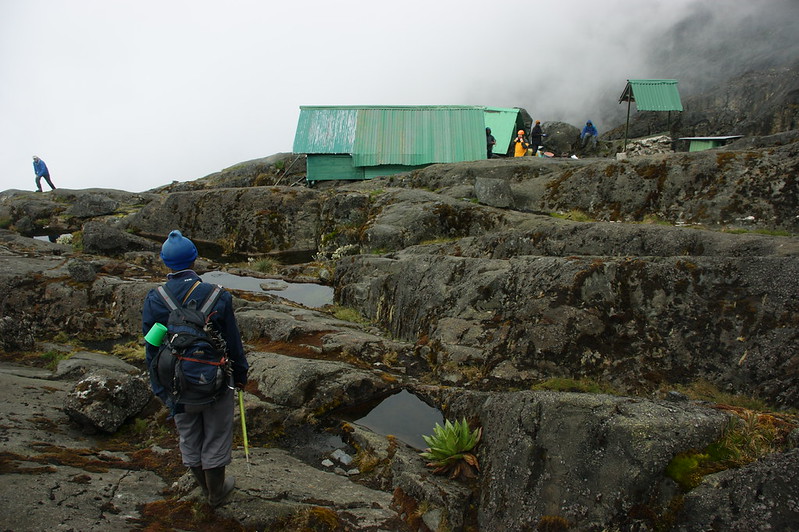
Elena Hut, perched at 4,541 metres on the rocks above the Stanley Glacier, is the highest sleeping point on this itinerary. It is a spartan, functional shelter — no luxury, but dry, wind-protected, and equipped with the basics. From its doorway on a clear evening, you can see the summit icefield above and the full sweep of the Rwenzori’s central massif below. The sun, setting over the Congo Basin to the west, turns the glacier a shade of amber that has no earthly equivalent.
The afternoon is devoted to glacier orientation with your certified mountain guide: crampons are fitted and tested, the use of the ice axe is practiced, and rope technique for the crevassed sections is walked through with care and precision. No one begins this briefing without fully completing it. The Rwenzori glaciers are genuine mountaineering terrain, and your guide’s role, learned over years and dozens of summit ascents, is to ensure you arrive at Margherita Peak safely. An early dinner, layers of clothing, and a strict 3:00 AM wake-up call. Sleep, if the altitude allows it.
Day 6: Summit Day — Elena Hut → Margherita Peak (5,109m) → Elena Hut
Before first light, with headlamps illuminating the snowfield above and the vast African darkness spread below, your rope team moves off from Elena Hut. The air at this hour has a crystalline stillness to it. The cold is serious and total. And ahead, invisible in the night sky, Margherita Peak waits.
The ascent crosses the Stanley Glacier, a field of crevassed blue ice, on fixed rope lines that your guide has assessed and prepared before dawn. Crampons bite into ice that has lain here since before the first human footprint on this continent. The gradient steepens through the upper couloir, where the thin air begins to make itself felt even in well-acclimatized lungs. Step. Breathe. Step. Breathe. The pace is deliberate, measured, and sustainable.
“The summit of Margherita Peak is the closest thing in Africa to a Himalayan climbing experience, glacier travel, altitude, technical terrain, and a view that stretches from the Congo Basin to the Ugandan plains. Every step to reach it is earned. there is earned.” Senior Guide, Rwenzori Trekking Expeditions |
In the hour after sunrise, with the horizon already blazing copper and gold, you step onto the corniced snow ridge that marks the summit of Margherita Peak, which stands 5,109 meters above sea level. Africa’s third highest point. This is the third time in history that humanity has climbed above 5,000 meters on this continent. Uganda spreads to the east, invisible beneath the clouds. The Congo Basin stretches west, an emerald immensity. The Stanley Plateau glacier gleams below you. The feeling is not triumph alone; it is something quieter, more lasting. It is the particular satisfaction of a body pushed to its limit and a mind utterly present.
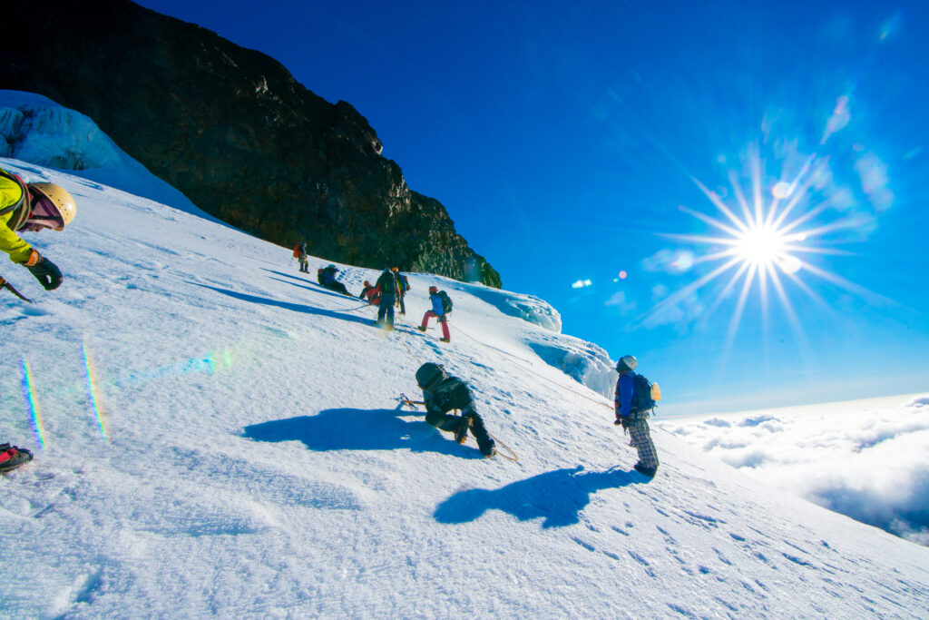
Your guide allows proper time at the summit, photographs, a moment of stillness, and the ceremonial signing of the summit register before the descent begins. Descent on a glacier is careful, methodical, and equally guided. By midday, you are back at Elena Hut, where a warming meal and the quiet celebration of your team await.
Day 7: Elena Hut (4,541m) → Kitandara Lakes (4,027m) via Freshfield Pass
If the summit was the emotional apex of this expedition, the traverse to the Kitandara Lakes is its most visually stunning passage. Descending from Elena Hut and crossing the Freshfield Pass at approximately 4,282 meters, the route reveals the western face of the Rwenzori, a landscape utterly different in character from the Bujuku Valley. Wider, more open, swept by westerlies carrying moisture from the Congo, the terrain here has a high, cold grandeur that the eastern slopes only hint at.
The Kitandara Lakes arrive like a reward. Two glacially carved tarns at 4,027 meters, their surfaces dark and still in the shadow of the central peaks, are surrounded by a bog garden of giant lobelias and heather, with the ridgeline of Mount Baker reflected in the water on calm afternoons. Your guide knows where to find the light at this time of day, where to position a camera, and which stories belong to these lakes: the stories of the Bakonjo who sheltered here in the mist and of the early explorers who named these waters after the Kitandara River, a name lost to most maps but present in the mountain’s memory. Kitandara Camp is tonight’s rest point, its hut positioned above the upper lake with a view that requires no enhancement.
Day 8: Kitandara (4,027m) → Guy Yeoman Hut (3,261m) → Trailhead
The final trekking day is a long one, and the Rwenzori does not make it easy. The trail descends through all the vegetation zones in reverse, from the high moorland through the giant heather and groundsel forest down into the increasingly dense montane forest of the lower slopes, and the terrain underfoot remains characteristically Rwenzori: wet, rooted, and utterly engaging.
A mid-morning stop at Guy Yeoman Hut allows for a final look back up the valley you have traversed, the upper peaks lost as always in their private weather system of cloud and mist. Then the descent continues to Nyabitaba Hut and finally to the Nyakalengija trailhead, where your private vehicle awaits, along with cold drinks, a change of clothes from your main luggage, and the particular lightness of a person who has been somewhere rare and returned changed by it.
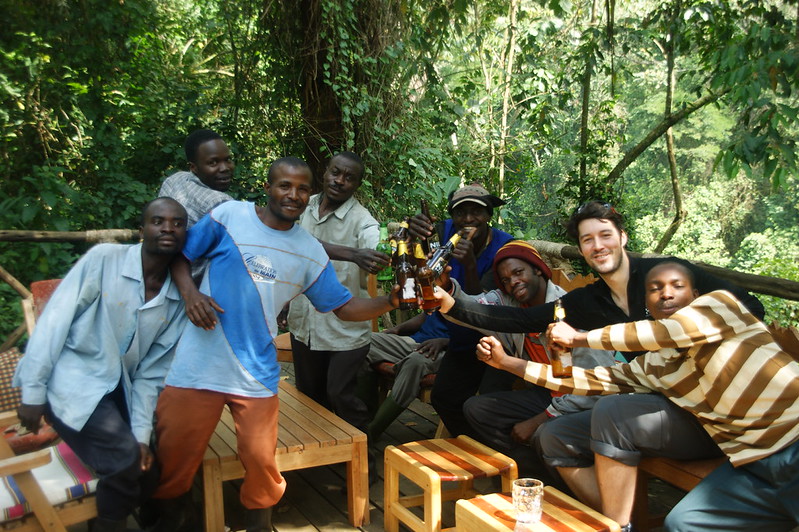
The farewell to your porter team and guides is a moment this itinerary deliberately preserves. These are not anonymous figures in a tourism transaction; they are mountain professionals whose livelihoods, whose families, whose entire community infrastructure is built around the Rwenzori and the travelers who come to it. Your guide facilitates the custom of individual gratitude and, where appropriate, gratuity, before the vehicle pulls away toward Kasese and a final night in town.
Day 9: Kasese → Kampala or Entebbe — End of Expedition
The return journey to Kampala or Entebbe, with your private vehicle waiting after breakfast, is a time for decompression and processing. The road that seemed merely long on arrival feels altogether different now, carrying a traveler who has stood on one of Africa’s towering peaks. The landscape through the windows, the wetlands, the green equatorial farmland, and the distant shimmer of Lake Victoria somehow look more vivid than before.
Your Rwenzori Trekking Expeditions representative ensures you arrive at Entebbe International Airport in ample time for your onward flight or delivers you to your preferred Kampala hotel. The expedition formally concludes here, but the experience, and what it does to a person, concludes nothing. It begins something.
Day-by-Day Altitude Profile
Day | Location/Camp | Altitude | Terrain Notes |
Day 1 | Nyakalengija Gate | 1,646 m | Approach through montane forest |
Day 2 | Nyabitaba Hut → John Matte Hut | 2,651 m | Afro-alpine moorland begins |
Day 3 | John Matte Hut → Bujuku Hut | 3,977m | Giant lobelia & senecio forest |
Day 4 | Bujuku Hut → Elena Hut | 4,541 m | The glacier approach begins |
Day 5 | Summit Day — Margherita Peak | 5,109 m | Highest point of the trek |
Day 6 | Elena Hut → Kitandara Lakes | 4,027m | High-altitude lake descent |
Day 7 | Kitandara → Guy Yeoman Hut | 3,261m | Descent through heather zones |
Day 8 | Guy Yeoman → Nyabitaba → Trailhead | 1,646 m | Final forest descent |
Day 9 | Kasese → Kampala/Entebbe | ~1,000m | Transfer day |
How Difficult Is the Margherita Peak Trek?
This inquiry is the question most commonly asked and the one that most needs an honest, experienced answer. Margherita Peak is genuinely challenging. It is not technically extreme by the standards of the world’s high mountains, but it demands genuine physical fitness, mental resilience, and a willingness to embrace serious discomfort in service of an extraordinary experience. There is no easy version of this trek, and you should not trust any operator who claims otherwise with your safety.
The Central Circuit Trail involves six to ten hours of hiking per day over terrain that is consistently wet, often muddy, sometimes technical, and always strenuous. Altitude is a factor from Day 3 onward, and the summit day at 5,109 meters places demands on the cardiovascular and respiratory systems that no amount of lowland fitness entirely prepares you for. Acute Mountain Sickness (AMS) is a genuine risk above 4,000 meters, and your guide carries the training and equipment to respond to symptoms immediately.
The summit section requires the use of crampons, an ice axe, and a fixed rope for genuine glacier mountaineering, albeit guided and non-technical in the Himalayan sense. Prior glacier experience is helpful but not required. What is required is fitness, good health, a stable head for heights, and the ability to follow your guide’s instructions precisely.
Category | Detail |
Terrain | Mud, roots, rock scrambles, scree, glacier ice |
Technical Sections | Roped glacier traverse to Margherita summit |
Physical Demand | High — 6–10 hours hiking per day at altitude |
Altitude Sickness Risk | Moderate to high, above 4,000m |
Equipment Required | Crampons, ice axe, harness (provided) |
Prior Experience Needed | Multi-day trekking; glacier experience helpful |
Fitness Level | Excellent — 3+ months of preparation recommended |
Our recommendation: begin a structured fitness program at least three months before the trek, incorporating sustained cardio (running, cycling, swimming), load-carrying hill walks, and, if possible, a warm-up trek at altitude. We are pleased to share a detailed preparation program with all confirmed clients.
Best Time to Trek Margherita Peak
The Rwenzori Mountains receive rainfall throughout the year; this mountain range is a range that generates its own weather systems, and the phrase “best time” must be understood in relative rather than absolute terms. There is no month in which the Rwenzori is reliably dry. There are, however, seasons in which the weather is considerably more favorable, (windows that experienced operators know well and that our itinerary scheduling reflects.)
Major Season: June to August
The East African long dry season, running from June through August, offers the most consistently stable conditions in the Rwenzori. Rainfall is reduced, though never entirely absent; cloud cover is lower and more intermittent; and the glacier and upper snowfields are at their most navigable. Success rates for summit day are highest during this window. June, July, and August are consequently the most popular months for the Margherita Peak expedition, and places fill early with the global mountaineering community. Book six to nine months in advance for peak-season dates.
Secondary Season: December to February
Uganda’s short dry season, from December into February, offers a second window of relative stability. Christmas and New Year summit treks are a tradition among Rwenzori regulars, and the mountain in January can be spectacular, cold, sharp-aired, and has frequent clear summit days. This window is particularly popular with visitors combining the Rwenzori with a Ugandan gorilla trekking safari in Bwindi Impenetrable National Park, a combination that Rwenzori Trekking Expeditions curates as a seamless combined itinerary.
Shoulder Seasons: March–May and September–November
The wetter shoulder seasons are not without their advocates. The forests are at their most verdantly alive, the waterfalls at full fury, and the mountain atmosphere most dramatically primordial. Wildlife encounters tend to be richer in these months. Summit success rates are lower, and some sections of trail are more technically demanding in wet conditions. They are not seasons we discourage, but they require experienced guidance, additional equipment, and a more flexible attitude toward summit outcomes. We guide year-round, with full, honest disclosure of conditions at any given time.
How to Get to the Rwenzori Mountains
The Rwenzori Mountains National Park is located in western Uganda, near the town of Kasese and approximately 370 kilometers from the capital, Kampala. The gateway to the Central Circuit Trail is the Nyakalengija trailhead, accessible from Kasese via a short drive on a laterite road.
By Air: The nearest international airport is Entebbe International Airport (EBB), served by numerous African and international carriers, including Kenya Airways, Ethiopian Airlines, Turkish Airlines, and Qatar Airways. Aerolink Uganda offers a domestic flight from Entebbe to Kasese Airport that takes approximately one hour, subject to scheduling. Your Rwenzori Trekking Expeditions transfer team handles all airport logistics.
By Road: The overland drive from Entebbe or Kampala to Kasese takes approximately five to six hours via the Fort Portal highway, or four to five hours via Mbarara and Bushenyi. All road transfers are operated privately, in comfortable 4WD vehicles, with an experienced driver who speaks English and knows the route. Stops for fuel, refreshments, and photography at the equator crossing and the Katonga wetlands are standard inclusions.
What Is Included in the Trek?
Every detail of your expedition is curated and managed by Rwenzori Trekking Expeditions. From the moment you confirm your booking to the moment you return to Entebbe, the logistics of your mountain journey are ours to carry so that your attention can remain entirely on the experience.
Included
Category | What Is Covered |
Transfers | Private return road transfers: Entebbe/Kampala ↔ Kasese ↔ Nyakalengija |
Park Fees & Permits | Uganda Wildlife Authority entry fees and trekking permits for all days |
Guide Services | Certified lead guide throughout the trek; assistant guides as required by group size |
Porter Team | Full Bakonjo porter team for group gear and communal equipment (personal porter available) |
Accommodation | Mountain hut accommodation (Nyabitaba, John Matte, Bujuku, Elena, Kitandara, Guy Yeoman) + Kasese guesthouse (Nights 1 & 8) |
All Meals on Trek | Full board: breakfast, lunch, dinner, and hot drinks throughout the trekking days |
Technical Equipment | Crampons, ice axe, climbing harness, helmets, and fixed ropes for summit section |
Emergency Equipment | Comprehensive first aid kit, pulse oximeter, supplemental oxygen, stretcher, and rescue coordination |
Pre-Trek Briefing | Full equipment check, route briefing, and altitude awareness session in Kasese |
Summit Certificate | Official Rwenzori Trekking Expeditions Margherita Peak summit certificate |
Rescue Insurance | Mountain rescue insurance included in the expedition fee |
Not Included
Category | Notes |
International Flights | Not included — arrange independently via your preferred carrier |
Uganda Visa | USD 50 on arrival or in advance via evisa.go.ug |
Travel Insurance | Required, must include medical evacuation cover; we recommend World Nomads or similar |
Personal Porter | Available at additional cost — highly recommended for comfort |
Gratuities | For guides and porters — voluntary but culturally important; guidelines provided on request |
Alcoholic Beverages | Not supplied at mountain huts |
Personal Gear & Clothing | Your personal trekking equipment (see packing list) |
Pre/Post-Trek Accommodation | Hotel nights in Kampala or Entebbe before/after the expedition |
Extensions & Add-ons | Gorilla trekking, game drives, cultural visits are quoted and arranged separately |
What Should I Pack for Margherita Peak?
Packing for the Rwenzori demands a layering strategy built around one inescapable truth: this mountain is wet, cold, and unpredictable, and the only insurance against discomfort is preparation. The list below reflects what our guides have learned works and what common omissions look like on Day 5 at Elena Hut, when there is no gear shop within three hours of the snowfield.

Rwenzori Trekking Expeditions provides technical glacier equipment, crampons, an ice axe, a climbing harness, a helmet, and fixed ropes as part of your expedition fee. You do not need to own or carry this equipment. Everything else below, however, should be in your pack.
Item | Notes |
Base Layer | Moisture-wicking thermal top & bottoms (merino wool preferred) |
Mid Layer | Fleece jacket or down vest |
Outer Shell | Waterproof, windproof jacket & trousers — essential in the Rwenzori |
Summit Insulation | Heavy down jacket for Elena Hut and summit night |
Trekking Boots | Waterproof, ankle-support boots — broken in before the trek |
Gaiters | Essential for deep Rwenzori mud; knee-length preferred |
Gloves | Thin liner gloves and waterproof outer gloves; summit mitts recommended |
Hat & Balaclava | Warm hat for high camp; sun hat for lower elevations |
Trekking Poles | Adjustable, highly recommended for mud and glacier sections |
Headlamp | With spare batteries, mandatory for 3:00 AM summit start |
Sleeping Bag | -10°C rated minimum; this is not optional at Elena Hut |
Sleeping Liner | Adds warmth; keeps hut bedding clean |
Sunscreen | SPF 50+ — UV intensity is extreme above 4,000 m. |
Glacier Sunglasses | UV400-rated, standard sunglasses are insufficient on the snowfield |
Water Bottles | 2–3 litres capacity; water purification tablets as backup |
Personal First Aid | Personal medications, blister care, diamox (consult your doctor) |
Camera & Power Bank | A waterproof camera case strongly recommended |
Dry Bags | Keep gear dry; the Rwenzori’s wet conditions are constant |
Passport & Documents | UWA permit, travel insurance documents, emergency contacts |