Where Is Mount Emin Located?
Mount Emin lies in the northern-to-central section of the Rwenzori range, positioned north of Mount Gessi and broadly northeast of the Mount Stanley massif, within the range’s western flank straddling the Uganda-DRC border. Its position places it somewhat apart from the classic Central Circuit trail and Kilembe trail trekking corridors that funnel most Ugandan-side visitors toward Mount Stanley, which is a significant part of why it remains comparatively unvisited from the Ugandan side.

The mountain is most commonly accessed via the Mugusu Valley, which extends from the Ugandan side into Congolese territory, and its summit ridge, running between Umberto and Kraepelin peaks, sits directly on the international border. Nearby valleys and passes connect Mount Emin to Mount Gessi to its south and, further north, toward Mount Luigi di Savoia; on the Ugandan side, distant views of Mount Emin’s rugged profile are occasionally possible from higher points on the Central Circuit Trail in clear conditions, though it is not a peak most Central Circuit itineraries approach directly.
We are not aware of a single, universally agreed set of summit coordinates for Umberto Peak published by an authoritative surveying body, and we would rather note that gap than publish an unverified figure. Trekkers requiring precise coordinates for expedition planning should request them directly from a licensed operator with current Congolese-side route experience.
Why Mount Emin Is Important
Geological Importance
Mount Emin has the same basic geological history as the rest of the Rwenzori: a block of Precambrian metamorphic basement rock, gneiss, schist, and amphibolite that were uplifted along fault lines as part of the Albertine Rift’s western rift-shoulder formation. Its narrow, rugged twin-summit ridge structure offers a smaller-scale but geologically comparable record of the same tectonic uplift and glacial erosion processes visible on Mount Stanley, making it a useful reference point for understanding the range’s formation as a whole, even though it has attracted far less dedicated geological survey attention than Stanley.
Ecological Importance
As with every major Rwenzori massif, Mount Emin’s slopes host the range’s characteristic sequence of montane forest, bamboo, heather, and Afro-alpine moorland zones, contributing to the unbroken vegetation gradient that earned the wider park its UNESCO listing. Its relative isolation from established trekking routes means its lower and middle slopes remain comparatively undisturbed by visitor traffic, which may make it ecologically valuable as a lower-pressure habitat corridor, though we are not aware of published, Emin-specific ecological survey data to confirm this beyond general inference from the wider park’s documented ecology.
Scientific Importance
Mount Emin’s largely unglaciated, moderately eroded profile offers geologists and glaciologists a useful comparison point against the more heavily studied, still-glaciated Mount Stanley, a natural before-and-after reference for understanding how a Rwenzori massif evolves once its ice has fully retreated. Dedicated scientific literature specifically focused on Mount Emin remains sparse compared to Stanley; most of what is documented about the mountain sits within broader Rwenzori-wide geological and glaciological studies rather than Emin-specific research.
Conservation Importance
Mount Emin falls entirely within the boundaries of Rwenzori Mountains National Park and its associated UNESCO World Heritage Site designation, affording it the same formal legal protection as the park’s more visited peaks, under the joint stewardship of the Uganda Wildlife Authority on the Ugandan side and Congolese park authorities across the border.
Mountaineering Importance
For experienced trekkers, Mount Emin’s appeal lies precisely in what makes it commercially under-visited: narrow, rugged, technically interesting ridgeline terrain, genuine remoteness, and the particular satisfaction of standing on a summit that comparatively few trekkers reach. Today, it is most often part of a longer multi-peak Rwenzori expedition that targets several or all six major massifs, rather than being pursued as a stand-alone objective.
The Peaks of Mount Emin
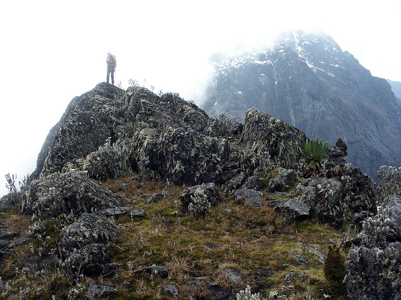
Mount Emin consists of two major peaks joined by a narrow, rugged connecting ridge, a simpler structure than the multi-peak Stanley or Speke massifs, but no less demanding underfoot.
Umberto Peak
Elevation | Approximately 4,798 metres (15,741 ft)—the higher and more southerly of Mount Emin’s two summits |
Terrain | Narrow, rocky ridge terrain with steep approaches; consistently described across sources as rugged rather than technical in the glaciated sense |
Geological features | Precambrian metamorphic rock (gneiss and related basement lithologies consistent with the wider Rwenzori massif), with ridge forms shaped by past glacial erosion now expressed as bare rock rather than active ice |
Historical notes | Reached during the Duke of the Abruzzi’s 1906 Rwenzori expedition, which achieved first ascents of all six major massifs over a roughly two-month campaign; Umberto Peak is understood to be named for King Umberto I of Italy, uncle of the expedition’s leader, Luigi Amedeo |
Climbing characteristics | Typically approached from the southwest ridge, most often reached via the Mugusu Valley from the Congolese side, it’s described by operators as a shorter, non-glaciated climb relative to a full Margherita Peak summit attempt |
Kraepelin Peak
Elevation | Approximately 4,791 metres (15,720 ft), the lower of Mount Emin’s two summits, connected to Umberto by a narrow ridge |
Terrain | Similar rugged, rocky ridge character to Umberto Peak |
Geological features | Consistent with the wider Emin massif’s Precambrian basement geology |
Historical notes | We have not located a definitive, widely corroborated public account of the specific individual honoured in this peak’s naming; we note this as a genuine gap in the published record rather than speculate |
Climbing characteristics | Generally climbed in combination with Umberto Peak via the connecting ridge, rather than as a separate, independent objective |
Mount Emin ranks fourth among the Rwenzori’s six major massifs, above Mount Gessi and Mount Luigi di Savoia, but below Mount Baker, Mount Speke, and Mount Stanley.
History of Mount Emin
Indigenous History
The Bakonzo people have inhabited the lower slopes and valleys of the Rwenzori range, including the areas surrounding Mount Emin, for many generations, holding detailed traditional knowledge of the range’s terrain, weather patterns, and resources that long predates any European survey. Published, Emin-specific ethnographic or oral-history documentation is notably thinner than that for the more visited Stanley massif, and we present this section as an honest acknowledgment of that gap rather than as an assumption that no such knowledge or association exists.
European Exploration and Mapping
Mount Emin, like the rest of the range, entered the documented European record only after Henry Morton Stanley’s 1888–1889 sighting confirmed the existence of the long-legendary “Mountains of the Moon.” Detailed mapping and naming of the range’s individual massifs, including Emin, followed during Luigi Amedeo, Duke of the Abruzzi’s, 1906 scientific expedition, which combined mountaineering with topographic survey, geological investigation, and Vittorio Sella’s landmark photographic documentation of the range’s glaciers in their early-twentieth-century extent.
The Duke of the Abruzzi Expedition
Over approximately two months in mid-1906, the Duke of the Abruzzi’s team achieved first ascents of all six major Rwenzori massifs: Stanley, Speke, Baker, Emin, Gessi, and Luigi di Savoia, a mountaineering program not matched in scope by any subsequent Rwenzori expedition. Contemporary and later secondary sources place the team’s ascent of Mount Emin’s Umberto Peak within this same 1906 campaign, following the Margherita and Alexandra Peak ascents on Mount Stanley and preceding the team’s move on to Mount Speke, Gessi, and Luigi di Savoia; we present this sequence as reported in secondary historical accounts, since we have not independently verified the exact date against the expedition’s original published narrative.
Who Was Emin Pasha?
The mountain’s name honors Mehmed Emin Pasha, born Isaak Eduard Schnitzer in 1840 in Prussian Silesia (in present-day Poland). Trained as a physician, Schnitzer worked across the Ottoman Empire before entering the service of the Egyptian administration in Sudan, adopting the name Emin and rising, by 1878, to become governor of Equatoria, Egypt’s southernmost province on the upper Nile. Cut off from northern Sudan by the Mahdist uprising of the 1880s, Emin Pasha became the subject of an international rescue effort, the Emin Pasha Relief Expedition, led by Henry Morton Stanley between 1887 and 1889, that itself contributed significantly to European geographic knowledge of the Rwenzori region and the wider Great Lakes area of Central Africa. Emin Pasha was, by contemporary account, also a serious naturalist, contributing substantially to the ornithological, ethnographic, and meteorological documentation of equatorial Africa before his death in 1892 in the Congo Free State.
It is worth presenting this history in its full context rather than a simplified heroic frame: Emin Pasha’s career unfolded entirely within the administrative apparatus of nineteenth-century Ottoman-Egyptian and, later, German colonial ambition in Africa, and the Rwenzori’s European naming convention as a whole, honoring explorers, expedition patrons, and European royalty, reflects the norms of that colonial-era exploration period rather than any indigenous naming tradition. We present these facts as a historical record, not an endorsement of the colonial framework within which they occurred.
Geology of Mount Emin
Mount Emin’s bedrock belongs to the same Precambrian basement complex that underlies the entire Rwenzori range: ancient metamorphic rock, principally gneiss, schist, and amphibolite, dated broadly to more than a billion years old, uplifted along fault lines during the Albertine Rift’s formation beginning roughly three to four million years ago. As with its neighboring massifs, Mount Emin’s dramatic relief is the product of this fault-block (horst) uplift acting on rock that was already ancient long before the uplift itself began, subsequently shaped by erosion and, during past glacial periods, by ice.
What distinguishes Emin’s landscape today, in visual terms, is the degree to which its glacial legacy is now expressed purely in landform rather than in remaining ice: its narrow, twin-summit ridge and steep connecting saddle are widely described as showing clear signs of past glacial erosion, the kind of sharpened ridgelines typical of formerly glaciated terrain, even though, as detailed below, no glacier ice remains on the mountain today. Trekkers reaching the connecting ridge between Umberto and Kraepelin peaks are, in effect, walking across a landform sculpted by ice that disappeared long before living memory of the mountain in its current state.
Glacial History Of Mount Emin
Mount Emin was very likely among the Rwenzori massifs carrying at least modest glacier ice at the time of the Duke of the Abruzzi’s 1906 survey, consistent with the broader documented pattern across the range’s higher peaks in the early twentieth century; however, we have not located a source that specifically quantifies Emin’s historic glacier extent with the same rigor applied to Mount Stanley’s better-studied ice fields, and we flag that as a genuine gap rather than assert a specific historic ice area for Emin.
Both current operator reporting and the wider scientific literature on Rwenzori glacial retreat well establish that Mount Emin carries no glacier ice today. This evidence places it in the same category as Mount Speke and Mount Baker, both of which peer-reviewed remote-sensing research published in 2024 confirmed have also lost their glaciers entirely, leaving Mount Stanley as the sole remaining glaciated massif in the entire Rwenzori range. The evidence of Mount Emin’s glacial past survives instead in its landforms: the cirque-like basins, steepened ridgelines, and U-shaped valley sections typical of formerly glaciated terrain, visible to any trekker who reaches its upper slopes, even in the complete absence of ice.
Vegetation Zones Around Mount Emin
Zone | Approx. Elevation | Character Around Mount Emin |
Montane Forest | Below ~2,500m | Dense tropical hardwood forest on the lower approach slopes, particularly on the Mugusu Valley approach |
Bamboo Zone | ~2,400–3,000m | Dense Arundinaria bamboo stands typical of the wider Rwenzori mid-altitude belt |
Heather Belt | ~3,000–3,500m | Giant heather forest draped in moss and lichen, thinning as the route gains the upper valley |
Afro-alpine Moorland | ~3,500–4,300m | Giant lobelias and groundsels on the higher approach slopes below the summit ridge |
Alpine Rock Zone | Above ~4,300m | Bare rock and rugged ridge terrain on the final approach to Umberto and Kraepelin peaks, with vegetation thinning to near-absence |
This is the same fundamental altitudinal sequence found across the wider Rwenzori range, and it is precisely this unbroken zone-by-zone transition, repeated, with local variation, on every major massif, including Emin, that underpinned the park’s 1994 UNESCO World Heritage inscription.
Wildlife Around Mount Emin
Wildlife encounters on Mount Emin’s approach slopes follow the same general pattern found across the wider Rwenzori range, concentrated heavily in the lower zones, though we should be clear that dedicated, Emin-specific wildlife survey data is limited; the following reflects the general ecological pattern documented for the wider park, applied to Emin’s comparable habitat zones rather than site-specific census data.
Primates and Forest Mammals
Blue monkeys and black-and-white colobus are plausible in the lower montane forest sections of the Mugusu Valley approach, consistent with their documented range across similar-elevation forest elsewhere in the park, alongside forest antelope such as bushbuck in forest-edge clearings.
Albertine Rift Endemic Birds
The montane forest and bamboo zones on Emin’s slopes fall within the same elevation bands that support Albertine Rift endemics such as the Rwenzori turaco and handsome francolin elsewhere in the range, though we are not aware of a published, Emin-specific bird checklist confirming their presence on this particular massif.
Amphibians and Reptiles
The cool, wet lower and middle slopes plausibly support montane frog species and forest chameleons consistent with those documented on comparable-elevation terrain elsewhere in the park, though again without dedicated Emin-specific survey confirmation.
Butterflies and Invertebrates
Forest clearings on the lower approach are likely to support butterfly diversity consistent with the wider park’s documented pattern, particularly on sunlit mornings following rain.
We want to be transparent here: this wildlife section describes what is ecologically plausible based on Mount Emin’s habitat zones and their documented equivalents elsewhere in the park, rather than a confirmed, site-specific species census for Mount Emin itself. For verified species data at the whole-park level, see our dedicated Rwenzori Mountains Wildlife Guide.
Trekking Around Mount Emin
Mount Emin is not commonly climbed as a stand-alone objective, and it is worth being direct about why: it is outside the well-established Central Circuit trail and Kilembe trail trekking corridors that serve most Ugandan-side visitors; its approach is generally considered more practical from the Congolese side; and it lacks the glaciated, headline-summit appeal of Margherita Peak that drives most commercial Rwenzori bookings. In practice, most trekkers who reach Mount Emin’s summits do so as part of longer multi-peak expeditions, commonly a 13-day or longer itinerary that also targets Gessi, Speke, Stanley, Luigi di Savoia, and Baker in a single trip, deliberately following the same six-massif program the Duke of the Abruzzi’s 1906 expedition completed.
The standard approach to Umberto Peak begins from the southwest ridge, most practically reached via the Mugusu Valley, which extends into Congolese territory; the route continues through Afro-alpine terrain to the saddle between Umberto and Kraepelin peaks before the final ridge ascent. Nearby camps and logistics along this approach are considerably less developed than the hut networks on the Central Circuit trail or Kilembe trails, and expeditions to Emin should be arranged well in advance with an operator experienced in the Congolese-side approach or in multi-peak Central Circuit Trail extensions, since standard commercial itineraries do not include them by default.
Difficulty and Accessibility
Being honest about accessibility is more useful here than generic reassurance. Mount Emin’s terrain, with its narrow, rugged, rocky ridgelines connecting the two summits, is consistently described in available sources as demanding underfoot, though non-technical in the glaciated sense, since the mountain carries no ice. Elevation alone places it firmly in serious high-altitude trekking territory, with the same acclimatization demands as any Rwenzori peak above 4,500 meters.
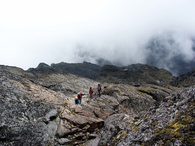
Trail conditions on the less-developed Emin approach are generally rougher and less predictable than on the established Central Circuit trail or Kilembe routes; weather is subject to the same near-daily precipitation typical of the range, and a genuine base level of high-altitude trekking fitness, ideally with prior Rwenzori or comparable experience, is strongly advisable before attempting it. Most operators position Mount Emin as an objective for experienced trekkers extending a multi-peak itinerary rather than a first Rwenzori summit.
Weather and Climate
Mount Emin has a similar climate to the wider Rwenzori range, with a near-constant chance of rain in any month, two wetter periods (March to May and September to November), and two drier windows (June to August and December to February). Temperatures fall steadily with elevation, from warm, humid conditions in the lower forest to regular overnight sub-zero temperatures on the upper ridge approaching Umberto and Kraepelin peaks, with cloud cover and visibility changing rapidly and unpredictably through the day, particularly in the afternoon.
Best Time to Visit/Hike/Climb Mount Emin
The two established Rwenzori dry-season windows, June through August and mid-December through February, provide the best general conditions for an Emin approach, with firmer trails and better visibility for navigation and photography. We would rather be cautious than definitive here: no period on this equatorial, high-rainfall range guarantees dry weather, wildlife sightings, or clear summit visibility, and trekkers should plan and pack for rain and cold regardless of season.
Photography Guide
The connecting ridge between Umberto and Kraepelin peaks offers striking panoramic views across the surrounding Emin and Gessi valleys on clear days, while the Afro-alpine moorland on the upper approach provides classic giant lobelia and groundsel foreground subjects against the mountain’s rugged rock backdrop. As with the rest of the range, sunrise and early-morning light offer the most reliable clear-visibility window before afternoon clouds typically build, and the lower montane forest sections of the Mugusu Valley approach are the best opportunity for wildlife and forest-landscape photography on this particular route.
Conservation
Mount Emin is protected by the same UNESCO World Heritage Site designation, granted in 1994, that covers all of Rwenzori Mountains National Park and is jointly managed by the Uganda Wildlife Authority on the Ugandan side and Congolese protected-area authorities across the border. Its relative remoteness from established trekking infrastructure may mean lower direct visitor pressure than on the Central Circuit Trail or Kilembe routes, though its isolation also means fewer resources are typically directed toward monitoring or trail management on this specific approach. Climate change affects Mount Emin principally through its influence on the wider park’s hydrology and vegetation zones rather than through glacier loss specifically, since the mountain’s ice disappeared before the current era of detailed scientific monitoring began. Responsible trekking practice here follows standard Leave No Trace principles: staying on established paths, packing out all waste, minimizing disturbance to wildlife and vegetation, and travelling with a licensed operator whose guiding fees support both park protection and local community livelihoods on both sides of the border.
Mount Emin Compared with Other Major Rwenzori Massifs
Mountain | Approx. Height | Distinguishing Feature |
Mount Stanley | 5,109 m | Highest massif in the range; home to Margherita Peak and the Rwenzori’s last remaining glaciers |
Mount Speke | 4,890 m | Second-highest massif; four summits, including Vittorio Emanuele Peak |
Mount Baker | 4,843 m | Third-highest massif; highest point is Edward Peak |
Mount Emin | 4,798 m | Fourth-highest massif; rugged twin-summit ridge (Umberto and Kraepelin); no remaining glaciers; most practically approached from DRC |
Mount Gessi | 4,715 m | Fifth-highest massif; twin peaks (Iolanda and Bottego); glaciers present historically, now melted |
Mount Luigi di Savoia | 4,627 m | Sixth-highest massif; named for expedition leader Luigi Amedeo, Duke of the Abruzzi, himself |
This comparison places Mount Emin precisely where it sits within the Rwenzori hierarchy: firmly mid-table by elevation, distinguished less by height than by its rugged, narrow ridge character; its now-ice-free summit; and its unusually strong practical association with the Congolese rather than Ugandan approach.