Cheptegei Peak On Mount Stanley: Rwenzori Mountains Complete Trekking Guide
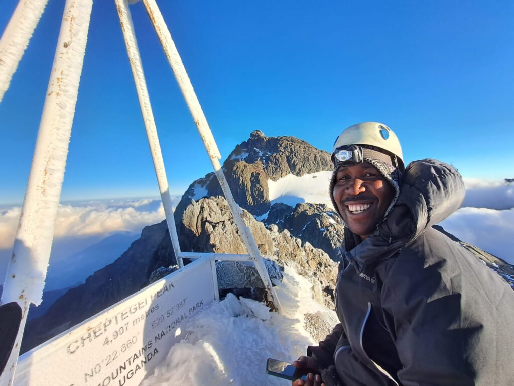
Cheptegei Peak, at 4,907 meters, on Mount Stanley in the Rwenzori Mountains. The Cheptegei peak is another highest point on Mount Stanley in the Rwenzori Mountains National Park, a UNESCO World Heritage Site renowned for its dramatic alpine landscapes, equatorial glaciers, and exceptional biodiversity. Located within the legendary Mountains of the Moon, Cheptegei Peak offers adventurous hikers and mountaineers the opportunity to experience one of Africa’s most spectacular high-altitude environments without necessarily attempting the highest summit, Margherita Peak (5,109 meters).
Reaching Cheptegei Peak involves trekking the scenic Kilembe Trail, which passes through tropical rainforest, bamboo forests, giant heather, Afro-alpine moorland, glacial valleys, and permanent ice fields. Along the journey, trekkers encounter iconic giant lobelias, giant groundsels, crystal-clear alpine lakes, waterfalls, and breathtaking panoramic views of Mount Stanley, Mount Speke, Mount Baker, and the surrounding Rwenzori massif.
Cheptegei Peak, at 4,907 meters on the massif of Mount Stanley, was formally designated in 2021 to honor Joshua Cheptegei, the Ugandan long-distance runner who shattered the 10,000-meter world record in 2020 and redefined what was possible for an entire generation of African athletes. To climb this peak via the Kilembe Trail, the Rwenzori’s wild southern approach, is to pass through five vegetation zones in 8 days: from the Nyamwamba River gorge with its cascading waterfalls and ancient forest through the bamboo cathedral and giant heather moorland into the Afro-alpine world of towering lobelias and groundsel trees and finally onto the rocky upper mountain, where the summit offers a 360-degree panorama that encompasses two countries, multiple mountain massifs, and the faint curve of the earth to the west. Fewer than 300 trekkers reach Cheptegei Peak each year. This guide tells you everything you need to know to be among them.
Cheptegei Peak (4,969 m) is one of Africa’s newest named summits and one of its most solitary. Named in 2021 after Uganda’s Olympic champion Joshua Cheptegei, it stands on Mount Stanley’s southern massif and is accessible via the Kilembe Trail without glacier crossing or technical equipment. Fewer than 300 trekkers reach it each year, making every ascent a genuinely rare achievement. |
Quick Facts About the 13-Day Rwenzori Six Peaks Expedition
| DETAIL | INFORMATION |
| Summit Name | Cheptegei Peak |
| Mountain | Mount Stanley — Rwenzori Range, Uganda |
| Altitude | 4,969m / 16,302ft above sea level |
| Named For | Joshua Cheptegei — Uganda’s world record-breaking distance runner |
| Year Named | 2021 (following Cheptegei’s 10,000m world record in 2020) |
| Location | Rwenzori Mountains National Park, Western Uganda (UNESCO World Heritage Site) |
| Primary Access Route | Kilembe Trail — southern approach to the Rwenzori massif |
| Glacier Crossing Required | No—non-glaciated, rocky summit |
| Technical Equipment | No crampons, ice axe, or harness required |
| Rubber Boots | Mandatory throughout the Kilembe Trail approach |
| Recommended Duration | 8 days (Kilembe Trail full approach and return) |
| Nearest Town | Kasese (12km from Kilembe trailhead by road) |
| Annual Trekkers | Fewer than 300 |
| Best Season | December–February and June–August |
| Park Management | Uganda Wildlife Authority (UWA) |
| UNESCO Status | Rwenzori Mountains National Park — World Heritage Site since 1994 |
The Story of Cheptegei Peak, A Summit Named for a Champion
On the 14th of October, 2020, at a specially organized time trial event in Valencia, Spain, Joshua Cheptegei of Uganda ran 10,000 meters in 26 minutes, 11 seconds, and 00 hundredths, erasing the previous world record by more than six seconds and establishing himself as the finest 10,000-meter runner in the history of the event. In Uganda, the reaction was immediate and enormous. In a country where athletics has always been a source of national pride, Cheptegei’s achievement was seen as something beyond sport, a declaration of what was possible from the mountains of western Uganda, where he had grown up training in the altitude of the Kapchorwa highlands.
The following year, Ugandan authorities designated a previously unnamed high point on Mount Stanley in the Rwenzori Mountains as Cheptegei Peak, an elevation of 4,969 meters that carries, in its naming, both the honor of a remarkable individual achievement and the broader statement that Uganda’s mountains, like its athletes, deserve to be known and recognized by the world. The peak sits within the massif of Mount Stanley, the same mountain that hosts Margherita Peak, Africa’s third-highest summit at 5,109 meters, and its approach via the Kilembe Trail takes trekkers through the full ecological richness of the Rwenzori’s southern flank.
| ❝ | When they named this peak for Cheptegei, it felt right in a way that is difficult to explain unless you have climbed it. The mountain demands everything from you, just as his races demand everything from him. You do not arrive at 4,969 meters casually. You earn it over eight days, through every vegetation zone the Rwenzori contains. The naming made the summit mean something beyond altitude. |
For trekkers, the naming provides something valuable beyond its cultural significance: a clear, well-defined objective on the Kilembe Trail that previously existed without a specific summit identity.
Cheptegei Peak gives the Kilembe Trail a named, elevated goal that sits above the tourist-accessible Mutinda Lookout (3,535m) but below the glaciated demands of Margherita Peak, occupying the perfect middle ground for experienced trekkers who want a genuine high-altitude summit without technical mountaineering requirements.
The Rwenzori Trekking Trails — Which Route Reaches Cheptegei Peak?
The Rwenzori Mountains National Park is served by three established trekking routes, each approaching the range from a different direction and offering a different ecological and experiential character. Cheptegei Peak is accessed via the Kilembe Trail, the southern approach, and cannot be reached directly from the Central Circuit Trail without crossing the high mountain junction between the two systems.
The Central Circuit Trail, The Classic Rwenzori Experience
The Central Circuit Trail, the Rwenzori’s oldest and most used trekking route, begins at Nyakalengija village on the northern side of the national park. It loops the high massif in both directions, connecting the major mountain huts at Nyabitaba, John Matte, Bigo, Bujuku, Elena, and Guy Yeoman in a complete circuit that takes 7 to 10 days depending on the summit objective.
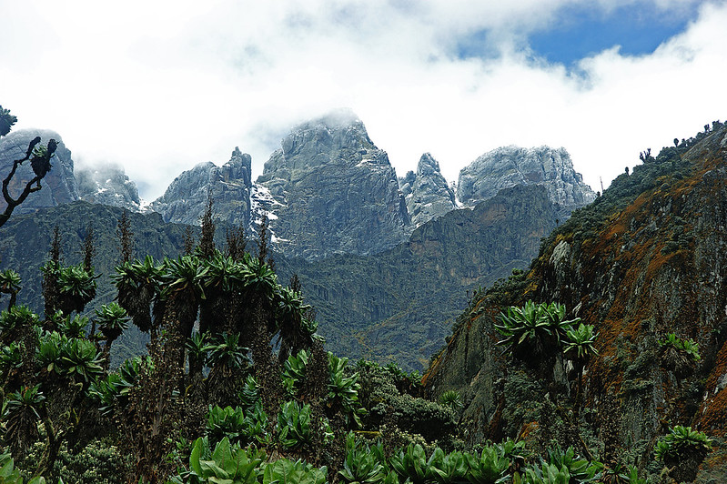
The Central Circuit is the route for Margherita Peak (5,109m), Weismann’s Peak (4,627m), and multiple combination expeditions targeting the northern and central massifs. It carries the highest traffic of any Rwenzori route and offers the most fully serviced mountain hut infrastructure in the park.
The Kilembe Trail, The Road to Cheptegei Peak
The Kilembe Trail, which is the Rwenzori’s southern approach, begins at Kilembe Village Gate on the southwestern flank of the range, approximately 12 kilometers from Kasese town. It enters the mountain through the Nyamwamba River gorge, a dramatic canyon of cascading waterfalls and ancient riverine forest, and ascends through bamboo, giant heather, and Afro-alpine moorland to the high camps above 4,000 meters.
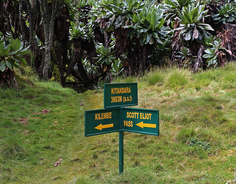
The Kilembe Trail is significantly less trafficked than the Central Circuit, with fewer than 300 trekkers completing the full high route per year. It is the primary access route for Cheptegei Peak (4,969m) and, via the high mountain junction with the Central Circuit, for Margherita Peak (5,109m) on the 8-day Kilembe Trail Margherita excursion. Rubber boots are mandatory throughout.
The Bukurungu Trail, The Undiscovered Approach
The Bukurungu Trail approaches the Rwenzori from the eastern side, offering a third distinct ecological experience and connecting with the high mountain zone above 4,000 meters. The least-developed and least-trafficked of the three routes, the Bukurungu Trail is for experienced mountain travelers specifically seeking the Rwenzori’s most remote and self-reliant trekking experience. Rwenzori Trekking Expeditions operates custom Bukurungu itineraries on request for groups with appropriate mountain experience.
Central Circuit vs. Kilembe Trail, Quick Comparison
FEATURE | CENTRAL CIRCUIT | KILEMBE TRAIL |
Trailhead | Nyakalengija (1,646m) | Kilembe Village (1,463m) |
Approach Character | Valley, structured forest | River gorge, waterfalls, wilder |
Annual Trekkers | Several thousand | Fewer than 300 (full route) |
Rubber Boots | Recommended (bogs) | MANDATORY throughout |
Cheptegei Peak Access | Not available | Primary access route |
Margherita Peak | Yes (Elena Hut approach) | Yes (via high junction, 8-day variant) |
Waterfall Scenery | Moderate | Exceptional — multiple major falls |
Ecological Variety | All 6 zones (incl. glacial) | 5 zones — all non-glaciated |
Technical Equipment | Required for Margherita | Not required for Cheptegei |
Best Short Trek | 2-day Nyabitaba Hut | 2-day Sine Camp trek |
Solitude Rating | Moderate | Very High |
Experience Rwenzori Beyond Expectations
Spots Filling Fast — Schedule Your Trek Today
Attractions on and Around Cheptegei Peak
The Nyamwamba River Gorge and Kilembe Waterfalls
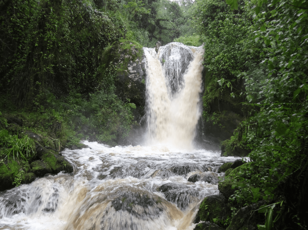
The approach to Cheptegei Peak begins in the Nyamwamba River gorge, one of the most visually dramatic opening sections of any mountain trail in East Africa. The river runs powerful and clear alongside the lower trail, crossing it twice on log bridges in the first hour, and the gorge walls carry multiple large waterfalls that fall off the rock faces above in long, foaming curtains. The largest cascade drops more than 40 meters into the river below, and several more are visible from the trail on the approach to Samalira Camp. These waterfalls are reason enough for some travelers to visit the Kilembe Trail, and they represent only the first of many natural spectacles the eight-day route contains.
Giant Heather Forest and Three-Horned Chameleons
Between Sine Camp (2,350 m) and Samalira Camp (2,700 m), the Kilembe Trail passes through the bamboo zone into the ancient giant heather forest, where Erica arborea trees grow to eight meters and are draped entirely in hanging mosses and lichen that accumulate 20 to 30 kilograms of living epiphytic material per tree. This is the habitat of the three-horned chameleon, Trioceros johnstoni, a species endemic to the Albertine Rift mountains and one of the most reliably and dramatically encountered wildlife species on the entire trail. Your private guide knows the trees where these prehistoric-looking creatures congregate, and the experience of watching a three-horned chameleon move through the heather in its slow, deliberate way is one of the Kilembe Trail’s most distinct pleasures.
The Afro-Alpine Moorland to Giant Lobelias and Groundsels
Above Mutinda Camp at 3,535 meters, the Kilembe Trail enters the Afro-alpine moorland that is the Rwenzori’s most visually extraordinary ecological zone. Giant groundsel trees, Senecio adnivalis, reaching five meters in height with their thick, corky trunks and alien cabbage-rosette heads, stand in scattered groups across the open moorland. Giant lobelias, Lobelia wollastonii, similarly impressive at four to five meters, rise from the bog margins like prehistoric candelabras. These plants are found only in the Afro-alpine zones of equatorial African mountains and reach their most dramatic expression in the Rwenzori range. No photograph adequately prepares first-time visitors for the experience of moving through this landscape on the approach to Bugata Camp and the Cheptegei high zone.
The Summit Panorama from 4,969 Metres
The view from Cheptegei Peak on a clear morning is among the finest panoramas available from any non-glaciated summit in East Africa. To the north, the full Stanley massif rises with the glacial remnants pale against the sky, including Margherita Peak itself, the highest point in Uganda, visible from Cheptegei at a distance that conveys the full scale of the mountain you are standing on. To the east, Mount Baker’s dark flanks and the Freshfield Pass ridge are visible in their entirety. To the west, the Kilembe valley falls 3,500 meters in a single plunge to the Kasese plain below, and beyond it, the dark, apparently endless canopy of the lowland forest in Congo stretches to a horizon that seems impossibly distant. To the south, the mountain system of the Albertine Rift unfolds in diminishing ranges toward Rwanda and Burundi. Fewer than 300 people per year see this view. The silence on the summit, when the wind allows it, is yours entirely.
Rwenzori Birds: The Albertine Rift Avifauna
The Kilembe Trail traverses the Albertine Rift montane forest ecosystem, one of the world’s premier birdwatching environments and home to an extraordinary concentration of endemic species found nowhere else on earth. The Rwenzori turaco, with its crimson wing flashes and brilliant green crest, is a near-daily sighting on the lower forest sections. Doherty’s bushshrike, the African green broadbill, the Rwenzori batis, the white-starred robin, and the handsome francolin are all reliably present in the heather-forest transition zone between Sine and Samalira camps. For dedicated birdwatchers, the eight-day Cheptegei route provides more sustained contact with Albertine Rift endemic species than almost any other accessible route in East Africa.
The Bakonzo People and Mountain Cultural Heritage
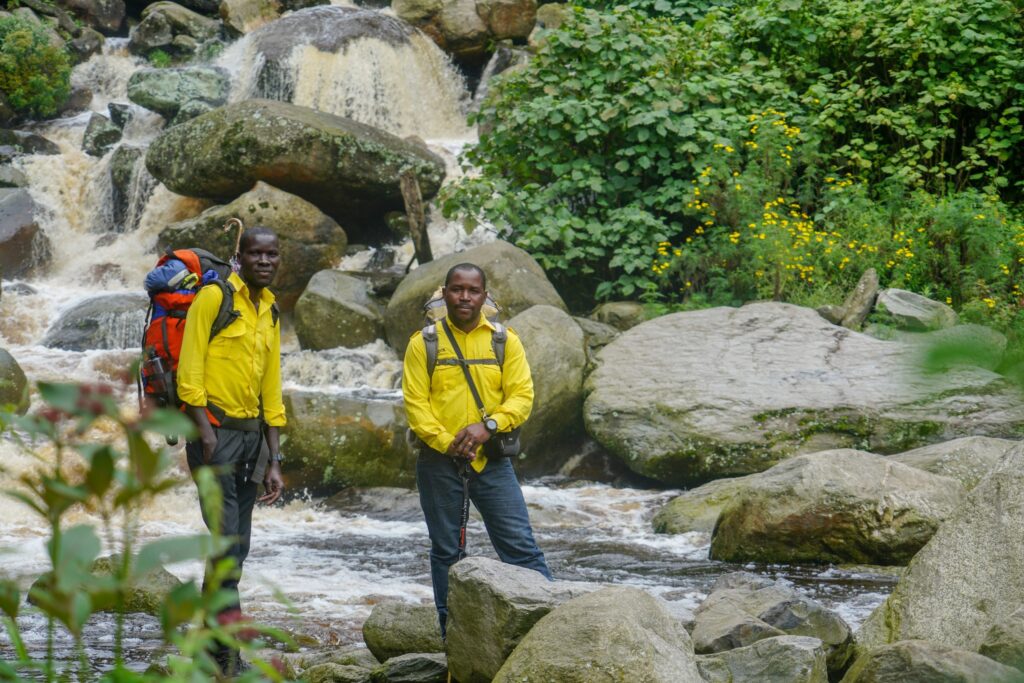
The Bakonzo people, known locally as the Bakonjo, are the indigenous guardians of the Rwenzori Mountains, a community whose relationship with this range stretches back through generations of hunter-gathering, farming, and guiding. The porters and guides who accompany every Rwenzori Trekking Expeditions departure are members of this community, people who grew up close to the mountain and who have a deep understanding of its ecology, weather patterns, and character that cannot be acquired from training manuals alone. The Kilembe trailhead at Kilembe village carries its own additional historical layer: the site was the center of Uganda’s copper mining industry for decades, and the rusting infrastructure at the forest edge is a tangible reminder of the industrial history that preceded and financed much of the region’s development.
How to Get to the Rwenzori Mountains and Cheptegei Peak
Cheptegei Peak is accessed via the Kilembe Trail, which begins at Kilembe Village Gate, approximately 12 kilometers from Kasese town by road in western Uganda. Kasese is the gateway city for all Rwenzori trekking operations and is reached from Entebbe International Airport by two primary routes: overland by private vehicle (370km, 5 to 6 hours via Mbarara and Fort Portal) or by domestic flight to Kasese Airport (KSE, approximately 60 minutes). Rwenzori Trekking Expeditions coordinates all airport collections, private vehicle transfers, and trailhead logistics from Entebbe, Kampala, or Fort Portal as a seamlessly managed component of the expedition package.
From Entebbe International Airport (EBB)
Entebbe International Airport is the primary entry point for international trekkers visiting Uganda, served by Ethiopian Airlines, Kenya Airways, RwandAir, Emirates, and a growing range of European carriers. The overland journey from Entebbe to Kasese covers approximately 430 kilometers via the Kampala–Mbarara highway, a scenic drive through Uganda’s equatorial interior that passes the Equator monument at Kayabwe, the rolling hills of Ankole cattle country, and the Bunyangabu foothills before the Rwenzori Mountains appear on the western horizon, typically first as a wall of cloud, then, on clear evenings, as a dark, massive presence above the Kasese plain.
From Kampala
Kampala to Kasese is approximately 380 kilometers by road, a journey of five to six hours on the Mbarara-Fort Portal highway. Shared coach services run daily from Kampala’s Kisenyi Bus Terminal to Kasese. For private transfers, Rwenzori Trekking Expeditions coordinates comfortable 4WD vehicle collection from any Kampala address. Most trekkers arrange to arrive in Kasese the evening before Day 1 of the expedition to allow for the pre-trek briefing, gear check, and early morning trailhead transfer.
Domestic Flights to Kasese
For trekkers arriving on tight international connections or those who prefer to minimize road travel time, scheduled domestic flights connect Entebbe to Kasese Airport (KSE) in approximately one hour. Charter options are available for same-day connections. From Kasese Airport, the transfer to the pre-trek hotel is under 10 minutes, and the Kilembe trailhead is 15 minutes by road. Rwenzori Trekking Expeditions coordinates all domestic flight bookings and airport collections on request.
Experience Rwenzori Beyond Expectations
Spots Filling Fast — Schedule Your Trek Today
Best Time to Climb Cheptegei Peak in the Rwenzori Mountains
The Rwenzori Mountains receive precipitation throughout the year; it is, in fact, one of the wettest mountain environments on earth, receiving over 200 rain days annually. This is the ecological foundation of its extraordinary biodiversity, but it also means that planning around the weather requires specific seasonal knowledge rather than a simple dry-season assumption.
December to February: The Primary Dry Season
The December to February window is widely considered the best season for climbing Cheptegei Peak and for Kilembe Trail trekking in general. Trail conditions are easiest, the Nyamwamba gorge crossings are safest, the peat bogs above Mutinda are firm enough for confident movement, and the upper mountain rock on the Cheptegei Peak approach dries enough for secure scrambling. Summit visibility is at its clearest in this period, and the pre-dawn departure from the high camp most often takes place under a sky dense with stars. Daytime temperatures on the trail range from 6°C to 20°C depending on altitude; overnight at Bugata and the high camp can drop to -4°C on clear nights. January is typically the driest single month of the year.
June to August — The Secondary Dry Season
The long dry season from June to early September provides the year’s second most reliable conditions for Kilembe Trail trekking and Cheptegei Peak summit attempts. July and August in particular offer the highest probability of dry trail surfaces and clear summit views. The Kilembe Trail’s waterfalls are still spectacular in this period, carrying enough water to be dramatic without the high-water hazard of the wet season.
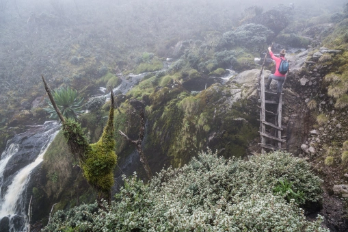
This is the Rwenzori’s peak trekking season for international visitors, and advance booking of two to three months is recommended for private expedition slots.
March to May and September to November: The Wet Seasons
The Rwenzori’s two wetter periods, the long rains of March to May and the shorter rains of September to November, transform the Kilembe Trail into a more challenging but, in many ways, more visually compelling environment. The waterfalls are at their most spectacular volume. The forest vegetation is at its most intensely saturated green. The birdlife is at its most active. For experienced trekkers who are properly equipped with rubber boots, reliable waterproofs, and the mental flexibility to enjoy sustained wet conditions, wet season trekking on the Kilembe Trail has a rawness and intensity that the dry season simply does not replicate. Summit success rates for Cheptegei Peak are lower in the wet season due to reduced visibility and wetter rock on the summit approach, but for well-prepared teams with experienced guides, they remain achievable.
MONTH | CONDITIONS | SUMMIT VISIBILITY | TRAIL DIFFICULTY | RECOMMENDED |
December | Dry, clear | Excellent | Moderate | Highly Recommended |
January | Driest month, best | Excellent | Moderate | Highly Recommended |
February | Dry, warm | Very Good | Moderate | Highly Recommended |
March | Transitional | Good | Moderate+ | Good |
April | Heavy rains | Poor | High | Experienced only |
May | Heavy rains | Poor | High | Experienced only |
June | The dry season starts | Very Good | Moderate | Recommended |
July | Dry, peak season | Excellent | Moderate | Highly Recommended |
August | Dry, peak season | Excellent | Moderate | Highly Recommended |
September | Transitional | Variable | Moderate+ | Good |
October | Short rains begin | Variable | Moderate+ | Good |
November | Short rains | Moderate | High | Experienced only |
Experience Rwenzori Beyond Expectations
Spots Filling Fast — Schedule Your Trek Today
How Safe Is It to Climb Cheptegei Peak?
Rwenzori Mountains National Park is a UNESCO World Heritage Site actively managed by the Uganda Wildlife Authority with an excellent safety record for guided trekking expeditions. Crime against trekkers within the park is extremely rare. The mountain guides and porters of the Kilembe community have maintained a professional safety culture across decades of expedition operations. Trekking operators and independent travelers consistently report security within and around the park as very good.
The primary safety considerations on a Cheptegei Peak expedition are altitude-related illness, the physical demands of the Kilembe Trail terrain, and the isolated character of the upper mountain, all of which are directly managed through the expertise, equipment, and protocols of the Rwenzori Trekking Expeditions guide team. Every expedition carries a comprehensive medical kit, including a pulse oximeter for daily monitoring, altitude medication (Diamox and dexamethasone), and a wilderness first-aid kit sufficient for the range of terrain-related injuries the Kilembe Trail presents. All lead guides are trained in wilderness first aid to WAFA standards.
The altitude management protocol is the most important single safety element on the Cheptegei Peak expedition. Symptoms of AMS that do not respond to rest and adequate hydration, severe headache unrelieved by ibuprofen, vomiting, loss of coordination, confusion, or shortness of breath at rest, require immediate descent. The guide, not the trekker, makes this decision, which is non-negotiable. The 8-day Rwenzori Trek to Cheptegei Peak itinerary schedule significantly reduces the statistical likelihood of severe AMS compared to compressed itineraries, but individual physiological responses to altitude vary and cannot be predicted with certainty.
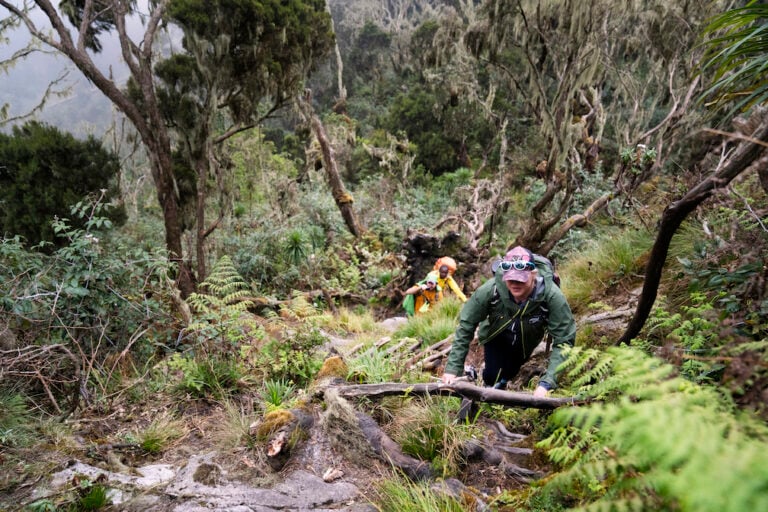
All participants must have travel insurance that covers emergency medical evacuation from altitude (at least USD $250,000), emergency medical treatment, and repatriation. Policy documents are required at the pre-trek briefing in Kasese. Mobile phone connectivity is effectively absent above Samalira Camp, making the guide team’s emergency communication device, carried on every expedition, a critical safety asset.
Experience Rwenzori Beyond Expectations
Spots Filling Fast — Schedule Your Trek Today
Level of Difficulty: Climbing Cheptegei Peak
Cheptegei Peak is rated strenuous, which reflects the 8-day Rwenzori trek itinerary commitment, the total distance of about 80 kilometers, the total altitude gain of 3,506 meters from Kilembe Village to the summit, and the demanding terrain of the Kilembe Trail. It is, however, a non-glaciated summit that requires no technical mountaineering equipment and is accessible to any trekker with genuine fitness, appropriate preparation, and the right guide team.
What Makes the Kilembe Trail Physically Demanding
Several specific characteristics of the Kilembe Trail contribute to its strenuous rating beyond simple altitude. The Nyamwamba River gorge section in the lower trail is steeper and more technically demanding than the Central Circuit trail‘s northern approach, with log bridge crossings on a gradient that requires sustained balance and care. The peat bogs above Mutinda Camp are among the deepest and most extensive on any Rwenzori route; the rubber boots that are mandatory throughout the route provide the only effective protection against losing a boot in meters of saturated peat. The daily distances cover significant vertical gain in conditions that are almost universally wet, muddy, and root-covered on the trail surface. The summit day itself demands genuine aerobic capacity and mental determination, beginning at 4:00 AM from the high camp at approximately 4,500 meters and involving a rocky scramble at nearly 5,000 meters.
Altitude and Acclimatisation
At 4,969 meters, Cheptegei Peak is in the altitude zone where acclimatization is critical, and where the body’s physiological responses to thin air, reduced oxygen saturation, increased respiratory rate, disturbed sleep, and reduced appetite are normal and expected. The 8-day schedule provides an excellent acclimatization profile: the first three days average less than 700 meters of altitude gain per day, days 4 and 5 slow to less than 550 meters, and the summit is attempted on day 6 from a high camp position that the body has had time to partially acclimatize to. Your Rwenzori Trekking Expeditions guide conducts daily oxygen saturation monitoring from Mutinda Camp upward. The altitude protocol is non-negotiable: symptoms of AMS that do not resolve with rest and hydration require descent.
Who Is Best Suited to Cheptegei Peak
Trekkers best suited for the 8-day Cheptegei Peak expedition have completed at least one multi-day mountain trek of three or more days, can walk 8 to 10 kilometers per day while carrying a 10-kilogram daypack on varied terrain, have some experience at altitudes above 3,000 meters, and are genuinely comfortable with sustained wet conditions and technically uneven trail surfaces. Prior experience on Kilimanjaro, Nepal trekking routes above 3,500 meters, or the Rwenzori Central Circuit Trail provides excellent preparation. Completely inexperienced trekkers are better served by starting with the shorter Kilembe Trail options, the 2-day Sine Camp trek or the 4-day Mutinda Lookout hike, before committing to the full summit expedition.
Experience Rwenzori Beyond Expectations
Spots Filling Fast — Schedule Your Trek Today
What to Pack and Wear for Climbing Cheptegei Peak
The Kilembe Trail‘s combination of persistent moisture, altitude range, and trail character demands a packing approach built around two non-negotiable principles: total waterproofing and comprehensive layering. The mountain will test both every day of the eight-day itinerary, and the difference between the right gear and inadequate gear is not merely comfort; it is safety. Every confirmed client receives a comprehensive, season-specific equipment list from the Rwenzori Trekking Expeditions team. The following covers the essential categories.
Footwear: The Critical Choices
Rubber boots, knee-length, with a firm inner sole and excellent ankle support, are mandatory on the Kilembe Trail from Day 1 to Day 8. Conventional waterproof trekking boots are inadequate for the Nyamwamba Gorge section, the deep peat bogs above Mutinda, and the multiple river crossings throughout the route. Hire is available in Kasese if you prefer not to travel with rubber boots. For the summit approach from the high camp on the rocky Cheptegei pyramid, gaiters over the rubber boots provide additional ankle support and grip. Bring lightweight trainers or sandals for hut use; dry footwear at the end of each walking day makes a measurable difference to morale and foot health.
Clothing System
A minimum of two sets of moisture-wicking thermal base layers, merino wool strongly preferred for its warmth-when-damp properties, form the foundation of the clothing system. Above the base layer, a 250-weight fleece mid-layer handles the temperature range between the lower forest and the upper moorland. An insulated jacket rated to -10°C is essential from Bugata Camp upward and for the pre-dawn summit departure, when temperatures at the high camp, with wind chill, can reach -10°C or lower. The most critical single clothing item is a fully waterproof, breathable shell jacket and matching trousers with fully taped seams, rated to at least a 10,000 mm hydrostatic head. A warm hat covering the ears, neck gaiter, lightweight inner gloves with insulated outer gloves for the summit morning, and four to five pairs of wool or synthetic socks complete the essential clothing list.
Sleeping and Technical Equipment
A sleeping bag rated to -10°C is mandatory for the high camp at approximately 4,500 meters, where temperatures drop to this level on clear nights. A sleeping bag liner adds warmth and hygiene. A 35 to 45-liter daypack with a waterproof rain cover carries trail essentials, water (minimum 2 liters), energy food, a warm layer, a headtorch with spare batteries rated to at least 300 lumens for the 4:00 AM summit departure, and personal medications. Two adjustable trekking poles are essential safety equipment on every section of the Kilembe Trail. Sunscreen SPF 50+ and quality UV-blocking sunglasses are critical above 4,000 meters, where UV exposure is severe.
🧭 Packing Note from Our Guides The single most common pre-trek packing error on the Kilembe Trail is underestimating the waterproof requirements. A rain jacket that performs adequately in a city rain shower will fail on the Kilembe Trail within hours. Budget for a properly rated, seam-taped outer shell. Everything else on the list is secondary to this task. The mountain will test it on Day 1. |
Frequently Asked Questions: Cheptegei Peak and Rwenzori Trekking
Cheptegei Peak is a summit at 4,969 meters on Mount Stanley in the Rwenzori Mountains National Park of western Uganda. It was formally named in 2021 in honor of Joshua Cheptegei, Uganda’s world record-holding long-distance runner. The peak sits on the southern massif of Mount Stanley, the same mountain that hosts Margherita Peak, Africa’s third highest summit at 5,109 meters, and is accessed via the Kilembe Trail from Kilembe Village, approximately 12 kilometers from Kasese town.
Joshua Cheptegei is a Ugandan long-distance runner who broke the 10,000-meter world record in Valencia, Spain, on 7 October 2020, running the distance in 26 minutes, 11 seconds, shattering the previous record by more than six seconds. In 2021, Uganda named a previously unnamed high point on Mount Stanley in his honor, recognizing his achievement as a landmark moment for Uganda and for African athletics. Cheptegei also holds multiple other world records and Olympic medals, cementing his status as one of the greatest distance runners in history.
Cheptegei Peak stands at 4,969 meters (16,302 feet) above sea level on the southern massif of Mount Stanley in Uganda’s Rwenzori Mountains. Note that some sources cite the peak at 4,907 meters; the discrepancy reflects different measurement references and ongoing survey work on the peak. Rwenzori Trekking Expeditions uses the formally designated elevation of 4,969 meters as confirmed by the Uganda Wildlife Authority.
Prior experience of multi-day trekking at altitudes above 4,500 meters is essential for the thirteen-day expedition. Trekkers who have completed the eight-day Margherita Peak expedition, a significant Himalayan or Andean trek, or equivalent high-altitude multi-day routes are well-prepared. Trekkers without prior high-altitude experience above 4,000 meters should begin with a shorter Rwenzori expedition before attempting the six-peak circuit. Rwenzori Trekking Expeditions conducts a fitness and experience assessment for all thirteen-day bookings.
No. Cheptegei Peak is a non-glaciated rocky summit; the approach from the Kilembe Trail high camp involves a steep scramble on solid Rwenzori gneiss and granite but does not cross any glacier terrain. Crampons, ice axes, and technical ropes are not required. This distinguishes Cheptegei Peak from Margherita Peak (5,109m) on the same mountain, which requires glacier crossing equipment. Rubber boots, trekking poles, gaiters, and appropriate cold-weather clothing are the critical equipment requirements for Cheptegei.
The recommended itinerary for Cheptegei Peak is 8 days via the Kilembe trail with 7 nights on the mountain, and the summit is attempted on Day 6 from a high camp at approximately 4,500 meters. The 8-day Rwenzori trek to Cheptegei Peak provides an excellent acclimatization profile, with the summit success rate significantly higher on this schedule than on any compressed alternative. Shorter options exist for trekkers with prior very high-altitude experience, but the 8-day itinerary is the standard recommendation from the Rwenzori Trekking Expeditions guide team.
Rubber boots, knee-length, with adequate inner sole support, are mandatory on the Kilembe Trail from Kilembe Village Gate to the high camps. The trail’s deep peat bogs above Mutinda Camp, persistent river crossings in the lower gorge, and consistently wet trail surface throughout make conventional waterproof trekking boots inadequate. Rubber boot hire is available in Kasese; the Rwenzori Trekking Expeditions team confirms boot sizes and hire arrangements at the pre-trek briefing.
The two best windows/seasons (months) to climb/trek/visit Cheptegei Peak are January to February (primary dry season) and June to August (secondary dry season). January is typically the single driest month and offers the clearest summit views. July and August provide the most reliably dry trail conditions for international visitors whose schedules align with the northern summer. Trekking is possible year-round; the wet season months offer spectacular waterfall drama and lush vegetation but lower summit success rates due to reduced visibility and wetter rock on the summit approach.
Both mountains offer serious challenges at comparable altitudes, but the challenge type differs. Kilimanjaro’s standard routes involve higher maximum altitude (5,895m) but more straightforward, less technically varied terrain. The Kilembe Trail to Cheptegei Peak (4,969 m) involves more demanding and varied terrain, river gorge crossings, deep peat bogs, steep rooted paths, and conditions that are persistently wetter than Kilimanjaro’s drier approach routes. Most Kilimanjaro veterans find the Kilembe Trail more physically engaging and the solitude more profound. The 8-day Cheptegei itinerary‘s acclimatization profile is comparable to or better than most Kilimanjaro routes.
The full 8-day Cheptegei Peak summit expedition is not recommended for complete beginners. Some prior multi-day trekking experience and a reasonable level of cardiovascular fitness are required for a safe and enjoyable experience on the full summit route. However, the shorter Kilembe Trail options, such as the 2-day Sine Camp trek and the 4-day Mutinda Lookout trek, are suitable for fit, motivated beginners and provide an excellent introduction to the Kilembe Trail‘s character and ecology without the demands of the full summit approach.
Both peaks are on Mount Stanley, the highest massif in the Rwenzori range. Margherita Peak (5,109 m) is the highest point of Mount Stanley and the third highest mountain in Africa and requires a glacier crossing with crampons, an ice axe, and a harness. Cheptegei Peak (4,969 m) is a newer named summit on the southern massif of the same mountain, accessible without glacier equipment via the Kilembe Trail. Cheptegei Peak is the definitive summit objective for experienced trekkers who want a serious high-altitude Rwenzori achievement without the technical mountaineering demands of Margherita Peak.
Absolutely, and this combination is one of Rwenzori Trekking Expeditions‘ most popular multi-experience Uganda itineraries. Bwindi Impenetrable National Park, home to roughly half the world’s remaining mountain gorillas, is approximately three to four hours’ drive from Kasese. The 8-day Cheptegei expedition followed by a gorilla trekking permit at Bwindi represents one of the most extraordinary dual-experience itineraries in East Africa. Rwenzori Trekking Expeditions coordinates all gorilla permit arrangements and inter-destination logistics on request.
Nights 1 and 7 are spent at Sine Camp (2,350 m), a staffed metal-frame hut with sleeping platforms and a cook shelter. Nights 2 and 6 are at Samalira Camp (2,700 m), a similar hut at the heather-forest boundary. Night 3 and Night 5 (post-summit) are at Bugata Camp (4,062 m)—the highest established camp on the Kilembe Trail, a basic metal-frame hut with outstanding views in all directions. Night 4, the pre-summit acclimatization night, is at the high camp at approximately 4,500 meters, in lightweight tents erected and managed by the porter team. All meals are prepared by your dedicated mountain cook throughout the trip.
The 8-day Cheptegei Peak private expedition with Rwenzori Trekking Expeditions is priced from USD $1,750 per person for a group of two, fully all-inclusive: Uganda Wildlife Authority park fees, certified guide and assistant guide, full porter team, mountain cook, all meals, high camp tent setup, emergency communication device, and private road transfers. Contact the team at Rwenzori Trekking Expeditions for a personalized quotation based on your group size and preferred dates.
All international visitors to Uganda require a valid passport with at least six months’ validity remaining. Most nationalities obtain a tourist visa on arrival or can apply in advance via the Uganda e-visa portal. Travel insurance is mandatory for all Cheptegei Peak trekkers and must include emergency medical evacuation from altitude (minimum USD $250,000 coverage), trip cancellation, and emergency repatriation. Policy documents are required at the pre-trek briefing in Kasese. Proof of Yellow Fever vaccination is required for entry to Uganda
Mobile signal (MTN Uganda and Airtel Uganda) is available in Kasese and at Kilembe Village and intermittently in the lower gorge below Sine camp. From Sine Camp upward, the signal becomes unreliable and is effectively absent above Samalira Camp. At Bugata Camp and the high camp, there is no mobile connectivity. Inform family and contacts of your full itinerary and daily camp positions before departure. Your Rwenzori Trekking Expeditions lead guide carries a satellite-capable emergency communication device throughout the trek.
For trekkers who want to extend their Kilembe Trail experience into a multi-peak expedition, Rwenzori Trekking Expeditions offers a combined itinerary that continues from the Cheptegei high zone through the high mountain junction to connect with the Central Circuit system, allowing access to Margherita Peak (5,109m) and additional summits. The 13-day 6-peaks grand expedition combines peaks from both trail systems. Contact the team to discuss custom multi-peak itineraries based on your experience, fitness, and time availability.
Rwenzori Trekking Expeditions operates exclusively in the Rwenzori Mountains, not as one menu item in a generalist Uganda safari portfolio but as the focused work of a team whose entire professional identity is invested in this specific mountain range. The guides are community members who grew up within sight of the Kilembe trail and have walked it in every season. The porters are career professionals, not seasonal hires. Every expedition is private, every guide is certified, and every safety protocol is applied without compromise. For the Cheptegei Peak expedition specifically, the team’s Kilembe Trail knowledge, the seasonal conditions, the wildlife patterns, the camp logistics, and the summit approach variations are the most important single asset on the mountain.
Experience Rwenzori Beyond Expectations
Spots Filling Fast — Schedule Your Trek Today
The Rwenzori Mountains : Africa's Mountains of the Moon
The Rwenzori Mountains range rises from the equatorial floor of western Uganda as an improbable wall of cloud and forest, a block mountain range created by the same tectonic forces that formed the East African Rift Valley, thrust upward rather than folded, with its ancient crystalline rocks among the oldest geological formations in East Africa. Ptolemy, the second-century Greek geographer, described mountains at the source of the Nile with permanent snow, and for centuries, European cartographers marked the space where Uganda’s western mountains would eventually be found with the tantalizing label: ‘Mountains of the Moon. ‘ The Rwenzoris were indeed those mountains, their summit glaciers feeding the Nile headwaters, their ecological complexity unlike anything else on the continent.
The Rwenzori Mountains National Park, designated a UNESCO World Heritage Site in 1994, covers 996 square kilometers and shelters six major mountain massifs, each with multiple named peaks. The entire range receives more than 200 rain days per year, earning it the distinction of being one of the wettest mountain environments on earth and producing the extraordinary botanical richness that defines its trekking appeal. The glaciers at its summit, which have given the range its ‘Mountains of the Moon‘ identity for centuries, have retreated by over 80% in the past hundred years. Scientists now consider their total disappearance within the next two to three decades an effectively certain outcome.
The Six Major Massifs of the Rwenzori Mountains
Mount Stanley 5,109 m | The highest massif in the Rwenzori range and the third-highest mountain in Africa. Home to Margherita Peak (the summit), Albert Peak, Alexandra Peak, and Cheptegei Peak. The Stanley Glacier on its upper slopes is one of Africa’s last equatorial glaciers. Located on the Uganda-DRC border. |
Mount Speke 4,890m | The second highest Rwenzori massif, crowned by Vittorio Emanuele Peak. It is accessible via the Central Circuit Trail and is the subject of the 9-day three-peaks expedition. The approach offers some of the finest Afro-alpine moorland scenery in the range. |
Mount Baker 4,843m | The third major Rwenzori massif, with Edward Peak as its highest point at 4,843 m. Baker’s southern faces are visible from the Kitandara Lakes and the Freshfield Pass on the Central Circuit trail. The 5-day Edward Peak trek and the three-peaks expedition are targets. |
Mount Emin 4,798 m | Named for Eduard Schnitzer, known as Emin Pasha. Umberto and Kraepelin Peaks are its twin summits. A 7-day Rwenzori trekking itinerary is available for this less-visited massif, offering outstanding solitude and botanical richness on the approach. |
Mount Gessi 4,715m | It is named for Romolo Gessi, an explorer and aide to General Gordon. Bottego and Iolanda peaks are its summits. Mount Gessi features in the grand 13-day Rwenzori six-peaks expedition and ranks among the least-visited of the major Rwenzori massifs. |
Mount Luigi di Savoia 4,627 m | Named for the Duke of Abruzzi, Luigi Amedeo di Savoia, who led the first successful expedition to Margherita Peak in 1906. Weismann’s Peak (the summit of Luigi di Savoia at 4,627 m) is the target of the 6-day Rwenzori Central Circuit expedition, the most popular non-glacier summit in the range. |
Experience Rwenzori Beyond Expectations
Spots Filling Fast — Schedule Your Trek Today
Rwenzori Trekking Packages: From a Weekend to a Full Expedition
Rwenzori Trekking Expeditions offers a complete portfolio of guided mountain experiences across both the Central Circuit trail and Kilembe trails, from two-day forest immersion treks to 13-day expeditions targeting six peaks. The following represents the full range, with Cheptegei Peak’s 8-day Rwenzori expedition highlighted within the broader context of what the Rwenzori range offers.
Short Treks: 2 to 4 Days
2 Days 2,652 m | 2-Day Rwenzori Trek to Nyabitaba Hut The Rwenzori’s finest short mountain walk, ancient montane forest, endemic birdwatching, colobus monkeys, and a staffed mountain hut overnight on the Central Circuit trail are all available. Ideal for beginners. Visit www.rwenzoritrekkingexpeditions.com |
2 Days 2,350 m | 2-Day Trek to Sine Camp (Kilembe Trail) The introductory Kilembe Trail experience includes the Nyamwamba River gorge, bamboo forest, three-horned chameleons, and a forest camp overnight. The perfect first step toward the Cheptegei Peak summit. Visit www.rwenzoritrekkingexpeditions.com |
4 Days 3,535m | 4-Day Rwenzori Trek to Mutinda Lookout (Kilembe Trail) The best panoramic viewpoint on the Kilembe Trail, a four-day hike through waterfalls, bamboo, heather, and Afro-alpine moorland to the ridge lookout above the Kasese plain. Book via trek@rwenzoritrekkingexpeditions.com |
4 Days ~3,000m | 4-Day Rwenzori Waterfalls Hike (Kilembe Trail) A waterfall-focused expedition on the lower Kilembe Trail, multiple major cascades, riverine forest, and bamboo, without the commitment of the full summit approach. Visit www.rwenzoritrekkingexpeditions.com |
Classic Summit Treks: 6 to 10 Days
6 Days 4,627 m | 6-Day Rwenzori Trek to Weismann’s Peak (4,627m) via Central Circuit Experience the complete Central Circuit trail in six extraordinary days, featuring Kitandara Lakes, giant heather moorland, and a genuine high-altitude non-technical summit, all without glacier requirements. Visit www.rwenzoritrekkingexpeditions.com |
8 Days 4,969m | 8-Day Cheptegei Peak Expedition (Kilembe Trail) The signature Kilembe Trail expedition, Africa’s most solitary high-altitude route to a named summit. No glacier. No crampons. Full Afro-alpine botanical experience. Fewer than 300 trekkers per year. Visit www.rwenzoritrekkingexpeditions.com |
8 Days 5,109 m | 8-Day Margherita Peak via Kilembe Trail (5,109m) The Kilembe Trail extended to Africa’s third-highest summit, the same wild southern approach as Cheptegei, plus the Stanley Glacier crossing and Margherita Peak. Crampons and an ice axe are required. Visit www.rwenzoritrekkingexpeditions.com |
10 Days 5,109 m | 10-Day Margherita Peak via Full Central Circuit (5,109m) The definitive Rwenzori summit offers the best acclimatization, the highest success rate, and a full ecological circuit. The 10-day itinerary remains the most comprehensive and safest Margherita Peak approach. Visit www.rwenzoritrekkingexpeditions.com |
Epic Multi-Peak Expeditions
13 Days 5,109 m peak | 13-Day Rwenzori 6 Peaks Grand Expedition Summit all six major Rwenzori massifs, Mount Stanley, Speke, Baker, Luigi di Savoia, Emin, and Gessi, in the ultimate Rwenzori challenge. For expedition-grade mountaineers only. Visit www.rwenzoritrekkingexpeditions.com |
Experience Rwenzori Beyond Expectations
Spots Filling Fast — Schedule Your Trek Today
Why Book Your Cheptegei Peak Trek with Rwenzori Trekking Expeditions?
The decision of which operator to trust with a Cheptegei Peak expedition is, at its core, a decision about the quality of knowledge and care that accompanies you on the mountain. Rwenzori Trekking Expeditions brings the following to every expedition it operates.
Exclusive Rwenzori Specialisation
Every guide, every porter, and every logistical arrangement on a Rwenzori Trekking Expeditions trek draws on Rwenzori-specific knowledge and community connection. The team does not operate safaris, beach holidays, or gorilla treks under the same banner as a separate division; the Rwenzori Mountains are the entire scope of the operation, and that focus produces a depth of knowledge that no generalist operator can replicate. When the mountain weather shifts at 4,500 meters, the guide knows it before the barometer confirms it. When the three-horned chameleon is most likely to be visible in the heather zone, the guide knows which tree to look at. This is the quality of knowledge that changes a good mountain experience into an extraordinary one.
Private Expeditions: Your Mountain, Your Experience
Every departure is fully private. Your guide is dedicated to your group, your pace is set by your physiology and interests, and the experience of the mountain is calibrated entirely to you. There are no shared group departures, no strangers whose pace or appetite for the three-horned chameleon sighting might differ from yours, and no compromise on the quality of individual attention from the guide team across eight days.
Community-First Employment Model
Every guide and porter employed by Rwenzori Trekking Expeditions is a member of the Kilembe or Kasese community, paid above the industry standard rate, employed within regulated load limits, and provided with appropriate insurance and equipment for the trail conditions they work in. The team’s economic relationship with the Rwenzori mountain communities is one of the most direct and meaningful forms of conservation-linked livelihood support available in western Uganda. Booking with Rwenzori Trekking Expeditions means that your summit achievement is simultaneously a community investment.
Uncompromising Safety Standards
Every expedition carries a Gamow bag, pulse oximeter, altitude medication, and a comprehensive wilderness first-aid kit as standard. Daily health monitoring is non-negotiable protocol from Mutinda Camp upward. The altitude descent protocol is applied by the guide without negotiation. The safety record of Rwenzori Trekking Expeditions is the foundation of its reputation, and that reputation is not something any number of successful summits would be worth compromising.
Experience Rwenzori Beyond Expectations
Spots Filling Fast — Schedule Your Trek Today
Begin Planning Your Cheptegei Peak Expedition
A mountain named for a world record. A summit earned by you.
Cheptegei Peak is not a famous mountain like Kilimanjaro or Margherita Peak. It is famous in a different and perhaps more meaningful way as a summit that very few people have ever stood on, named for an achievement that redefined what human endurance could produce, located in one of Africa’s most ecologically extraordinary mountain ranges, and accessible only to those willing to commit eight days of genuine effort to the Kilembe Trail’s demanding approach.
Your guide has walked this trail in every season. The porter team knows every river crossing and bog pathway. The mountain cook has produced hot dinners at Bugata Camp when the temperature was well below freezing. Every detail of the eight-day expedition, from the pre-trek briefing in Kasese to the tip ceremony at Kilembe Gate, is managed by a team whose entire professional identity is the quality of your Rwenzori experience. The decision to go is the only thing that remains to be made.
Contact Rwenzori Trekking Expeditions today.
www.rwenzoritrekkingexpeditions.com
trek@rwenzoritrekkingexpeditions.com | WhatsApp Available | Response within Minutes