Trekking the Rwenzori Mountains
Can beginners trek the Rwenzori Mountains?
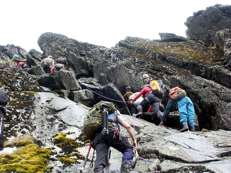
Complete beginners with no mountain experience can absolutely trek in the Rwenzori as far as the moorland and Afro-alpine zones, provided they are reasonably fit and well prepared. Reaching Margherita Peak itself, however, is a different matter and does require guided glacier travel skills, which your guides will teach and supervise on the mountain, but a baseline level of physical fitness and mental resilience is essential.
How difficult is the Rwenzori trek?
The Rwenzori has a reputation, among trekkers who have done both, for being harder than Kilimanjaro. The terrain is muddy and root-strewn through the forest and bamboo zones, boggy through the moorland, and rocky and glaciated near the summit, and the trails are far less manicured than Kilimanjaro’s well-worn paths. Weather changes quickly, and the sheer variety of terrain, forest, bog, scree, rock, and ice, sometimes all in a single day, demands more of a trekker’s adaptability than a single, steadily graded volcanic slope does.
How long does it take to climb the Rwenzori Mountains?
The standard Central Circuit trail itinerary to Margherita Peak takes seven to nine days, while the Kilembe Trail typically takes eight days, with some operators offering compressed five-day options for very fit, well-acclimatized trekkers and combined itineraries covering both trails, or non-summit exploratory treks, running fifteen days or longer.
Which route is best for the Rwenzori Mountains?
Neither route is objectively “better”—they suit different priorities. The Central Circuit trail, approaching from the east via Nyakalengija, is generally considered the shorter and more established path to Margherita Peak, offering strong infrastructure and iconic views of Lake Bujuku framed by Mount Stanley, Mount Baker, and Mount Speke. The Kilembe Trail, approaching from the south, is longer, more rugged, and less signposted, appealing to trekkers who want a rawer, more immersive wilderness experience and who don’t mind spending more time navigating genuinely waterlogged terrain rather than a boardwalk. We break down the full comparison, camp by camp, in our Central Circuit and Kilembe Trail route guides.
Which route reaches Margherita Peak?
Both the Central Circuit and the Kilembe Trail reach Margherita Peak on Mount Stanley; they simply approach the same glaciated summit from opposite sides of the range, converging on similar high camps: Elena Hut on the Central Circuit and Margherita Camp on the Kilembe side, before the final glacier crossing.
What is the Central Circuit Trail?
The Central Circuit is a loop route that begins and ends near the Nyakalengija trailhead, running roughly fifty-six kilometers through the Bujuku Valley and past a chain of huts and camps, offering acclimatization through the full sequence of vegetation zones before the summit push from Elena Hut.
What is the Kilembe Trail?
The Kilembe Trail is a point-to-point route beginning in the village of Kilembe, west of the park, following the Nyamwamba Valley up through the same vegetation zones toward Margherita Camp and the southern approach to Margherita Peak’s summit.
Which Rwenzori trail route is more scenic?
Both routes are extraordinary, but they showcase different landscapes: the Central Circuit trail is famous for Lake Bujuku and its dramatic amphitheater of surrounding peaks, while the Kilembe Trail passes several glacial lakes of its own and a rawer, less-trodden stretch of bamboo and heather forest that many repeat visitors find more atmospheric precisely because it feels wilder.
How many hours do you hike each day?
Daily hiking on both routes typically runs between four and eight hours, depending on the stage of the itinerary, terrain, and weather, with summit day itself involving considerably longer hours, often a pre-dawn start and ten or more hours of combined ascent and descent.
Margherita Peak
What is Margherita Peak?
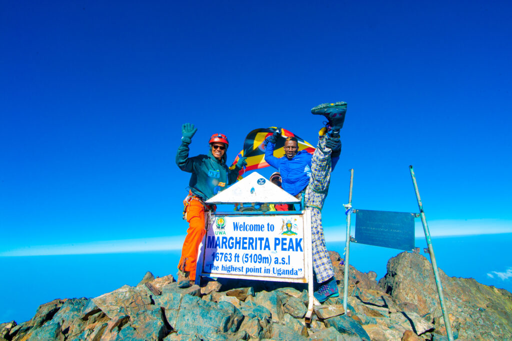
Margherita Peak is the summit of Mount Stanley and the highest point in the entire Rwenzori range, sitting at 5,109 meters and ranking as Africa’s third-highest point after Kilimanjaro and Mount Kenya.
How high is Margherita Peak?
Margherita Peak stands at 5,109 meters above sea level.
Can beginners climb Margherita Peak?
Beginners can attempt Margherita Peak, but only as part of a properly guided expedition and after spending enough acclimatization days in the itinerary; the summit push itself involves technical glacier travel, so prior mountaineering experience is not mandatory, but genuine physical preparation and comfort with exposure and cold are essential.
Is technical climbing required?
Yes. The final stretch to Margherita Peak crosses glaciated terrain and requires the use of crampons, an ice axe, and a rope managed by your guide, along with some rock scrambling near the summit block itself. This is what separates Margherita Peak from a straightforward trekking summit like Kilimanjaro’s Uhuru Peak.
How many days does it take to climb to Margherita Peak?
Reaching Margherita Peak typically requires seven to nine days via the Central Circuit trail or around eight days via the Kilembe Trail, allowing for acclimatization, though compressed five-day options exist for very fit trekkers.
Is trekking Margherita Peak harder than Kilimanjaro?
The two mountains present genuinely different kinds of difficulty, so “harder” depends partly on what challenges you. The Rwenzori is known for rugged, often muddy terrain, unpredictable weather, and a technical glacier crossing at the summit, while Kilimanjaro follows well-established paths up a single volcanic cone with no technical climbing required at all. A trekker who struggles with route-finding and wet conditions but is comfortable at altitude might find the Rwenzori tougher; a trekker intimidated by ropes and crampons but fine with long, steady walking might find Kilimanjaro more approachable despite its altitude challenges. Fitness, prior experience, acclimatisation strategy, and route choice all factor in.
What equipment is needed?
Margherita Peak requires crampons, an ice axe, and a climbing harness for the glacier crossing, all of which are typically provided or arranged by your trekking operator, along with warm technical clothing suitable for sub-freezing summit conditions. Our complete packing list goes through every layer and item in detail.
When is the best time to climb?
The two drier windows — roughly December to February and June to August — offer the most stable conditions for a Margherita Peak attempt, reducing (though never eliminating) the chance of the heavy rain that can make both the bog sections and the summit glacier considerably more difficult and dangerous.
Weather in the Rwenzori Mountains

What is the weather like in the Rwenzori Mountains?
Expect a genuinely equatorial mountain climate: warm and humid in the lower forest zone, cooling steadily as you climb, and bitterly cold, sometimes below freezing, at the higher camps and on summit day. Rain is a near-daily possibility somewhere on the mountain regardless of season, which is part of why the Rwenzori has earned its “wet mountain” reputation among East African trekking circles.
Does it rain every day in the Rwenzori Mountains?
Not every day brings rain to every part of the trek, but afternoon showers are common even in the drier months, and the higher, western-facing slopes near the DRC border tend to catch the heaviest and most frequent rainfall in the range.
Does it snow in the Rwenzori Mountains?
Yes, snow and permanent glacier ice persist at the highest elevations, particularly on Mount Stanley near Margherita Peak, though the extent of snow cover fluctuates with weather patterns and has been steadily shrinking as the range’s glaciers retreat.
How cold are the Rwenzori Mountains?
Temperatures at the higher camps regularly drop below freezing overnight, and summit day conditions on Margherita Peak can feel dramatically colder still once wind chill is factored in, even though daytime temperatures in the lower forest zone can feel humid and warm by comparison.
When is the best time to visit the Rwenzori Mountains?
The two driest windows, December through February and June through August, generally offer the most favorable trekking conditions, though “dry season” in the Rwenzori is a relative term, and rain gear is essential regardless of when you go. Our Best Time to Visit guide breaks the season down month by month.
Which months are driest on the Rwenzori Mountains?
January, February, and the July–August stretch tend to see the least rainfall, though even these months can bring unpredictable showers given the range’s position on the edge of the Congo Basin.
Which months are wettest in Rwenzori Mountains National Park?
March through May and September through November are generally the wettest periods, coinciding with East Africa’s two main rainy seasons, and are best avoided by trekkers who want to minimize mud and reduce the risk of weather delays on summit day.
Can I trek during the rainy season in Rwenzori Mountains National Park?
Trekking is possible during the rainy season, and some experienced hikers actually prefer it for the dramatically green, mist-wrapped scenery, but be prepared for significantly muddier trails, higher river levels, and a greater chance that poor visibility could affect a Margherita Peak summit attempt.
Wildlife of the Rwenzori Mountains
What animals live in the Rwenzori?
The park’s montane forests are home to elephants, chimpanzees, various duiker species, and several primate species, alongside two mammals found nowhere else on Earth: the Rwenzori climbing mouse and the Rwenzori red duiker.
Can I see monkeys?
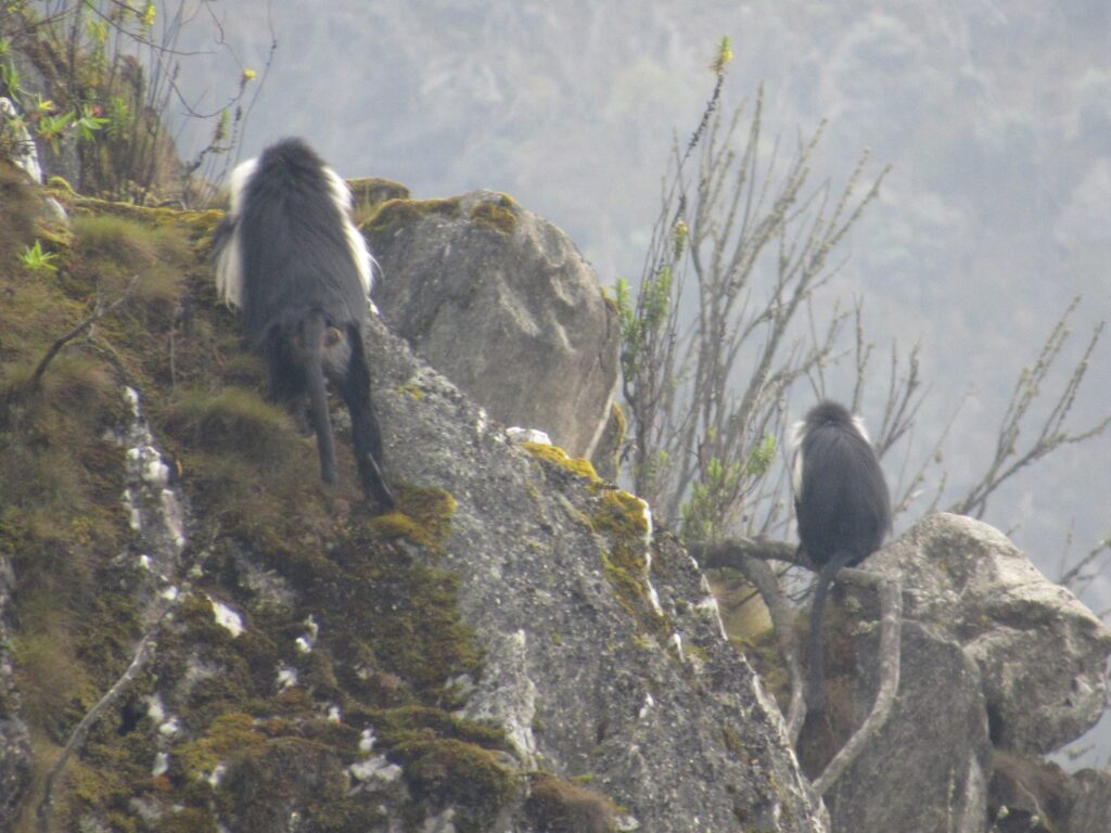
Yes. Several monkey species inhabit the lower forest zones, and sightings, along with occasional chimpanzee calls echoing through the canopy, are a regular feature of the first days of both major trekking routes.
Are there elephants?
Forest elephants do inhabit the lower reaches of the park, though direct sightings on the trekking trails themselves are relatively uncommon, since the trails tend to climb quickly above the elephants’ preferred forest habitat.
Are there dangerous animals?
The Rwenzori has considerably fewer large predators than Uganda’s savannah parks, and dangerous encounters on the trekking trails are rare, though guides carry the appropriate training and awareness for the forest zone’s resident wildlife as a standard precaution.
Which birds are endemic?
Nineteen of the roughly 241 recorded bird species in the range are found only in the Albertine Rift region, making the Rwenzori a genuinely significant destination for serious birders alongside its appeal to trekkers and mountaineers.
What plants are unique?
The range’s Afro-alpine zone hosts some of the strangest plant life on the continent, including giant groundsels and giant lobelias that grow to heights unimaginable for their lowland relatives, along with dense stands of giant heather that give the moorland its otherworldly, almost prehistoric character.
Are giant lobelias found there?
Yes, giant lobelias are one of the signature sights of the Afro-alpine zone, typically encountered between roughly 3,500 and 4,300 meters, where their tall rosette form has evolved specifically to survive the freeze-thaw cycle of near-equatorial high altitude.
Vegetation Zones of the Rwenzori
How many vegetation zones are there?
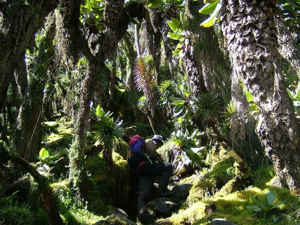
The Rwenzori has five distinct vegetation zones stacked vertically up the mountainside: montane forest, bamboo and mixed forest, heather-dominated zone, Afro-alpine moorland, and finally the nival zone of bare rock, snow, and glacier above roughly 4,500 meters. This near-complete, undisturbed sequence is one of the specific attributes UNESCO cited when inscribing the park as a World Heritage Site.
Why are the plants so unusual?
Isolation at high altitude near the equator has caused a phenomenon called Afro-alpine gigantism, where certain plant lineages evolved much larger forms than their lowland relatives to survive intense UV exposure, dramatic daily temperature swings, and the freeze-thaw cycles typical of tropical high mountains.
What are giant groundsels?
Giant groundsels are tree-sized relatives of ordinary garden groundsel, growing trunks several meters tall topped with rosettes of thick, waxy leaves, a striking and instantly recognizable feature of the Rwenzori’s Afro-alpine zone.
What are giant lobelias?
Giant lobelias are tall, rosette-forming plants that can reach several meters in height, adapted with thick, water-retaining leaves and a protective inner structure that helps their growing tip survive nightly frost even while sitting almost directly on the equator.
Why do plants become larger at high altitude?
In most of the world, higher altitude means smaller, hardier plants, but in the isolated Afro-alpine zones of East Africa’s tall mountains, the opposite pattern emerges: larger plant forms retain heat more effectively and protect their vulnerable growing points from the nightly freeze that is a constant feature of life in regions this close to the equator yet this high above sea level.
Glaciers of the Rwenzori Mountains
Are there glaciers in Uganda?
Yes, the Rwenzori is home to some of the last remaining tropical glaciers on Earth, found on the upper slopes of Mount Stanley, with the Stanley Plateau glacier being the most significant remaining ice body in the range.
Why do glaciers exist near the equator?
Glaciers survive here purely because of altitude rather than latitude: at over 5,000 meters, temperatures stay low enough year-round for snow and ice to persist, even though the range sits almost exactly on the equator.
Are the glaciers disappearing?
Yes, and rapidly. Scientific monitoring shows the range has lost more than ninety percent of its ice since measurements began in the early twentieth century, and the remaining Stanley Plateau glacier lost close to thirty percent of its surface area between 2020 and 2024 alone, with researchers now warning that the range’s glaciers could disappear entirely within a decade or two if current climate trends continue. Because conditions are changing quickly, we review and update this section regularly and encourage trekkers who want to see equatorial ice in person to treat the experience as a genuinely limited-time opportunity rather than assuming the glaciers will still be there in ten or twenty years.
Can visitors walk on glaciers?
Yes, trekkers attempting Margherita Peak cross the remaining glacier ice on Mount Stanley as part of the final summit push, always roped to a qualified guide and equipped with crampons and an ice axe, since crevasses and rapidly changing surface conditions make unroped travel genuinely dangerous.

How much glacier ice remains?
Only a small fraction of the ice mapped by early twentieth-century expeditions remains today, concentrated almost entirely on Mount Stanley, with the other massifs that once carried glaciers, including Mount Speke and Mount Baker, having already lost theirs in recent decades.
Difficulty and Fitness for Rwenzori Trekking
How fit do I need to be for a Renzori Trek?
A good working benchmark is the ability to walk 5 to 8 hours a day on uneven, sometimes steep and muddy terrain for consecutive days while carrying a daypack. Trekkers who arrive with a solid cardiovascular base and some prior hiking experience consistently have a better time on the mountain than those who treat it as their first serious physical challenge.
Can children trek the Rwenzori Mountains?
Children can join the lower-altitude day hikes and shorter forest-zone excursions, but the full multi-day trek to Margherita Peak, with its cold nights, technical glacier crossing, and sustained physical demands, is generally not appropriate for younger children and is best reserved for teenagers and adults in good health.
Can older adults climb Rwenzori Mountains?
Age alone is not the limiting factor; overall fitness, prior altitude experience, and any underlying health conditions matter far more. We have guided many older trekkers to Margherita Peak successfully, provided they trained properly beforehand and paced themselves sensibly with our guides’ recommended acclimatization schedule.
How should I prepare for a Rwenzori trek?
Begin cardiovascular training several months out; hill walking, stair climbing, and long walks with a loaded pack are ideal, combined with some strength work for your legs and core, and, where possible, practice hikes on multiple consecutive days to build the kind of cumulative fitness the Rwenzori actually demands.
What exercises should I do?
Focus on sustained aerobic conditioning such as hiking, running, or cycling, paired with leg-strengthening work like squats, lunges, and stair climbs; and core stability exercises, since a strong core noticeably reduces fatigue when carrying a pack over uneven terrain for multiple consecutive days.
How difficult is summit day?
Summit day on Margherita Peak is the hardest single day of the trek by a wide margin: a pre-dawn start, several hours of glacier travel requiring crampons and rope work, exposure to serious cold and wind, and then the same distance again in reverse to descend, often totaling ten hours or more of sustained effort at altitude.
Altitude and Health Of Rwenzori
Will I get altitude sickness in the Rwenzori Mountains?
Altitude sickness is a real possibility on any trek reaching the elevations found in the Rwenzori, and it can affect fit and experienced trekkers just as readily as beginners, since individual susceptibility varies more than fitness level does. Well-designed itineraries build in gradual ascent and rest days specifically to reduce this risk.
How high is Margherita Peak?
Margherita Peak sits at 5,109 meters above sea level, comfortably within the range where altitude-related symptoms become a genuine consideration for most travelers.
How do guides manage altitude?
Experienced guides pace ascents deliberately, build acclimatization days into the itinerary, monitor trekkers for early symptoms, and are prepared to adjust or abandon a summit attempt if a member of the group shows signs of serious altitude illness, prioritizing safety over reaching the top.
What are the symptoms of altitude sickness?
Common early symptoms include headache, nausea, fatigue disproportionate to the day’s exertion, and disturbed sleep, while more serious symptoms such as confusion, severe shortness of breath at rest, or loss of coordination indicate a dangerous progression that requires immediate descent.
How can I reduce the risk of altitude sickness in the Rwenzori Mountains?
Ascending gradually, staying well hydrated, avoiding alcohol during the trek, and communicating openly with your guide about how you are feeling are the most effective everyday strategies, alongside choosing an itinerary with adequate acclimatization days built in rather than the shortest possible schedule. Please note that this information is general travel guidance rather than medical advice, and anyone with underlying health conditions, or concerns about altitude specifically, should consult a qualified healthcare professional or travel medicine clinic before booking. Our Altitude Sickness Guide goes into further detail on prevention and recognition.
Packing for a Rwenzori Trek
What should I pack for a Rwenzori trek?
Pack in layers built around a moisture-wicking base layer; an insulating mid-layer such as fleece or down; and a waterproof, breathable outer shell, along with sturdy waterproof hiking boots, warm gloves, a warm hat, gaiters, and, for a Margherita Peak attempt, technical mountaineering layers suited to sub-freezing summit conditions. Our complete packing list covers every item in detail, organized by vegetation zone, so you know exactly what you’ll need and when.
What clothes should I wear for a Rwenzori trek?
Layering is the single most important packing principle for the Rwenzori, since a single day’s hike can move you through humid rainforest, cool moorland, and near-freezing high camp conditions, sometimes within a matter of hours.
Do I need waterproof boots?
Yes, waterproof and well broken-in hiking boots with excellent ankle support are essential, given how frequently trails cross bogs, streams, and simply wet, muddy ground throughout the trek.
Can I rent equipment?
Technical mountaineering equipment for a Margherita Peak attempt, including crampons, an ice axe, and a climbing harness, is typically available to rent through your trekking operator, which is worth confirming in advance so you are not travelling internationally with specialized gear you will only use for a single day.
What kind of sleeping bag do I need?
A four-season sleeping bag rated to at least minus ten degrees Celsius is recommended, given how cold the higher camps get overnight, particularly in the days leading up to a summit attempt.
Do I need trekking poles?
Trekking poles are strongly recommended, both for stability on the range’s frequently muddy and root-strewn trails and to reduce strain on your knees during the long descents that follow each day’s climb.
How many clothes should I bring?
Because laundry facilities do not exist on the mountain, most trekkers pack enough base layers and socks for the full trip while planning to re-wear insulating and outer layers daily, prioritizing quick-drying synthetic or merino wool fabrics over cotton, which retains moisture and chills quickly once wet.
Accommodation For Rwenzori Treks
Where do Rwenzori trekkers sleep?
Depending on the route, trekkers sleep either in mountain huts or in tents at designated campsites spaced along the trail, with both the Central Circuit trail and Kilembe Trail offering a mix of hut and camp accommodation at different stages of the itinerary.
Are there mountain huts?
Yes, a network of huts exists along both major routes, offering basic dormitory-style shelter that is a considerable improvement over tent camping in the frequently wet Rwenzori climate, though standards vary by location and route.
Are tents used along Rwenzori trails?
Tents supplement the hut network at certain camps and are standard equipment carried by your trekking crew, providing a reliable fallback accommodation option regardless of hut capacity or condition at any given stop.
Are showers available in the Rwenzori huts/camps?
Basic washing facilities exist at some camps, typically in the form of a bowl of heated water rather than a proper shower, so trekkers should adjust their expectations accordingly and pack quick-drying wipes as a practical supplement.
Is electricity available in the Rwenzori camps/huts?
Electricity is generally not available at the huts and camps themselves, so trekkers should plan around solar chargers, spare batteries, and power banks rather than expecting to plug in devices along the route.
Can phones be charged?
Charging options on the mountain are limited to what you bring yourself, typically a power bank or small solar panel, since the huts and camps do not have grid electricity.
Food on the Rwenzori Trek
What food is served?
Trekking crews prepare hot, calorie-dense meals throughout the trip, typically combining local staples with pasta, rice, soups, and stews, designed to replace the substantial energy trekkers burn each day at altitude.
Can vegetarians be accommodated?
Yes, vegetarian and most other dietary requirements can be accommodated with advance notice, allowing your trekking operator’s cooks to plan and pack the appropriate ingredients before departure.
Is drinking water provided?
Drinking water is typically sourced from mountain streams and treated or boiled by your crew before consumption, and trekkers are usually advised to carry a reusable bottle or hydration bladder rather than relying on bottled water, which is impractical to carry in the necessary quantities.
Can I bring snacks?
Bringing your own familiar energy bars, electrolyte supplements, or favorite snacks is a particularly sensible idea, both for personal preference and as a reliable energy boost on demanding days such as the summit push.
Guides and Porters Of Rwenzori Mountains
Are guides required for the Rwenzori?
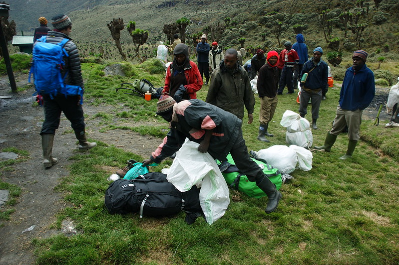
Yes, guides are mandatory for all trekking within Rwenzori Mountains National Park, both as a matter of park regulation and, more importantly, for genuine safety given the terrain, weather, and technical glacier crossing involved in a Margherita Peak attempt.
Why should I hire porters in the Rwenzori?
Porters carry the bulk of your gear, allowing you to hike with only a light daypack and conserve energy for the terrain and altitude itself, while hiring porters also directly supports the local Bakonzo community economy, which depends heavily on mountain tourism.
How much weight can a porter carry on a Rwenzori trek?
Regulated weight limits apply to protect porter welfare, and a reputable operator will always adhere to these limits rather than overloading porters to cut costs, which is one of the practical questions worth asking any company you are considering.
How many guides accompany a group of Rwenzori Treks?
Group sizes and guide-to-trekker ratios vary by operator and itinerary, but a well-run expedition will always ensure enough qualified guides and support staff to manage the group safely, particularly on summit day when the party may need to split by pace or ability.
Do the guides speak English?
Yes, lead guides on established routes are typically fluent in English, and many also speak additional languages, though it is always worth confirming specific language needs in advance if you are traveling in a group with other primary languages.
Rwenzori Mountains Frequently Asked Questions: Obtain definitive responses to frequently asked questions about the Rwenzori Mountains, involving Rwenzori trekking routes, difficulty levels, safety considerations, weather conditions, peaks, cost of climbing Rwenzori Mountains, What to wear/pack for Rwenzori, Rwenzori accommodation, hiking preparation.
Explore informative answers to your pressing questions regarding the Rwenzori Mountains, including Rwenzori trekking routes and their difficulties, safety recommendations, climatic conditions, notable Rwenzori Peaks, and vital hiking preparations. The Rwenzori Mountains inspire awe, distinguishing themselves from all other mountain ranges in Africa. These prominent peaks are situated directly on the equator, yet they include perpetual glaciers, captivating mist-enshrouded valleys, and some of the most distinctive alpine vegetation on Earth.
The Rwenzori range extends along the boundary of western Uganda and the Democratic Republic of Congo, constituting a segment of the Albertine Rift. At 5,109 meters, Margherita Peak on Mount Stanley is its highest peak and the third-tallest point in Africa. In contrast to Kilimanjaro or Mount Kenya, the Rwenzori provides multi-day walking across dense woods, marshy lowlands, rugged hills, and glacial regions. The outcome is a wilderness experience that appears untamed, secluded and resistant to mass tourism.
The same question is frequently asked by tourists who intend to hike the Rwenzori: How difficult is the trek? What are the available routes? Is it safe? When is the best time to visit Rwenzori Mountains? This Frequently Asked Questions guide about Rwenzori provides essential information in one place, enabling trekkers to plan with assurance.
What is the location of the Rwenzori Mountains?
The Rwenzori Mountains are situated in western Uganda and the Democratic Republic of Congo, constituting a section of the Albertine Rift, the western arm of the East African Rift Valley. The range, which is roughly 120 km long and 65 km wide, is located in the districts of Kasese, Bundibugyo, and Ntoronko in Uganda and extends into the DRC‘s North Kivu Province. Margherita Peak atop Mount Stanley, at 5109 meters, is the third-highest mountain in Africa. The Rwenzori mountains are in Rwenzori Mountains National Park in Uganda in part by Virunga National Park in the Democratic Republic of the Congo.
Rwenzori Mountains National Park, founded in 1991, occupies around 998 square kilometers and is designated as a UNESCO World Heritage Site. The mountains are internationally acknowledged for their distinctive biodiversity, striking glacial topography, and endemic species, rendering them an important ecological and conservation zone in the East African region.
What is the origin of the name “Mountains of the Moon”?
Ptolemy, an ancient geographer, referred to the Rwenzori Mountains as the “Mountains of the Moon.” He posited that these mountains were the origin of the Nile, the name inspired by their enchanting and enigmatic appearance. The summits are exceedingly elevated and frequently enveloped in mist and snow, rendering them reminiscent of a dreamlike landscape.
The Rwenzori Mountains are now frequently referred to as the “Mountains of the Moon” due to their peculiar and exquisite look. The name denotes the uniqueness and grandeur of these mountains, evoking their extensive history and awe.
What distinguishes the Rwenzori Mountains from other African mountain ranges?
In contrast to Kilimanjaro and Mount Kenya, which are a result of volcanic eruptions, the Rwenzori Mountains are the result of faulting, a geological process that removes materials from the Earth’s crust. The Rwenzori Mountains are distinctive, featuring diverse flora that creates various vegetation zones as altitude increases. It Rwenzori Mountains comprise distinct zones, each characterized by unique plant species: montane, bamboo, heather, alpine, and glacier zones.
These exhibit unusual plant species, such as huge lobelias and giant heather, which exclusively thrive in this type of environment. The Rwenzori Mountains exhibit a distinctive characteristic of permanent glaciers and snow on their peaks, which is atypical given their location in the tropical region.
What are the major peaks of the Rwenzori Mountains?
The highest peak in the Rwenzori is Margherita Peak, located on Mount Stanley. It is situated at an elevation of 5,109 meters (16,763 feet) above sea level. This designates it as the third tallest peak in Africa. Mount Stanley is the main peak in the range, however several other significant summits exist, as Mount Speke, Mount Baker, Mount Emin, Mount Gessi, and Mount Luigi di Savoia. These mountains are all majestic and breathtaking, and some of them even get snow all year round.
Due to their substantial altitude and freezing temperature, numerous peaks possess snow and glaciers at their peaks, despite their proximity to the tropics. Climbing these mountains can be challenging and frequently requires experience, specialized equipment, and technical climbing abilities. The snow-covered peaks, steep inclines, and rugged trails provide the Rwenzori a formidable task for mountaineers, while simultaneously offering a splendid spot for adventure and natural splendor.
Is it possible for first-timers to climb the Rwenzori Mountains?
Yes, Beginners/First-timers (people who have never been hiking before can hike/climb/trek the Rwenzori mountains as long as they are fit and well-prepared. Experience in climbing is not a prerequisite for hiking the Rwenzori Mountains. Most of the Rwenzori Mountains trail routes don’t require any technical expertise, thus anyone can simply trek/climb/hike them. The Rwenzori Mountains trail routes leads climbers through picturesque forests, rivers, and valleys, often spanning several days.
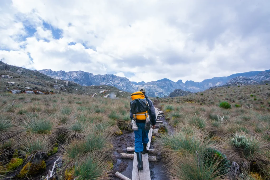
To hike to the top of Margherita, one must have climbing gear/equipment such as crampons, ropes, hiking boots, and harnesses. An expert guide can facilitate the ascent, regardless of prior experience. A great option for first-time hikers to enjoy the mountain’s Rwenzori views without requiring technical abilities is to begin with easier trails. With adequate preparation, even first timers can enjoy a remarkable experience in the Rwenzori Mountains; one can climb several peaks regardless of prior expertise.
Which Rwenzori trekking trails are the most popular in the Rwenzori Mountains?
The Rwenzori Mountains provide 2 main trekking routes/trails. The primary route/trail is the Central Circuit Trail, starting in Nyakalengeja. The second is the Kilembe trail route, beginning from Kilembe, a town adjacent to Kasese in western Uganda. The most popular Rwenzori trekking trail/route is the central circuit trail, which has less difficult and steep climbs that allow hikers to reach the peak quickly.
The central circuit trail forms a loop across the mountains, allowing hikers to return to their starting point. Although the Kilembe trail is longer, more difficult, and has steeper slopes, it offers trekkers breathtaking vistas of the stunning scenery. However, both treks have breathtaking views of various terrains that highlight the Rwenzori Mountains’ natural beauty.
How many days does it take to hike Mount Rwenzori?
The complete journey to Margherita Peak on Mount Stanley typically requires 7 to 10 days, contingent upon the selected route and hiking pace. For those interested solely in the lower regions of the Rwenzori Mountains, such as the montane to heather zones, shorter excursions lasting 3 to 5 days are also offered. These excursions do not attain the summit but nonetheless provide exquisite sensations of the mountains. Experienced hikers can traverse the Central Circuit Trail to Margherita Summit in 4 to 5 days. Nonetheless, this is doable solely for exceptionally fast and expert hikers, but it may not provide sufficient time for acclimatization.
To enhance acclimatization, hikers are recommended to allocate 7 and 8 days for the central circuit and Kilembe trail route, respectively, for those intending to summit Margherita Peak. Longer hikes give trekkers more time to acclimate, which guarantees a smooth hike in the Rwenzori Mountains. Hikers seeking to ascend other prominent peaks in the Rwenzori Mountains, such as Baker, Mount Speke, Mount Emin, Mount Luigi di Savoia, and Mount Gessi, need only 5 days to complete each ascent. To incorporate additional independent peaks into your trekking itinerary, you necessitate an extra day for each peak added.
What is the best time to hike Rwenzori Mountain?
The Rwenzori Mountains experience dry and wet seasons, with dry seasons/months occurring from December to early March and from June to early September. The best months to go trekking Rwenzori Mountains are December through early March and June through early September because of the ideal weather, which includes dry trails, bright skies, high visibility, and less difficult crossings, particularly near the riverside. Many hikers favor this period due to a more seamless and secure trekking experience.
The rainy seasons occur from late March to May and late September to November; during these periods, the mountains see heavy rainfall, rendering hiking difficult due to saturated trails and poor visibility. Nevertheless, certain seasoned hikers continue to trek during the rainy season for the sake of adventure and reduced crowds. Due to the fluctuating climate of Rwenzori, rain can occur even in the dry season; therefore, it is essential to pack waterproof outfits and rain protection regardless of the timing of your visit.
How difficult is it to trek Rwenzori Mountain?
Trekking to Margherita Peak is a difficult and demanding experience that requires long trek through muddy areas, steep, rocky slopes, and freezing glaciers. Certain sections necessitate technical proficiency, requiring the use of specialized climbing equipment, such as ropes, ice axes, and crampons, for traversing the ice. Breathing becomes more difficult at this high altitude, and some people may have headaches, fatigue, or dizziness.

The trek is unsuitable for anyone who are unfit or inadequately prepared.
Nevertheless, some beginner climbers possessing exceptional physical fitness, appropriate equipment, and resolute determination have reached the peak. Professional climbing experience is not required; nonetheless, preparedness for the challenge and adherence to instructions are essential. With adequate training and preparation, this challenging trek may be a memorable and memorable experience. Moreover, one can traverse alternative summits in the Rwenzori Mountains, which present a more manageable navigation compared to the summit of Margherita.
Do I need a guide to trek, or can I do it solo?
Every tourist to Uganda’s Rwenzori Mountains National Park is required by law to have a professional guide. To safeguard the ecosystem and climbers, solo hiking is prohibited. Certified tour operators organize the majority of hikes, supplying all essentials for the expedition in the Rwenzori Mountains. These teams comprise skilled guides well-versed in the mountain’s terrain and educated about the routes and paths, porters to transport heavy luggage, cooks to attend to the hikers’ needs, and all required logistics to facilitate a seamless hiking experience.
These crews also guarantee compliance with park rules and regulations and adherence to designated routes. Due to the challenging terrain, variable weather conditions, and potential hazards, solo trekking is prohibited. Accompanied by a guide and the whole support staff, you can safely relish the journey while contributing to the preservation of the park’s flora, animals, and picturesque scenery.
What kinds of animals might I see in the Rwenzori Mountains?
The Rwenzori Mountains are abundant in biodiversity and provide a distinctive experience for nature enthusiasts, featuring diverse flora and fauna for trekkers to observe. Various creatures, including colobus monkeys, can be observed in the lower woodland zone.
This region of the mountain’s forest zone is also home to forest elephants. Advancing into the heather zone, one may observe duikers and many bird species, including those peculiar to the Rwenzori Mountains, such as the Rwenzori turaco, which is seen in the tree canopies.
Which types of accommodations are accessible during the trek?
Trekkers in the Rwenzori Mountains sleep in mountain huts or camping tents, contingent upon their chosen trail. These huts are modest and constructed primarily to safeguard trekkers from rain and chilly temperatures. Within the huts, wooden platforms are equipped with basic mattresses arranged in either a dormitory configuration or a private room setup.
Trekkers share these fundamental mattresses, which necessitate only sleeping bags, with fellow trekkers. Certain facilities, such as those along the Kilembe route, are equipped with solar electricity for charging, although others lack this feature. These facilities are meticulously maintained and provide refuge for hikers during their Rwenzori trekking expedition in the Rwenzori Mountains. During the treks, meals in the mountains are cooked by chefs; usually, a cook advances with the entire group to provide hot meals at each campsite. Typically, hikers receive breakfast, lunch, and dinner daily.
What should I pack/wear for the trek?
When planning for a journey in the Rwenzori Mountains, it is necessary to bring appropriate supplies for a secure and seamless hike. Mountain weather can rapidly fluctuate at any hour, necessitating preparedness for both radiant sunshine and frigid temperatures. It is advisable that you wear layered attire, beginning with lightweight garments in warm conditions and progressively adding layers as temperatures decrease.
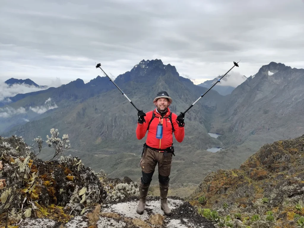
It is advisable to bring a robust waterproof jacket and rain pants to remain dry in the event of sporadic rainfall. Individuals planning for climbing Margherita should prepare by packing hiking boots, rubber boots, daypacks, sleeping bags, insulated clothing, warm socks, gloves, and essential trekking equipment like ropes, crampons, harnesses, and helmets. Additional necessities that should be considered encompass a camera, a headlamp, spare batteries, a first aid kit, sunscreen, a water bottle, snacks, and other personal effects for usage during the Rwenzori trekking safari.
Is altitude sickness a risk in the Rwenzori Mountains? – Frequently Asked Quests About Rwenzor Mountains
Altitude sickness is a significant risk when trekking in the Rwenzori Mountains, particularly at elevations exceeding 3000 meters. At elevated altitudes, the air contains reduced oxygen levels, hence complicating the body’s ability to function effectively. Numerous trekkers encounter symptoms including headaches, nausea, dizziness, fatigue, or insomnia. These symptoms may initially manifest gradually but may advance if not well addressed. Individuals respond variably to high altitude, and even physically fit persons may experience illness. The advantageous aspect of the Rwenzori mountains, characterized by both ascents and descents, enables the body to acclimatize to the surroundings, hence minimizing the chances of altitude sickness.
To mitigate risk, it is essential to select a hiking route that provides a gradual and consistent ascent. This provides your body sufficient time to acclimatize to the altitude. Consuming plenty water facilitates your body’s adaptation process. It is best to hike to high altitudes before climbing Rwenzori in order to adapt. It’s crucial to eat a balanced diet and get adequate sleep, and you should notify your guide right away if you suspect altitude sickness.
Guides are trained to assist in such instances and will be aware of the appropriate actions to take. Lowering the altitude is the safest course of action for more severe problems or symptoms, although in mild cases you might just need to rest. Never attempt to ignore severe symptoms. Safety must always be prioritized during high-altitude treks. You may safely embrace the Rwenzori experience by being cautious and paying attention to your body.
What is the cost of trekking in the Rwenzori Mountains?
A standard Rwenzori trek, lasting between 7 and 10 days, may range in cost from $1300 to $1800. The precise cost is contingent upon the selected Rwenzori Trekking trail/routes, the duration of your stay on the mountain, the tour agency you engage, and numerous other variables. Certain routes are lengthier and more demanding, resulting in higher costs. Others are of shorter duration, rendering them more economical; however, peak rates typically remain unaffected by the duration or any other variables.
The cost of Rwenzori trekking covers various aspects, including the total time of the stay and the mountain hike, covering most expenses aside from gratuities. Packages often encompass park entrance fees, professional guide costs, meals, accommodation, and porters; furthermore, for individuals trekking to extreme altitudes, the expense of hiking equipment is also incorporated. Additional expenses, such as airport transfers.
Are there alternatives for shorter or less challenging Rwenzori Mountains treks?
Indeed, not all individuals require peak summiting; there exist trekking alternatives ranging from 1 to 5 days that provide exploration of the verdant slopes, waterfalls, and mountainous forests inside the Rwenzori ranges. These are ideal for adventurers wishing to discover the natural splendor of the Rwenzori Mountains. Visitors may experience the mountains via one-day nature hikes or five-day treks along the Central circuit trail and the Kilembe trail.
What degree of fitness is necessary For climbing Rwenzori Mountains?
While professional athleticism is not a prerequisite for trekking in the Rwenzori mountains, great physical fitness is essential. The expedition is difficult due to prolonged daily walking, frequently ascending via rugged paths and trails under varying weather conditions. Certain days can be exceedingly prolonged and exhausting, particularly at elevated altitudes, when the atmosphere becomes less dense and cooler.
To condition your body for the walk, it is advisable to begin training several months prior to your Rwenzori trekking Safari. This might be accomplished by hiking in the area in question, jogging, doing long-distance walks, or consistently ascending stairs. This increases your endurance, strengthens your legs, and helps you become accustomed to walking while carrying a backpack. It will be easier and more pleasant to climb the mountain if you exercise more beforehand.
Is the trek safe for solo female travelers or groups?
Yes, whether you are a lone female tourist or a member of a group, trekking in the Rwenzori mountains is usually safe with capable women. Rwenzori trekking expeditions employ skilled and knowledgeable guides who are familiar with the mountain and its unique features, including variations in the temperature. Guides exhibit professionalism, adeptly managing emergencies and assuring trekkers’ enjoyment while maintaining safety during the expedition. Porters assist during the trek by carrying large packs and providing support to trekkers when the terrain gets challenging or difficult.
Uganda is among the safest nations in East Africa, characterized by its kind and hospitable people, while the government ensures stringent security measures in tourism zones and national parks. But like in any travel circumstance, it’s important to use common sense, put your own safety first, heed trail guidance, and follow your guide’s directions.
Why should I choose Rwenzori over Kilimanjaro or Mount Kenya?
Although Mount Kilimanjaro is more renowned and frequently frequented by many tourists, the Rwenzori Mountains provide a distinctly unique experience. Trekking Rwenzori Mountains offers an opportunity to discover a secluded and sparsely populated region of Africa that remains largely unspoiled by tourists. The region is sparsely populated, retaining its natural and untamed beauty, which renders the experience tranquil and intimate.
The Rwenzori routes present greater challenges than those found on Kilimanjaro and in Mount Kenya, although they are ideal for individuals seeking genuine adventure and desiring to test their limits in a serene, more exhilarating environment. The Rwenzori Mountains are replete with natural marvels, encompassing dense woods, rivers, exotic vegetation, and enchanting vistas characterized by distinctive flora, including huge lobelias, moss-laden trees, and high-altitude glaciers. The snow-covered summits, including Margherita and many more, provide climbers with an exhilarating trek across the mountains of Rwenzori.