The 10-day Rwenzori 4 Peaks trek summits the 4 Rwenzori peaks of Margherita (5,109 m), Vittorio Emanuele (4,890 m), Edward (4,843 m), and Weismann (4,620 m) in 10 days via the Kilembe Trail. Rwenzori Trekking Expeditions offers a private 10-day Rwenzori trek to 10 high peaks of the Rwenzori Mountains on Mount Stanley, Mount Speke, Mount Baker & Mount Luigi Di Savoia via the Kilembe trail route of Rwenzori Mountains National Park.
Kilembe → Sine Camp → Kiharo → Bugata → Bujuku → Elena Hut → Margherita (5,109m) → Speke (4,890m) → Scott-Elliot Pass → Kitandara → Baker (4,843m) → Freshfield Pass → Weismann (4,627m) → Kilembe
| 10 Days · 4 Summits | Kilembe Trail | Year-Round | Strenuous / Expert | Fully Private & Bespoke |
The 10-Day Rwenzori Four Peaks Trekking Expedition to Mount Baker (4842 m), Margherita Peak (5109 m), Mount Speke (4890 m), and Weismann’s Peak (4620 m) is the finest and most comprehensive multi-peak trekking achievement available in Uganda’s Rwenzori Mountains National Park. This is not an itinerary designed for those who simply want to reach a high point and photograph the view. This is a sustained, technically demanding, and emotionally transforming alpine journey through five distinct ecological/vegetation zones, across two extraordinary high mountain passes, and up four separate summit massifs, each with its own character, its own demands, and its own irreplaceable moment at the top.
Four distinct massifs. Four summit moments. One continuous, seamlessly managed, privately guided adventure.
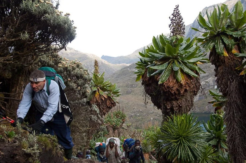 Via the celebrated Kilembe Trail, your private expedition team from Rwenzori Trekking Expeditions will guide you from the forest-cloaked lower slopes above the former copper-mining settlement of Kilembe, through the giant heather zone with its moss-wrapped trees, across the surreal giant lobelia and groundsel moorlands, and into the glaciated heights of Mount Stanley, Mount Speke, Mount Baker, and Mount Luigi di Savoia.
You will stand on Margherita Peak at 5,109 meters on Mount Stanley, Africa’s third-highest summit, at dawn, watching the light come up over the Congo Basin. You will traverse to Vittorio Emanuele Peak on Mount Speke at 4,890 meters, looking back at the route you carved yesterday across Stanley’s glacier. You will climb Edward Peak at 4,843 meters on Mount Baker through the mist that provides these mountains their ancient name. And on the final summit morning, you will stand on Weismann Peak at 4,627 meters, the least-visited of the four and the most purely Rwenzori in character, with the knowledge that you have done something very few people in this world have done or ever will.
The 10-Day Rwenzori Four Peaks Expedition begins with your arrival at Entebbe International Airport, where your Rwenzori Trekking Expeditions representative meets you for the private transfer to Kasese, the gateway town on Uganda’s western Rift Valley edge, 380 kilometers west of Kampala. Day One is your preparation day: gear check, porter allocation, guide briefing, and an early night. The mountain begins on Day Two at the Kilembe Trailhead.
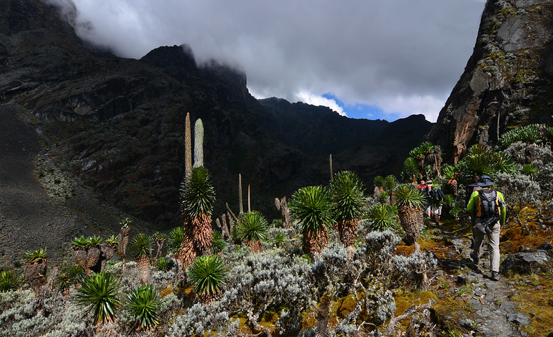 Days Two through Ten unfold as nine consecutive days on the Kilembe Trail and its high massif approach. The first three days ascend progressively through Sine Camp (2,610 m), Kiharo Camp (3,061 m), and Bugata Camp (3,750 m), allowing the body to acclimatize through every vegetation zone the Rwenzori produces. Day Four reaches the expedition’s operational hub at Bujuku Camp (3,962m), with Lake Bujuku and the Elena Glacier of Mount Stanley directly above.
Days Five and Six are the first two summit days: Margherita Peak (5,109 m) on Mount Stanley, with glacier travel on crampons, followed, after recovery rest, by Vittorio Emanuele Peak (4,890 m) on Mount Speke via the Speke approach. Day Seven crosses Scott-Elliot Pass (4,372 m), one of the Rwenzori’s great high ridges, into the southern valley where the extraordinary twin Kitandara Lakes await. Day Eight delivers Edward Peak (4,843m) on Mount Baker. Day Nine carries you south over Freshfield Pass (4,282m) to the high camp below Weismann Peak. Day Ten is the final summit, Weismann at 4,627 m, followed by the long, rewarding descent back to the Kilembe Trailhead and the transfer to Kasese.
Every logistical element of the journey is curated and confirmed by your Rwenzori Trekking Expeditions team: private transfers, all UWA park and peak permits, full-board mountain catering, your dedicated lead guide, assistant guides, a full porter team, crampons and ice axe provision for the glacier approaches, and post-trek hotel accommodation in Kasese. Nothing is left to circumstance. Everything is already handled.
Expedition at a Glance: 10-Day Rwenzori Four Peaks Trekking/Hiking
Arrival | Arrival in Kasese | Gear check & expedition briefing | Overnight Kasese hotel |
Day 1 | Kilembe Trailhead (1,590m) → Sine Camp (2,610m) | ~10 km | Forest ascent begins |
Day 2 | Sine Camp → Kiharo Camp (3,061m) | ~9 km | Giant heather zone |
Day 3 | Kiharo Camp → Bugata Camp (3,750m) | ~8 km | Afro-alpine moorland & lobelias |
Day 4 | Bugata Camp → Bujuku Camp (3,962m) | ~7 km | Acclimatisation & Lake Bujuku |
Day 5 | Summit Day 1: Margherita Peak (5,109m) | Glacier crossing | Return to Bujuku |
Day 6 | Summit Day 2: Vittorio Emanuele Peak, Mt Speke (4,890m) | Return to Bujuku |
Day 7 | Bujuku → Scott-Elliot Pass (4,372m) → Kitandara Camp (4,023m) | ~8 km |
Day 8 | Summit Day 3: Edward Peak, Mt Baker (4,843m) | Return to Kitandara |
Day 9 | Kitandara → Freshfield Pass (4,282m) → High Weismann Camp (~4,200m) |
Day 10 | Summit Day 4: Weismann Peak, Mt Luigi di Savoia (4,627m) → Descent to Kilembe → Kasese |
Note: The itinerary above presents an 11-movement structure within a 10-night expedition framework. Days are counted from the first night (Kasese) to the final descent. Your Rwenzori Trekking Expeditions consultant will confirm the precise day-count structure based on your arrival date and group pace preferences.
Arrival: Entebbe / Kampala to Kasese | ~380–420 km
The road west from Kampala to Kasese is one of Uganda’s finest driving journeys. A seven-hour arc through tea-covered highlands, past the crater lakes of Fort Portal, and down into the Rift Valley, where the air thickens with the presence of something large and ancient just beyond the western horizon. Your dedicated driver and private vehicle handle everything from the moment you are met at Entebbe International Airport or your Kampala hotel: luggage, navigation, the mid-journey lunch stop, and the final approach into Kasese as the Rwenzori range fills the windshield with an ambition that cannot be contained by glass.
Kasese sits at the mountain’s foot like a town that has always known it exists in the shadow of something extraordinary. It is a genuinely Ugandan town, busy, warm, and colorful, and your carefully selected hotel provides comfortable accommodation, a hot meal, and the tranquility before the mountain. This evening belongs to preparation: your lead guide arrives for the comprehensive pre-expedition briefing. Equipment is inspected and weighed. Porter allocations are confirmed. The route, the camps, the summit strategy, the acclimatization protocol, and the contingency plans are all walked through with the unhurried confidence of people who have been here many times before. No question is too small. No detail is left unaddressed.
Accommodation & Meals: Kasese hotel (selected for briefing). Full-board dinner.
Day 2: Kilembe (1,590m) to Sine Camp (2,610m) | ~10 km | Approximately 5–6 hours
The Kilembe Trailhead has a particular quality of anticipation, a gateway feel that all serious mountain beginnings possess. Your private vehicle delivers the team the short distance from Kasese to Kilembe, past the historic copper mine that once made this valley an industrial artery of western Uganda. The Uganda Wildlife Authority check-in and registration formalities are handled efficiently and entirely by your guide team; you are free to absorb the scene: porters adjusting loads with practiced authority, the smell of damp forest already reaching down from the slopes above, and ahead, the wall of equatorial green that marks the beginning of the Rwenzori Mountains National Park.
The trail rises immediately through the former copper-mining terrain, a landscape in its own right, the industrial past softened by decades of vegetation reclamation, before crossing the Mubuku River on a steel-railed bridge. From the bridge, the Rwenzori forest begins in earnest: dense, dark, and cathedral-humid, alive with the calls of Rwenzori turacos in the canopy above and the sound of unseen streams threading through the undergrowth below. Red-tailed monkeys and L’Hoest’s monkeys move through the upper branches with the untroubled authority of animals that have never learned to fear the occasional human below.
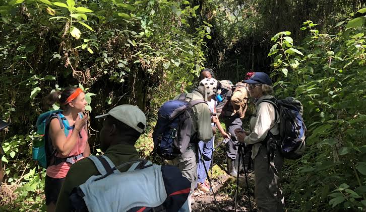
The ascent to Sine Camp is steady and immediately engaging. The forest deepens as altitude increases. Bamboo appears and then thickens into groves that filter the light into green columns. The air is saturated; the famous Rwenzori moisture is not simply weather but a quality of the landscape itself, as fundamental to the experience as the rock beneath the trail. Sine Camp arrives in a forest clearing at 2,610 meters: a solid mountain hut with sleeping platforms, a cook’s area, and the particular satisfaction of a first camp well and truly earned. Your cook has arrived ahead of the main group; hot food is waiting.
Accommodation & Meals: Sine Camp hut (2,610m). Full-board dinner and all subsequent meals included. The mountain rhythm begins tonight.
Day 3: Sine Camp (2,610m) to Kiharo Camp (3,061m) | ~9 km | Approximately 5–6 hours
The transition from montane forest to giant heather zone is one of the defining experiences of any Rwenzori expedition, and it is on Day Three that it announces itself in full. The bamboo gives way, the canopy opens and closes in different configurations, and then, unmistakably, the heathers begin. Erica arborea, the dominant species, has reached heights here that exist nowhere else on earth where this genus grows: five, six, or eight meters of gnarled trunk wrapped so completely in sphagnum moss that the wood beneath is entirely invisible. The effect is one of profound strangeness, as though something older than taxonomy has reimagined the forest.
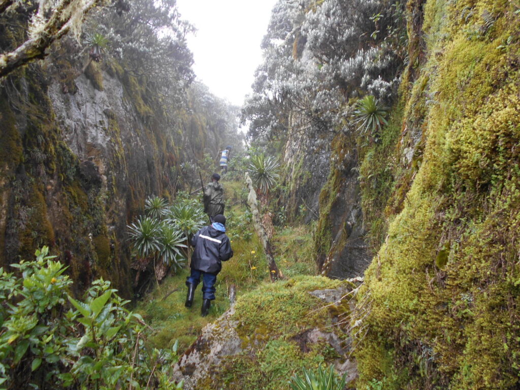
The path narrows and becomes more technical. Roots and moss-covered stones require consistent attention underfoot, and your guide’s natural, unhurried pace sets the rhythm that will carry you efficiently through the day without depleting reserves needed for the days ahead. Three-horned chameleons occasionally appear in the heather branches, slow, deliberate, and almost perfectly camouflaged, providing moments of delight that require nothing more than the willingness to look carefully at what is already there.
Kiharo Camp sits on a small ridge at 3,061 meters, perched at the transition between heather forest and the open moorland zones above. The views west over the Kilembe Valley open up on clear evenings with a beauty that is entirely disproportionate to the modest elevation gained. The mist that rolls in after sunset is not unwelcome, it is atmospheric, and it settles on the camp with the gentle authority of a familiar presence. Dinner is hot and substantial; your cook reads the energy levels of the group and responds accordingly.
Accommodation & Meals: Kiharo Camp hut (3,061m). Full-board meals throughout.
Day 4: Kiharo Camp (3,061m) to Bugata Camp (3,750m) | ~8 km | Approximately 5–7 hours
Day Four is when the Rwenzori stops resembling anything you have encountered in other mountain ranges and becomes entirely, overwhelmingly itself. The path climbs out of the heather forest into the afro-alpine zone, the giant lobelia and Senecio moorland that has made the Rwenzori famous among botanists, geographers, and everyone who has ever seen a photograph of this landscape and felt the immediate, irrational desire to stand inside it.
Giant Lobelia wollastonii rises two to three meters from the bog, its silver-blue rosettes pointing skyward in silent congregation. Tree groundsel, Senecio adnivalis, forms loose groves between the path’s boardwalk sections, their silver-backed leaves catching the diffused light with photographic precision. The trail crosses numerous streams on wooden bridges and traverses long stretches of elevated boardwalk designed to protect the delicate bog vegetation beneath, a reminder that you are walking through an ecosystem of extraordinary fragility and irreplaceable value.
Altitude is a genuine companion by this stage of the journey. At Bugata Camp’s 3,750 meters, the air has thinned sufficiently to make sustained exertion feel meaningfully different from sea level. The body is adapting; this process is entirely normal, and your guide monitors the group with practiced, unobtrusive attentiveness. The communal space at Bugata Camp is where the expedition’s daily acclimatization briefing takes place: symptoms to watch for, hydration protocols, and tomorrow’s approach to the operational hub at Bujuku. A stone-built refuge against the cold, the camp is comfortable by mountain standards and genuinely welcoming.
Accommodation & Meals: Bugata Camp hut (3,750m). Full-board meals. Altitude acclimatization assessment by your certified lead guide will take place this evening.
Day 5: Bugata Camp (3,750m) to Bujuku Camp (3,962m) | ~7 km | 4–5 hours | Acclimatisation Day
The Bujuku Valley opens before you like a painting from a world older than human memory. A vast, boggy floor of Afro-alpine vegetation stretches between dark rock walls, the Elena Glacier of Mount Stanley visible above its western edge like a rumor of permanence in a landscape otherwise defined by change. Lake Bujuku, a glacial tarn at 3,962 meters, reflects the sky in perfect stillness on clear mornings and disappears into clouds on overcast ones with equal beauty. The giant lobelias and groundsels here reach their greatest densities, forming a forest within a moorland, an ecosystem within an ecosystem.
This is deliberately the shorter day of the expedition, designed as an acclimatization buffer before the summit push begins tomorrow. Arriving at Bujuku Camp by early afternoon allows for genuine rest, limited exploration of the valley’s immediate surroundings, and the particular pleasure of sitting outside a mountain hut at nearly four thousand meters and simply looking at the terrain around you. The Elena Glacier, retreating, scientists estimate, toward complete disappearance within three decades, is visible from the camp entrance. To look at it in the afternoon light is to hold two things simultaneously: the joy of being here now and the quiet urgency of that ticking clock.
Your lead guide conducts a thorough summit briefing this evening. Tomorrow’s Margherita push requires a pre-dawn start, and the technical requirements—crampons, an ice axe, and the rope traverse above the glacier—are explained in practical, reassuring detail. Questions are answered. Kit is laid out and ready. The altitude is manageable. The body is prepared. The summit is tomorrow.
Accommodation & Meals: Bujuku Camp hut (3,962m). Full-board meals. This evening, your guide team fitted and checked your crampons and ice axes.
Day 6: Bujuku / Elena Camp (4,541m) to Margherita Peak (5,109m) to Return to Bujuku | ~6–8 hours round trip
The alarm sounds in the deep darkness before first light, and the cold inside Elena Camp at 4,541 meters is immediate and clarifying. There is no hesitation; you have been moving toward this moment for five days, and the body knows it. Crampons are fitted in torchlight. The rope is clipped. Your private lead guide checks each connection with the silent efficiency of someone who has done this hundreds of times and for whom each inspection is as important as the first.
The ascent of the Stanley Glacier begins on ancient ice, ice that has existed at this equatorial latitude for thousands of years and is now, measurably and irreversibly, retreating. Your crampons bite into the surface with a satisfaction that is partly physical and partly psychological: you are committed, moving upward, the darkness lightening by slow degrees around you. The guide’s pace is deliberate and sustainable. Behind you, the lights of the valley floor disappear as the gradient increases and the glacier narrows between rock walls that emerge from the ice like the prows of frozen ships.
Dawn arrives on the Stanley Plateau in stages: first a faint grey on the eastern horizon, then amber, then gold, and finally, as you approach the final rocky approach to the summit, a full equatorial sunrise that sets the horizon from Uganda to the Congo on fire. The summit push above the glacier requires rock scrambling on terrain that demands hands and full attention, your guide close, and the fixed ropes present on the steepest sections. And then, without announcement or fanfare, you are there. Margherita Peak, 5,109 meters. Africa’s third highest point.
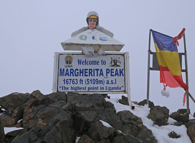
The view from Margherita on a clear morning is one of the finest on the African continent: the Congo Basin extending to the western horizon in an unbroken green immensity; the Rwenzori ridge curving away in both directions with Speke and Baker visible below; and the glacier falling away beneath your boots in a sweep of ancient ice that deserves all the reverence you can summon. You have earned every second of it.
The descent retraces the glacier route to Elena and then continues to Bujuku Camp, where a proper meal and the particular warmth of post-summit accomplishment await. Rest is not optional; tomorrow brings another peak.
Accommodation & Meals: Advance to Elena Camp (4,541 m) for the summit start, then return to Bujuku Camp (3,962 m). Full-board meals. Summit certificates will be presented to all Margherita summiteers.
Day 7: Bujuku Camp (3,962m) to Vittorio Emanuele Peak (4,890m) to Return to Bujuku | ~5–7 hours round trip
There is a particular quality to the certificates that follow a summit achieved the previous day. The body carries its experience with a different kind of awareness, tired in the deep, productive way that comes from genuine effort but also electrified by the residue of yesterday’s achievement. Breakfast at Bujuku is substantial, warm, and timed to allow proper fuelling before the second summit push.
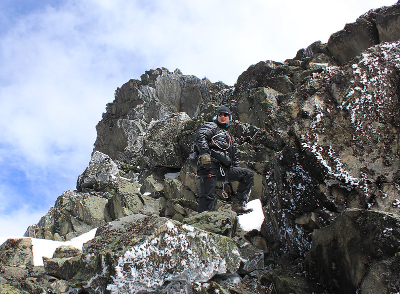
Mount Speke’s Vittorio Emanuele Peak at 4,890 meters is approached from the Bujuku Valley along a route that skirts the base of the Speke massif, ascending through the final lobelia moorland before reaching the rockier, more open upper slopes. The terrain is sustained but less technically demanding than the Margherita glacier; crampons are not required on the standard Speke approach, though the altitude and the cumulative physical investment of the preceding days ensure that nothing here is casual.
The summit of Vittorio Emanuele Peak offers a perspective on the Stanley massif that is unavailable from any other vantage point on this expedition: you look directly across to the line of yesterday’s Margherita ascent, able to trace the exact route of the glacier traverse from this adjacent elevation. The geography of the range reveals itself in three dimensions in a way that no map has fully prepared you for. Mount Baker’s Edward Peak is visible to the south, across the Scott-Elliot Pass that will be tomorrow’s crossing. The scale is both humbling and exhilarating.
The return to Bujuku Camp is the last night in this extraordinary valley. Your cook prepares a proper celebratory dinner; two summits in two days deserve something warm and generous, and the evening carries the easy satisfaction of a team that has moved through serious terrain and found itself equal to it.
Accommodation & Meals: Bujuku Camp hut (3,962m). Full-board meals. Final night in the Bujuku Valley.
Day 8: Bujuku Camp (3,962m) – Scott-Elliot Pass (4,372m) – Kitandara Camp (4,023m) | ~8 km | Approximately 5–6 hours
Scott-Elliot Pass, at 4,372 meters, is one of the Rwenzori’s defining geographical moments. Named for the naturalist who explored these mountains at the turn of the twentieth century, the pass sits on the lofty ridge dividing the Bujuku Valley to the north from the Kitandara Valley to the south, and from its narrow, wind-scoured saddle, the full scale of the range’s ambition becomes suddenly apparent.
The ascent from Bujuku to the pass climbs through the final lobelia and groundsel zones, past pools that freeze overnight and rock faces shattered by the same daily freeze-thaw cycle that has been working on this terrain since the last ice age. The trail requires consistent attention to the upper approach’s loose rock, some exposure, and the altitude, making every step feel more considered than lower down. Your guide sets the pace with the unhurried confidence of someone for whom Scott-Elliot Pass is familiar territory; the summit’s effort is calibrated, not punishing.
From the pass, the descent into the Kitandara Valley is one of the expedition’s finest walking stretches: a long, gradually declining traverse across the southern face of the Baker massif with the twin Kitandara Lakes shimmering below in their valley basin. These lakes, set in a broad, serene Afro-alpine hollow, form the most quietly beautiful camp setting of the entire expedition. The water is still. The surrounding vegetation has a different character from the northern valley. Mount Baker dominates the northeastern skyline, with Edward Peak visible and tomorrow’s objective.
Kitandara Camp, positioned between the two lakes at 4,023 meters, receives you with a warmth that only comes after a day of serious movement through exceptional terrain. The camp’s elevated position offers views looking back across the Scott-Elliot ridge and forward toward the Baker massif, making it worth staying awake as long as the cold permits.
Accommodation & Meals: Kitandara Camp hut (4,023 m). Full-board meals. Two summits completed; two to go.
Day 9: Summit Three: Edward Peak On Mount Baker (4,843m) Kitandara Camp (4,023m) – Edward Peak (4,843m) – Return to Kitandara | ~5–6 hours round trip
Mount Baker’s Edward Peak, at 4,843 meters, is a summit of genuine technical character, steeper, rockier, and more physically demanding in its upper approach than either of the two peaks preceding it. The ascent from Kitandara Camp departs before first light, climbing steeply up the eastern face of the Baker massif through rock and the remnant scrub that clings to the higher slopes with improbable tenacity.
The upper section of the Baker ascent involves sustained scrambling, hands and feet engaged, the exposure significant, and the rock demanding genuine respect in wet conditions. Your guide manages this section with the calm authority of deep familiarity, identifying the best lines, maintaining rope contact on the most exposed passages, and pacing the group to arrive at the summit with enough left in reserve to enjoy the moment rather than simply survive it.
Edward Peak, at 4,843 meters, is a compact, exposed summit point with panoramic views that sweep across the entirety of terrain you have covered. The Stanley massif, with Margherita’s summit ridge visible in clear conditions, sits to the north. The Speke massif rises to the northeast. Below, the Kitandara Lakes catch the morning light in their south-facing basin. It is a view that contextualizes everything, the distances covered, the altitude gained, and the effort sustained, and delivers it back to you as something extraordinary.
The return to Kitandara Camp is the last afternoon at these remarkable lakes. The evening is reflective and warm. Three summits are in the body’s memory. One remains.
Accommodation & Meals: Kitandara Camp hut (4,023 m). Full-board meals. Three summits achieved. Tomorrow, we will cross Freshfield Pass and approach Weismann.
Day 10: The Southern Arc — Kitandara to Weismann High Camp
Kitandara Camp (4,023m) → Freshfield Pass (4,282m) → High Camp (~4,200m) | ~7 km | Approximately 5–7 hours
Freshfield Pass, at 4,282 meters, is the second of the expedition’s two remarkable ridge crossings, and it connects the Baker-Kitandara world to the Luigi di Savoia massif in the south, a less-visited, more solitary section of the Rwenzori that carries a different quality of remoteness. The ascent from Kitandara is gradual and rewarding, winding through the final afro-alpine meadows where the vegetation has a different palette from the northern valleys: different mosses, different groundsel assemblages, and different silences.
From the pass, the view west across the Democratic Republic of Congo is one of the expedition’s most striking geographical revelations: an endless, forested immensity stretching to a horizon the eye cannot perceive. The Congo Basin, from this elevation, has a quality of endless depth, a green ocean viewed from a high cliff, the curvature of the earth faintly perceptible on the clearest days. To the north, the entire Rwenzori ridge you have traversed over the preceding days extends in its full, extraordinary length.
The trail descends from Freshfield into the approach terrain of the Luigi di Savoia massif, where Mount Luigi di Savoia, the Rwenzori’s least-visited major peak complex and the location of Weismann Peak, stands in isolated, rarely disturbed magnificence. The high camp established for the night at approximately 4,200 meters places you perfectly for an early push tomorrow. The evening here is one of the quietest of the entire expedition: fewer trekkers reach this section than any other, and the sense of genuine remoteness is palpable. Your cook produces a warm, generous dinner that is both practical sustenance and something of a ceremony.
Accommodation & Meals: High camp near the Weismann approach (~4,200m). Full-board meals. Final summit briefing conducted by your lead guide.
Day 10: High Camp (~4,200 m) – Weismann Peak (4,627m) – Kilembe Trailhead (1,590m), Kasese
The fourth and final summit morning of this expedition has a different emotional texture from all the others. There is the same pre-dawn cold, the same quiet efficiency of kit preparation, the same focused calm of a team moving toward an objective. But there is also the knowledge that this is the last time, the last summit start, the last glacial darkness, and the last test of what the mountain can ask and what you can give.
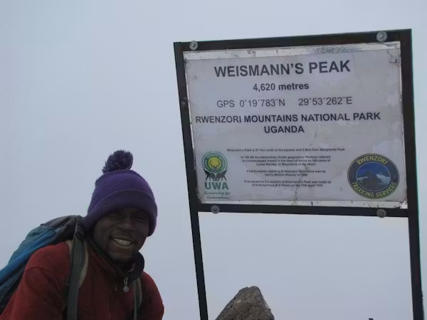
Weismann Peak, the summit of Mount Luigi di Savoia at 4,627 meters, is reached by a scrambling approach over loose rock and heather that requires confident footwork and occasional hand placements on steeper sections. Fixed ropes assist climbers on the most technical passages. The summit itself is a broad, flat-topped point with exceptional views south toward the Congo border and north along the full Rwenzori ridgeline, a farewell panorama from one of the range’s most remote and least-climbed high points. You have earned the solitude of this summit in every possible sense.
The descent from Weismann is the longest single downhill movement of the expedition: a sustained, multi-hour drop of more than 3,000 meters of altitude, returning through the heather zone, the bamboo groves, and the lower forest to the Kilembe Trailhead at 1,590 meters. The descent is demanding, the legs working against gravity’s accumulated pull, but the knowledge of what has been achieved makes every downward step feel like a kind of celebration.
At the trailhead, your private vehicle is waiting. Your dedicated driver has the cooler stocked. The Kasese hotel has been notified of your arrival time. A hot shower and a proper meal are imminent, and the mountain (all four summits) is behind you.
The evening in Kasese is one of those rare times when the distance between where you have been and where you are now is so great that the ordinary pleasures of a hotel room inspire almost absurd gratitude. Clean clothes. A real bed. A dining room with a menu. You have just completed one of Africa’s most ambitious mountain expeditions, and it is perfectly acceptable to sit with that for a while.
Accommodation & Meals: Kasese hotel (post-trek night). Dinner included. All mountain certificates were presented. Your team arranges the transfer to Entebbe or onward destination.
What the cost of 10-day Rwenzori trek to a 4-peak expedition covers
The Rwenzori Trekking Expeditions’ 10-Day Four Peaks Rwenzori trekking package is structured as a fully inclusive expedition. From the moment your team meets you at Entebbe Airport or your Kampala hotel to the moment your post-trek transfer departs Kasese, every logistical element is pre-arranged, confirmed, and handled by your dedicated expedition team. The investment below covers everything that matters. For complete transparency, we list the few personal items outside this scope in the exclusions.
Included in Your Package
| Private vehicle transfers: Entebbe or Kampala → Kasese (arrival) and return | ✓ |
| Kasese hotel to Kilembe Trailhead transfer on Day 1 and return on final day | ✓ |
| Pre-trek night accommodation in Kasese (including dinner) | ✓ |
| Post-trek night accommodation in Kasese (including dinner) | ✓ |
| All Uganda Wildlife Authority (UWA) national park entry fees | ✓ |
| All four peak permits: Margherita, Vittorio Emanuele, Edward, Weismann | ✓ |
| One certified professional lead mountain guide (private — your group only) | ✓ |
| Assistant mountain guides (scaled to group size; minimum 1 per 4 trekkers) | ✓ |
| Full dedicated porter team, personal kit portage up to 15 kg per trekker | ✓ |
| Cook throughout the mountain trek (full-board, three meals and hot drinks daily) | ✓ |
| All mountain hut accommodation across 9 nights on the Kilembe Trail | ✓ |
| Crampons and ice axes provided for the Margherita glacier approach | ✓ |
| Fixed-line rope support on technical summit sections | ✓ |
| Emergency oxygen canister carried by guide team | ✓ |
| Comprehensive wilderness first-aid kit carried at all times | ✓ |
| UWA-mandated rescue fund levy | ✓ |
| Pre-trek equipment check and gear inspection | ✓ |
| Altitude acclimatisation monitoring throughout by certified guide | ✓ |
| Summit certificates for all four peaks successfully summited | ✓ |
Not Included
| International flights to and from Entebbe International Airport | ✗ |
| Uganda tourist visa (obtainable online at visas.immigration.go.ug or on arrival) | ✗ |
| Comprehensive travel and medical insurance, including emergency mountain rescue cover — mandatory | ✗ |
| Personal trekking and mountaineering equipment: boots, gaiters, sleeping bag (-5°C rated minimum), layers, poles | ✗ |
| Personal porterage above the 15 kg per-trekker guideline | ✗ |
| Alcoholic beverages | ✗ |
| Personal medical supplies and altitude sickness medication (acetazolamide/Diamox — consult your doctor) | ✗ |
| Gratuities for guides and porters, entirely discretionary but warmly appreciated and genuinely impactful | ✗ |
| Optional pre- or post-expedition nights in Kampala, Fort Portal, or Kasese beyond those specified | ✗ |
| Any optional extensions: gorilla trekking in Bwindi, wildlife in Queen Elizabeth, chimpanzee trekking in Kibale | ✗ |
Why HirePorters For Your Safari
The Rwenzori porter team is not a support service. They are the expedition. Local Bakonzo men and women, most of whom were born and raised in the shadow of the mountains their community has lived beside for generations, are your porters, carrying the weight that makes the trekking experience possible not just physically but also culturally, experientially, and humanly. They move through terrain that would exhaust an unloaded trekker at a pace that still leaves room for conversation, laughter, and the unhurried certainty of people who belong completely to a landscape.
Rwenzori Trekking Expeditions fully follows Uganda Wildlife Authority porter welfare regulations, which include maximum porter loads of 15–18 kg (not counting their equipment and food), wages at or above the UWA-mandated minimum, hot meals at every camp, and appropriate shelter in porter-designated accommodation. We go further: our porters are equipped, respected, and treated as the professional specialists they are. Fair tipping at the expedition’s close is not required but is genuinely life-changing for families in the Rwenzori foothills; your guide will advise on appropriate amounts at the appropriate time.
Getting There—How to get to Kilembe Trailhead
The Kilembe Trailhead sits 14 kilometers from Kasese town in western Uganda’s Rift Valley. You can reach Kasese by private vehicle from Kampala (approximately 380km, 6–7 hours) or from Entebbe International Airport (approximately 420km, 7 hours). The most comfortable and seamlessly handled option is a private transfer arranged entirely by Rwenzori Trekking Expeditions, where your dedicated vehicle meets you at Entebbe arrivals or your Kampala hotel and delivers you, with a proper mid-journey lunch stop, to your Kasese accommodation. Your package includes all trailhead transfers on Day One of the expedition and the return transfer at the expedition’s close.
For trekkers transiting through Fort Portal, the road south to Kasese takes approximately 90 minutes and passes through scenery of considerable beauty. Kasese has reliable accommodation options ranging from comfortable guesthouses to quality mid-range hotels, and your Rwenzori Trekking Expeditions team will have your pre-trek accommodation pre-confirmed and ready on arrival. For a comprehensive guide to Kasese as an expedition base, visit the Getting There section on our website at www.rwenzoritrekkingexpeditions.com.
When is the best time/season to Attempt the Four Peaks (Margherita, Vittorio Emmanuele, Edward, Weismann)
The Rwenzori Mountains receive up to 3,000mm of annual rainfall — one of the highest precipitation rates of any mountain range in Africa. The Rwenzori is a mountain that is wet by nature, and understanding the seasonal rhythms is essential to planning an expedition whose four-summit objective demands the best possible conditions on multiple consecutive summit days.
December through February
January and February are the finest months for visiting/trekking/hiking/climbing Margherita Peak, Edward Peak, Vittorio Emanuele, and Weismann’s Peak and should be the first choice for anyone committed to maximizing summit success across all four objectives. The primary dry season brings the clearest skies of the year, the most stable glacier conditions on the Margherita approach, and generally firmer trail conditions through the high bog sections of the Kilembe Trail. The snowpack on the Stanley Plateau is most predictable, and the Elena Glacier’s crossing conditions are the best they will be all year. Pre-dawn summits starting on Margherita and Speke frequently deliver clear conditions that extend well into the morning, giving the expedition’s key photographic and experiential moments the light they deserve.
June through August—Secondary Season
The secondary dry window of June through August offers another strong opportunity for the Margherita peak, Vittorio Emmanuele peak, Edward peak, and Weissmann peak. June and early July tend to provide the best conditions within this window, with August occasionally marking the onset of the shorter wet season. This period is particularly popular among trekkers combining the Rwenzori expedition with gorilla trekking in Bwindi Impenetrable Forest; the two activities fit naturally in the same journey, and the gorilla trekking in August aligns well with mountain conditions. Visit our Rwenzori trekking and gorilla safari combination page on www.rwenzoritrekkingexpeditions.com for details on designing this dual adventure.
March–May and September–November
Shoulder and Wet Seasons)
The long rains of March through May and the short rains of September through November make trekking the Four Peaks (Margherita Peak, Edward Peak, Vittorio Emmanuele Peak, and Weismann Peak) substantially more challenging. Trail conditions in the high bog sections become significantly harder, river crossings require more caution, and the glacier approach on Margherita carries greater unpredictability. The summit success rate across all four peaks is lower in these months, and back-to-back summit days in wet conditions ask considerably more of both trekkers and guides. That said, the Rwenzori in the wet season has a fierce and particular beauty; the vegetation is at its most lush, the waterfalls are at full volume, and the huts are dramatically quieter. Determined, experienced trekkers who accept the conditions and carry appropriate gear can still complete this expedition in the wet season. Speak to your Rwenzori Trekking Expeditions consultant for honest seasonal advice specific to your travel dates.
Combining with Queen Elizabeth and Bwindi
If your Uganda journey extends beyond the Rwenzori to include wildlife viewing in Queen Elizabeth National Park or gorilla trekking in Bwindi Impenetrable Forest, the June through August window remains the strongest all-round seasonal choice. Queen Elizabeth’s savannah wildlife concentrates around water sources in the dry season, making game drives and the celebrated Kazinga Channel boat cruise particularly productive.
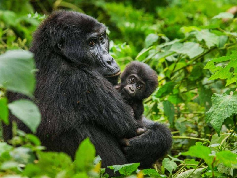
Bwindi’s gorilla trekking is available year-round, but drier forest conditions in June through August make tracking easier and photography more rewarding. Rwenzori Trekking Expeditions designs seamlessly combined Uganda itineraries that bring all three experiences together within a single, privately managed journey.