DAY 1 | Kilembe Village to Sine Camp — Into the Nyamwamba Gorge Kilembe Gate (1,463m) – Sine Camp (2,350m) | 4–5 Hours | ~7km | +887m |
The 8-day Cheptegei Peak hike begins at a place that announces itself through history before it announces itself through nature. Kilembe village, 12 kilometers from Kasese on a well-maintained dirt road, was for decades the center of Uganda’s copper mining industry, and the rusting conveyors, weathered headframes, and old processing buildings visible from the Uganda Wildlife Authority registration post are a fittingly industrial prologue to a journey that will carry you from the remnants of extraction to one of Africa’s most pristine alpine environments. Your private guide handles the registration formalities and introduces the porter team while you adjust pack straps and take the first deep breath of mountain air.
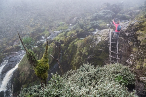
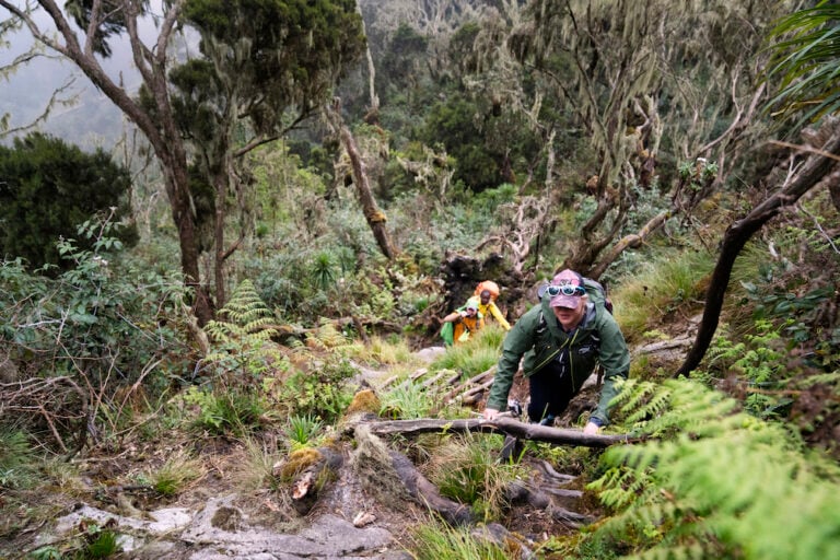
The trail enters the Nyamwamba River gorge almost immediately, the world narrowing to the width of the valley, and the sound of the river, powerful, white, and constant, replaces all other noise within minutes of the trailhead. The gorge forest is exuberantly tropical at this elevation: Ficus and Albizia trees form a high canopy, the understory thick with wild gingers, enormous ferns, and the first mosses beginning to colonize the shadier surfaces. In the first hour, you will cross two log bridges over the Nyamwamba, each requiring a careful, single-file approach that your guide demonstrates with practiced certainty; the planks are always damp, and while the river below is not dangerous at the crossing points, it provides a compelling reason to watch your footing.
The trail steepens consistently as the morning passes, the riverine forest gradually acquiring the denser, darker character of the lower montane zone. The first Rwenzori turacos appear in the canopy above, their red wing flashes brief and startling in the green, and your guide begins the running natural history commentary that will be one of the defining qualities of the next eight days. Since Camp arrives in a sheltered forest clearing at 2,350 meters in the late morning or early afternoon, its metal-frame hut is set back from a stream crossing with filtered views down toward the Nyamwamba gorge, and the Kasese plain is visible as a distant bright strip far below. The mountain cook has the first hot meal of the trek on the fire within 30 minutes of arrival.
Accommodation Sine Camp (2,350m) — staffed mountain hut with sleeping platforms | Meals: Breakfast in Kasese, Packed Lunch on trail, Dinner at camp | Walking Time: 4–5 hrs | Rubber boots: Mandatory from Day 1 |
DAY 2 | Sine Camp to Samalira Camp: Waterfalls, Bamboo and the First Heather World Sine Camp (2,350m) → Samalira Camp (2,700m) | 5–6 Hours | ~8km | +350m |
Day 2 of the 8-day Cheptegei Peak Rwenzori trek is the day that cements the Kilembe Trail’s reputation as the most scenically dramatic approach to the Rwenzori range. The trail climbs from Sine Camp through a bamboo zone that becomes progressively denser with altitude, with the giant mountain bamboo, Sinarundinaria alpina, arching overhead in natural tunnels of pale green light and a floor of soft fallen leaves that makes the walking almost luxurious underfoot. Black-and-white colobus monkeys are frequently heard and seen in the bamboo canopy here, the territorial calls of adult males carrying through the valley well before the animals themselves become visible.
The waterfalls of the Kilembe Trail midsection are among the finest in Uganda, and you encounter them repeatedly on this day’s walking. Multiple cascades fall off the Nyamwamba gorge walls in long, foaming curtains, the largest dropping more than 40 meters into the river below, and your guide knows the exact viewpoint, approximately two hours from Sine Camp, where the main cascade is framed most dramatically. A photographer’s pause here is not optional; it is the trail’s obligation. The spray from the falls carries across the trail on any breeze, adding a fine, cold mist to the air that sharpens the senses and makes the vegetation on either side luminously green.
Above the waterfall section, the forest transitions decisively into the heather zone. Erica arborea trees, draped entirely in hanging moss and lichen, close in on both sides of the trail, their root systems creating a simultaneously beautiful and uneven surface underfoot. Samalira Camp, at 2,700 meters, sits at the upper edge of this heather forest transition, a short distance above a waterfall that is still audible from the camp clearing on still mornings. The camp’s position in the heather-forest interface makes it one of the finest birdwatching camps on the entire Kilembe Trail; the diversity of Albertine Rift endemic species here is exceptional, and your guide’s identification commentary over dinner is as enjoyable as the bird list is impressive.
Accommodation Samalira Camp (2,700 m)—staffed mountain hut | Meals: Breakfast, Packed Lunch, Dinner | Walking Time: 5–6 hrs | Birdwatching highlight: Rwenzori turaco, Doherty’s bushshrike, three-horned chameleon |
DAY 3 | Samalira Camp to Mutinda Camp — Into the Afro-Alpine Samalira Camp (2,700m) – Mutinda Camp (3,535m) | 6–7 Hours | ~10km | +835m |
The third day is the most physically demanding of the lower mountain section and the day on which the Kilembe Trail reveals its full ecological ambition. The trail climbs 835 meters over approximately 10 kilometers—not extreme by mountain standards but sustained, with several steep sections on a root-covered, often muddy path that requires steady concentration. An early departure is non-negotiable: 7:00 AM at the latest to ensure arrival at Mutinda before afternoon cloud and associated rain close the views that make the camp worth every step of the ascent.
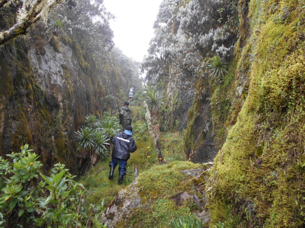
The first two hours from Samalira pass through progressively older and more dramatically draped heather forest, with trees that grow shorter and more moss-encrusted with each 100 meters of altitude, their trunks accumulating 20 to 30 kilograms of living epiphytic material in the perpetually damp air. And then, at approximately 3,000 meters, the forest opens abruptly onto open Afro-alpine moorland: from enclosed green tunnel to open sky in a single stride, from forest birds to wind and the immensity of the mountain above, from the sound of water to silence. The effect is immediate and profound.
The first giant groundsel trees, Senecio adnivalis, growing to four and five meters with their thick, corky trunks and alien cabbage-rosette heads, appear on the moorland slopes immediately above the treeline, standing in scattered groups that look precisely as extraordinary as every photograph of them suggests and somehow still more so in person. This area is where the Kilembe Trail’s botanical uniqueness is most fully expressed: a landscape that exists nowhere else on earth in quite this form, managed by altitude and the Rwenzori’s moisture into something between a prehistoric garden and a fever dream. Giant lobelias begin appearing at around 3,200 meters. By the time Mutinda Camp appears on its prominent ridge at 3,535 meters, the mountain has made its definitive argument for why this approach is worth every muddy step.
⚠ Safety & Medical Notice At 3,535 meters, Mutinda Camp is high enough for mild altitude symptoms—headache, reduced appetite, and slight nausea—to be common on Day 3 arrival. These are normal acclimatization responses. Drink 3–4 liters of water throughout the day, eat what your appetite allows, and report any symptoms clearly to your guide. The Rwenzori Trekking Expeditions guide conducts a full health assessment at every camp. Symptoms that do not resolve overnight require an honest conversation about the schedule ahead. |
Accommodation Mutinda Camp (3,535 m)—staffed mountain hut | Meals: Breakfast, Packed Lunch, Dinner | Walking Time: 6–7 hrs | Panoramic views to Kasese plains and Lake George on clear evenings |
DAY 4 | Mutinda Camp to Bugata Camp — Deep into High Country Mutinda (3,535 m)—Bugata Camp (4,062m) | 5–6 Hours | ~8km | +527m |
Day 4 of the 8-day trek Cheptegei Peak Rwenzori Trek carries the team above 4,000 meters for the first time, a significant physiological threshold that the previous three days of gradual acclimatization have prepared the body for—and the landscape above 4,000 meters on the Kilembe Trail is unlike anything the lower sections could have suggested. The giant lobelias of the Afro-alpine zone are most spectacular on the approach to Bugata Camp: individual Lobelia wollastonii plants stand four and five meters tall, with meter-long flower spikes rising above silver-green rosettes of waxy leaves, back-lit by the morning sun against the darkening sky of the high mountains. The effect is simultaneously prehistoric and somehow perfectly ordered, as though evolution designed this landscape to stop trekkers in their tracks, which it reliably does.
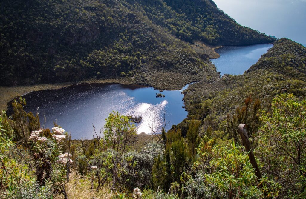
Above the lobelia zone, the trail enters a boulder field section of ancient Rwenzori gneiss and granite, dark water-worn rock covered in bright orange and grey lichens, the footing demanding careful attention but presenting no technical climbing. Your guide moves through this section with the unhurried confidence of someone who knows every significant boulder by disposition and every safe line through the labyrinth. At approximately 3,900 meters, a series of small glacial tarns appear, their still, dark surfaces reflecting the sky and bordered by cushion plants and the last tenacious groundsels, their silence absolute at this altitude.
Bugata Camp, at 4,062 meters, sits on a flat, sheltered terrace above the tarn system with views in all directions that qualify it as one of the finest mountain camp positions in East Africa. The Nyamwamba valley falls precipitously away to the west; the Rwenzori central massif rises in all its full complexity to the north; and on clear evenings the Virunga volcanoes on the Congo border are faintly visible to the southwest, their conical profiles unmistakable against the darkening sky. Temperatures at Bugata drop to between 0 and 4 degrees Celsius overnight. Your guide’s evening health assessment is thorough and genuinely important; tomorrow’s move to high camp depends entirely on how the team is responding to the altitude reached today.
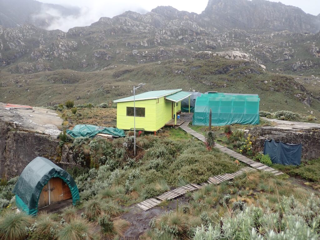
Accommodation Bugatá Camp (4,062 m) — staffed mountain hut | Meals: Breakfast, Packed Lunch, Dinner | Walking Time: 5–6 hrs | O₂ saturation monitoring: Daily health assessment by guide |
DAY 5 | Bugata Camp to High Camp — The Critical Altitude Night Bugata Camp (4,062m) → High Camp (~4,500m) | 3–4 Hours | ~5km | +438m | Acclimatisation Day |
Day 5 of the 8-day Cheptegei Peak trek is the most precisely designed day of the itinerary, not the longest or hardest, but the most important. The objective is simple and deliberately limited: move to the high camp at approximately 4,500 meters, establish the tented camp that the porter team carries up, rest completely for the remainder of the day, eat a full hot dinner, and sleep as well as the altitude allows before the 3:30 AM summit wake-up call. The short distance covered today is not a concession to weakness; it is the physiological intelligence at the center of why the 8-day Cheptegei Peak Trek works.
The trail from Bugata to the high camp crosses the upper boulder zone and gains the final ridge system that forms the approach to the Cheptegei summit pyramid. Vegetation becomes progressively sparser and more frost-adapted, with scattered cushion plants of Alchemilla argyrophylla, frost-tolerant mosses in the sheltered rock crevices, and extensive lichen communities on the exposed faces, which are the only living things able to survive this close to the summit. If the morning is clear, the Cheptegei summit itself becomes visible for the first time from the high camp position, a rocky, angular peak rising against the blue at 4,907 meters, now identifiably close after five days of approach. The sense of arrival is unmistakable.
After establishing camp, the afternoon belongs entirely to rest. No photography hikes. No summit reconnaissance walks. Lie down; keep warm; drink three liters minimum; eat what your appetite allows, which at 4,500 meters may be less than you expect, and let the body perform as much acclimatization as five days of gradual ascent make possible. The summit briefing takes place in the late afternoon: route conditions, gear check, crampon inspection (not needed for Cheptegei’s rocky summit, but poles and gaiters are essential), turnaround protocol (10:00 AM regardless of position), and emergency descent procedure. Be in your sleeping bag with your summit kit ready at 8:00 PM. The alarm at 3:30 AM comes sooner than you expect.
Accommodation High Camp (~4,500m) — tented camp, sleeping mats provided (bring your own -10°C sleeping bag) | Meals: Breakfast, Hot Lunch, Dinner | Walking Time: 3–4 hrs | Summit Briefing: Comprehensive route, safety, and turnaround review this evening |
DAY 6 | SUMMIT DAY — Cheptegei Peak (4,907m) and Return to Bugata High Camp (4,500m) [4:00 AM] → Cheptegei Peak (4,907m) → Bugata Camp (4,062m) | 9–11 Hours Total |
The guide’s knock comes at 3:30 AM. At 4,500 meters in the darkness above the Rwenzori range, this moment has a quality that is impossible to replicate at lower altitudes: The cold is immediate and penetrating, the silence above the tented camp is absolute, and the sky, on a clear night, is blazing with equatorial stars so dense that the Milky Way casts a faint shadow. The cook has hot tea and energy food ready. Headtorches come on. Trekking poles are taken from their overnight shelter inside the tent vestibule. At 4:00 AM exactly, the team steps out onto the frozen ground, and the summit attempt begins.
The pre-dawn ascent from the high camp follows the ridge trail northward in darkness, climbing steeply over rocky ground that the headtorch illuminates in a narrow moving pool of light. The wider darkness makes the mountain feel vast and immediate simultaneously, the ridge falling away on both sides into nothing, the summit somewhere above the last stars, the sound of boots on rock the only constant. The first sustained challenge is a boulder-field section at approximately 4,600 meters that requires careful route-finding in the pre-dawn darkness; your guide moves through it with the instinctive knowledge of someone who has made this ascent many times, reading the rocks without hesitation.
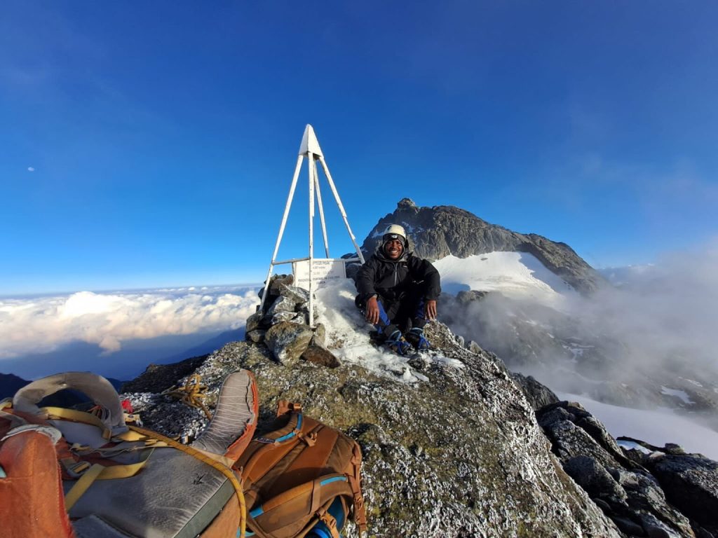
Above the boulder field, the ridge narrows and the angle eases briefly before the summit pyramid’s final approach. The rocky steps of the Cheptegei summit are a series of steep but manageable scrambles on solid Rwenzori gneiss, and at this altitude, the thin air makes each move require twice the effort it would at sea level, but the climb is well within the capability of any trekker who has managed the five days preceding this moment. Your guide leads the team up the clearest line, which shifts slightly with seasonal frost and ice on the rock faces. By approximately 7:00 to 8:00 AM, three to four hours after departure from the high camp, the team arrives on the summit of Cheptegei Peak at 4,907 meters.
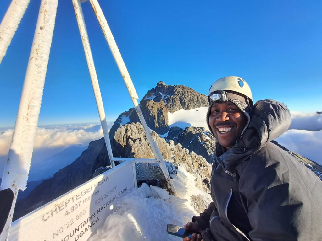
The summit view at 4,907 meters on a clear morning is one of the finest panoramas available from any non-glaciated summit in East Africa. To the north, the full Stanley massif rises with its glaciers pale and massive against the blue sky. To the east, Mount Baker and the Freshfield Pass are visible in their entirety. To the west, the Kilembe valley drops 3,400 meters in a single astonishing plunge to the Kasese plain below, and beyond it, the dark, endless canopy of the Congolese lowland forest fills the horizon. Fewer than 300 people have stood at this point and looked at this view each year. The silence on the summit, when the wind allows, is one of genuine remoteness.
The descent from Cheptegei reverses the ascent route; the same boulder-field navigated in daylight is now easier to route-find but harder on weary legs. Most teams reach the high camp by mid-morning, pack down the tented camp with the porter team, and continue the descent to Bugata Camp in the early afternoon. The evening at Bugata has a character that every post-summit camp shares: the mountain above, completed and behind you; the comfortable, familiar weight of achievement; and a dinner that tastes better than any you will eat at sea level for a considerable time.
Accommodation Bugata Camp (4,062m) | Meals: Pre-summit tea, Packed Lunch, Dinner | Summit: 4,907 m, Cheptegei Peak, Kilembe Trail | Total Walking Time: 9–11 hrs | Turnaround Protocol: 10:00 AM regardless of position, non-negotiable |
DAY 7 | Bugata Camp to Samalira Camp — The Great Descent Bugata Camp (4,062m) – Mutinda (rest stop) – Samalira Camp (2,700m) | 6–8 Hours | -1,362m |
After the physical and emotional intensity of summit day, the descent through the Rwenzori’s ecological zones has a particular contemplative quality, the mountain unreeling below as it was assembled above, each zone reappearing in reverse. From Bugata Camp, the trail moves back through the upper boulder field and into the giant lobelia moorland, where the lobelias are now backlit by the morning sun in a way the ascent never offered. The dew on the cushion plants catches the light. The moorland birds, augur buzzards riding the thermal currents above the open ground, and Rwenzori ravens calling from the rock faces, are active in the morning hours. It is, as your guide will observe, a different mountain going down than it was going up.
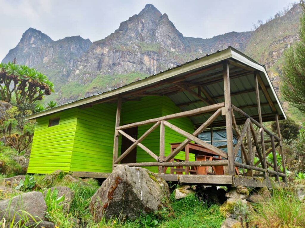
Mutinda Camp, at 3,535 meters, is a natural lunch stop at the midpoint of the day, its panoramic ridge viewpoint providing a final elevated perspective before the trail drops below the treeline. The Kasese plain far below and the faint shimmer of Lake George to the south look impossibly distant and flat after a week spent in this vertical country. The heather forest zone on the descent seems richer and more mysterious than on the ascent; the light at this hour filters through the moss-draped trees differently, and the tree forms are more dramatic when seen from above as the trail descends into them rather than climbing through them.
Samalira Camp at 2,700 meters feels comparatively warm and welcoming after three nights above 4,000 meters; the temperature at 2,700 meters feels almost tropical by comparison with Bugata and the high camp. The waterfalls audible from the camp are now a familiar sound, contextualized differently by the week that has passed since they were last heard. Dinner this evening has a celebratory ease, charged with significance by the summit’s proximity; now that the achievement is confirmed, the conversation is more relaxed, and the mountain cook’s final pre-exit dinner is the best meal of the trek.
Accommodation Samalira Camp (2,700m) | Meals: Breakfast, Packed Lunch, Dinner | Walking Time: 6–8 hrs | Guide Tip: Trekking poles are essential; 1,362 m descent tests knees significantly. Rest for 10 mins every 90 mins on the downhill. |
DAY 8 | Samalira Camp to Kilembe Village — Completing the Circuit Samalira Camp (2,700m) → Sine Camp (lunch) → Kilembe Village Gate (1,463m) | 5–6 Hours | -1,237m | Trek Complete |
The final morning in the Rwenzori Mountains begins with birdsong; the heather-forest dawn chorus at Samalira is a concentrated expression of the Kilembe Trail’s extraordinary birdlife, with multiple species calling simultaneously in the darkness before light, a sound that requires no natural history knowledge to appreciate as something unusual and fine. After a full breakfast, the trail descends through the bamboo zone and back into the Nyamwamba riverine forest; the gorge is now familiar and somehow both more beautiful and less overwhelming than it was on Day 1: the perspective of the summit behind you lends everything below a quality of abundance rather than threshold.
The waterfalls of the lower trail appear again, still dramatic, still insisting on the pause and the photograph. Sine Camp is the lunch stop; its forest clearing, the site of the first mountain sleep eight days ago, is now serving as the final resting point before the exit. After lunch, the last section of trail to Kilembe Village descends through the lower forest, where the two river crossings on their log bridges are navigated with the casual confidence of trekkers who have been on significantly more demanding terrain. The Nyamwamba’s sound gradually diminishes behind the increasing noise of the village chickens, voices, and the sound of the Kasese Road as the trailhead emerges and the Rwenzori Mountains National Park boundary is crossed for the last time.
The Uganda Wildlife Authority rangers at Kilembe Gate issue trek completion certificates with the quiet satisfaction of people who know what eight days on the Kilembe Trail actually demands. Your porter and guide team gathers for the tip ceremony, a moment of genuine mutual acknowledgement, facilitated with care and cultural knowledge by your Rwenzori Trekking Expeditions lead guide, who knows the name of every family represented on the team and what this week’s pay means to each of them. Your private vehicle for Kasese is waiting. The drive back takes under 30 minutes, and the distance between the person who drove this road eight days ago and the person driving it now is not measured in kilometers.
Transfer Kilembe Village Gate—Kasese | Private vehicle | Meals: Breakfast, Lunch | Porter & Guide tip ceremony at gate—guidance and cultural context provided by lead guide | Trek Completion Certificates issued by Uganda Wildlife Authority |
How Difficult Is the 8-Day Cheptegei Peak Trek?
The 8-day Cheptegei Peak Rwenzori expedition is rated strenuous, which means it covers about 80 kilometers, gains 3,444 meters in altitude, has consistently demanding terrain on the Kilembe Trail, and reaches a summit altitude of 4,907 meters. It is one grade below the Very Strenuous rating assigned to the compressed summit itineraries on the Central Circuit trail, primarily because the 8-day schedule provides a genuinely good acclimatization profile. It is not, however, a trek that rewards complacency or inadequate preparation.
The Kilembe Trail’s Specific Challenges
Several characteristics make the Kilembe Trail more physically demanding than the Central Circuit for equivalent elevation gain. The Nyamwamba River gorge section is steeper, narrower, and more technically demanding than the Nyakalengija approach, with repeated river crossings that require sustained balance on wet log bridges. The peat bogs above Mutinda Camp are among the deepest and most extensive on any Rwenzori route; rubber boots are not merely recommended but operationally necessary, and traversing the Afro-alpine wetlands requires a sustained mental and physical engagement that straightforward path walking does not. The descent days, particularly Day 7’s 1,362-meter drop from Bugata to Samalira, impose significant load on knees and ankles over 6 to 8 hours on steep, rooted terrain.
Who This Trek Is Right For
The 8-day Cheptegei Peak expedition is ideally suited to trekkers who have completed at least one multi-day mountain trek of three or more days, can sustain 8 to 10 kilometers of daily walking carrying a 10-kilogram daypack, have some prior experience at altitudes above 3,000 meters, and are genuinely comfortable on steep, muddy, and technically varied terrain in wet conditions. Prior experience in the Rwenzoris is an advantage but not a requirement. The 8-day Cheptegei Rwenzori Trek provides sufficient acclimatization for most well-prepared trekkers to reach Cheptegei Peak without significant altitude-related difficulties.
Altitude Management
At 4,907 meters, Cheptegei Peak requires serious acclimatization consideration. The 8-day Cheptegei Peak Rwenzori Trek has a gradual ascent profile, gaining an average of 690 meters per day for the first three days and then slowing down, making it the most important safety feature of the itinerary. Your Rwenzori Trekking Expeditions guide conducts daily oxygen saturation monitoring and applies the universal altitude protocol without exception: symptoms of AMS that do not respond to rest and adequate hydration require descent. Before departure, you should discuss acetazolamide (Diamox) with your doctor as prophylaxis for the upper mountain days.
The five vegetation zones traversed on the Kilembe Trail across eight days represent one of the most complete and least-disturbed altitudinal botanical gradients in East Africa. Each zone transition is visually dramatic and ecologically significant, and the cumulative experience of moving through all five zones in a single expedition is one of the 8-day Cheptegei trek’s most distinctive rewards.
Zone 1: Riverine Forest (1,463m–2,000m)
Tall tropical species dominate the Nyamwamba Gorge forest at the base of the Kilembe Trail. Ficus, Macaranga kilimandscharica, and Polyscias fulva form the upper canopy above a rich understory of wild gingers, balsams, and enormous ferns. This area is prime habitat for olive baboons, black-and-white colobus monkeys, African fish eagles over the river, and the dense assemblage of forest birds that make the Rwenzori’s lower elevations one of Uganda’s premier birdwatching environments.
Zone 2: Montane Forest and Bamboo (2,000m–2,800m)
The heather-bamboo transition zone between Sine and Samalira camps is the Kilembe Trail’s richest section for close wildlife encounters and endemic bird species. Target species include the Rwenzori turaco, Doherty’s bushshrike, Rwenzori batis, white-starred robin, African green broadbill, and Rwenzori apalis. Three-horned chameleons, Trioceros johnstoni, a species unique to the Albertine Rift, are regularly encountered on tree trunks in this zone and are among the most photographed animals on the entire route.
Zone 3: Giant Heather Moorland (2,800m–3,500m)
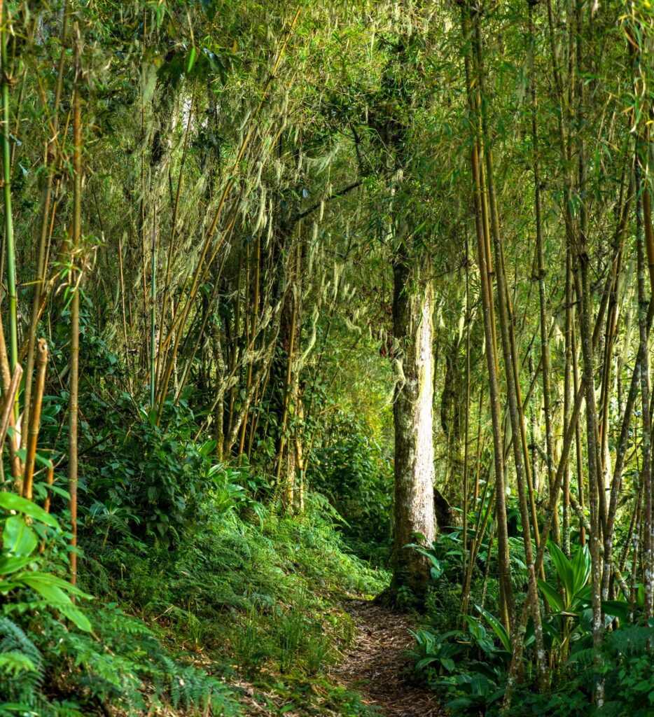
Ancient Erica arborea and Philippia benguelensis trees, draped entirely in hanging mosses and cushion lichen communities, line the trail through this zone, with individual trees accumulating 20 to 30 kilograms of living epiphytic material. Rock hyrax colonies occupy outcrops throughout the zone and are often heard calling in the evenings from the camp clearings. The three-horned chameleon range extends into the lower heather zone, and this species remains one of the Kilembe Trail’s most reliably seen endemic wildlife highlights.
Zone 4: Afro-Alpine Moorland (3,500m–4,400m)
Giant groundsels, Senecio adnivalis, reaching five meters in height, and giant lobelias, Lobelia wollastonii, which are similarly impressive, dominate the open moorland above Mutinda Camp. Both species are found only in the Afro-alpine zones of equatorial African mountains. Rwenzori leopard tracks are occasionally recorded in the soft peat of this zone. Augur buzzards circle reliably on thermal currents above the open moorland, and the Cape long-tailed starling appears near the upper camps.
Zone 5: High Alpine Rock (4,400m+)
Above the lobelia zone, vegetation reduces to scattered cushion plants, frost-adapted mosses, and extensive lichen communities on rock faces. This zone is defined more by geological character than biological richness. The ancient Rwenzori gneiss and granite, their surfaces colored by orange, grey, and black lichens, create a landscape of austere beauty that belongs entirely to the high mountain. The Cape long-tailed starling is occasionally seen near the high camp; otherwise, the only wildlife is the mountain itself.
Mountain Camps on the 8-Day Cheptegei Peak Trek
Sine Camp: 2,350m (Nights 1 and 7)
The trail’s first overnight stop sits at the edge of the heather transition zone in a sheltered forest clearing. The metal-frame hut provides sleeping platforms for up to 10 trekkers, with a separate cooking shelter and a stream water source 50 meters below camp. At the warmest overnight point on the itinerary, 10 to 12 degrees Celsius, Sine Camp is the ideal trail entry point and an appropriately celebratory final camp on the return descent. On Night 7, the warmth of Sine, after three nights above 4,000 meters, feels genuinely luxurious.
Samalira Camp: 2,700m (Nights 2 and 6)
Sitting at the upper edge of the heather forest zone with waterfalls audible from the clearing, Samalira is the finest birdwatching camp on the Kilembe Trail. The perpetual moisture of its position, directly above the waterfall spray zone and at the fog-forest boundary, means the air is always cool and damp; a fleece layer is appropriate after sunset in any season. The diversity of Albertine Rift endemic species visible from the camp clearing on still mornings is exceptional.
Bugata Camp, 4,062 m (Nights 3 and 5)
The highest established camp on the standard Kilembe Trail, Bugata sits on a flat terrace above the glacial tarn system with outstanding views in all directions. The metal-frame hut is simpler in construction than the lower camps; temperatures drop to 0 to 4 degrees Celsius overnight, and frost on the hut roof is common on clear nights. Water is sourced from the glacial tarns below camp. treated or boiled by the cook team as standard. This is the camp where the altitude begins to assert itself clearly and where the honest health assessment conversation has the most consequence.
High Camp, ~4,500m (Night 4)
The high camp is established using lightweight tents carried by the porter team on a rocky ridge below the Cheptegei summit pyramid. This is the coldest overnight of the entire trek; temperatures drop to -5 to -10 degrees Celsius on clear nights, and the wind at the exposed ridge can be significant. A sleeping bag rated to -10 degrees Celsius is mandatory; anything less adequate will compromise both sleep quality and summit-day performance. The high camp position provides the first clear view of the Cheptegei summit and, on clear evenings, a sunset over the Rwenzori that is the most beautiful evening of the entire expedition.
What Is Included in the 8-Day Cheptegei Peak Trek?
Every logistical, technical, and catering element of the expedition is managed by the Rwenzori Trekking Expeditions team so that your entire attention across eight days belongs to the mountain and the experience of being in it.
Fully Included
Your expedition includes all park entrance fees from the Uganda Wildlife Authority for 8 days, mountain hut fees for the staffed camp nights, and high camp tent setup fees.
A certified and experienced Kilembe Trail lead guide dedicated to your private group provides the primary safety and expertise throughout the trek.
An assistant guide accompanies every group of four or more trekkers.
A mountain cook provides three full meals per day from Day 1 lunch through Day 8 lunch.
A porter team, at a minimum ratio of one porter per trekker, carries all main luggage within the 15-kilogram limit.
The porter team supplies and erects high camp tents and sleeping mats. A comprehensive medical kit, including a pulse oximeter, altitude medication, and first-aid supplies, accompanies every expedition.
An emergency communication device is carried by the lead guide at all times.
Trek completion certificates are issued by the Uganda Wildlife Authority on Day 8 at Kilembe Gate.
The package includes private road transfers in both directions between Kasese and the Kilembe trailhead.
Not Included
International and domestic flights to and from Uganda, Uganda visa fees, and travel insurance are outside the package.
Travel insurance is mandatory and must include emergency medical evacuation from altitude (minimum USD $250,000 coverage), trip cancellation, and repatriation.
Personal trekking equipment, clothing, a sleeping bag rated to -10°C, rubber boots, trekking poles, and a personal day pack are the trekker’s responsibility. Rubber boots can be hired in Kasese; a full equipment list is provided on booking confirmation.
Personal gratuities for the guide, cook, and porter team, alcoholic beverages, any pre- or post-trek accommodation in Kasese or Kampala, and personal altitude medication (Diamox, available on prescription before departure) are also outside the package.
What Should I Pack for the 8-Day Cheptegei Peak Trek?
The Kilembe Trail is wetter than any other Rwenzori route throughout the year; the southwest-facing aspect and the Nyamwamba drainage system’s orographic effect create conditions where waterproof gear is operational equipment rather than optional comfort. The packing philosophy here is built around one overriding principle: no degree of waterproof protection is excessive. Every confirmed client receives a comprehensive, season-specific packing list; the following covers the critical categories.
Footwear: The Most Critical Decision
Rubber boots are mandatory on the Kilembe Trail, not a recommendation, not an option, but an operational requirement from Day 1 to Day 8. Conventional waterproof trekking boots will completely and rapidly fail against the Nyamwamba Gorge trail, the peat bogs above Mutinda, and the river crossings throughout the route. Knee-length rubber boots (Bogs, Hunter, or equivalent) with a firm inner sole are the correct choice. Bring lightweight trainers or sandals for hut use. For the summit approach from the high camp, gaiters over the rubber boots provide the additional ankle support and rock-face grip required for the Cheptegei pyramid scramble.
Clothing System
At least two sets of moisture-wicking base layers, merino wool strongly preferred for the Rwenzori’s persistent damp, form the foundation, with the ability to change into dry base layers at each camp critical for comfort and temperature management. A 250-weight fleece midlayer handles the temperature range between the lower forest and the heather zone. An insulated jacket rated to -10°C is essential from Bugata Camp upward and on summit morning, where wind chill can drop temperatures to -10 to -15°C. The critical outer layer is a fully waterproof, breathable shell jacket and matching trousers with completely taped seams rated to at least a 10,000 mm hydrostatic head: the Kilembe Trail’s persistent rain makes a substandard waterproof a genuine safety risk in the heather moorland and bog sections. A warm hat that covers the ears, a neck gaiter or balaclava for high camp and summit morning, lightweight inner gloves with insulated outer gloves for the summit, and at least four to five pairs of wool or synthetic socks complete the essential clothing system.
Sleep, Day Pack, and Technical Items
A sleeping bag rated to -10°C is mandatory for the high camp, where temperatures drop to this level on clear summit-eve nights. A sleeping bag liner adds meaningful warmth, margin, and hygiene. A 35- to 45-liter daypack with a waterproof rain cover carries trail essentials, water (minimum 2 liters), energy food, a warm layer, a headtorch with spare batteries (minimum 300 lumens; summit departure at 4:00 AM), a camera, and personal medications. Two adjustable trekking poles with rubber tips for the log bridges and rocky sections are essential on every day of this route and genuinely useful safety equipment rather than comfort accessories. Sunscreen SPF 50+ and quality UV-blocking sunglasses are critical above 4,000 meters; UV exposure at the summit altitude is severe.
The Kilembe Trail trailhead is located at Kilembe Village Gate, approximately 12 kilometers from Kasese town on a well-maintained dirt road accessible in any standard vehicle. Kasese is approximately 370 kilometers from Entebbe International Airport and 380 kilometers from Kampala, a road journey of five to six hours via the Mbarara–Fort Portal–Kasese highway. Rwenzori Trekking Expeditions coordinates all airport collections, road transfers, and trailhead logistics from Entebbe, Kampala, or Fort Portal as a seamlessly managed element of the expedition package. An overnight in Kasese the evening before Day 1 is mandatory for the equipment check, guide briefing, and early morning trailhead departure.
Domestic flights connect Entebbe to Kasese Airport (KSE) in approximately one hour, the fastest and most comfortable inbound option for trekkers arriving on international connections with limited recovery time. Charter options are available for same-day arrival and trailhead connection. For trekkers continuing to Bwindi Impenetrable Forest, Queen Elizabeth National Park, or other Uganda destinations after the trek, Rwenzori Trekking Expeditions coordinates onward logistics with the same care as the inbound arrangements.
Best Time to Trek Cheptegei Peak via the Kilembe Trail
December to February — Primary Dry Season
The December to February window provides the most settled trekking weather on the Kilembe Trail and the highest probability of clear summit views from Cheptegei Peak. Trail conditions are at their most manageable in this period; the peat bogs above Mutinda are firm enough for confident movement, the log bridge crossings are at their least treacherous, and the upper mountain rock on the summit approach dries sufficiently for confident scrambling. Daytime temperatures on the trail range from 6°C to 18°C depending on altitude; overnight at Bugata and the high camp can drop to -4°C on clear nights. This period is the window most recommended by Rwenzori Trekking Expeditions for first-time Kilembe Trail trekkers.
June to August — Secondary Dry Season
The long dry season from June to early September provides the year’s second most reliable trekking conditions and often the clearest summit panoramas. July and August in particular offer the highest probability of dry trail surfaces on the approach, and the Kilembe Trail’s famous waterfall section is still spectacular in this period, the falls carrying enough water to be dramatic without the seasonal flooding risk of the wet months.
This period is peak season; advance booking of two to three months is recommended for private expedition slots.
Wet Season Trekking—For the Experienced
The wetter months, “March to May and October to November,” bring the Kilembe Trail’s waterfall drama to its most spectacular state, the Afro-alpine moorland to its most lushly saturated, and the forest birdlife to its most frenetically active. For experienced trekkers who are fully equipped with appropriate rubber boots, reliable waterproofs, and the mental flexibility to embrace sustained wet conditions, the wet season Kilembe experience has a rawness and intensity that the dry season cannot replicate. Summit success rates are lower in the wet season due to summit-day visibility and wet rock on the Cheptegei pyramid, but they are not negligible for well-prepared teams with experienced guides.
Rwenzori Mountains National Park is a UNESCO World Heritage Site actively managed by the Uganda Wildlife Authority with an excellent safety record for guided trekking expeditions. Crime against trekkers within the park is extremely rare. The mountain guides and porters of the Kilembe community have maintained a professional safety culture across decades of expedition operations. Trekking operators and independent travelers consistently report security within and around the park as very good.
The primary safety considerations on a Cheptegei Peak expedition are altitude-related illness, the physical demands of the Kilembe Trail terrain, and the isolated character of the upper mountain, all of which are directly managed through the expertise, equipment, and protocols of the Rwenzori Trekking Expeditions guide team. Every expedition carries a comprehensive medical kit, including a pulse oximeter for daily monitoring, altitude medication (Diamox and dexamethasone), and a wilderness first-aid kit sufficient for the range of terrain-related injuries the Kilembe Trail presents. All lead guides are trained in wilderness first aid to WAFA standards.
The altitude management protocol is the most important single safety element on the Cheptegei Peak expedition. Symptoms of AMS that do not respond to rest and adequate hydration, severe headache unrelieved by ibuprofen, vomiting, loss of coordination, confusion, or shortness of breath at rest, require immediate descent. The guide, not the trekker, makes this decision, which is non-negotiable. The 8-day Rwenzori Trek to Cheptegei Peak itinerary schedule significantly reduces the statistical likelihood of severe AMS compared to compressed itineraries, but individual physiological responses to altitude vary and cannot be predicted with certainty.
All participants must have travel insurance that covers emergency medical evacuation from altitude (at least USD $250,000), emergency medical treatment, and repatriation. Policy documents are required at the pre-trek briefing in Kasese. Mobile phone connectivity is effectively absent above Samalira Camp, making the guide team’s emergency communication device, carried on every expedition, a critical safety asset.
Cheptegei Peak (4,907 m) is the highest non-glaciated summit accessible via the Kilembe Trail in Rwenzori Mountains National Park. Unlike Margherita Peak (5,109 m), it does not require glacier crossing, crampons, or an ice axe, making it accessible to experienced, high-altitude-capable trekkers without formal mountaineering training. Fewer than 300 trekkers per year complete the route, providing a level of solitude and genuine wilderness experience that the Central Circuit’s Margherita Peak route, with its much higher traffic, no longer offers. For trekkers who value wildness, ecological richness, and the sensation of genuine discovery over maximum altitude, Cheptegei Peak is a superior choice.
The Kilembe Trail presents different challenges rather than being straightforwardly harder or easier. The terrain is more technically demanding in the gorge section, the peat bogs are more extensive and deeper, and the rubber boot requirement throughout means a different kind of physical engagement from the Central Circuit’s approach. The 8-day Cheptegei itinerary’s acclimatization profile is excellent by any mountain standard, better than the 4-day or 6-day Central Circuit summit options. Trekkers who have done the Central Circuit consistently describe the Kilembe Trail as more adventurous, wilder, and more physically engaging. Rwenzori Trekking Expeditions guides the trail in both directions and can help you choose based on your specific experience and preferences.
No formal mountaineering qualifications are required. Cheptegei Peak‘s summit approach is a steep, technically demanding scramble on solid rock — not a glacier crossing. What is required is prior multi-day trekking experience, genuine cardiovascular fitness, comfort on steep and muddy terrain in wet conditions, and the mental resilience to sustain eight consecutive days of mountain effort. Trekkers who have completed Kilimanjaro, multi-day Nepal treks above 3,500 m, or the Central Circuit to Margherita via the 8- or 10-day routes are well positioned for this expedition.
The Kilembe Trail is wetter than any other Rwenzori route; the Nyamwamba River gorge, the deep peat bogs above Mutinda Camp, and the multiple river crossings throughout the route create conditions where conventional waterproof trekking boots are simply inadequate. Knee-length rubber boots (Bogs or equivalent) are standard equipment on all Kilembe Trail expeditions and are not optional at any point on the route. If you prefer not to bring your own, you can hire them in Kasese at the RTE pre-trek briefing.
Both routes use the Kilembe Trail and share the same camps through Bugata Camp. The 8-day Margherita Peak Kilembe trail variant continues from the upper Kilembe Trail through Weismann’s Pass to connect with the Central Circuit’s Elena Hut, from which the Margherita Peak glacier crossing is made. This version requires crampons, an ice axe, and a harness and targets the higher summit at 5,109 meters. The 8-day Cheptegei Peak variant stays on the Kilembe Trail, targets Cheptegei Peak (4,907m) from the high camp, and requires no technical glacier equipment. Cheptegei is the better choice for trekkers without glacier experience; Margherita via Kilembe is for those who want both the Kilembe Trail experience and the highest summit.
The summit success rate for Cheptegei Peak on the 8-day Cheptegei Peak Rwenzori Trek with Rwenzori Trekking Expeditions is approximately 80 to 85%, meaningfully higher than on compressed summit itineraries because the gradual acclimatization profile reduces altitude-related turnarounds significantly. The most common cause of unsuccessful summit bids is AMS developing at Bugata Camp or high camp, followed by adverse weather closing the summit window. Well-prepared trekkers arriving with prior high-altitude experience and who communicate openly with their guide throughout the acclimatization phase have very high completion rates.
Your Rwenzori Trekking Expeditions mountain cook provides three full meals per day from Day 1 lunch through Day 8 lunch. Typical meals include a cooked three-course dinner (soup, main course of rice, pasta, or posho with protein and vegetables, and dessert); a full cooked breakfast; and a packed trail lunch with sandwiches, fruit, and snacks. The guide team treats or filters all drinking water on the trail. Special dietary requirements, vegetarian, vegan, and gluten-free, are accommodated with advance notice at the time of booking. At the high camp and Bugata, meal portions are deliberately calibrated to match the reduced appetite common above 4,000 meters; eating what you can manage is always more important than eating everything served.
MTN Uganda and Airtel Uganda signals are available at Kilembe Village and intermittently in the lower gorge below Sine Camp. From Sine Camp upward, the signal becomes unreliable and is effectively absent above Samalira Camp. Mobile connectivity is absent at Bugata and the high camp. Inform family and contacts of your full itinerary and daily camp positions before departure. Your lead guide carries a satellite-capable emergency communication device throughout the trek. Internet connectivity on the mountain is not available; plan for eight days of full digital disconnection above the lower gorge.
Rwenzori Trekking Expeditions guides are trained in wilderness first aid and apply the international altitude protocol on every expedition without exception. If you develop symptoms of AMS, such as a severe persistent headache unrelieved by ibuprofen, vomiting, loss of coordination, confusion, or shortness of breath at rest, the guide will initiate descent immediately. The decision to descend is made by the guide, not the trekker, and it is not subject to negotiation. The medical kit carried on every expedition includes a pulse oximeter for objective assessment, dexamethasone for severe AMS, and a portable Gamow bag for emergency pressure treatment while evacuation is arranged. The goal of every Rwenzori Trekking Expeditions expedition is to bring every client back to Kilembe Village healthy; no summit achievement is worth a preventable health crisis.
The 8-day Cheptegei Rwenzori Peak private expedition with Rwenzori Trekking Expeditions is priced from USD $1,750 per person for a group of two, fully all-inclusive: Uganda Wildlife Authority park and hut fees, certified guide and assistant guide, full porter team, mountain cook, all meals, high camp tent setup, and private road transfers. Contact us, the team, at www.rwenzoritrekkingexpeditions.com for a personalized quotation based on your group size and preferred dates.
Absolutely! And Kasese’s central position in western Uganda makes it one of the best bases for a combined mountain and safari itinerary in East Africa. Queen Elizabeth National Park is 90 minutes by road; Bwindi Impenetrable Forest National Park and mountain gorilla trekking are three to four hours’ drive; Kibale Forest National Park for chimpanzee habituation is two hours; and Lake Mburo National Park is four hours. Rwenzori Trekking Expeditions coordinates all onward safari logistics for clients completing the Kilembe Trail, designing seamless multi-destination Uganda itineraries on request.
Absolutely, and this combination is one of Rwenzori Trekking Expeditions‘ most popular multi-experience Uganda itineraries. Bwindi Impenetrable National Park, home to roughly half the world’s remaining mountain gorillas, is approximately three to four hours’ drive from Kasese. The 8-day Cheptegei expedition followed by a gorilla trekking permit at Bwindi represents one of the most extraordinary dual-experience itineraries in East Africa. Rwenzori Trekking Expeditions coordinates all gorilla permit arrangements and inter-destination logistics on request.
Arriving in Kasese the evening before Day 1 is essential; the trek begins with an early morning transfer to Kilembe (45 minutes) and a park-gate start at 8:00 AM, which requires a fully rested and briefed departure. Use your Kasese evening for the Rwenzori Trekking Expeditions pre-trek briefing (scheduled at your accommodation), a full gear check and porter bag weigh-in (maximum 15 kilograms), rubber boot hire if needed, and a proper dinner before an early sleep. The Margherita Hotel in Kasese is the standard pre- and post-trek accommodation recommendation; the Rwenzori View Guesthouse is a good budget alternative. The Kasese market near the taxi park is the best place for last-minute supplies.
Fewer than 300 trekkers per year complete the full Kilembe Trail to the high camps above 4,000 meters. This represents a tiny fraction of the several thousand trekkers who attempt the Central Circuit annually and makes the Kilembe Trail to Cheptegei Peak one of the least-trafficked significant high-altitude routes in East Africa. On most days above Samalira Camp, your group will have the trail entirely to itself: no other expedition parties, no queue at camp, and no shared hut space unless your team fills it.
Kilimanjaro’s standard routes reach a higher maximum altitude (5,895 m) and involve more straightforward terrain; the Marangu and Machame routes in particular are less technically varied and less wet than the Kilembe Trail. Cheptegei Peak at 4,907 m is lower, but the Kilembe Trail’s terrain, river gorges, deep peat bogs, and steep-rooted paths are more physically demanding in a sustained, varied sense than Kilimanjaro’s better-worn approaches. Trekkers who have done Kilimanjaro consistently find the Kilembe Trail’s wildness and ecological variety more compelling and the isolation more profound. It is not a higher summit; it is a better mountain experience for those who value those qualities.
Exceptionally so. The Kilembe Trail traverses the entire montane forest ecosystem of the Albertine Rift, which is one of the world’s premier birdwatching environments. The Rwenzori turaco, African green broadbill, Doherty’s bushshrike, Rwenzori batis, white-starred robin, handsome francolin, Rwenzori apalis, and numerous sunbird species are all regularly seen between Kilembe Village and Samalira Camp.
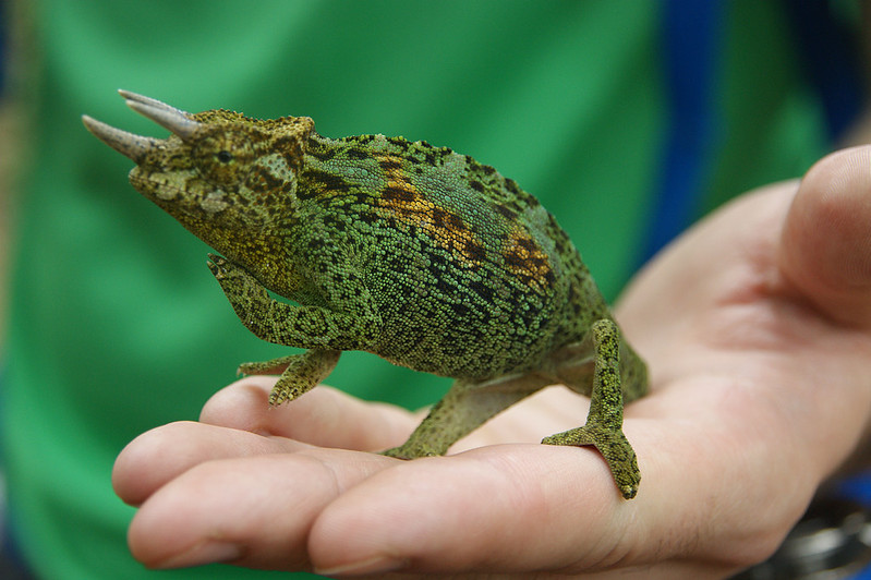
On the lower trail, birdwatchers consistently encounter and photograph the three-horned chameleon, Trioceros johnstoni, an Albertine Rift endemic, making it one of the most frequently seen wildlife species. For dedicated birdwatchers, the 8-day itinerary’s slower pace through the forest zones provides excellent encounter opportunities, and your guide’s bird knowledge is part of the value of the expedition.