The 8-day Mount Speke & Mount Stanley trek: Rwenzori Trekking Expeditions offers an 8-day Rwenzori hike to Mount Speke’s Vittorio Emmanuele peak (4,890 m) & Margherita Peak (5,109 m) on Mount Stanley via the Central Circuit trail of the Rwenzori Mountains in Rwenzori Mountains National Park.
The 8-day Rwenzori trek to Mount Speke & Mount Stanley (Margherita Peak) via the central circuit trail is graded as a very challenging expedition, built for trekkers who already have some high-altitude or multi-day hiking behind them and who want more from the Rwenzori than a single summit. Over the course of eight days you climb through ancient montane rainforest thick with primates and birdsong; a steep corridor of bamboo; atmospheric giant heather forest hung with lichen; and the surreal Afro-alpine moorland of giant lobelia and groundsel, before crossing genuine glacial terrain on the Stanley Plateau on summit day. You sleep beside Bujuku Lake with Mount Speke’s ridgeline rising directly above camp, cross two of the range’s highest passes, and stand, within the same week, on two separate African summits above 4,800 meters. It is a serious undertaking, and it rewards serious preparation.
Combining Speke and Stanley on one circuit is not simply a matter of convenience. The Central Circuit Trail places both mountains on the same physical loop, and the itinerary’s built-in rest and acclimatization day at Bujuku Camp, positioned directly beneath Mount Speke, is what makes climbing both peaks safely possible within eight days rather than requiring two separate trips. It is this shared acclimatization profile, more than simple proximity, that makes the combination genuinely efficient rather than merely ambitious.
Quick 8-Day Mount Speke & Margherita Peak Expedition Summary
Duration | 8 Days / 7 Nights on the mountain |
Route | Central Circuit Trail |
Destination | Rwenzori Mountains National Park, a UNESCO World Heritage Site |
Highest Summit | Margherita Peak, Mount Stanley — 5,109 m |
Second Summit | Vittorio Emanuele Peak, Mount Speke, 4,890 m |
Maximum Altitude | 5,109 m |
Difficulty | Very challenging — sustained high-altitude trekking with one technical glacier crossing |
Accommodation | Mountain huts and platform camps maintained by Rwenzori Mountaineering Services (current hut versus tented arrangements depend on ongoing park operations at time of booking) |
Best Time | Generally the two drier windows are mid-December to mid-February and June to August, though Rwenzori weather remains unpredictable in any month |
Starting Point | Nyakalengija trailhead, near Kasese |
What Makes This 8-Day Mount Speke & Margherita Peak Expedition Distinctive
 The defining feature of this 8-day Mount Speke & Mount Stanley trekking itinerary is that it delivers two genuinely separate African summits inside a single acclimatization profile, rather than compressing one summit attempt or padding the schedule unnecessarily. Because Bujuku Camp serves as the staging point for both the Speke ascent and the approach toward Stanley, the 8-day Rwenzori trek to Mount Speke & Mount Stanley (Margherita Peak) itinerary’s rest day there does double duty: it prepares the body for altitude gain while also serving as the base for the Speke summit bid, so no additional days are spent purely on repositioning.
The route also crosses a wider diversity of terrain than a single-peak trip typically allows: five vegetation zones, two major passes above 4,100 meters, direct lakeside camping at Bujuku and Kitandara, and a genuine, roped glacier crossing on the Stanley Plateau, the kind of technical variety that experienced trekkers specifically seek. And because the Central Circuit trail sees meaningfully fewer trekkers than the shorter, single-summit itineraries on the Kilembe side, this route offers a quieter, more expedition-like experience of the range, including sections of trail between Kitandara and Guy Yeoman that many visitors to the Rwenzori never see at all.
Who This Expedition Is For
This 8-day Mount Speke & Margherita Peak Rwenzori trekking itinerary suits experienced hikers with genuine multi-day trekking behind them, and ideally some previous exposure to altitudes above 3,500 metres, even if that experience came from a different mountain range entirely. Adventure travellers who want more than a single summit, photographers drawn to the Rwenzori’s changing light and dramatic ridgelines, and nature enthusiasts curious about a five-zone ecological transect all find this trek a rewarding match. It works equally well as a private expedition for a couple or a small group of friends or as a small guided departure, and travelers seeking a more comfortable, better-supported experience can request additional porter support, upgraded pre- and post-trek accommodation in Kasese, and a more generously staffed camp setup without changing the core route.
It is fair to say plainly that this is not the right trek for a first-time hiker or for anyone without a reasonable base of cardiovascular fitness and multi-day stamina. The combination of consecutive long days, cumulative altitude gain, cold, wet trail conditions, and a technical glacier crossing on summit day means that trekkers who find themselves genuinely uncertain about their fitness or altitude tolerance are usually far better served starting with a single-peak itinerary, such as our dedicated Mount Speke or Kilembe Trail treks, before returning for the full two-summit expedition.
Introducing the Two Mountains
Mount Speke and Vittorio Emanuele Peak
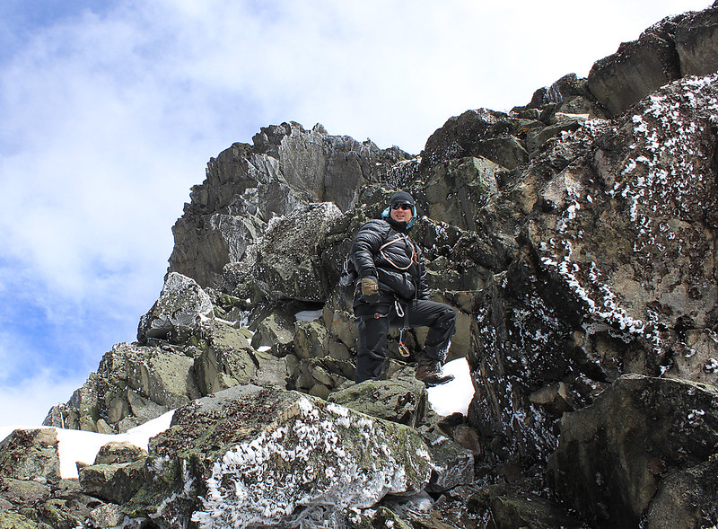 Mount Speke is the second-highest massif in the Rwenzori range, its highest point, Vittorio Emanuele Peak, reaching 4,890 meters. Together with Mount Stanley and Mount Baker, it forms the triangle of peaks enclosing the upper Bujuku Valley, and it takes its name from John Hanning Speke, the nineteenth-century explorer associated with the search for the source of the Nile, though Speke himself never climbed it. Geologically it shares the same fault-block origin as the rest of the range, and its ridgelines show the same glacial sculpting visible throughout the Rwenzori’s highest terrain. Once heavily glaciated on its northern face, Mount Speke’s ice has now retreated entirely, and the standard route to Vittorio Emanuele today is a demanding scramble over rock and, in wetter conditions, mud, rather than the glacier travel earlier twentieth-century accounts describe. Trekking highlights on the approach include the giant lobelia forest below Stuhlmann’s Pass and sweeping views into the Democratic Republic of the Congo from the upper ridge. A full profile of the mountain is available on our dedicated Mount Speke guide.
Mount Stanley and Margherita Peak
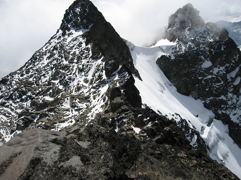 Mount Stanley is the Rwenzori’s and Uganda’s highest massif, its summit, Margherita Peak, reaching 5,109 meters and ranking as Africa’s third-highest point. Unlike Mount Speke and Mount Baker, Mount Stanley retains genuine glacier ice on its Stanley Plateau, making the Margherita summit push the only stretch of this entire expedition requiring crampons, an ice axe, and rope. The final approach follows the same historic line established by the Duke of the Abruzzi’s 1906 expedition, past Elena Hut and onto the glacier itself, with a strict, guide-enforced turnaround time built into the schedule to manage the mountain’s well-documented pattern of clear mornings giving way to afternoon cloud and snow. Full technical and historical detail is available on our dedicated Mount Stanley and Margherita Peak guide.
Understanding the Central Circuit Trail Of Rwenzori Mountains
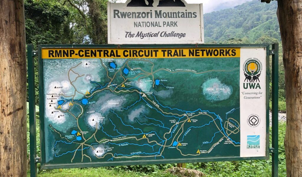 The Central Circuit Trail is the original route into the Rwenzori, opened to European expeditions in 1906 and still administered today through the Rwenzori Mountaineering Services hut network. It begins at the Nyakalengija trailhead near the village of Ibanda in Kasese District, at roughly 1,615 to 1,650 meters, and climbs through farmland to the park boundary before entering thick forest along the Mubuku River. From there the trail rises steadily through Nyabitaba, John Matte, and Bujuku camps, following the Bujuku Valley beneath Mount Speke’s northern flank, before splitting toward Scott Elliot Pass and Elena Hut for the Stanley approach or toward the Kitandara Lakes and Freshfield Pass for the return leg past Mount Baker. Along the way it crosses the Mubuku and Bujuku rivers, skirts Bujuku Lake and the Kitandara lakes, and passes through all five of the range’s classic vegetation zones in sequence.
We use this Central Circuit trail route for the combined Speke and Stanley expedition specifically because it is the only trail that places both summits, and a genuinely restorative acclimatisation camp, on a single continuous loop, avoiding the need for repeated trailhead transfers between separate treks.
The 8-day Mount Speke & Mount Stanley (Margherita Peak) expedition begins at the Nyakalengija trailhead, where a private briefing with your dedicated mountain guide covers the week ahead before the trail leads through farmland and out along the Mubuku River into thick Afro-montane forest. This is the richest wildlife stretch of the entire circuit, and the calls of wild chimpanzees frequently carry across the valley in the early hours, while black-and-white colobus and blue monkeys move through the canopy overhead and the electric-green Rwenzori turaco occasionally flashes between the trees.
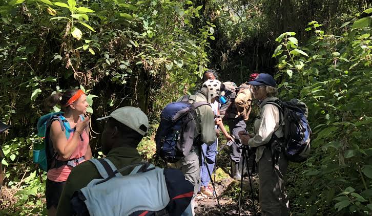 The trail climbs a long, steady ridge above the confluence of the Mubuku and Bujuku rivers, and Nyabitaba Camp at 2,651 metres, perched on its own forested spur, delivers the first real views back down the valley toward Kasese as the light fades. Dinner and a first briefing on tomorrow’s route are taken in camp.
Day 2: Nyabitaba Camp (2,651m)
to John Matte Camp (3,505 m): 7–8 hours
The trail drops from Nyabitaba to cross the Mubuku and Bujuku rivers via the Kurt Schafer Bridge before climbing steadily along the Mahoma ridge into a long, physically demanding stretch of bamboo forest, its steep, muddy sections among the more strenuous of the entire route. Beyond the bamboo, the trail crosses long stretches of slippery, moss-draped rock through the heather zone, and at the Nyamuleju rock shelter, a natural overhang used by early expeditions, Mount Stanley and Mount Speke both become visible for the first time, an arresting moment after two days walking largely inside the forest canopy. The final approach to John Matte Camp crosses tiring, waterlogged bog thick with tussock grass, and the sense of entering genuinely high mountain terrain builds steadily through the afternoon.
Day 3: John Matte Camp (3,505m) to Bujuku Camp (3,962m) 4-5 hours
A shorter day by distance, but a significant one for altitude, beginning with a further crossing of the Bujuku River before entering the Lower Bigo Bog, one of the most striking landscapes on the entire circuit, thick with giant lobelia rising incongruously from the wet, tussocked ground. Beyond the bog, the valley opens onto Bujuku Lake itself, with Mount Baker rising to the south and Mount Stanley’s glaciated ridgeline dominating the skyline to the west. Bujuku Camp, set at 3,962 metres directly beneath Mount Speke’s northern face, is where the expedition’s structure becomes clear: this is both a rest stop and a staging camp, and the additional night spent here before tomorrow’s Speke attempt is a deliberate acclimatisation choice built into the itinerary rather than a fixed distance requirement.
Day 4: Bujuku Camp Ascent of Vittorio Emanuele Peak, Mount Speke (4,890m), return to Bujuku Camp 8–10 hours round trip
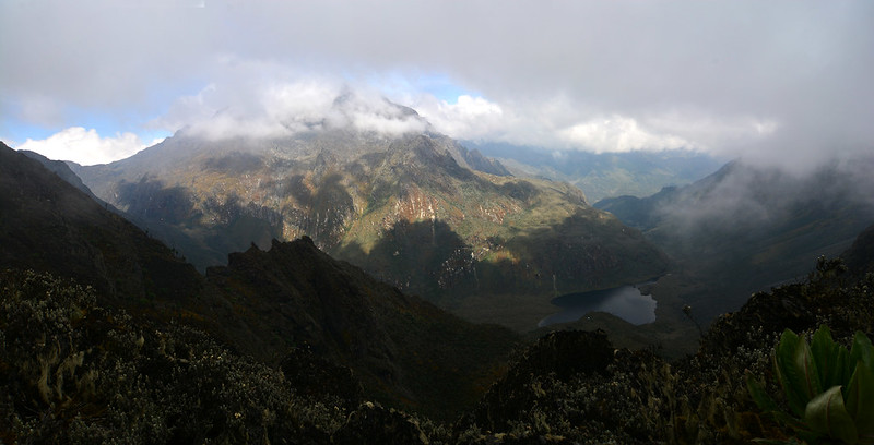
An eastward departure from Bujuku Camp leads gently uphill alongside a small creek through a forest of giant groundsel before the terrain opens into a meadow below Stuhlmann’s Pass, at approximately 4,192 meters, with sweeping views that open to acclimatization in the Democratic Republic of the Congo. A clear trail junction just below the pass turns the route onto Speke’s southwest ridge, climbing through Groundsel Gully onto increasingly bare rock. The final scramble to Vittorio Emanuele’s summit at 4,890 meters involves genuine exposure over slabs and short, steep sections that your guide will assess and, where needed, assist with rope, and standing on Uganda’s second-highest point, with Margherita’s glaciated summit visible across the valley, is one of the expedition’s defining moments. The return to Bujuku Camp retraces the same line, and a second night at Bujuku allows a full rest before the push toward Stanley begins.
Day 5: Bujuku Camp (3,962m) to Elena Hut via Scott Elliot Pass (4,541m) 4 – 5 hours
The trail climbs steadily out of the Bujuku Valley toward Scott Elliot Pass, at roughly 4,372 meters, the highest point on the standard circuit loop and a spot that rewards the climb with a sudden, spectacular view across Bujuku Lake to Mount Speke behind and the glaciated flank of Mount Stanley directly ahead. From the pass, a short but steep climb over large boulders leads to Elena Hut at 4,541 metres, perched immediately below the Stanley Plateau glacier and, for those who have never spent a night this close to permanent ice, an unforgettable place to sleep. The afternoon is kept deliberately light, reserved for rest, final equipment checks, and a technical briefing on tomorrow’s glacier crossing.
Day 6: Elena Hut (4,541m) to Margherita Peak (5,109m) down to Kitandara Camp (4,430m): 9–11 hours
This is the expedition’s central, demanding day, and it begins in darkness with a pre-dawn departure timed around the mountain’s reliable pattern of clear early hours giving way to afternoon cloud. Crampons, an ice axe, and a rope are used for crossing the Stanley Plateau glacier itself, guided by staff who read this ice daily and know exactly where the crevasse risk currently lies as the glacier continues its documented retreat. The final approach to Margherita’s summit is a genuine scramble over exposed rock and ice, governed throughout by a strict, non-negotiable turnaround time regardless of how close the summit feels. Standing on Africa’s third-highest point, with the full sweep of the Rwenzori’s peaks and, on a clear day, the plains of the Congo spread out below, is the expedition’s principal reward.
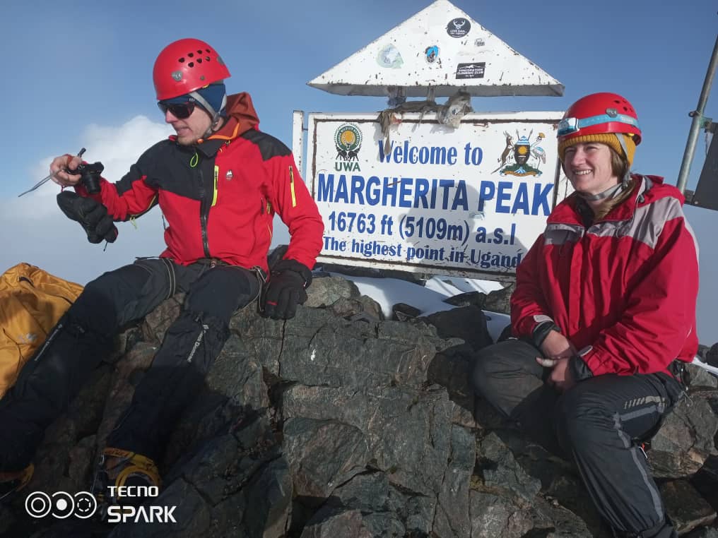
The descent retraces the route to Elena Hut before continuing down past Scott Elliot Pass to Kitandara Camp at 4,430 meters, beside the striking, mirror-still Kitandara Lakes, a long day, but one that ends in one of the most beautiful campsites on the entire circuit.
Day 7: Kitandara Camp to Guy Yeoman Camp via Freshfield Pass (4,430m to 3,261m) 6–7 hours
The trail climbs steeply out of the Kitandara basin, past the headwall directly beneath Mount Baker, to Freshfield Pass at approximately 4,282 meters, a long, flat expanse of high alpine moorland that offers views west into the Congo and back north to Mount Stanley one final time. From the pass, the trail descends through boggy, rocky terrain to the historic Bujongolo rock shelter, the base camp used by the Duke of the Abruzzi’s own 1906 expedition, before continuing down to Guy Yeoman Camp at 3,261 meters, back within the heather zone and noticeably warmer and greener after two nights spent above 4,400 meters.
Day 8: Guy Yeoman Camp to Nyabitaba to Nyakalengija & Exit the Park
The final day is a long, satisfying descent through the cliffs of Kichuchu, crossing the Mubuku River twice through bamboo forest, and completing the loop of the Central Circuit at Nyabitaba before the last stretch down to the Nyakalengija trailhead. Certificates are presented to trekkers who reached both summits, a private vehicle waits for the transfer back into Kasese, and a hot shower and a proper bed bring an eight-day expedition across two African summits to a close.
Inclusions and Exclusions
Transparency on cost is something we take seriously, as ambiguous inclusions are one of the most common sources of frustration on multi-day mountain treks. The table below sets out exactly what your trek fee covers and what is left for you to arrange.
Included | Excluded |
Uganda Wildlife Authority park entrance and Central Circuit concession fees | International flights and Uganda visa fees |
Professional, government-licensed mountain guide throughout | Pre- and post-trek hotel nights in Kasese or Kampala |
Porters and rangers as required by park regulations | Personal hiking gear, including boots and sleeping bag |
Accommodation at all mountain camps and huts | Tips and gratuities for guides, porters and cooks |
All meals on the mountain, prepared fresh by your trek cook | Personal travel insurance with high-altitude and evacuation cover |
Purified drinking water throughout the trek | Alcoholic and premium bottled drinks |
Rescue and evacuation coordination via Rwenzori Mountaineering Services | Optional extra acclimatisation nights beyond the standard itinerary |
Technical mountaineering equipment for the Margherita Peak glacier crossing | |
Private road transfer between Kasese and the Nyakalengija trailhead | |
Summit certificates on successful completion |
The Changing Landscapes of the Route
Few treks anywhere compress so much ecological range into eight days on foot. The lower trail passes through dense Afro-montane rainforest, rich with primates and birdsong, before climbing into a steep, cathedral-like corridor of bamboo forest. Above the bamboo, giant heather trees draped in pale lichen create an atmospheric, frequently mist-shrouded middle zone, giving way in turn to the surreal Afro-alpine moorland of giant lobelia and giant groundsel that surrounds Bujuku, Kitandara, and the approach to both summits. At the very top of the route, vegetation yields way entirely to bare rock and, on the Stanley Plateau alone, permanent glacial ice, a five-zone journey from equatorial rainforest to genuine high-mountain Kitandara inside a single week.
Wildlife Along the Route
Primates
Black-and-white colobus and blue monkeys are frequently encountered in the lower forest between Nyakalengija and Nyabitaba, and wild chimpanzees are present throughout this zone, more often heard calling than seen directly.
Albertine Rift Endemic Birds
The Rwenzori sits within the Albertine Rift, one of Africa’s centers of bird endemism, and the forest and heather zones offer genuine opportunities to spot the Rwenzori turaco and a range of other localized species.
Forest Mammals
Duiker species and occasional signs of larger forest mammals occur in the lower montane forest, though sightings are considerably less frequent than primate or bird encounters.
Amphibians and Butterflies
The exceptionally high rainfall through the lower and middle zones supports a rich community of montane amphibians and butterflies, of particular interest to trekkers traveling with a naturalist’s eye and a macro lens.
Wildlife sightings on any Rwenzori trek should be treated as a genuine possibility rather than a guarantee the area is wild, undisturbed habitat, and encounters vary by season, weather, and simple chance.
Physical Challenge and Fitness
This itinerary demands a genuine base of fitness. Daily hiking hours range from four to five on the shorter camp-to-camp days to nine or more on summit day itself, over terrain that is frequently steep, muddy, and uneven, with two separate high-altitude summit pushes inside the same week. Total elevation gain across the full circuit exceeds 4,000 metres, and the cumulative physical load of eight consecutive days at altitude, including two demanding summit days, is considerably greater than either peak would represent on its own. Recovery is as important as exertion here: the itinerary’s structure, including the second night at Bujumeters, is specifically designed to provide the body with genuine rest between the two summit efforts, and trekkers who arrive under-trained tend to find that their recovery deficit compounds rather than resolves as the week progresses. We recommend a minimum of eight to twelve weeks of dedicated cardiovascular and load-bearing training before departure, ideally including hikes on steep, varied terrain with a loaded daypack.
Acclimatisation
Altitude, not distance, is the primary variable this itinerary is built around. Ascending too quickly increases the risk of acute mountain sickness regardless of physical fitness, which is why the schedule includes a full extra night at Bujuku Camp, positioned specifically to allow the body to adjust before both the Speke summit attempt and the subsequent push toward Stanley. Early symptoms of altitude illness, persistent headache, nausea, unusual fatigue, or disturbed sleep are common and usually manageable but should always be reported to your guide immediately rather than pushed through silently, since guides are trained to adjust pace, arrange descent, or, in more serious cases, coordinate evacuation. Deliberate, steady hydration and a conservative, unhurried pace, particularly on the two ascent days, do more to protect against altitude illness than any single piece of equipment.
Equipment Guide
A well broken-in pair of waterproof hiking boots with solid ankle support is the single most important item on this itinerary, given the sustained, often muddy terrain across all eight days.
Waterproof, windproof outer clothing is essential given the Rwenzori’s near-daily rainfall, paired with warm, moisture-wicking base and mid layers rather than cotton, since conditions shift from humid forest heat to sub-zero glacier wind within the same day on summit pushes.
Insulated gloves and a warm hat matter more here than most first-time Rwenzori trekkers expect, particularly for the pre-dawn Margherita summit push, and a reliable headlamp with spare batteries is essential for both early starts.
Trekking poles meaningfully reduce strain on the steep, root-covered, and boggy sections that dominate several days of this route, and a four-season sleeping bag rated to at least minus ten degrees Celsius is necessary for the high camps at Bujuku, Elena, and Kitandara.
Technical mountaineering equipment for the Stanley Plateau glacier crossing, including crampons, an ice axe, and a harness, is provided as part of your package; the Speke ascent requires no glacier equipment but does benefit from the same trekking poles and sure footwear used throughout.
Weather and Climate
The Rwenzori is one of the wettest mountain environments in East Africa, with high-altitude sites recording well over 3,000 millimeters of rainfall a year, and this itinerary’s full eight routes are covered with that reality in mind rather than around an assumption of clear skies. Temperature falls steadily with altitude, from warm and humid in the lower forest to consistently sub-zero overnight at Bujuku, Elena, and Kitandara, with wind chill on both summit ridges frequently making conditions feel considerably colder than the air temperature alone suggests.

Cloud cover typically builds through each morning, which is why both summit attempts are scheduled for the pre-dawn hours, and Elena, afternoon rain, mist, or snow squalls should be expected as a near-daily pattern regardless of season rather than an occasional inconvenience.
Best Time to Trek
The two Rwenzori dry-season windows, mid-December to mid-February and June to August, generally offer firmer trail conditions across the boggy moorland sections and better visibility on both summit attempts and are the seasons we recommend for most first-time expedition trekkers. Outside these windows, particularly during the long rains of April and May, the trail becomes considerably muddier and river crossings more demanding, though the vegetation is at its most vivid and the trail noticeably quieter. It is worth being honest, however, that Rwenzori weather is genuinely unpredictable in any month, and even peak dry-season departures can encounter days of persistent cloud or rain; no itinerary on this mountain can guarantee favorable summit-day conditions, only a schedule and guiding team built to make the most of whatever conditions arrive.
Safety on the Central Circuit Trail
Altitude sickness is the most significant medical risk on this itinerary, and the built-in acclimatization day at Bujuku Camp, along with a conservative, guide-set daily pace, are the primary safeguards against it.
Slippery trail conditions through the bamboo, heather, and boggy moorland zones account for the majority of minor injuries on this route, making trekking poles and careful, unhurried footwork genuinely important rather than optional.
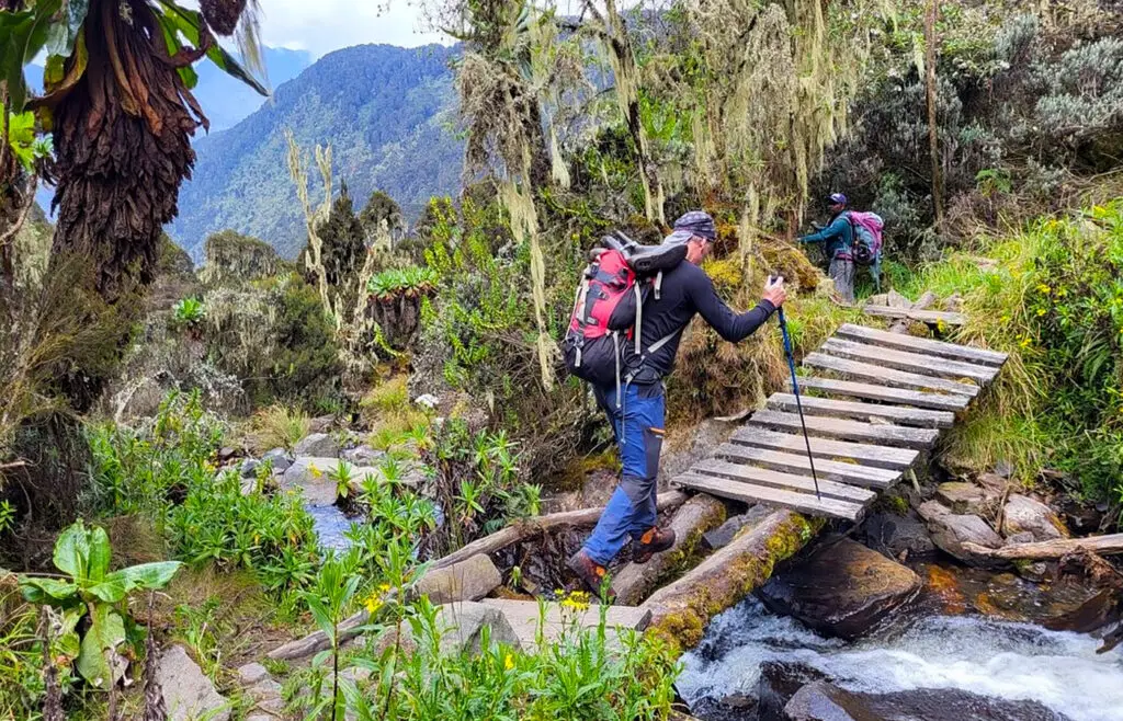
River crossings at the Mubuku and Bujuku rivers are generally straightforward but can become more demanding after heavy rain and are always assessed by your guide before crossing. Both summit attempts involve real technical terrain, with exposed rock scrambling on Speke and roped glacier travel on Stanley, and are led throughout by qualified mountain guides who are part of the established Rwenzori Mountaineering Services rescue network, which has clear emergency and evacuation procedures in place if conditions or an injury require a change of plan. Comprehensive travel insurance that explicitly covers high-altitude trekking and mountain evacuation to at least 5,500 meters is a firm requirement for this itinerary.
Conservation and Responsible Trekking
This entire route lies within Rwenzori Mountains National Park, inscribed as a UNESCO World Heritage Site in 1994 in recognition of its outstanding natural beauty and its complete, undisturbed sequence of vegetation zones.
The Uganda Wildlife Authority manages the park’s permitting, ranger presence, trail maintenance, and rescue coordination across the Central Circuit, and every trek fee on this itinerary includes the park and concession fees that directly fund that work.
We ask every trekker to follow Leave No Trace principles throughout: staying on established trails through the fragile moorland zones, packing out all waste rather than burying or burning it, and maintaining a respectful distance from wildlife at all times.
Choosing guides, porters, and cooks drawn from local Bakonzo communities, as we do throughout this itinerary, also ensures that the direct economic benefit of this expedition supports the people who have safeguarded this landscape for generations.
Practical Planning Information
Park permits, guide fees, porter arrangements, and rescue-fund contributions are all coordinated on your behalf and included in your quoted trek price, with no separate paperwork required from you beyond your own travel documents.
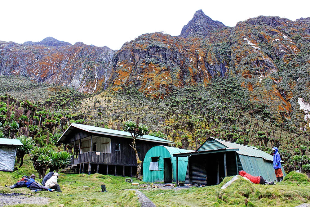
Accommodation on the mountain is in the current mix of huts and platform camps maintained along the Central Circuit trail; because hut versus tented arrangements can shift with ongoing park operations and maintenance schedules, we confirm the exact configuration for your specific departure dates at the time of booking rather than assuming a fixed setup.
All meals on the mountain are included and prepared fresh by your dedicated trek cook, and private road transfer between Kasese and the Nyakalengija trailhead is arranged as part of your package.
Group sizes on scheduled departures are typically kept to a maximum of eight trekkers, with fully private departures available for solo travelers, couples, and groups of any size; trekkers under eighteen are welcome only when accompanied by a parent or guardian and assessed individually for fitness and readiness.
Comprehensive travel insurance covering high-altitude trekking and evacuation is required for every booking, and we are glad to advise on appropriate policies at the time of inquiry.