The Rwenzori Mountains "Mountains Of The Moon"
The Rwenzori Mountains, also known as Ruwenzori, Rwenzururu, or Rwenjura, were referred to as the Mountains of the Moon by the 2nd-century CE geographer Ptolemy (Claudius Ptolemaeus). This range comprises six massifs divided by deep gorges, including Mount Stanley (5,109 meters), Mount Speke (4,890 meters), Mount Baker (4,843 meters), Mount Emin (4,798 meters), Mount Gessi (4,715 meters), and Mount Luigi di Savoia (4,627 meters). The range measures around 120 kilometers (75 miles) in length and 65 kilometers (40 miles) in width.
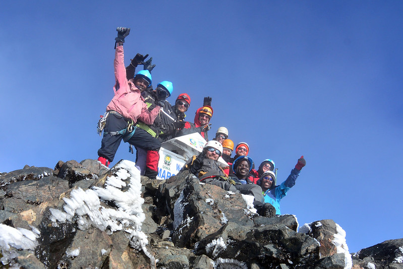
Mount Stanley
Mount Stanley
Mount Speke
Mount Gessi
Mount Emin
Mount Luigi Di Savoia
Although Mount Stanley boasts a number of subsidiary summits, the highest of these is Margherita Peak, at an elevation of 5,109 meters (16,762 feet), with its upper portions being perpetually snow-covered and glaciated.
The Rwenzori Mountains are situated along the boundary between Uganda and the Democratic Republic of the Congo. Rivers originating from the streams of the Rwenzori Mountains constitute one of the sources of the Nile. Nonetheless, the Rwenzori Mountains were historically regarded as the Source of the Nile.
Situated just north of the Equator, the Ruwenzori Range spans a maximum width of 30 miles (50 km) and stretches 80 miles (130 km) in a south-north direction between Lake Edward and Lake Albert. The Ruwenzori Range descends sharply to the west into the Western Rift Valley, although its eastern slope is more gradual, culminating in the highlands of western Uganda.
In contrast to the majority of African snow-capped mountains, the Ruwenzori is not a volcano; but rather, a substantial horst including six distinct glaciated masses, culminating in Mount Stanley at Margherita Peak (16,795 feet [5,109 meters]). The main mountains of the Ruwenzori Range are divided by passes and severely incised river valleys, all of which ultimately flow into the Semliki River. Glaciers and little lakes are seen in the upper valleys. The permanent snow line is located at approximately 14,800 feet (4,511 meters) on the eastern side and 15,900 feet (4,846 meters) on the western side. The mountain peaks are frequently covered by the clouds, generated intermittently by humid airstreams from the Atlantic and Indian Oceans.
Queen Elizabeth National Park (Ruwenzori), established in 1952, is situated east of Lake Edward and south of the Ruwenzori Range in southwestern Uganda.
The Ruwenzori is commercially significant due to its copper and cobalt resources, which are extracted near Kilembe, Uganda. Hydropower for mining is supplied by the Mubuku, the largest river in the range. The Amba and Konjo peoples of the lower eastern slopes primarily cultivate beans, sweet potatoes, and bananas.
Peaks Of Rwenzori Mountains
The highest peaks of Mt. Stanley feature Margherita (5109m), Alexandra (5091m), Albert (5087m), Elena (4968m), Great Tooth (4953m), Savoia (4977m), Elizabeth (4929m), Philip (4919m), Kitasamba (4862m), and Nyabubuya (4862m). Margherita Peak (5,109 m) on Mount Stanley positions the Rwenzori as the third highest mountain in Africa, following Mount Kilimanjaro (5,895 m) and Mount Kenya (5,200 m).
The highest peaks of Mt. Speke comprise Vittorio Emanuele (4890m), Ensonga (4865m), and Johnston (4834m).
The highest peaks of Mt. Baker consist of Edward (4843m), Semper (4795m), Grauer Rock (4484m), Moore (4624m), and Wollaston (4627m).
The two highest peaks of Mt. Emin are Umberto (4798m) and Kraepelin (4791m).
The summits of Mt. Gessi are Iolanda (4715m) and Bottego (4699m).
Mount Luigi di Savoia is the lowest of the six principal mountains, featuring three prominent peaks: Sella (4626m), Weismann (4620m), and Stairs (4545m).
Additional peaks beyond the main set of six mountains comprise the Portal Peaks (4391m), Cagni, Kinyangoma, Rukenga, Rugendwara, Humphreys, and Rwatamafuga.