7 Day Mount Baker & Weismann Peak Rwenzori Trekking
A 7 Day Mount Baker and Weismann’s Peak Rwenzori Trekking Expedition is a demanding, multi-day climb over the Kilembe trail, traversing many Rwenzori trekking Vegetation zones such as bamboo and alpine zones to attain a high-altitude peak characterized by glacier-covered, treacherous circumstances. The plan generally comprises daily climbs from one camp to another, culminating on day 5 with the trek to the top of Mt. Baker at 4,842 meters. The expedition entails steep inclines, muddy and rugged terrain, and necessitates readiness for cold, damp, and windy circumstances.
Note: You may ascend Mt. Baker provided you are in sound physical condition. The ascent of Baker is short yet demanding; yet, it is undeniably gratifying, especially on a clear day when one can appreciate the magnificent vistas of Mt. Stanley, Margherita Peak, and the glaciers. Alternatively, one may choose to ascend Weismann’s peak during the descent.
7 Day Mount Baker & Weismann Peak Rwenzori Trekking
Day 1
Begin at Trekkers Hostel at 1,450 meters and ascend to Sine Hut at 2,596 meters, yielding an elevation gain of 1,146 meters. Alternatively, persons in excellent physical condition may choose to proceed to Kalalama Camp at 3,134 meters, which provides stunning views and permits more time in Mutinda Camp, where one can ascend to Mutinda Lookout at 3,975 meters.
We begin our rise through the valley floor, maneuvering around the tall trees of the Afro Montane Forest Zone. This is a steady incline with several avian species and the potential to observe blue monkeys traversing the forest. Visitors may occasionally witness groups of 15 to 20 black and white Colobus monkeys navigating the treetops. Infrequent observations of the L’Hoest monkey, essential to Bukonzo cultural symbols, are protected under the jurisdiction of the King or Omusinga, despite the audible presence of distant wild chimpanzees. A vast assortment of plant species is present, encompassing forest trees, bamboo thickets, low shrubs, flowers, mushrooms, and various moss and lichen-clad vines cascading from the towering trees, creating a striking visual appeal. Enock’s Falls are situated within 200 meters of Sine Hut, offering an exceptional opportunity to capture a memorable screensaver.
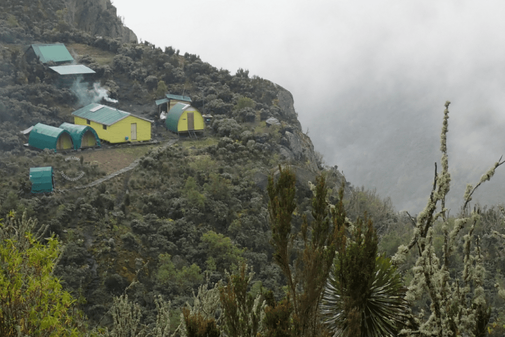
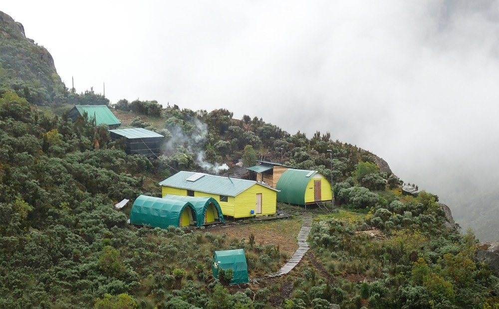
Sine Camp, located at an altitude of 2,596 meters, features wooden huts nestled among tall forest trees on a little ridge, providing an opportunity to admire the grandeur of the Afro Montane forest while overlooking a stunning waterfall tumbling over the rocks below. Some clients prefer to sit outdoors, enjoying the warmth of the campfire while discussing the mountains and their communal life with the guides. Sine is situated just below the bamboo zone, and the vicinity is home to a rich range of avian species. Enock Falls, situated 150 meters from the camp, is enveloped by lush greenery and tumbling vines. Truly magnificent. Individuals at Sine, especially those in perfect physical condition, may choose to ascend to Kalalama Camp at an altitude of 3,134 meters. This path provides breathtaking views and permits prolonged stays at Mutinda Camp, enabling ascent to Mutinda Lookout at 3,975 meters.
Day 2
The Rwenzori trekking expedition begins at 8:30 AM, proceeding right into the Bamboo-Mimulopsis Zone, noted for its steep ascent featuring numerous elevated steps. In the rainy season, the bamboo area becomes exceedingly muddy and treacherous, causing delays in work. The atmosphere and the forest are remarkable as you climb 551 meters over 1.8 kilometers to Kalalama Camp at 3,147 meters, located in the Heather-Rapanea Zone, where one can take a short break and savor a cup of tea or coffee before continuing to Mutinda Camp. The path meanders over numerous minor hills along a ridge, lowers into the valley, ascends again, crosses multiple small streams, and nears moss-laden waterfalls. You ascend gently beside a scenic moss-covered river that flows over the rocks beneath the Giant Heather trees, whose trunks are embellished with green moss and clothed in Usnea lichen. The trail meanders as you climb the deep valley, abundant with diverse vegetation and flowers. This valley is unique, featuring several Giant Heather plants that provide a scenic atmosphere often shrouded in mist.
In the afternoon, you may wish to ascend to the summit of Mutinda Lookout, which takes approximately one to two hours to ascend and one hour to descend. The views are breathtaking as you stand on moss-laden rocks at an altitude of 3,925 meters, surveying the Rwenzori Mountains, the town of Kasese, and Lake George. Trekker’s ascending to Margherita Peak or any of the primary peaks will discover that climbing Mutinda, at 3,975 meters, is an efficient means of acclimatization and reducing the risk of high altitude sickness.
Rest at Mutinda Camp, situated at an altitude of 3,582 meters.
Day 3:
The route to Bugata Camp is boggy, particularly in the wet season; nevertheless, with little skill, one can navigate from tussock to tussock to improve movement. Commence by traversing the Mutinda Valley, maneuvering through tussock grass and everlasting flowers interspersed with numerous Giant Lobelias, before ascending a steep incline to the Namusangi Valley (3,840 meters), distinguished by majestic waterfalls, while relishing breathtaking vistas of the Mutinda Peaks in the background. The Namusangi Valley is vast, with multiple elevations as the route steadily ascends to Bugata Camp at 4,100 meters.
Day 4:
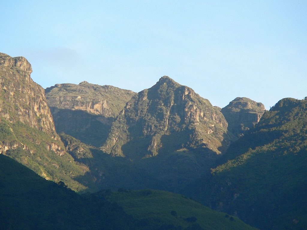
Trek to Hunwick’s Camp via Bamwanjarra Pass. Upon leaving Bugata Camp, you ascend a ridge, thereafter dip slightly, and then ascend to Bamwanjarra Pass at 4,450 meters, where a cabin is provided for severe weather. On a clear day, the pass provides remarkable vistas of the three primary peaks. The path crosses the valley, bordering the edges of wetlands and thick coniferous vegetation, comprising moss, large groundsel, and lobelia. This spot may be the foremost area in the Rwenzori for watching the Malachite Sunbird since it forages on various lobelia flowers and is acknowledged as a nesting ground. Subsequently, there are precipitous segments succeeded by a steady elevation across a ridge to Hunwick’s Camp, situated atop a profound valley with superb vistas of Mt. Stanley, Mt. Baker, Weismann’s Peak, and McConnell’s Prong.
Day 5:
4.3-kilometer elevation gain , Four to six hours up and two to three hours descending. Commence departure at 6:30 AM to ascent Mt. Baker, which has an elevation of 4,842 meters. The period of ascent from McConnell’s Camp (Camp 4) to the peak is three to four hours, but the descent requires three hours. This ascent is tough, marked by steep, rocky terrain, requiring a robust tolerance for heights, especially in sections like the crevice descending to the glacier, which presents a considerable drop-off. Although steep Mt. Baker is classified as non-technical, it becomes treacherous during the rainy months (April-May and September-October) when the ice-coated rocks are extremely slick; hence, safety ropes will be utilized consistently on steep inclines. After ascending, you drop via a crevice in the rock face to access the glacier, followed by a short 300-meter trek to the peak.
In favorable weather or after a break in cloud cover, the views of the prominent peaks of Magherita, Alexandria, Stanley’s Plateau, and the glaciers are outstanding, highlighting the majesty of these breathtaking snow-capped mountains. The panorama is spectacular. Upon processing this significant life event, we navigate the glacier, scale the crevice in the rock face, and descend to McConnell’s Camp. Spend the night at Camp 4.
Day 6
Distance to Kiharo Camp: 11 kilometers The duration necessary for walking ranges from 4 to 7 hours. We begin the day at Hunwick’s Camp by climbing a ridge toward McConnell’s Prong, which provides the most breathtaking views of all three summits and Scott Elliott’s Pass, before reaching Oliver’s Pass at an altitude of 4,505 metres. The distance from Hunwick’s Camp to the peak of Oliver’s Pass is 3 kilometers. The path subsequently passes under Weismann’s Peak to the confluence of the Nyamwamba River, which flows via Kilembe and Kasese to Lake George in Queen Elizabeth National Park.
To summit Weismanns Peak, which rises to 4,620 meters from Oliver’s Pass, an extra charge of $20 per individual is necessary.
On a clear day, one can witness spectacular views of Margherita, Mt Stanley, Mt Speke, and Mt Baker.
Upon crossing the junction, the path descends down the valley towards Kiharo Camp, situated within a deep valley distinguished by steep cliffs and verdant vegetation. Upon descending the valley, following each bog, you will navigate a ridge of stones and soil that seems out of place; nonetheless, it was deposited by sluggish glaciers that eventually halted their advance, melted, and left a heap of boulders and debris at the site of their former presence.
Day 7:
The distance from Kiharo Camp to the park gate is 12.2 km, and a further 2.8 km to Trekkers Hostel. Individuals needing to connect to planes returning to Kampala or attending other commitments must leave Kiharo early, as the trek requires 5 to 8 hours of walking.
The descent through the Nyamwamba Valley is primarily downhill and exceptionally scenic, showcasing stunning views, moss-covered rocks by the river, cascading waterfalls, deep gorges, and trees that may be unrivaled in the Rwenzori Mountains. This portion of the route necessitated six years to ascertain a traversable road appropriate for travelers. In 1937, the explorer and geologist McConnell endeavored to traverse this valley but was unsuccessful and had to return in search of an alternative way up the mountain; however, this exceptionally stunning valley is now accessible for observation.
A few kilometers from Kiharo Camp, the path veers right to parallel the river. In the open settings, one may witness a Duiker subtly foraging in small clearings while navigating the riverside. One may opt to cross the river by leaping across the rocks along its path. A few kilometers downstream, the landscape turns markedly steep with multiple waterfalls, requiring a detour from the river to navigate a little ridge to avoid the steep sections. At the base, we re encounter the river, which includes a significant rock shelter and an appropriate spot for rest. After crossing a small creek, you ascend a gentle slope before descending to the river to bypass another set of impassable waterfalls. The forest in this region is magnificent and abundant in species, encompassing various birds, monkeys, dikers, and hyraxes. A remarkable event and culmination of an unbelievable journey.
Conclusion of the 7-Day Rwenzori Trek Itinerary to Mount Baker and Weismann Peak